SSEC Data Center images celebrate 40th anniversary
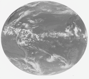
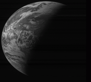
The very first geostationary satellite images in the Space Science and Engineering Center’s (SSEC) online archive turned 40 today.
On 27 June 1974, the SSEC Data Center recorded and archived data from the Synchronous Meteorological Satellite (SMS-1), an early weather satellite launched only weeks before. Recognizing the research value of collecting and archiving this type of data, the Center had recently installed its first rooftop antenna. The SMS data were processed through that antenna.

First complete full disk infrared image in the SSEC online archive from 27 June 1974. Credit: Jerry Robaidek, SSEC Data Center.

First complete full disk visible image in the SSEC online archive from 27 June 1974. Credit: Jerry Robaidek, SSEC Data Center.
The SMS-1 was not the first geostationary satellite, however. It was preceded by the NASA Applications Technology Satellites (ATS) — ATS-I flew in 1966, followed by ATS-III in 1967. Unique to these two satellites was the Spin-Scan Cloud Camera invented by Verner Suomi and Robert Parent, co-founders of SSEC.
The camera allowed for the collection of continuous satellite imagery of a fixed point on the earth at 20-minute intervals.
Though not yet in real-time, scientists could now construct weather loops, or movies, with the ATS images, observing weather systems as they developed. This is a direct result of the Suomi-Parent spin-scan camera invention.
Satellite sensing technology was immediately transformed from the production of interesting snapshots into the gathering of meaningful, quantitative data. This concept revolutionized satellite meteorology, allowing meteorologists to incorporate current synoptic information into weather forecasts.
Building on the success of the ATS missions, the SMS satellites included the next generation spin-scan camera, known as the Visible Infrared Spin-Scan Radiometer (VISSR). The VISSR improved upon the original camera design to generate the cloud cover data that had quickly become so necessary to researchers and forecasters.
The follow-on to the SMS was the Geostationary Operational Environmental Satellite (GOES) series, which continues today.
The SSEC Data Center carries on the tradition of providing timely, high quality geophysical data through its extensive archive and in real-time to support the scientific computing needs of SSEC scientists, their research collaborators, and other organizations worldwide.
by Jean Phillips
