9.1. Creating VIIRS SDR GeoTIFF Files
This example walks through the creation of VIIRS GeoTIFF output files and adding overlays.
9.1.1. Basic VIIRS SDR GeoTIFF file creation
Find the options available when creating VIIRS SDR GeoTIFFs:
polar2grid.sh -r viirs_sdr -w geotiff -h
List the supported products that can be created from your VIIRS SDR dataset:
polar2grid.sh -r viirs_sdr -w geotiff --list-products -f <path_to_sdr_files>
This will provide a list of standard products that can be created from the files that are provided to polar2grid.sh.
To create VIIRS GeoTIFF files of all default products (including true and false color) found in your data set and reprojected in default Platte Carrée projection using the default 4 workers, execute the following command:
polar2grid.sh -r viirs_sdr -w geotiff -f <path_to_sdr_files>
Create a subset of VIIRS I- and M-Band reprojected GeoTIFFs using 8 workers:
polar2grid.sh -r viirs_sdr -w geotiff -p i01 i05 m09 m14 --num-workers 8 -f <path_to_sdr_files>
Create only true color and false color GeoTIFFs with a black background (no alpha channel):
polar2grid.sh -r viirs_sdr -w geotiff -p true_color false_color --fill-value 0 -f <path_to_sdr_files>
Create a true color image from a NOAA-20 VIIRS pass acquired on 19 September 2022, 17:53 UTC, in a US Centric Lambert Conformal Conic (LCC) projection:
polar2grid.sh -r viirs_sdr -w geotiff -p true_color -g lcc_fit -f /data/viirs_sdr
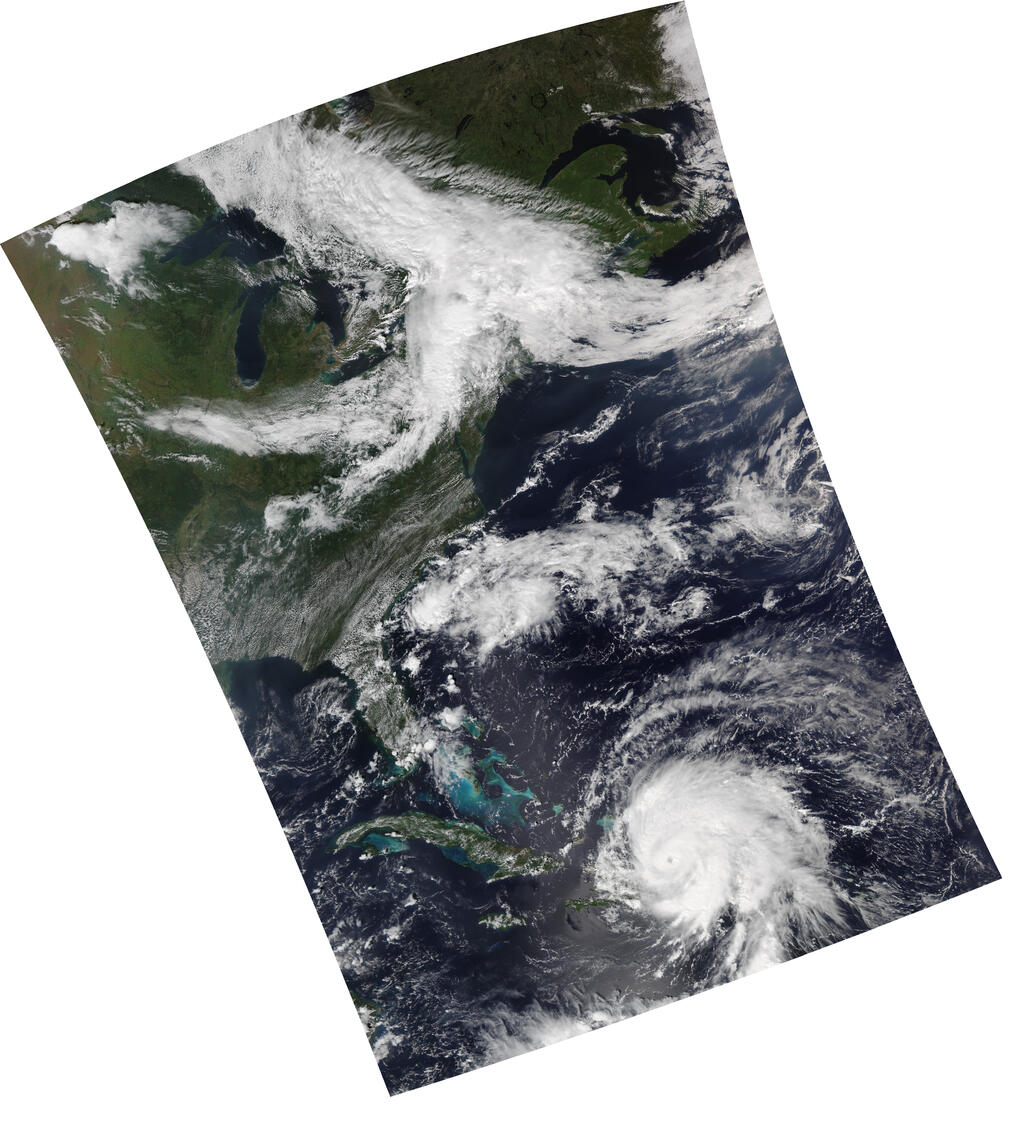
Fig. 9.1 VIIRS True color image in Lambert Conformal Conic (LCC) projection (noaa20_viirs_true_color_20220919_175331_lcc_fit.tif).
Add coastlines, borders and latitude/longitude grid lines to the true color image, and write the output to the file “myfile.png”.
add_coastlines.sh --add-coastlines --add-borders --borders-resolution=h --borders-outline='red' --add-grid noaa20_viirs_true_color_20220919_175331_lcc_fit.tif -o myfile.png
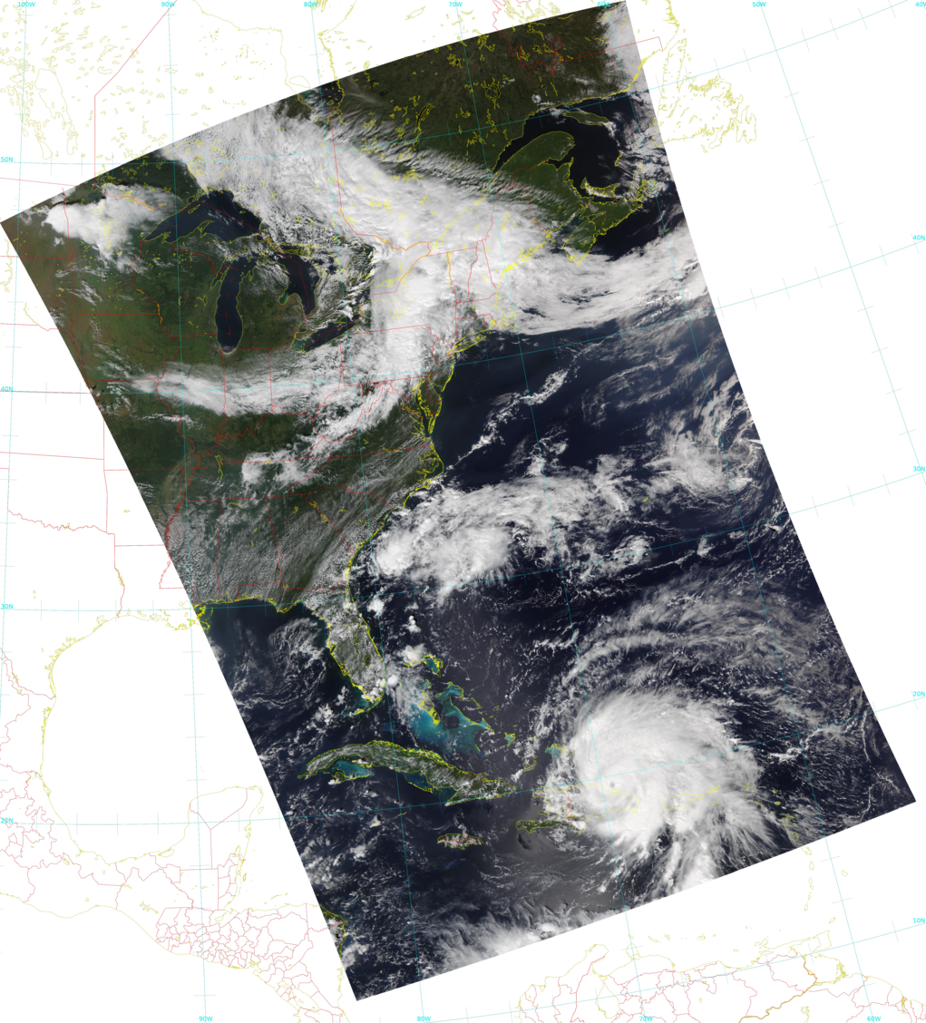
Fig. 9.2 VIIRS True color image with overlays (myfile.png).
Convert the true color GeoTIFF file into a Google Earth compatible Keyhole Markup language Zipped (KMZ) file.
gtiff2kmz.sh noaa20_viirs_true_color_20220919_175331_lcc_fit.tif
which creates the noaa20_viirs_true_color_20220919_175331_lcc_fit.kmz file. When displayed in Google Earth this image appears as:
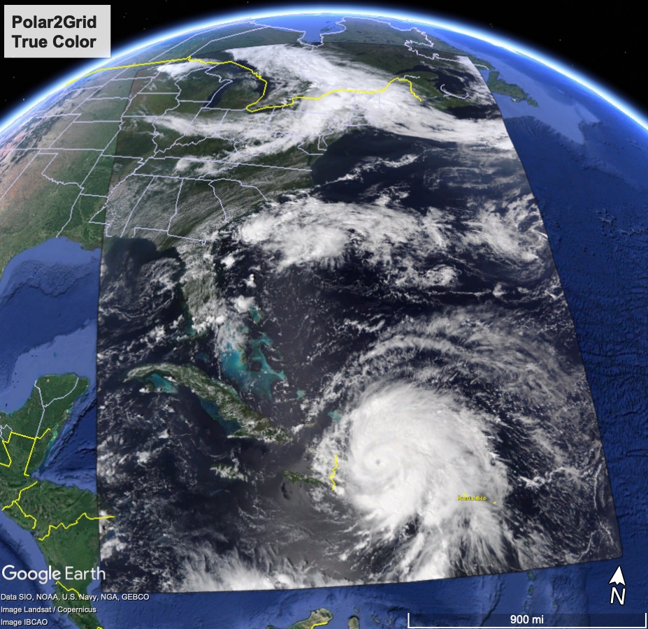
Fig. 9.3 VIIRS True color KMZ image displayed in the Google Earth Geobrowser.