Remote Sensors and Data Collection - The Sensor Footprint

backforward

For remote sensing instruments, the distance between the sensor and the target plays a large role in the amount and quality of data produced. Also, due to the factors defined below, the spatial resolution will vary from image center to the edge of the swath.

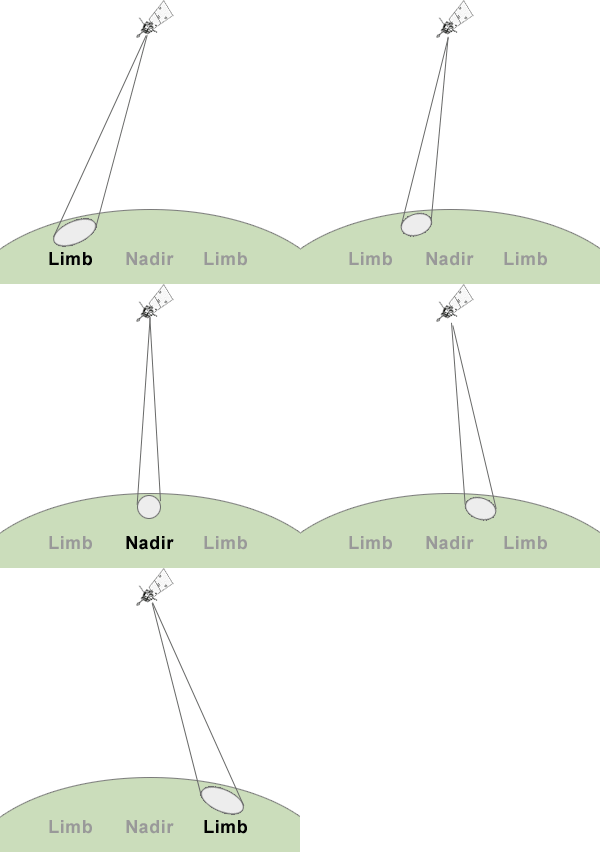
  • Instantaneous Field of View : The angular cone of visibility of a remote sensor. It determines the area on the Earth's surface sensed at a particular moment in time.
  • Nadir : The point on the Earth's surface directly below the satellite. Spatial Resolution is optimal here. Also called the sub-satellite point.
  • Limb : The edge of the apparent disk of a celestial body. Also used to refer to either edge of the sensor's swath, as shown in the graphic at right. Since the sensor IFOV is distorted at the limb, spatial resolution will be lower here.
Satellite Nadir and Limb

Sensor Footprint Simulator

The tool below simulates how changing the sensor IFOV (spot size) and sampling rate will affect the data generated from the area viewed in the scene to the right. When making adjustments, you should see:

  • When the sensor footprint is small, it is more distorted (oblong) at the limb.
  • When the sampling rate is low, the area between samples will have to be represented by data from the previous sample in the output imagery.

We're sorry, this application won't run because your web browser is not Java-enabled

This tool simulates a remote sensor footprint.


To continue, click the forward arrow below  
 

home pageHome Comments? Contact us    This project is sponsored by NASA  NASA logo backforward