Southern Plains Fires: Winter
2005-2006
Robert Rabin1
1NOAA/NSSL and
UW-Madison/CIMSS
BACKGROUND
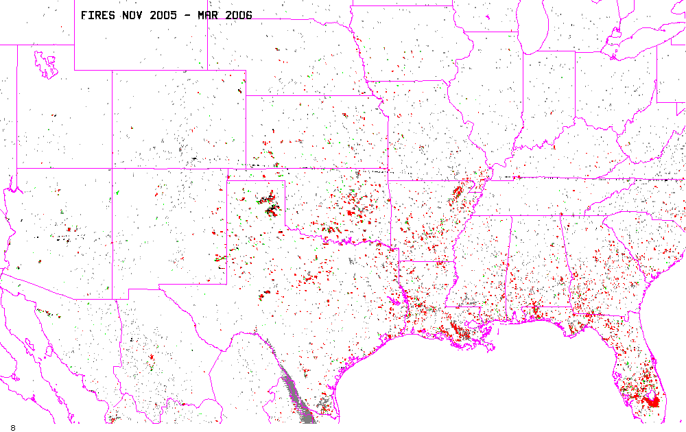
Extremely dry soil, combined with periodic episodes of strong winds,
unseasonable warmth, and very low relative humidity have lead to the
high risk of wild-fires across portions of the Southern Plains from
late
December 2005 through mid March 2006. Numerous grass fires have
burned
in the region, causing loss of property and life in a few cases.
This purpose of this web site is to show the spatial extent of the
fires as mapped by satellite, and to provide comparison of surface
conditions which may have been factors in the observed fire patterns.
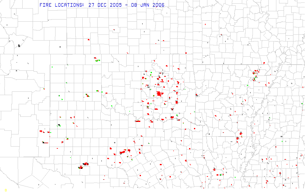
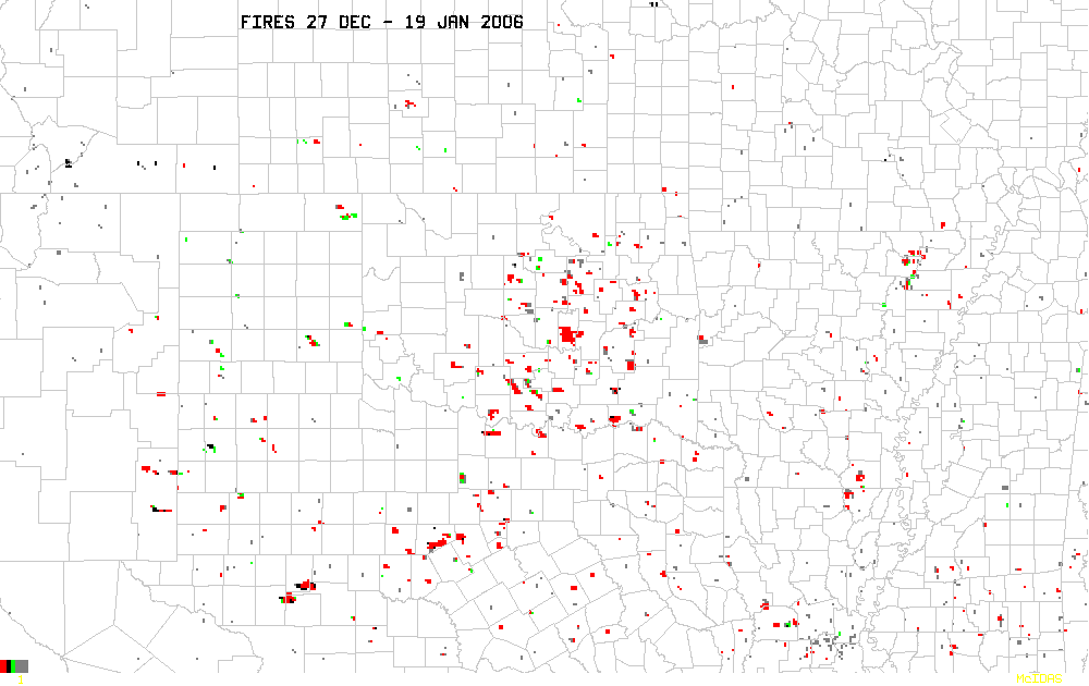
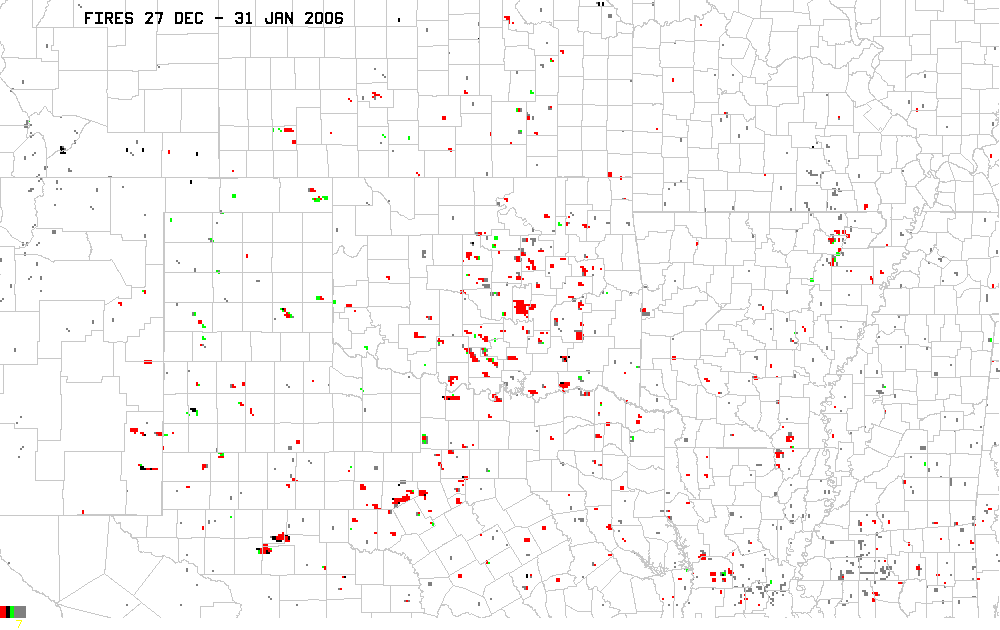
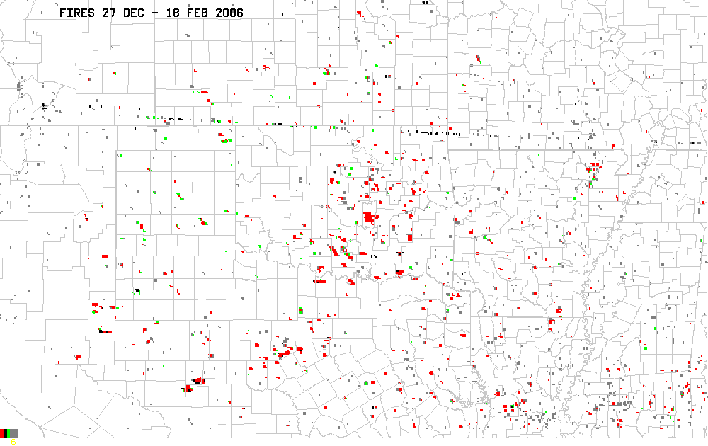
Fire locations are from the GOES
Automated Biomass Burning Algorithm (ABBA)
produced at the Cooperative Instutute
of Meteorological Satellite Studies (CIMSS),
University of Wisconsin-Madison. They are accumulated hourly and
daily for display at the NOAA/SPC. For purposes
of this study, fire locations have been accumulated over a period of
days to compare with surface vegetation conditions, soil moisture, and
population maps.
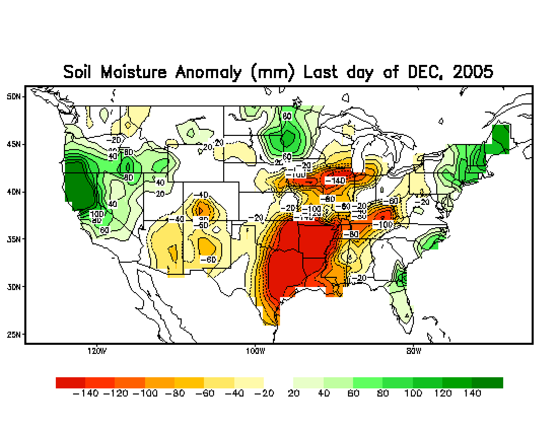
Table 1 and Movie 1 compare images of fire locations, vegetation
index (NDVI as derived from MODIS), soil moisture
estimates (from the
NOAA Climate Prediction Center),
and population densities. The evolution of modeled soil moisture
can be viewed in Movie 2. Fire locations on each individual day
are available in Movie 3.
A link to the Texas panhandle fires of 12 March 2006 is available here.
Java based applications used for interactive animations were
developed
by Tom Whittaker of the Space Science and Engineering Center SSEC,
University of Wisconsin-Madison. The animations can take a while
to load, depending on network speed, computer systems, etc. Also, there
can be a problem viewing these on certain machines (Macs).
Table 1. Comparison of
fire locations and surface factors.
Movie
1. Overlay fire locations on time-varying NDVI and population
density.
Click
here.
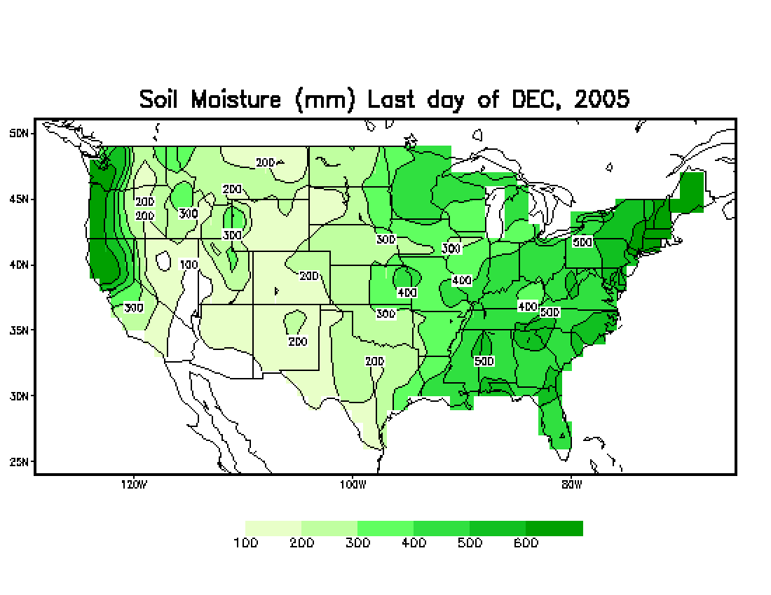
Movie 2. Soil moisture
(Dec. 2005, Jan. 2006, 20 Feb. 2006).
Click to view evolution in
soil moisture and
soil moisture anomalies.
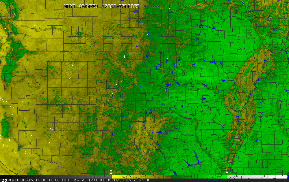
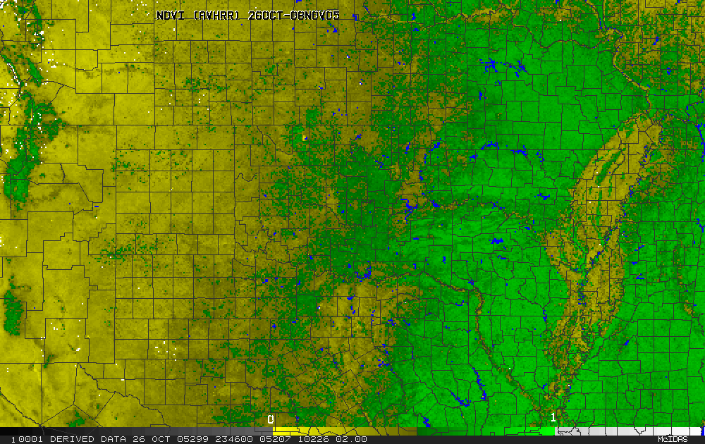
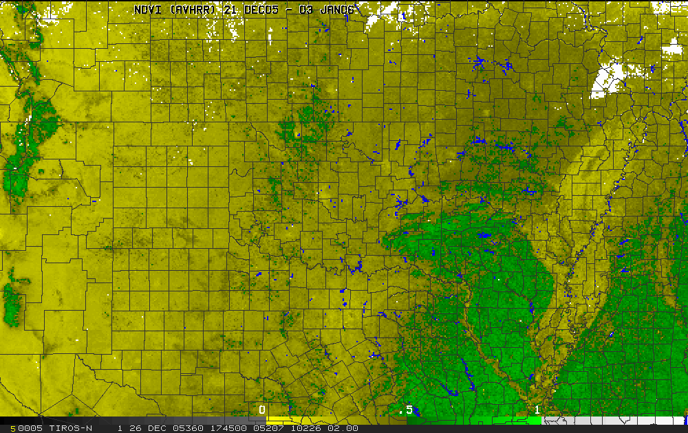
Movie 3. Evolution of NDVI (Oct 2005 - May 2006).
Data is courtesy of Kevin Gallo (NESDIS) and Jeremy
Merry (Science
Applications International Corp) and the EROS National Data Center,
USGS. To minimize cloud cover, these products are produced from
composites of daily AVHRR scenes over 14-day periods. Areas
lacking any clear skies are indicated in white. Water surfaces
are shown in blue.
Click
here
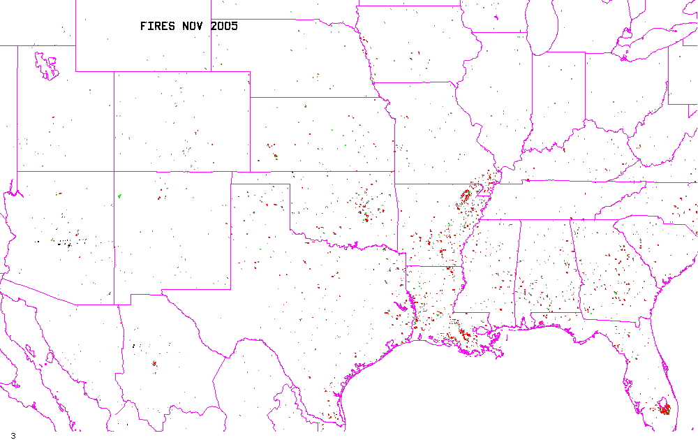
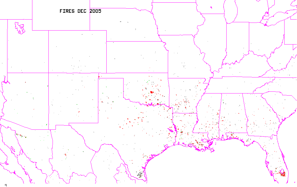
Movie 4. Movie of fire
locations on individual days (27 Dec 2005 - 18
Feb 2006) .
Click
here.
____________________________________________________________________________________________________
Seasonal
Fire Summary
November 2005
December 2005
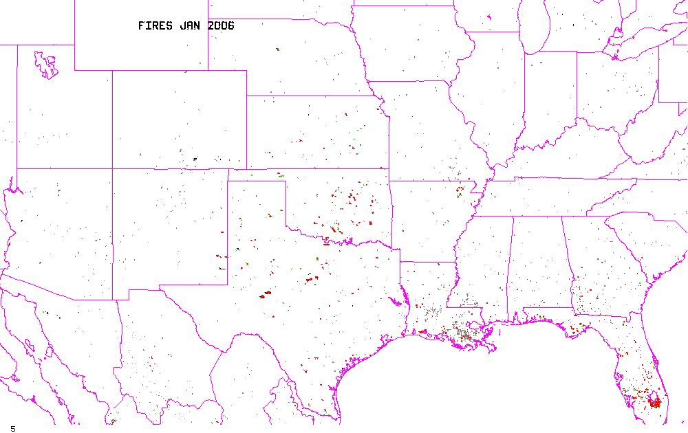
January 2006
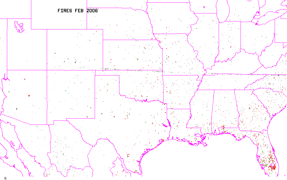
February 2006
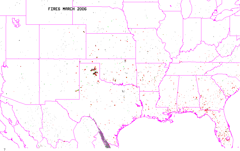
March 2006
Nov 2005 - Mar 2006
Disclaimer. The products from GOES or other
satellites
shown here are experimental. These have been generated within a
research environment and are not intended to be considered operational.
Timeliness, availability, and accuracy are sought but not guaranteed.
Return to CIMSS
(UW-Madison)
or NSSL (NOAA/NSSL).
Last update was 17 March 2006. Feedback.