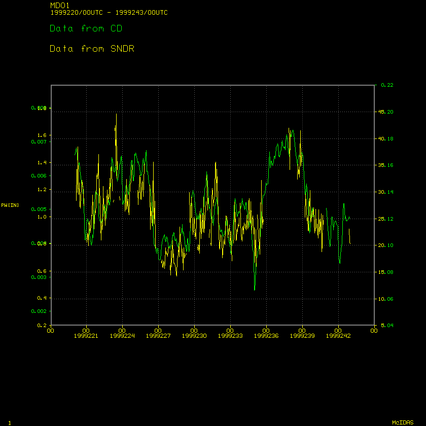
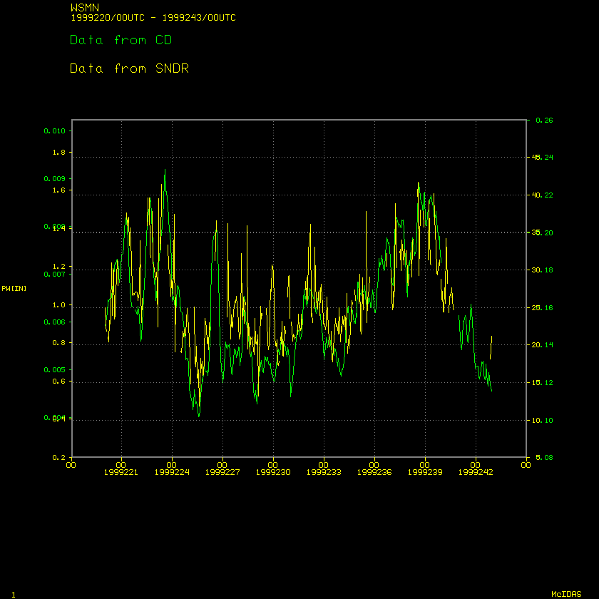
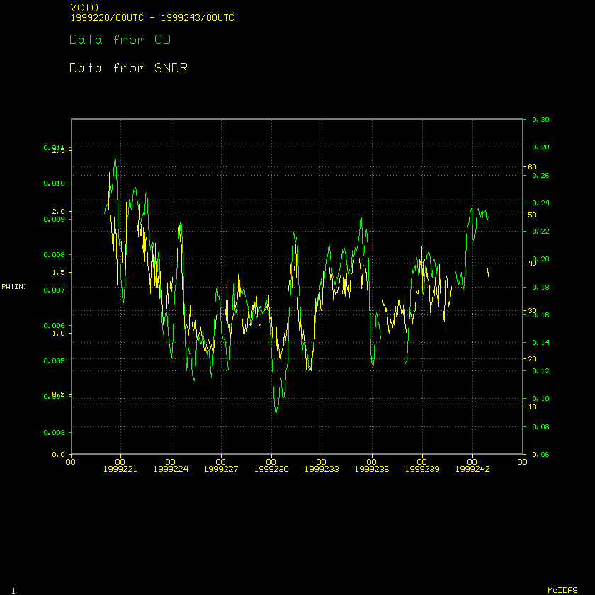
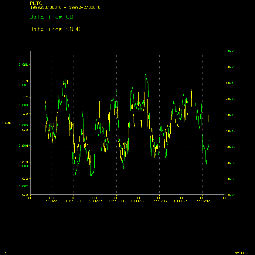
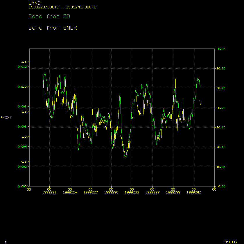
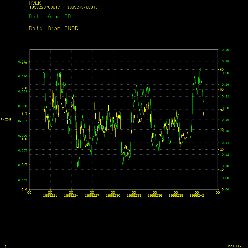
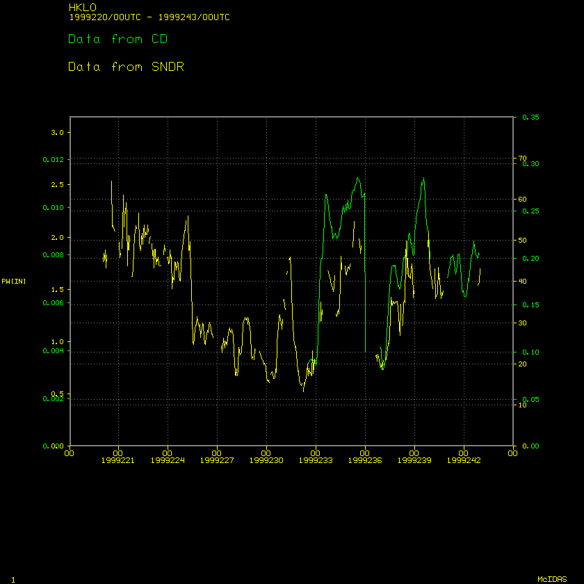
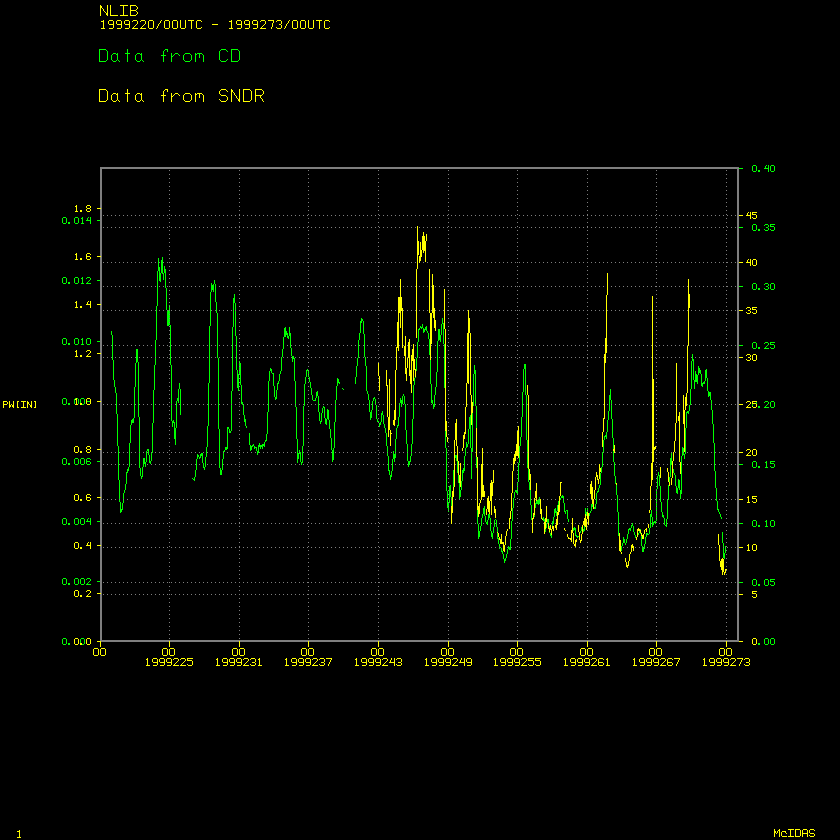
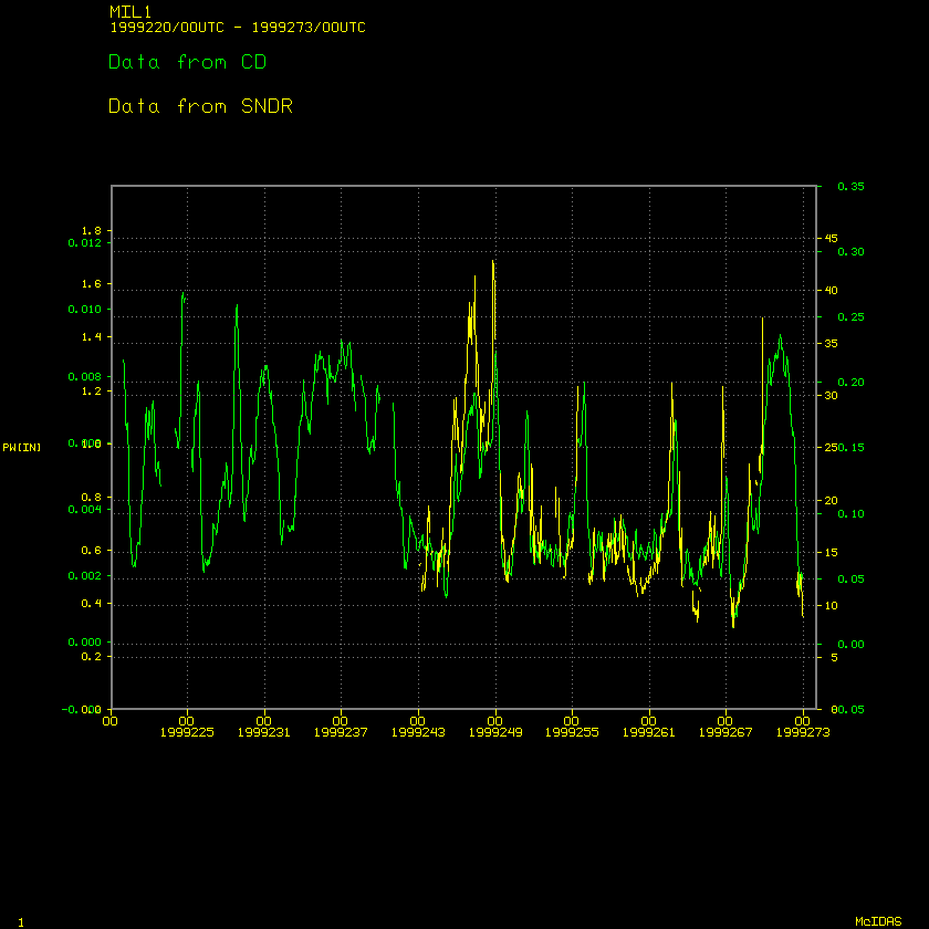
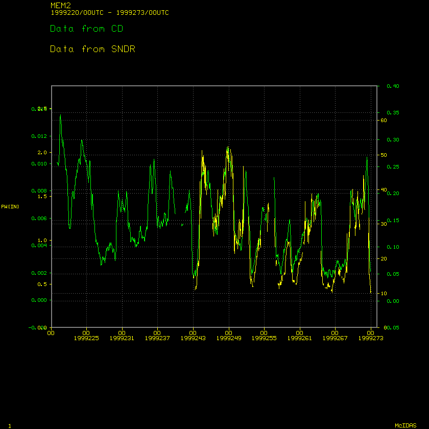
These are time series plots of wet delay (data obtained from Chuck Demets
and noted as CD) and sounder-derived precipitable
water. Here are the stations for which there are comparisons: Note that
the map that shows their locations is below.
- MDO1, or Ft. Davis, TX (near Big Bend National Park)
- WSMN, White Sands Missile Range, New Mexico
- VCIO, Vici, Oklahoma, in the western part of OK, near the panhandle
- PLTC, Platteville, CO
- LMNO, Lamont, Oklahoma (north central part of state)
- HVLK, Haviland, Kansas (south central part of state)
- HKLO, near Haskell, OK (south of Tulsa)
- NLIB, North Liberty, IA
- MIL1, Milwaukee, WI
- MEM2, Across the river from Memphis, TN
![[Map Showing Station Locations]](mapkey.gif)
Would you like to ask me a question? Click HERE!