McIDAS Learning Guide
Version 2015
[Search Manual]
[Table of Contents]
[Go
to Previous]
[Go
to Next]
Real-time Data Access - Fronts
In this exercise you will display current and forecasted NCEP fronts on maps
and over satellite images.
- Erase the images and graphics on frames 1 through 4.
- Type: ERASE F 1 4
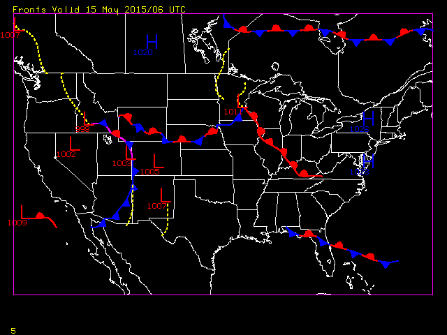
- Display the most recent NCEP frontal positions on a map
of the United States.
- Type: FRNTDISP USA LATEST
Entering 'LATEST' in the time parameter will use the latest analysis within
the previous 6 hours. You should get a map that looks similar to this:
- Next, list the decoded front point and High/Low positions
in a tabular format.
- Type: FRNTDISP USA LATEST OUT=TAB
You will see that the data is listed in a format that labels the latitude,
longitude and pressure of each High and Low, and the latitude and longitude
for each point of the troughs and fronts.
- Display the most recent GOES-East IR Full Disk image centered
over Topeka with a magnitude of -2 on frame 2. Overlay the latest NCEP fronts
on the image.
- Type: SF 2;IMGDISP EASTL/FD BAND=2
MAG=-2 STA=TOP;MAP
- Type: FRNTDISP
The default of FRNTDISP is to use the current frame navigation to display
the latest NCEP frontal positions.
- Display the 24 hour forcast over the United States at 0Z
on frame 3.
- Type: SF 3;FRNTDISP USA 0 FHOUR=24
This commands draws the 24-hour forcast fronts in today's 00 UTC NCEP frontal
position analysis product on a map of the United States.
[Search Manual]
[Table of Contents]
[Go
to Previous]
[Go
to Next]