Type: ERASE F 1 4
Type: FRNTDISP USA LATEST
Entering 'LATEST' in the time parameter will use the latest analysis within the previous 6 hours. You should get a map that looks similar to this:
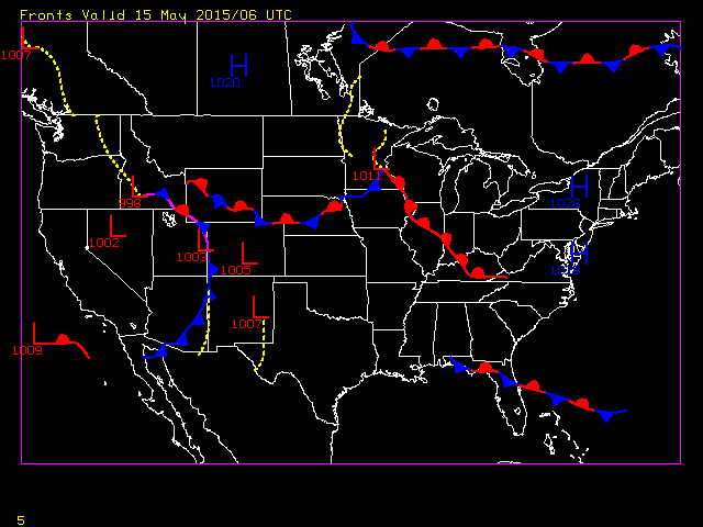
Type: FRNTDISP USA LATEST OUT=TAB
You will see that the data is listed in a format that labels the latitude, longitude and pressure of each High and Low, and the latitude and longitude for each point of the troughs and fronts.
Type: SF 2;IMGDISP RTGOESR/FD BAND=13 MAG=-2 STA=TOP;MAP
Type: FRNTDISP
The default of FRNTDISP is to use the current frame navigation to display the latest NCEP frontal positions.
Type: SF 3;FRNTDISP USA 0 FHOUR=24
This commands draws the 24-hour forcast fronts in today's 00 UTC NCEP frontal position analysis product on a map of the United States.