Choosing Satellite Imagery
The Satellite->Imagery chooser allows you to access satellite imagery on local or remote ADDE servers. For more information on how to use this chooser, see Getting Started - Displaying Satellite Imagery.
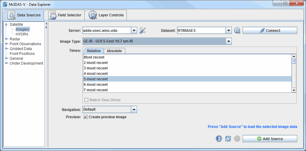 Image 1: Satellite Imagery Chooser
Properties
- Server - Selects the server to be used. Enter in a server name or choose one from the pulldown menu. Right-click in the entry box to manage your ADDE servers and to delete the server from the list.
 Manage - Manages the list of servers by opening the ADDE Servers tab of the User Preferences window.
- Dataset - Selects the dataset to be used. Enter in a dataset name or choose one from the pulldown menu.
 Public Datasets - Lists the public datasets available on the server.
 - Connects and queries the server for available image types.
- Image Type - Selects the image type.
- Times: Relative - Allows you to select a group of up to the last 100 times.
- Times: Absolute - Allows you to select one or more absolute times. When choosing absolute times for the first time, McIDAS-V needs to query the ADDE server for the times. This may take some time. To select more than one time use Ctrl+click or Shift+click. See the Timeline Controls section for details on its use. Click on the
 Select Day button to narrow down a large dataset to one day.
- Match Time Driver - Selects times that match the time driver, assuming one has been set. For more on this feature, see Time Matching. This option is only available if a time driver has been set in the session.
- Navigation - Selects one of the available navigation types. Use Default for most images, and Lat/Lon if LALO navigation should be used. Level 1b servers and POES servers often require Lat/Lon navigation to be used.
- Preview - Displays a preview of the image in the Region tab of the Field Selector. If this box is unchecked, then only a map of the image coverage area will be shown without any data.
 Help - Brings up this help page.
 Refresh - Updates the Imagery chooser with the most recent data.
 Cancel - Cancels the query of data. The chooser will reset back to default.
 - Loads the selected data.