GOES 1-km visible
imagery
Northern Alaska
Robert Rabin1
1NOAA/NSSL and
UW-Madison/CIMSS
BACKGROUND
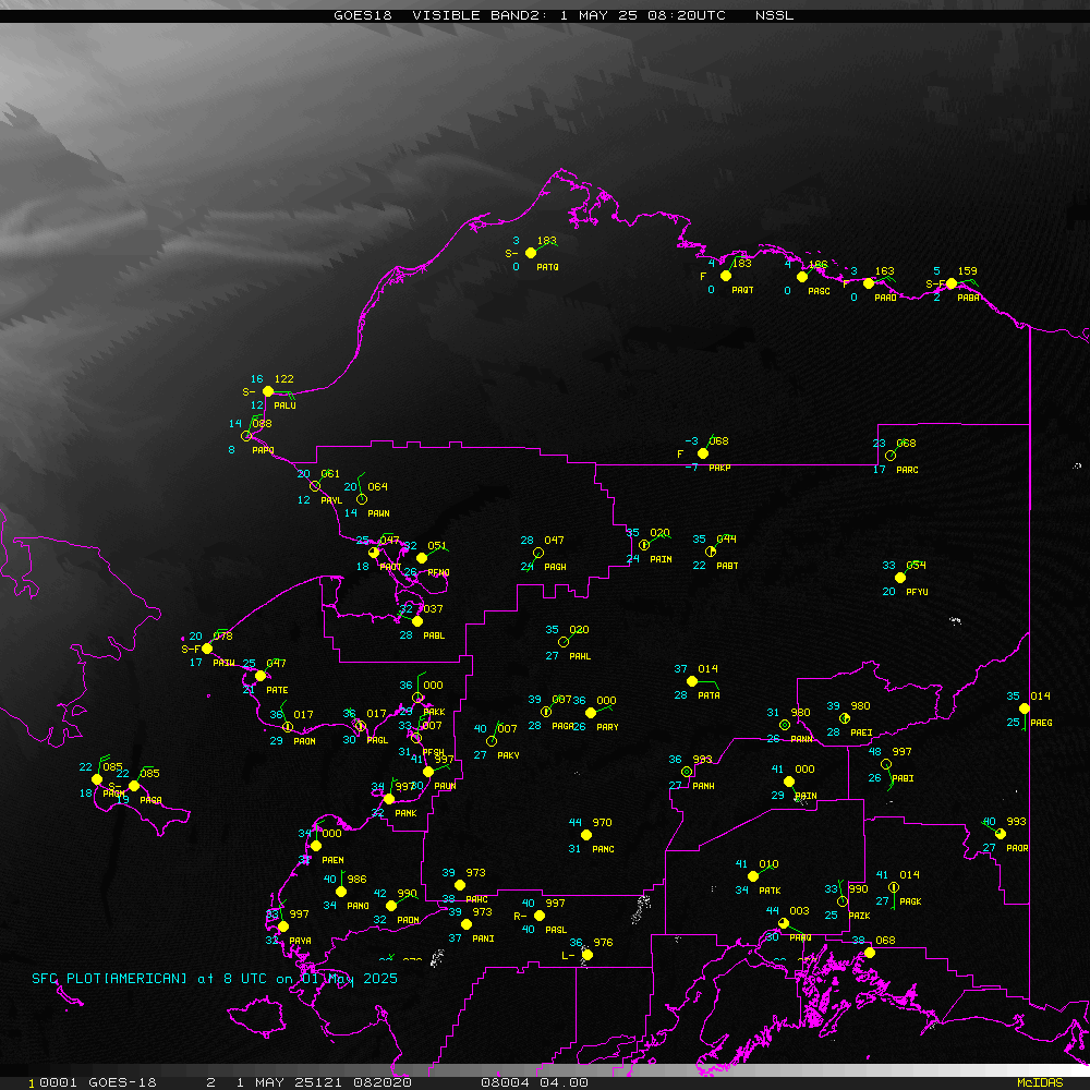
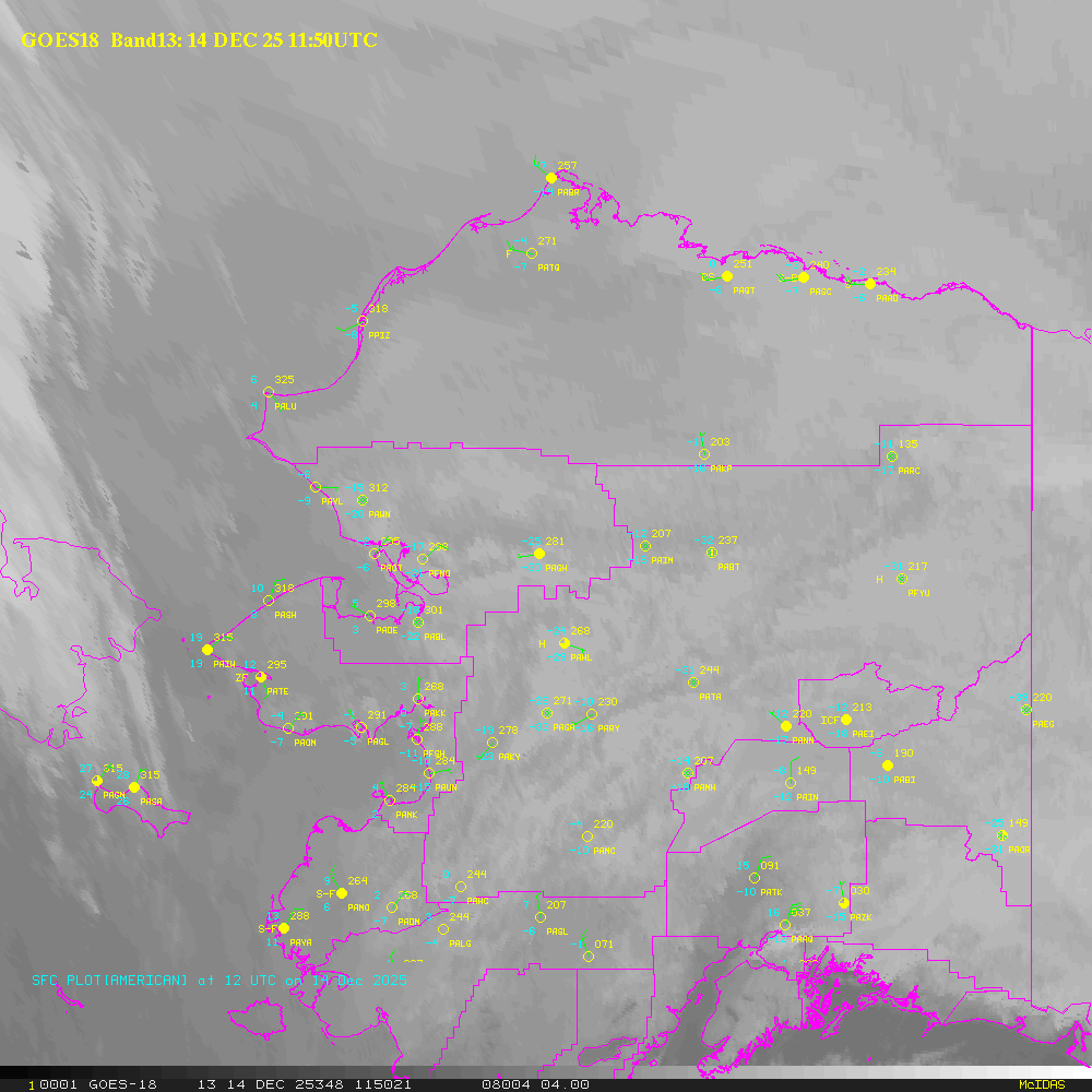
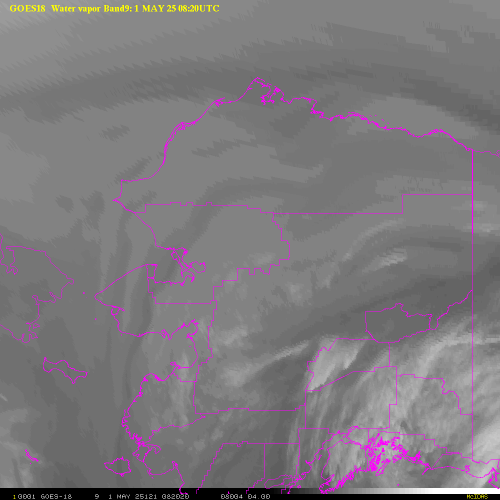
This web page provides near real-time imagery for northern Alaska and
surrounding areas. The background images linked in table below are from
the visible and infrared
channels of the NOAA geostationary satellite GOES-17 (western
satellite). Since the GOES satellite is in orbit above the
equator (in order to be "geostationary"), the viewing angle at
high latitudes such as Northern Alaska is quite skewed and exhibits
degraded resolution. For this reason, the images appear distorted near
the northwestern edge of these images. The apparent offset of
clouds from their true location above the ground, parallax, is also a
significant problem. A parallax correction has been applied to
the images using the cloud top temperature from band 13 (10.3 microns) and
a standard atmosphere temperature profile. The
images are updated at 10-20 minutes intervals. Note that visible
images are available 24 hours daily during the polar summer at these
high latitudes.
HTML5 based applications used for interactive animations were
developed
by Tom Whittaker of the Space Science and Engineering Center SSEC,
University of Wisconsin-Madison.
Table 1. Latest images
for selected areas
Table
2. Latest daily movies (past few hours)
Disclaimer. The products from GOES or other
satellites
shown here are experimental. These have been generated within a
research environment and are not intended to be considered operational.
Timeliness, availability, and accuracy are sought but not guaranteed.
Return to CIMSS
(UW-Madison)
or NSSL (NOAA/NSSL).
Last update was 19 Dec 2019. Feedback.