A measure of how well the two processes match can be gleaned from comparisons at three other stations: Vici, OK, White Sands Missile Range in New Mexico, and Scripps Institute of Oceanography just north of San Diego CA. Admittedly, this comparison is extremely limited; we are trying to secure more GaMIT data and more GiPSY data to produce more comparisons.
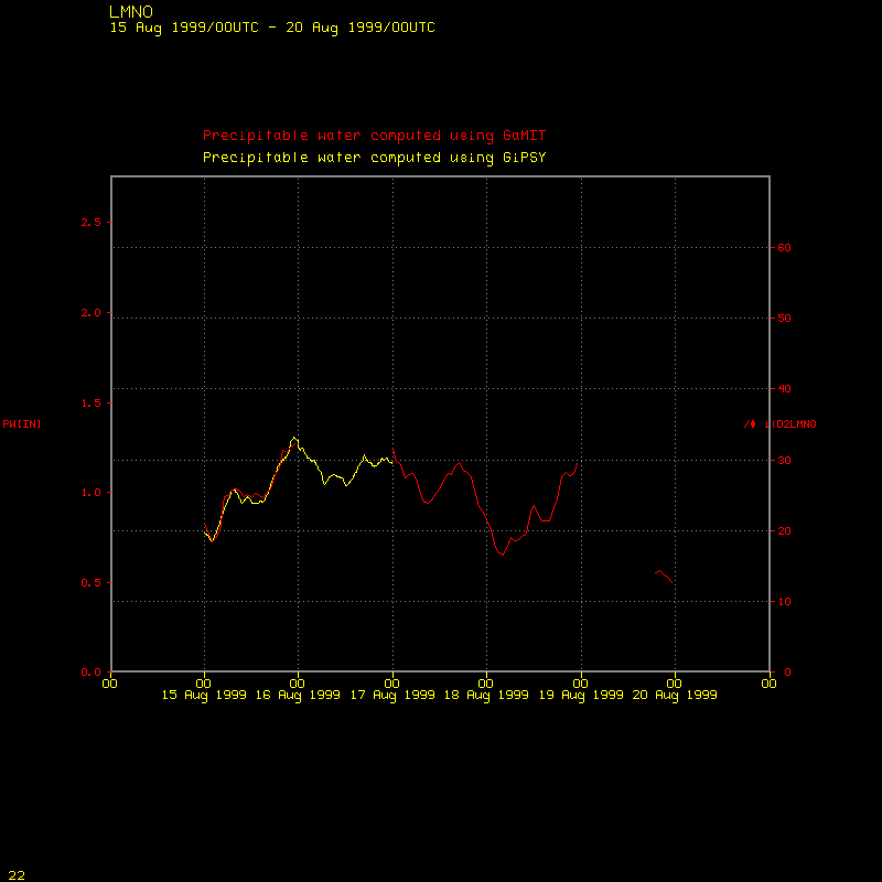
Click the image at left to see a time
series plot of precipitable water (GiPSY-produced vs. GaMIT-produced)
at Lamont, OK.
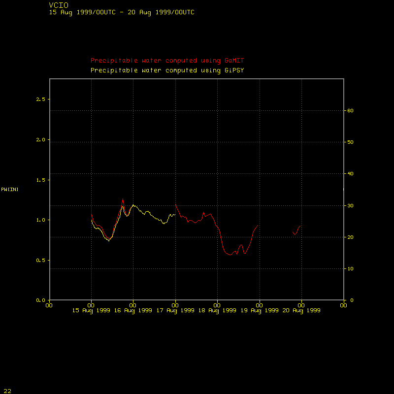 Click the image at left to see a time
series plot of precipitable water (GiPSY-produced vs. GaMIT-produced)
at Vici, OK.
Click the image at left to see a time
series plot of precipitable water (GiPSY-produced vs. GaMIT-produced)
at Vici, OK.
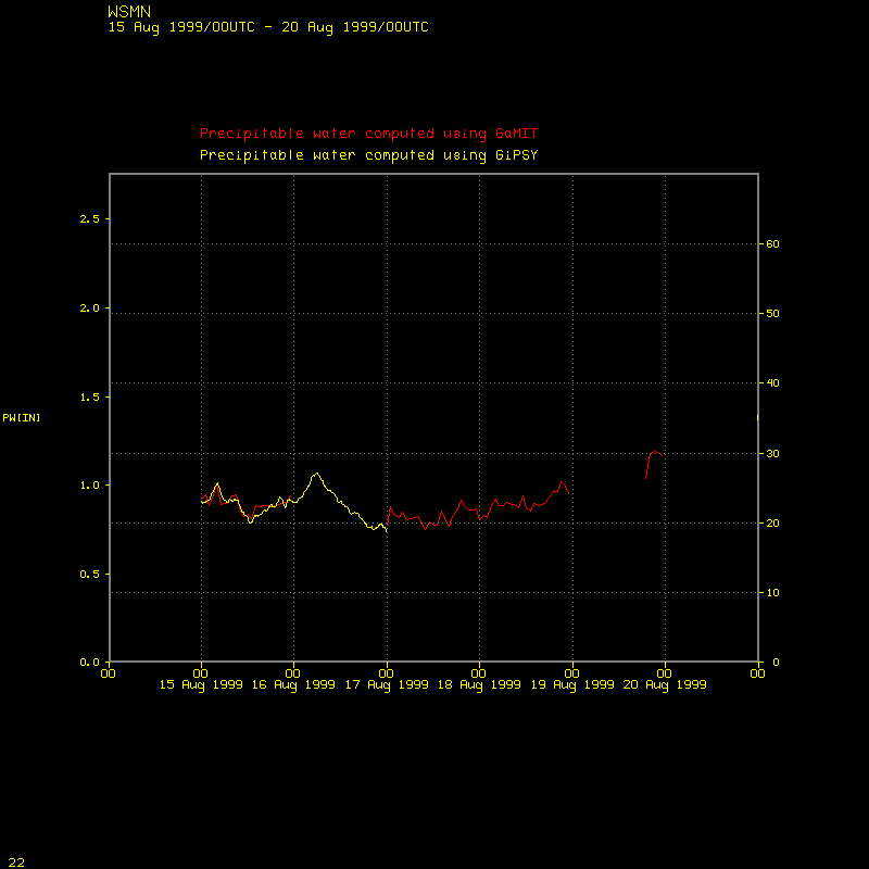 Click the image at left to see a time
series plot of precipitable water (GiPSY-produced vs. GaMIT-produced)
at White Sands Missile Range in New Mexico.
Click the image at left to see a time
series plot of precipitable water (GiPSY-produced vs. GaMIT-produced)
at White Sands Missile Range in New Mexico.
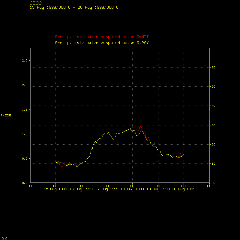 Click the image at left to see a time
series plot of precipitable water (GiPSY-produced vs. GaMIT-produced)
at the Scripps Institute of Oceanography in La Jolla, CA
(just north of San Diego).
Click the image at left to see a time
series plot of precipitable water (GiPSY-produced vs. GaMIT-produced)
at the Scripps Institute of Oceanography in La Jolla, CA
(just north of San Diego).
One thing that is evident in the four plots above: the GiPSY precipitable water is usually a bit smaller (i.e., it shows less water vapor in the air) than the GaMIT precipitable water. There are times when the reverse is true, but in general, GiPSY is drier.