This webpage shows scatterplots of precipitable water estimated from two satellite sources: GPS (on the y-axis) and GOES Sounder data (on the x-axis). Immediately below is a scatterplot using all of the GOES Sounder data. Below that is a slideshow in which different GOES Sounder data is turned on and off, depending on the number of pixels used to determine the precipitable water. Recall that between 4 and 9 can be used; if only 3 or fewer pixels are clear enough to be used, the retrieval is ignored because of clouds. GPS can sense moisture even if clouds are present.
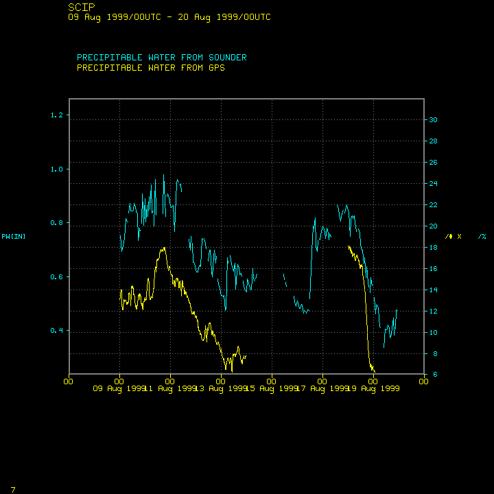
This scatterplot is for station SCIP -- San Clemente Island. This is one of the Channel Islands off the coast of southern California (Catalina Island being the most famous). Although it is in the ocean, expect the precipitable water to be low: subsidence beneath the Pacific High dominates the weather.
![[Scatterplot for SCIP on San Clemente Island off the coast of CA -- Click to see map of locations]](../mapcompare.gif)
Click here for time series plot.