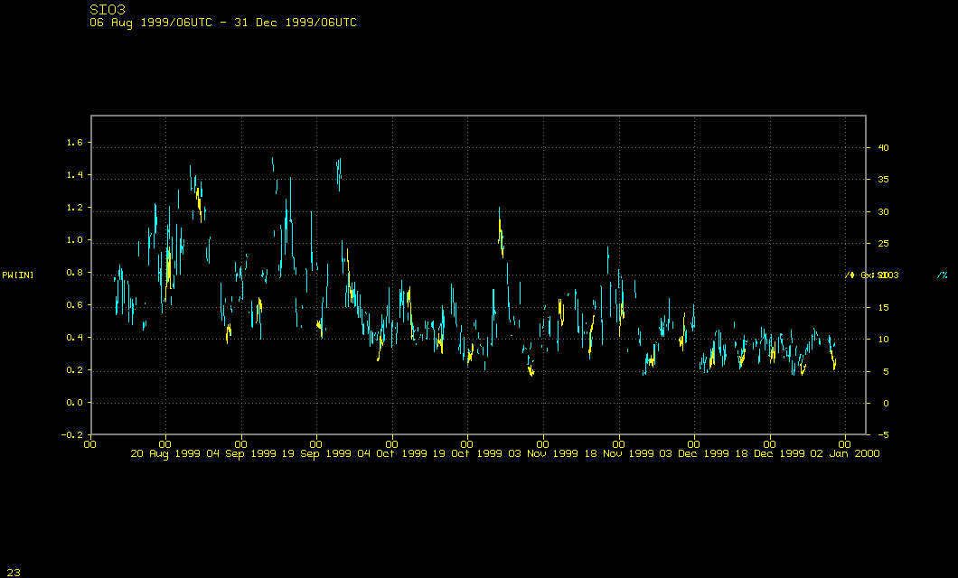
Toggle between the three images in the loop at below: it is a time series of Sounder precipitable water (in blue) and GPS precipitable water (in yellow). Do they show the same thing? These data are for the Scripps Institute of Oceanography in La Jolla, CA (just north of San Diego)
Click to toggle between GOES Sounder and GPS data