

report produced with glance, version 0.3.0.05
analysis generated Fri May 31 17:36:38 2013 by user wstraka on presto.ssec.wisc.edu
file A:
path: /data/users/wstraka/craackly_data/clouds_abi/l2_output/geocatL2.GOES-16.Fulldisk.2005155.200000.hdf
md5sum for file A: 8930aeb826147fedbaa7bb067c86bea9
last modified: Tue May 28 15:38:34 2013
file B:
path: /data/users/wstraka/craackly_data/clouds_abi/AIT_ABI/GOESR_ABI_FG_2005155_2000_00_AWG_CLOUD_PHASE.nc
md5sum for file B: 4c9d5f27dc3e04afb75c6637891c2f55
last modified: Wed May 22 20:57:35 2013
A configuration file was used to control the production of this report.
Please see this copy of the configuration file
for details.
latitude in A: pixel_latitude
latitude in B: Latitude
longitude in A: pixel_longitude
longitude in B: Longitude
longitude/latitude comparison epsilon: 0.1
WARNING: 31 data points
(0.0001054% of all data)
show possible mismatch in values stored in file a
and file b longitude and latitude values. Depending on the degree of mismatch, some data value comparisons
in this report may be distorted or spatially nonsensical. Please consider re-running this report and including an
examination of your longitude and latitude variables with appropriate epsilons in order to analyze the significance
of the difference.
View mismatching points in A's lon/lat system
View mismatching points in B's lon/lat system
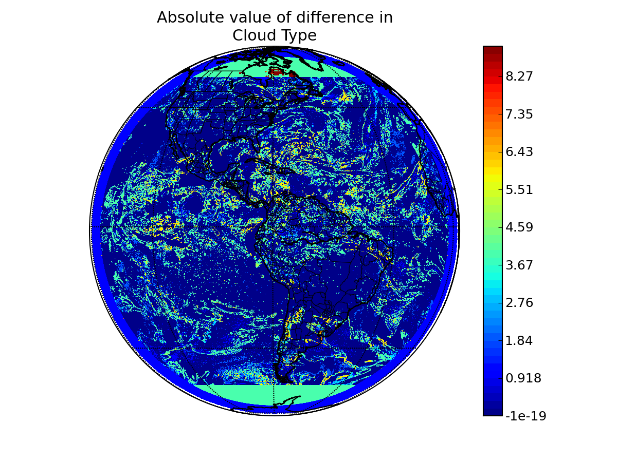
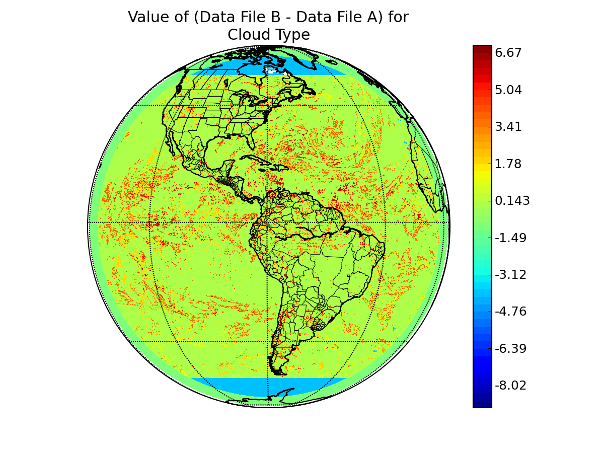
variable name in A: baseline_ctype_seviri_nodiag_cloud_type
variable name in B: CloudType
epsilon value: 0.0
"missing" data value in A: -128
"missing" data value in B: -128
units in A: none
units in B: 1