
report produced with glance, version 0.2.6.24
comparison generated Tue Dec 28 19:43:17 2010 by user wstraka on craackly.ssec.wisc.edu
file A:
path: /data/wstraka/OTTC_v4/truth_data/geocatL2.GOES-R.2003126.221838.hdf
md5sum for file A: 5af64aa46ca1fcbe5f3134c4f41e6d48
last modified: Wed Nov 17 23:07:00 2010
file B:
path: /home/wstraka/geocat_fwiw_ottc/l2_output/geocatL2.GOES-R.2003126.221838.hdf
md5sum for file B: 42d8e992694e16a516e10563e65ab012
last modified: Tue Dec 28 19:32:01 2010
A configuration file was used to control the production report.
Please see this copy of the configuration file
for details.
latitude in A: pixel_latitude
latitude in B: pixel_latitude
longitude in A: pixel_longitude
longitude in B: pixel_longitude
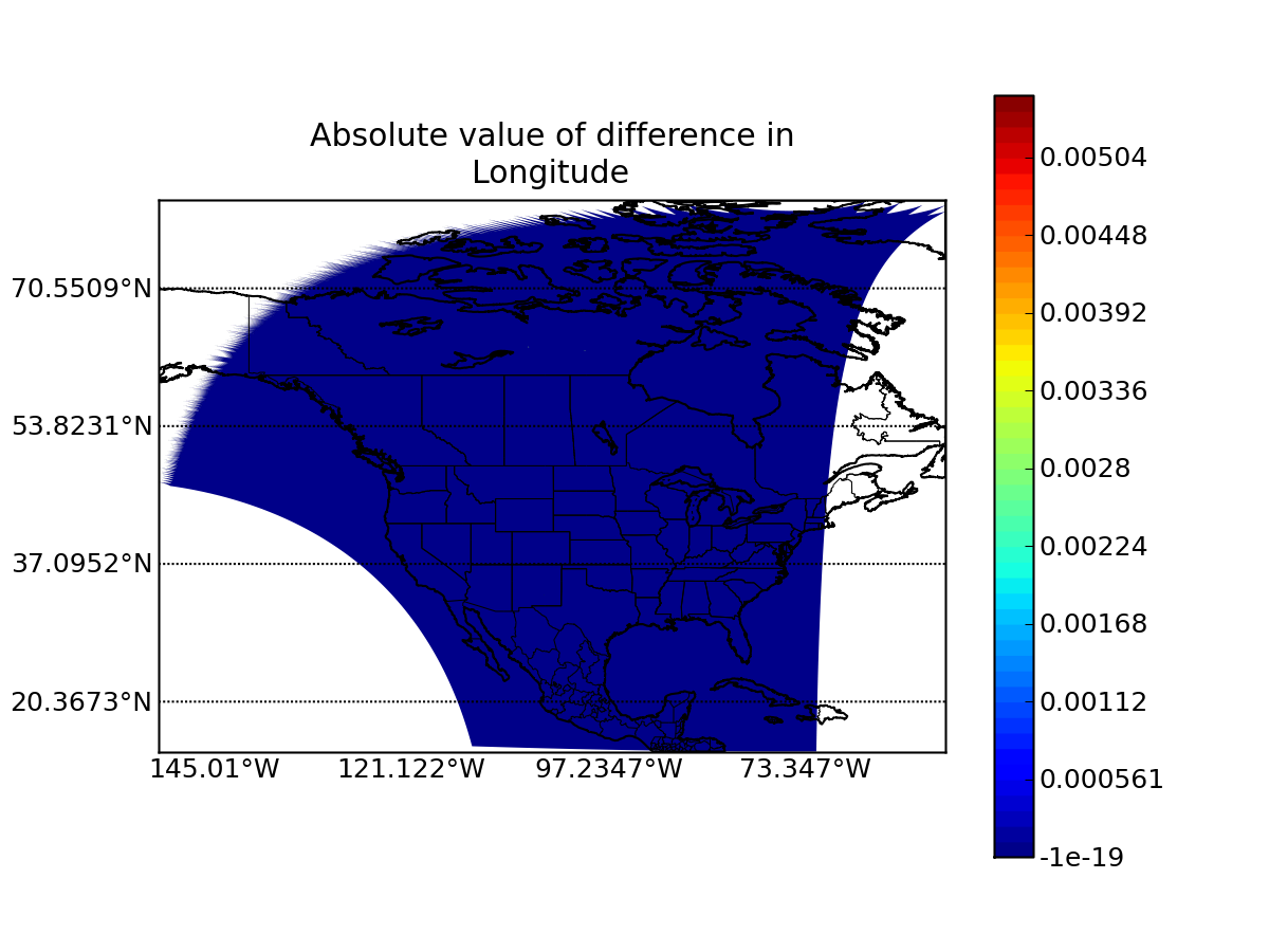
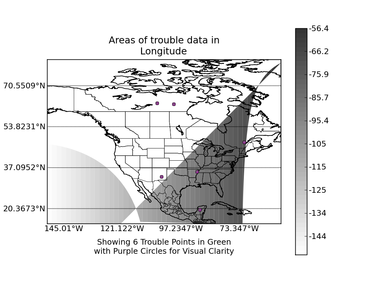
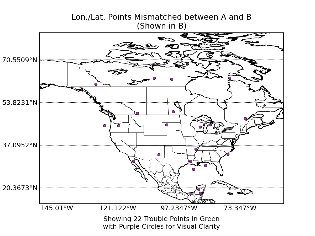
WARNING: 22 data points
(0.00055% of all data)
show possible mismatch in values stored in file a
and file b longitude and latitude values. Depending on the degree of mismatch, some data value comparisons
in this report may be distorted or spatially nonsensical. Please consider re-running this report and including an
examination of your longitude and latitude variables with appropriate epsilons in order to analyze the significance
of the difference.
View mismatching points in A's lon/lat system
View mismatching points in B's lon/lat system
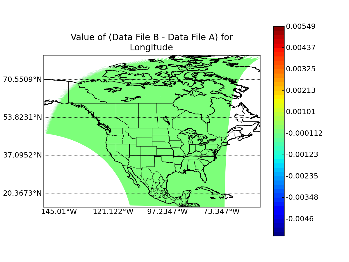
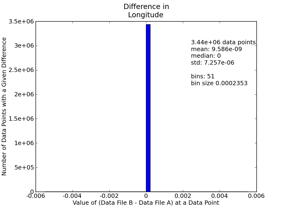
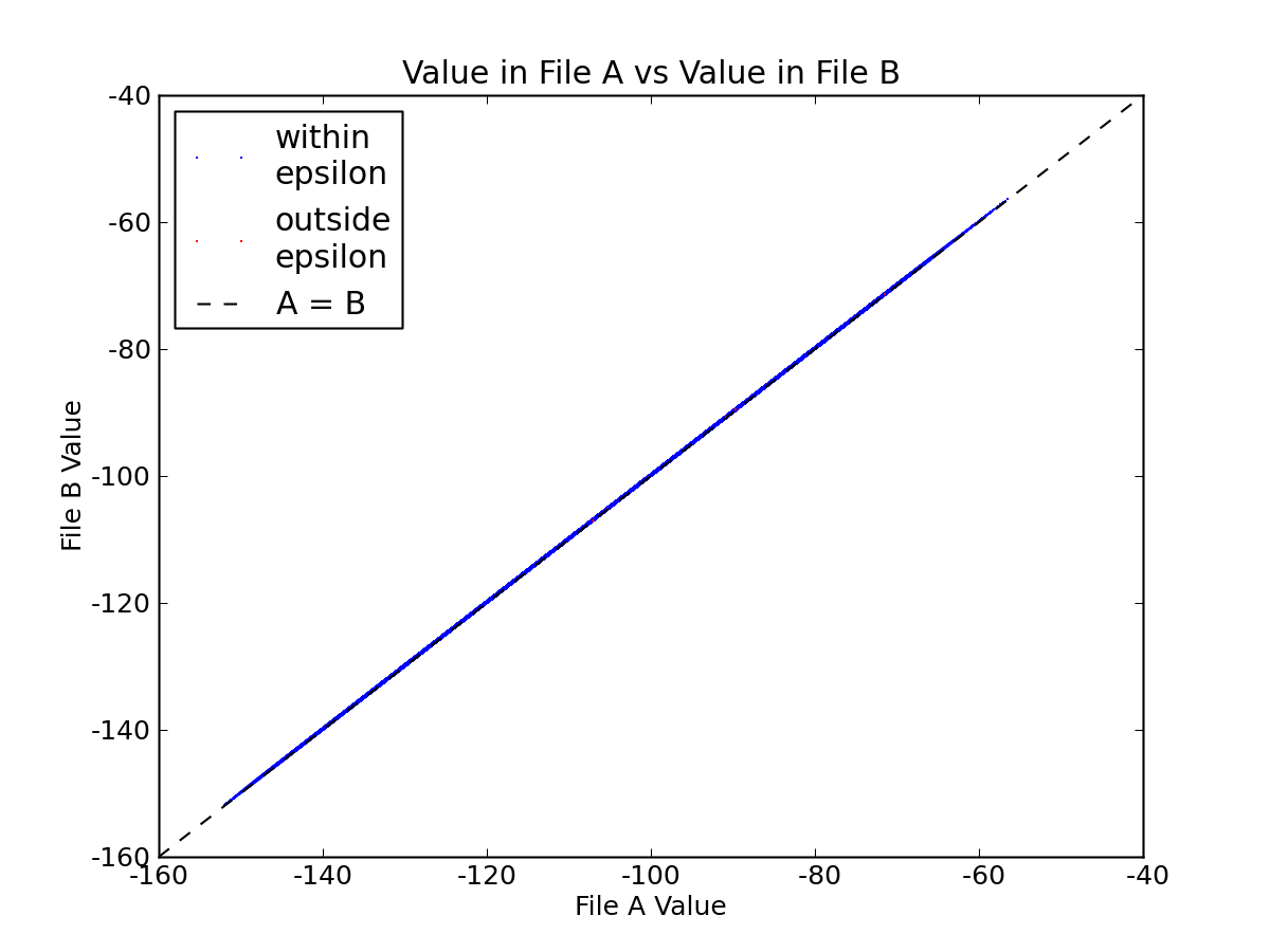
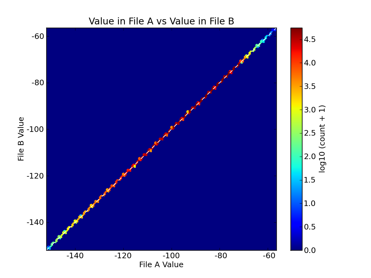
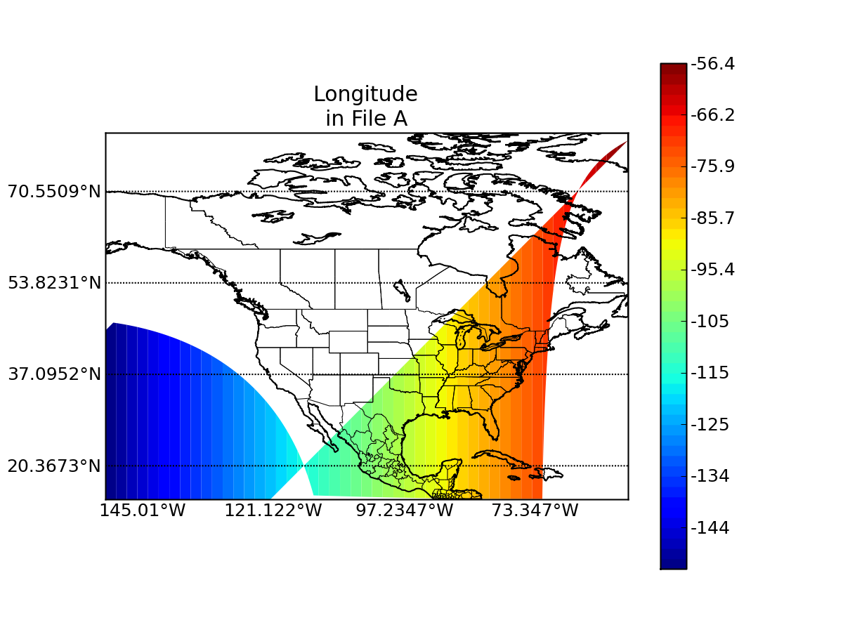
variable name: pixel_longitude
epsilon value: 0.0
"missing" data value in A: -32768
"missing" data value in B: -32768
units in A: degrees_east
units in B: degrees_east