report produced with glance, version 0.2.6.17
comparison generated Fri May 21 22:23:19 2010 by user wstraka on craackly.ssec.wisc.edu
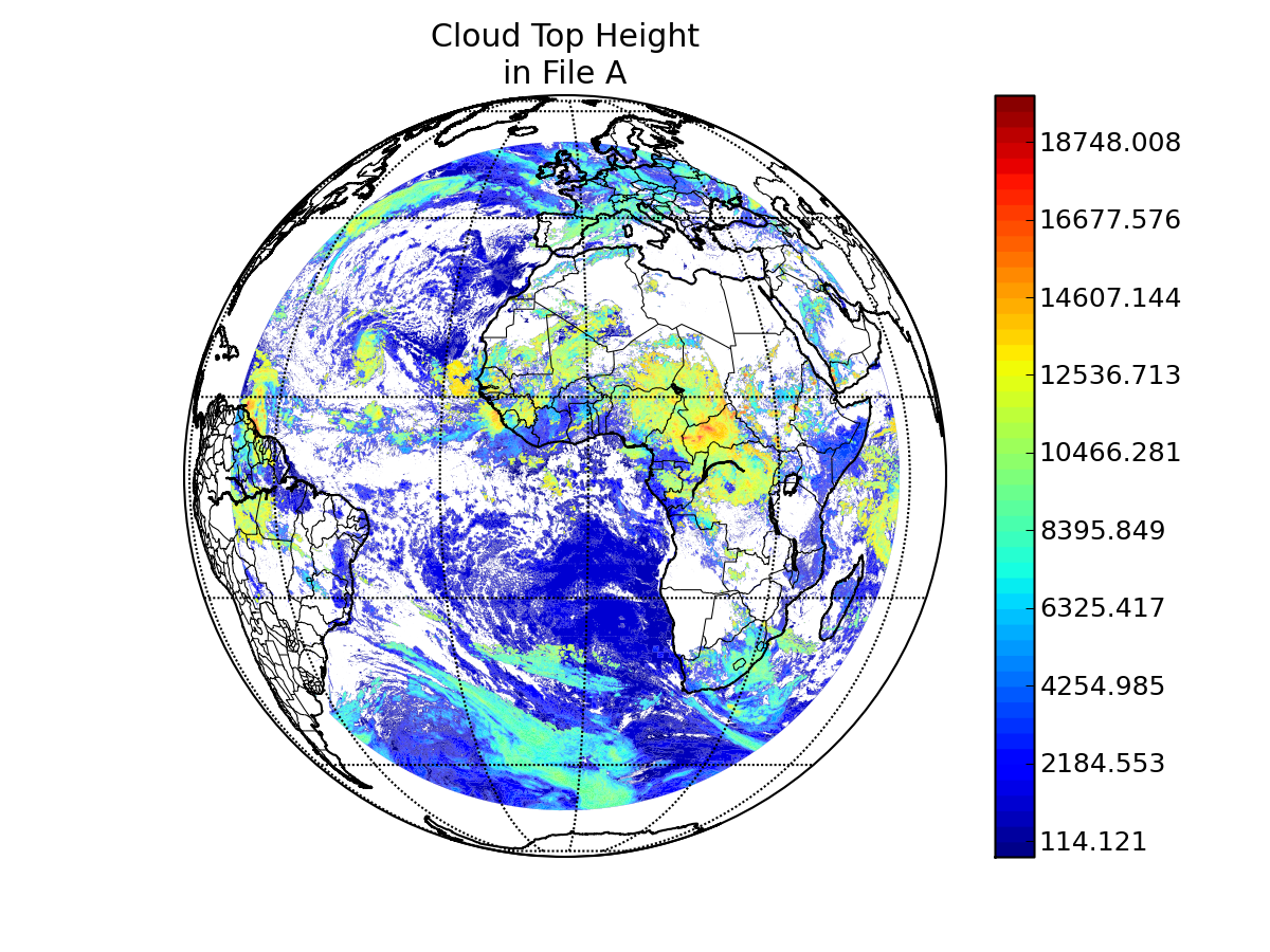
file A:
path: /data/wstraka/PFAAST_CRTM/PFAAST//MSG8_SEVIRI_2006236_1200_00_AWG_CLOUD_HEIGHT.nc
md5sum for file A: 405cd39da4f6de9aa91fb313377bc477
last modified: Tue May 18 16:40:54 2010
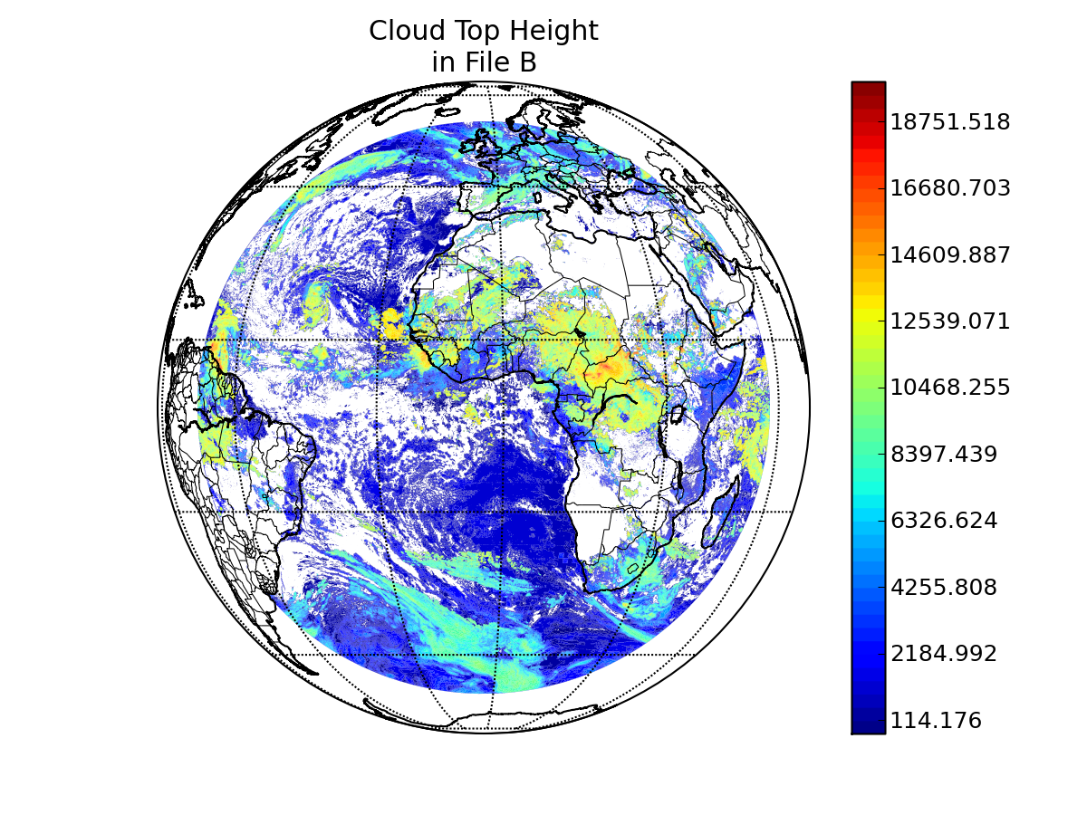
file B:
path: /data/wstraka/PFAAST_CRTM/CRTM//MSG8_SEVIRI_2006236_1200_00_AWG_CLOUD_HEIGHT.nc
md5sum for file B: bbc5d7e1a85a7a4e50d9e1b30712b7c9
last modified: Tue May 18 16:40:53 2010
A configuration file was used to control the production report.
Please see this copy of the configuration file
for details.
latitude: Latitude
longitude: Longitude
longitude/latitude comparison epsilon: 0.01
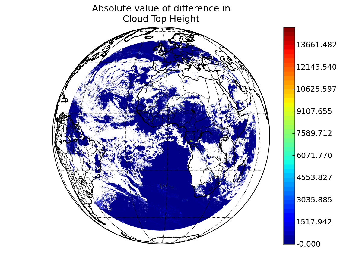
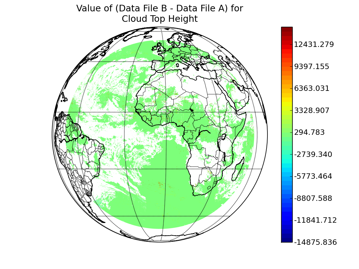
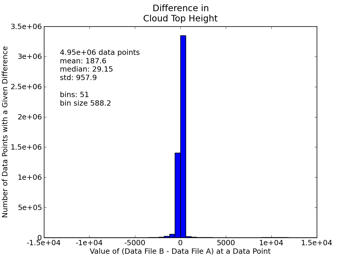
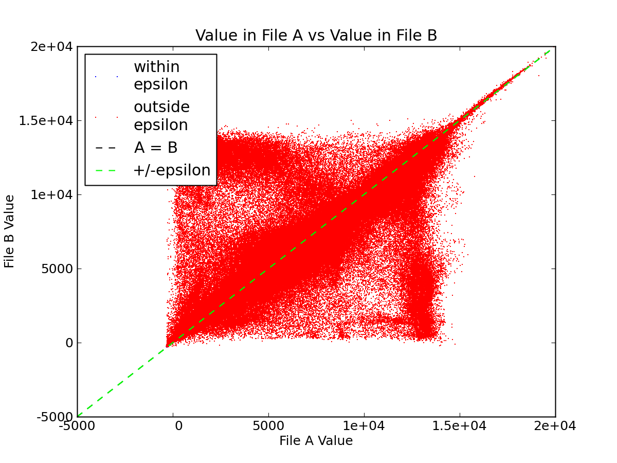
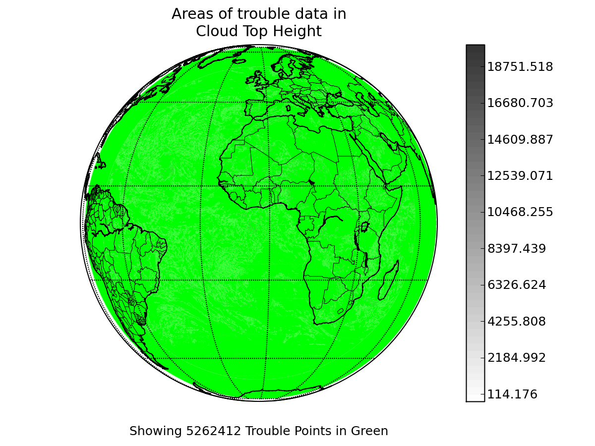
variable name: Cloud_Top_Height
epsilon value: 0.01
"missing" data value in A: -999.0
"missing" data value in B: -999.0
Note: The data for this variable from file A was filtered.
Please see this copy of
the original configuration file to view the data filtering function.
Note: The data for this variable from file B was filtered.
Please see this copy of
the original configuration file to view the data filtering function.