report produced with glance, version 0.2.6.17
comparison generated Sat May 22 00:16:28 2010 by user wstraka on craackly.ssec.wisc.edu
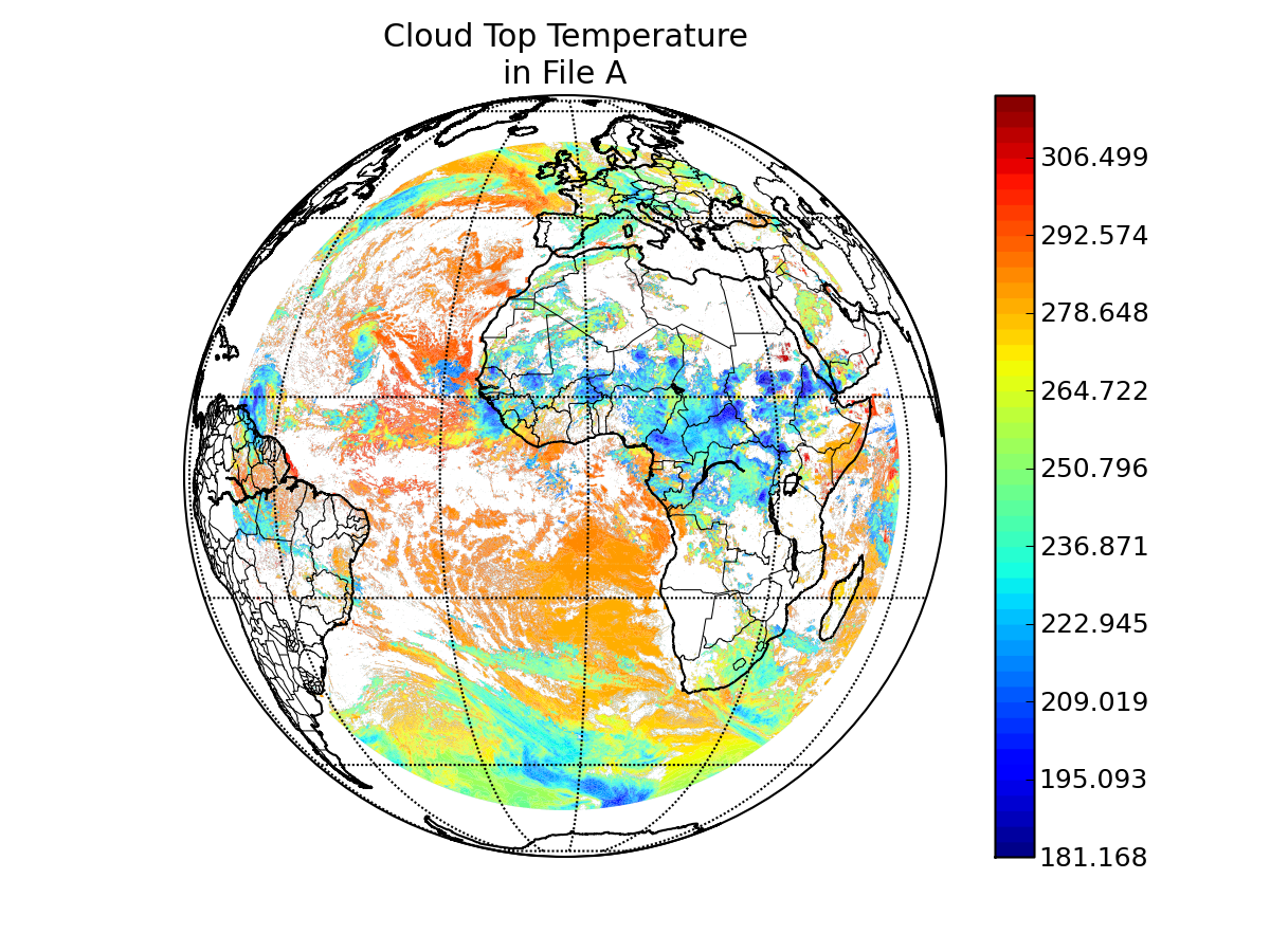
file A:
path: /data/wstraka/PFAAST_CRTM/PFAAST//MSG8_SEVIRI_2006236_1600_00_AWG_CLOUD_HEIGHT.nc
md5sum for file A: 29466e0372016ada4f71e42c2b292074
last modified: Tue May 18 16:56:55 2010
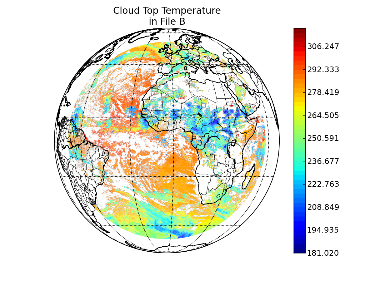
file B:
path: /data/wstraka/PFAAST_CRTM/CRTM//MSG8_SEVIRI_2006236_1600_00_AWG_CLOUD_HEIGHT.nc
md5sum for file B: a80f94f30f21a4e559437256fe3e9833
last modified: Tue May 18 16:54:45 2010
A configuration file was used to control the production report.
Please see this copy of the configuration file
for details.
latitude: Latitude
longitude: Longitude
longitude/latitude comparison epsilon: 0.01
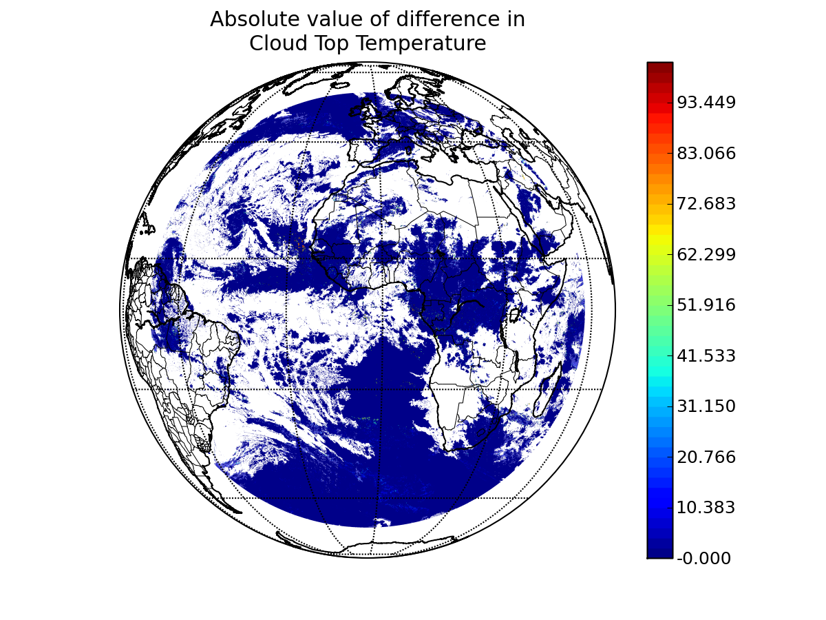
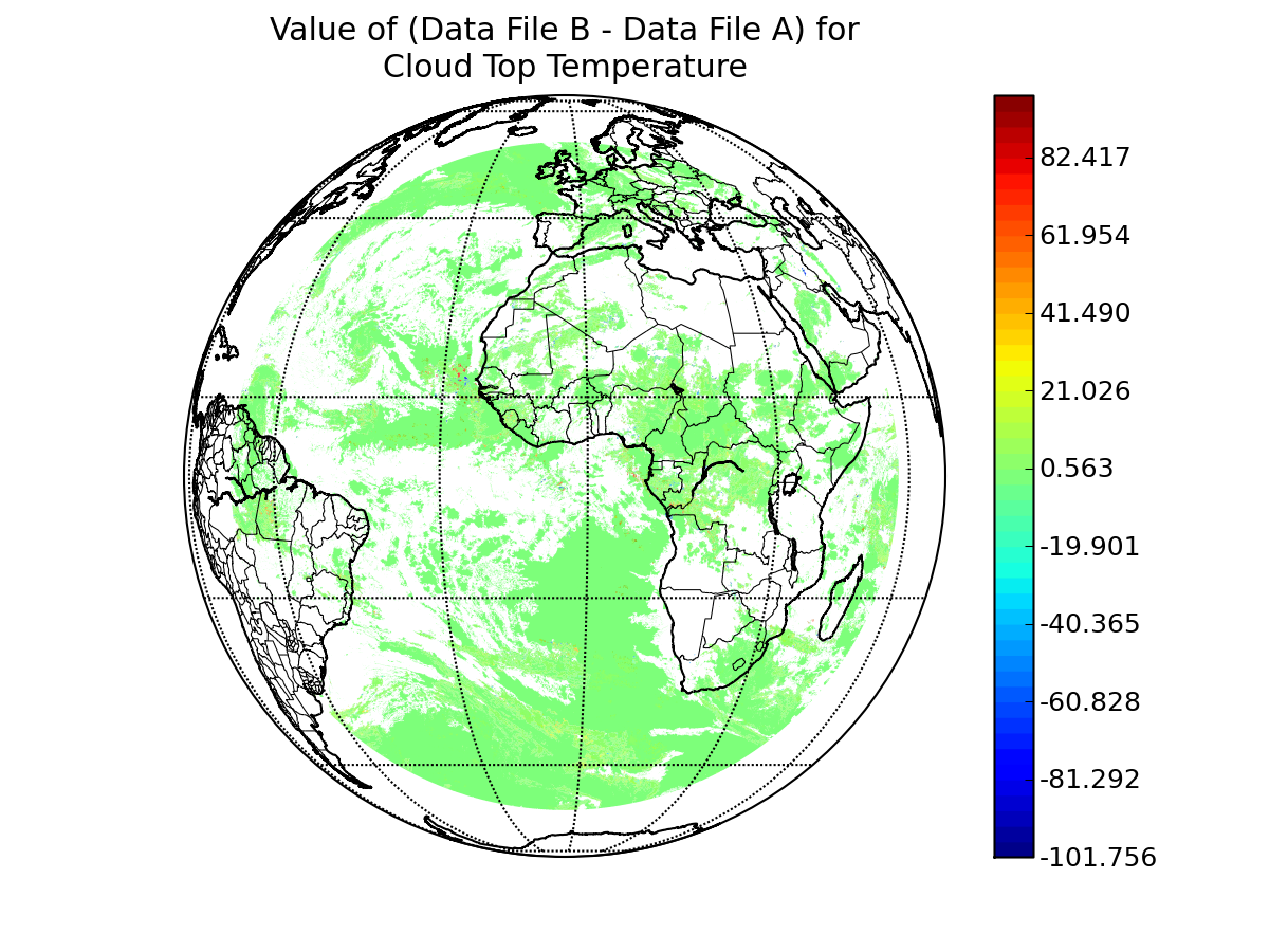
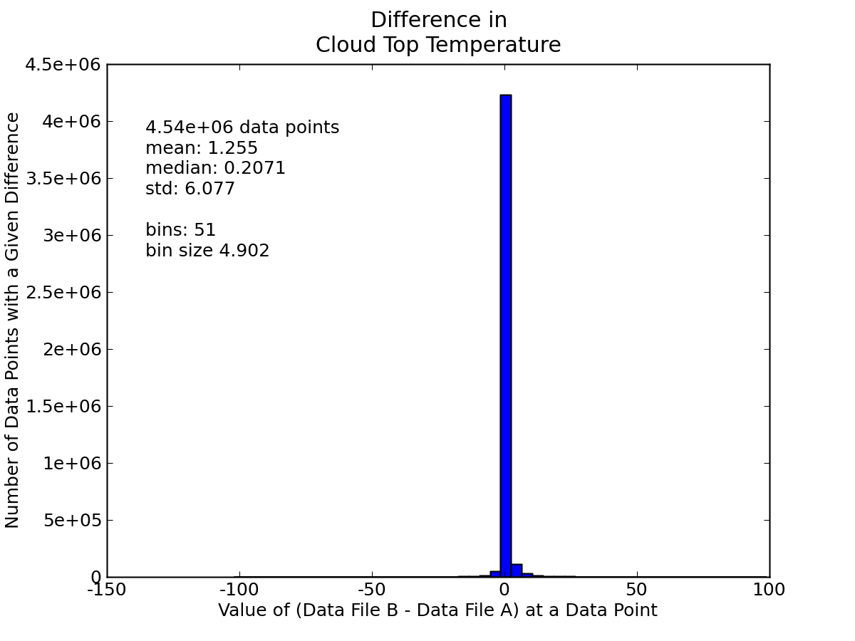
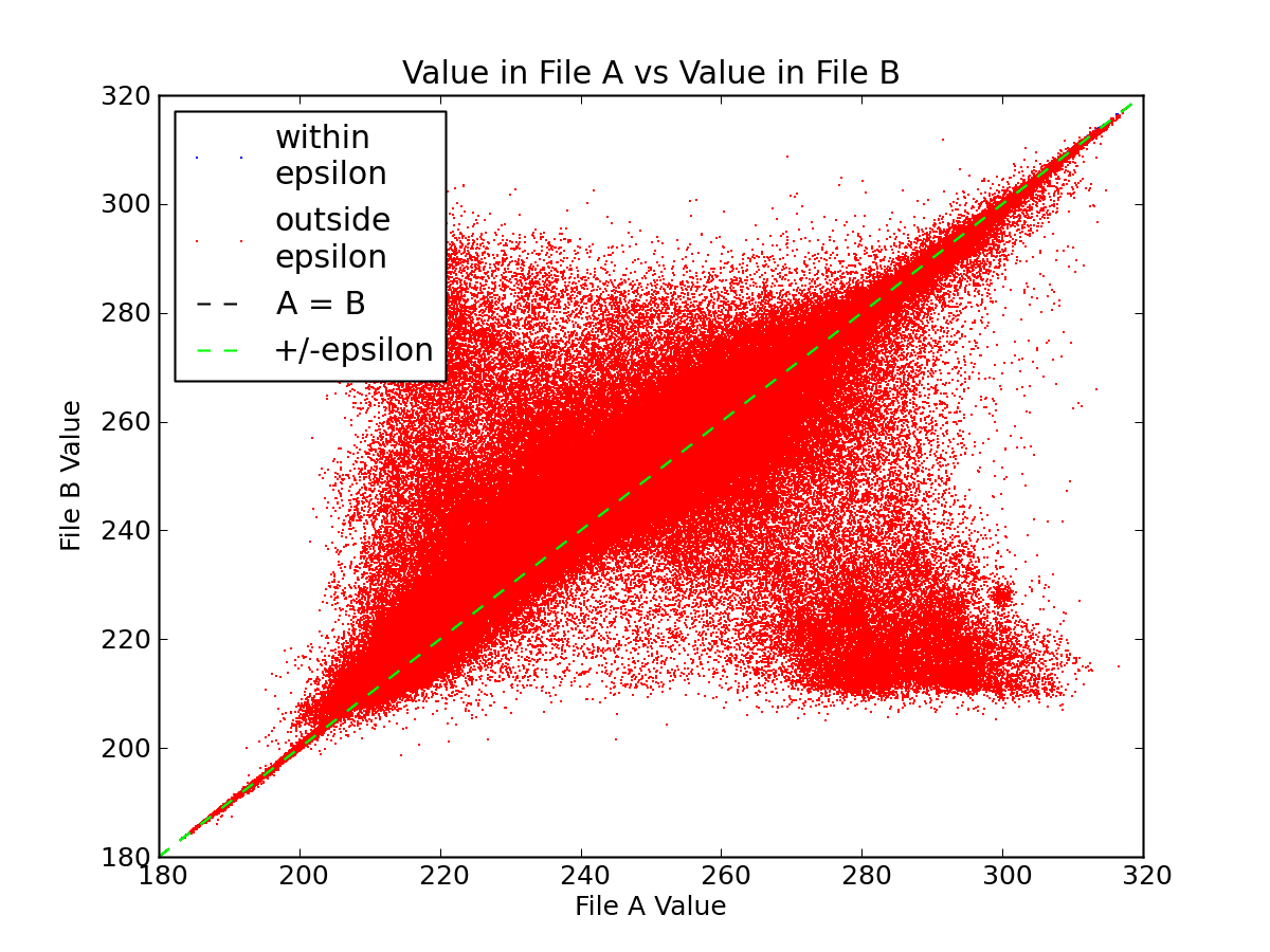
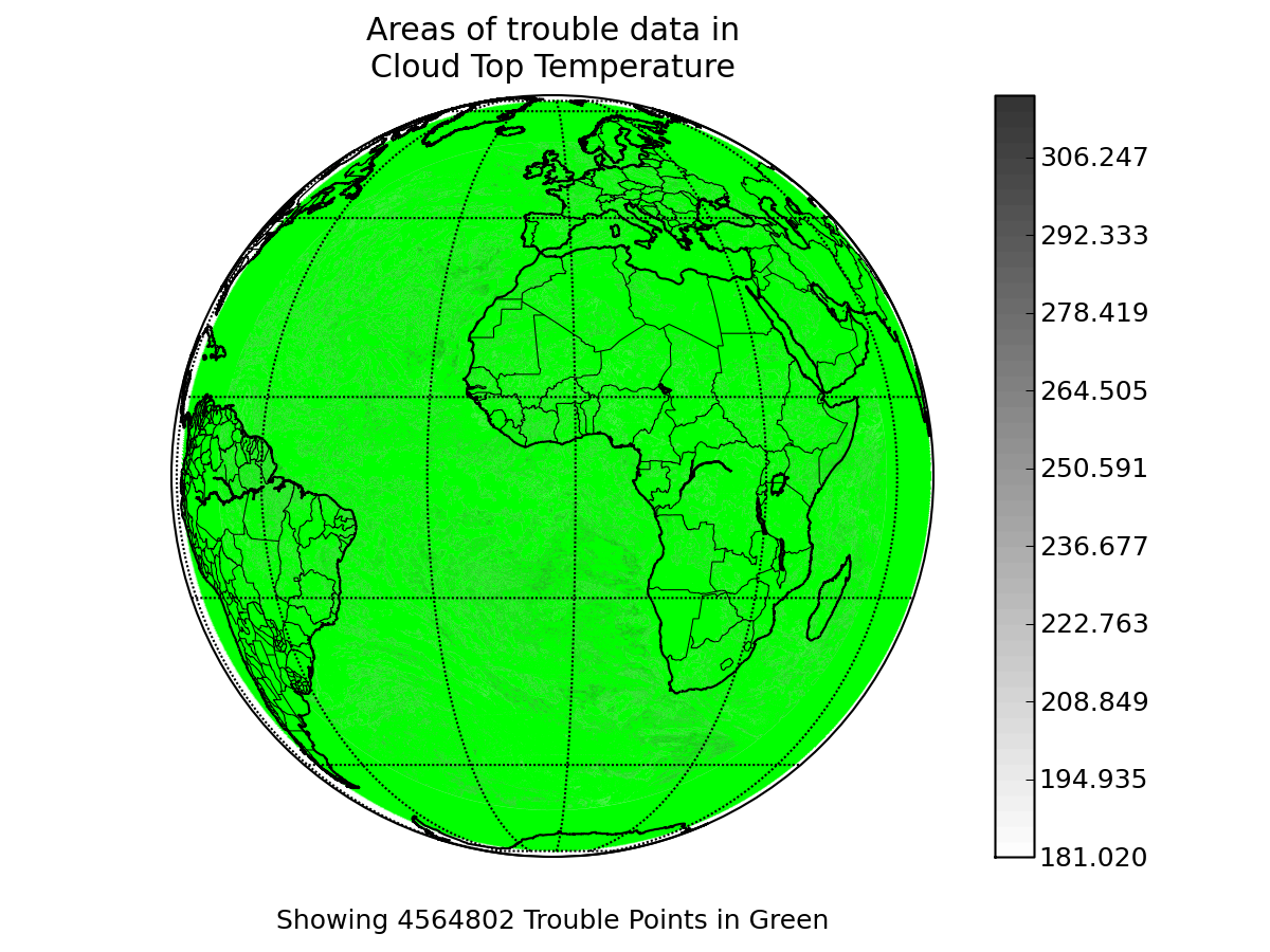
variable name: Cloud_Top_Temp
epsilon value: 0.01
"missing" data value in A: -999.0
"missing" data value in B: -999.0
Note: The data for this variable from file A was filtered.
Please see this copy of
the original configuration file to view the data filtering function.
Note: The data for this variable from file B was filtered.
Please see this copy of
the original configuration file to view the data filtering function.