report produced with glance, version 0.3.3
analysis generated Thu Jun 1 16:22:04 2017 by user wstraka on kanchi.ssec.wisc.edu
file A:
path: /data/temp/brunner/GOESR_ABI_FD_2017137_2000_00_AVIATION_VOL_ASH_BL.nc
md5sum for file A: 202ff89e8a9ad4c39ad476f7fc2de2ae
last modified: Thu Jun 1 15:16:07 2017
file B:
path: /data/temp/brunner/geocatL2.GOES-16.Full_Disk.2017137.200030.hdf
md5sum for file B: 1c4d7d29a72d93057ded6355327d9516
last modified: Thu Jun 1 15:16:01 2017
A configuration file was used to control the production of this report.
Please see this copy of the configuration file
for details.
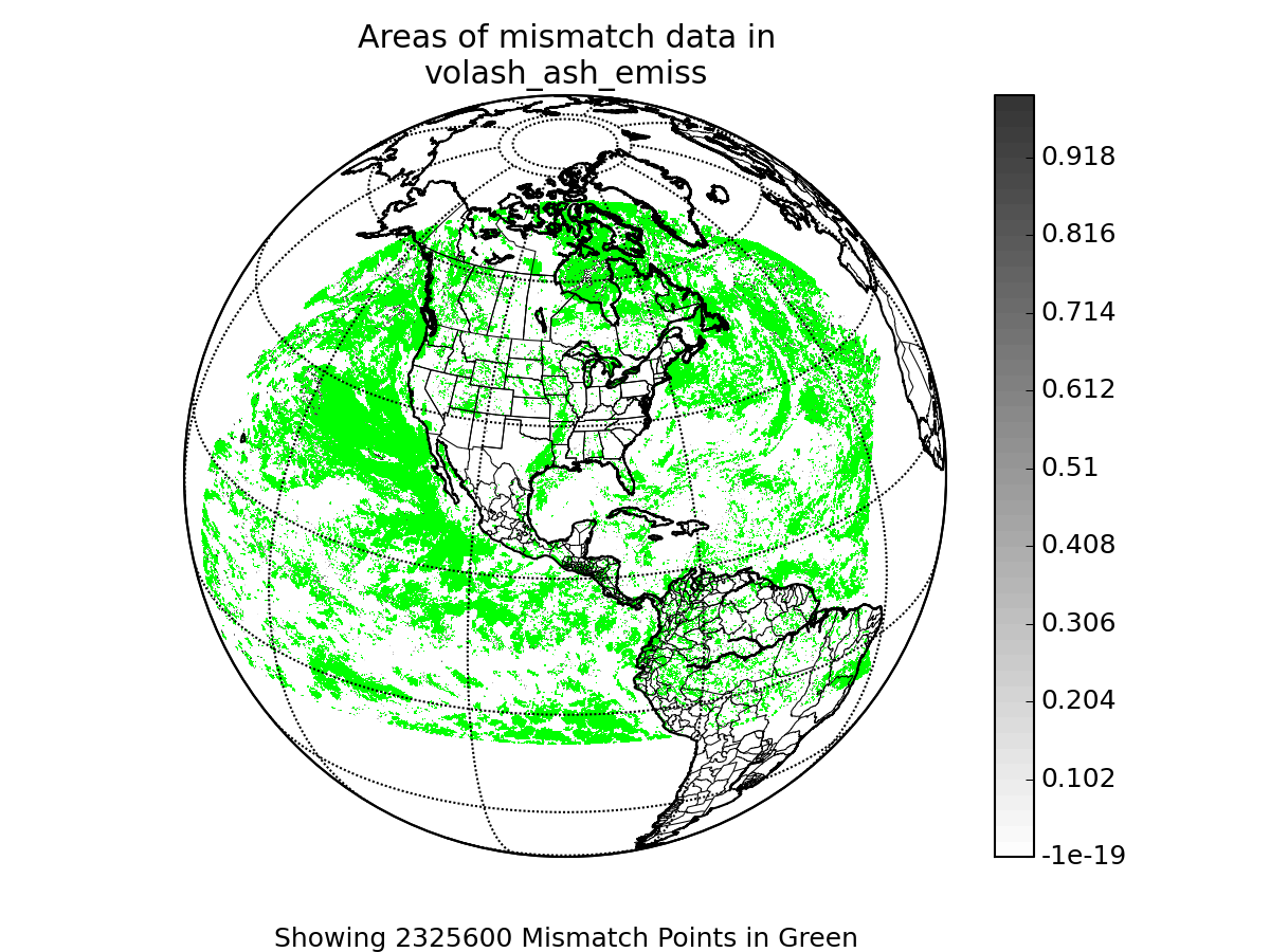
Note: The data for this variable from file A was filtered.
Note: The data for this variable from file B was filtered.
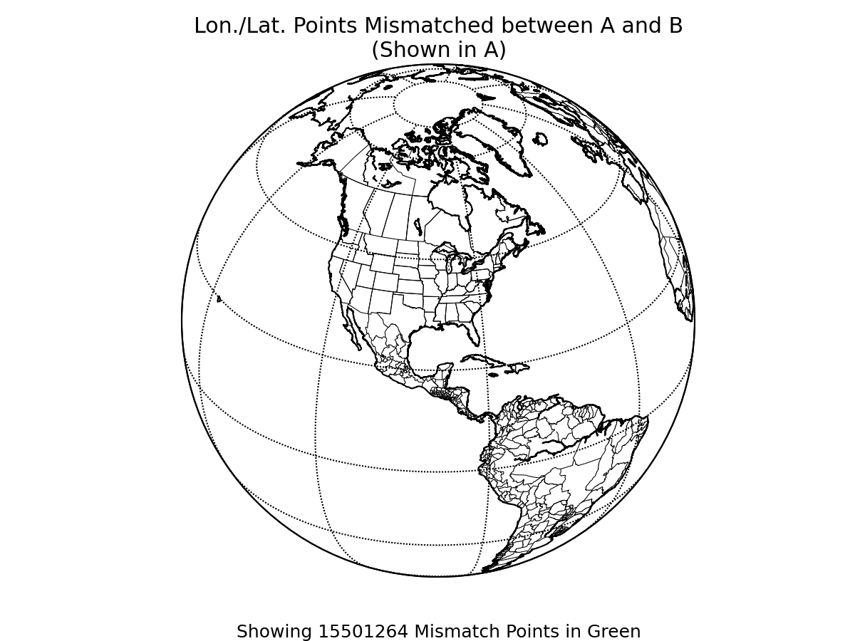
Note: The latitude in file A was filtered.
Note: The longitude in file A was filtered.
Please see the original configuration file to view any data filtering functions.
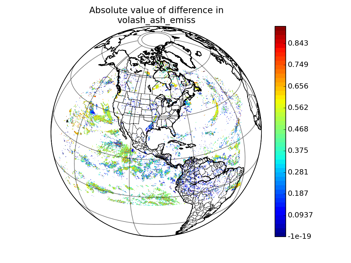
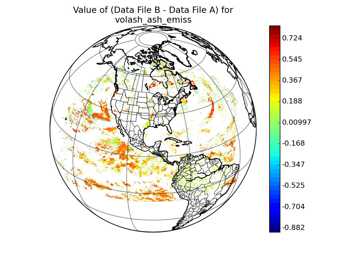
latitude in A: Latitude
latitude in B: pixel_latitude
longitude in A: Longitude
longitude in B: pixel_longitude
longitude/latitude comparison epsilon: 0.0
WARNING: 15501264 data points
(86.12% of all data)
show possible mismatch in values stored in file a
and file b longitude and latitude values. Depending on the degree of mismatch, some data value comparisons
in this report may be distorted or spatially nonsensical. Please consider re-running this report and including an
examination of your longitude and latitude variables with appropriate epsilons in order to analyze the significance
of the difference.
View mismatching points in A's lon/lat system
View mismatching points in B's lon/lat system
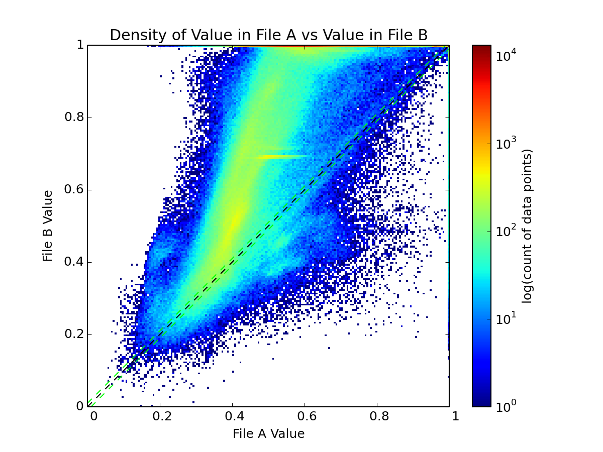
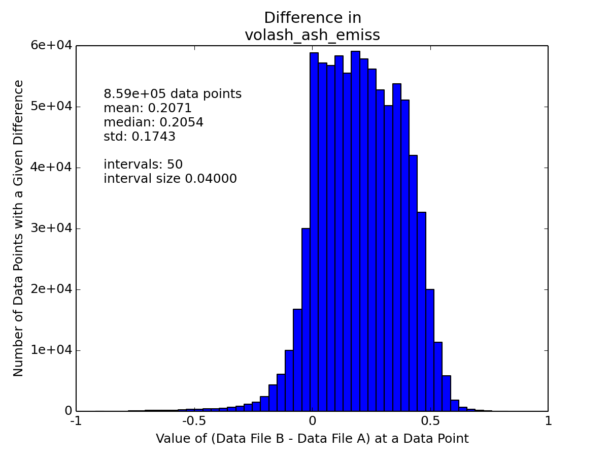
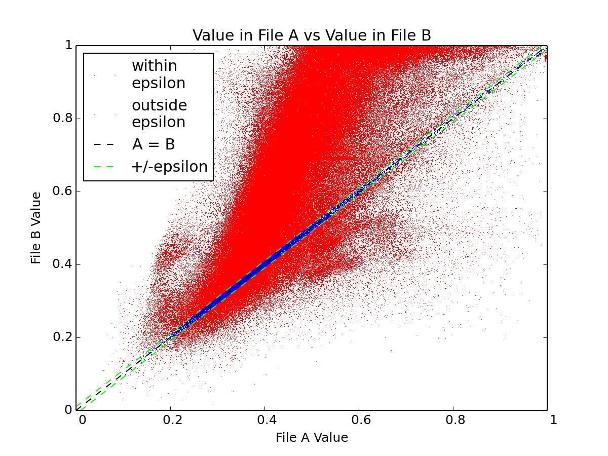
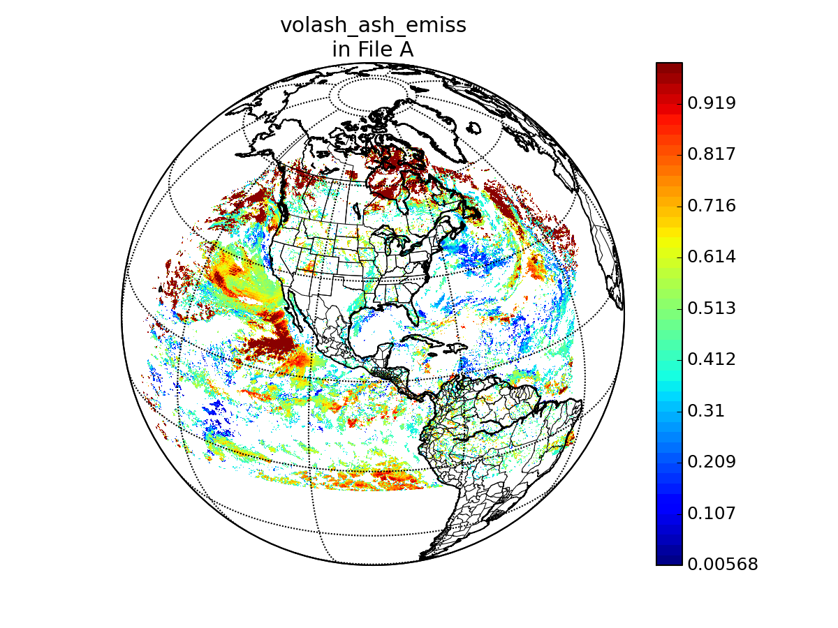
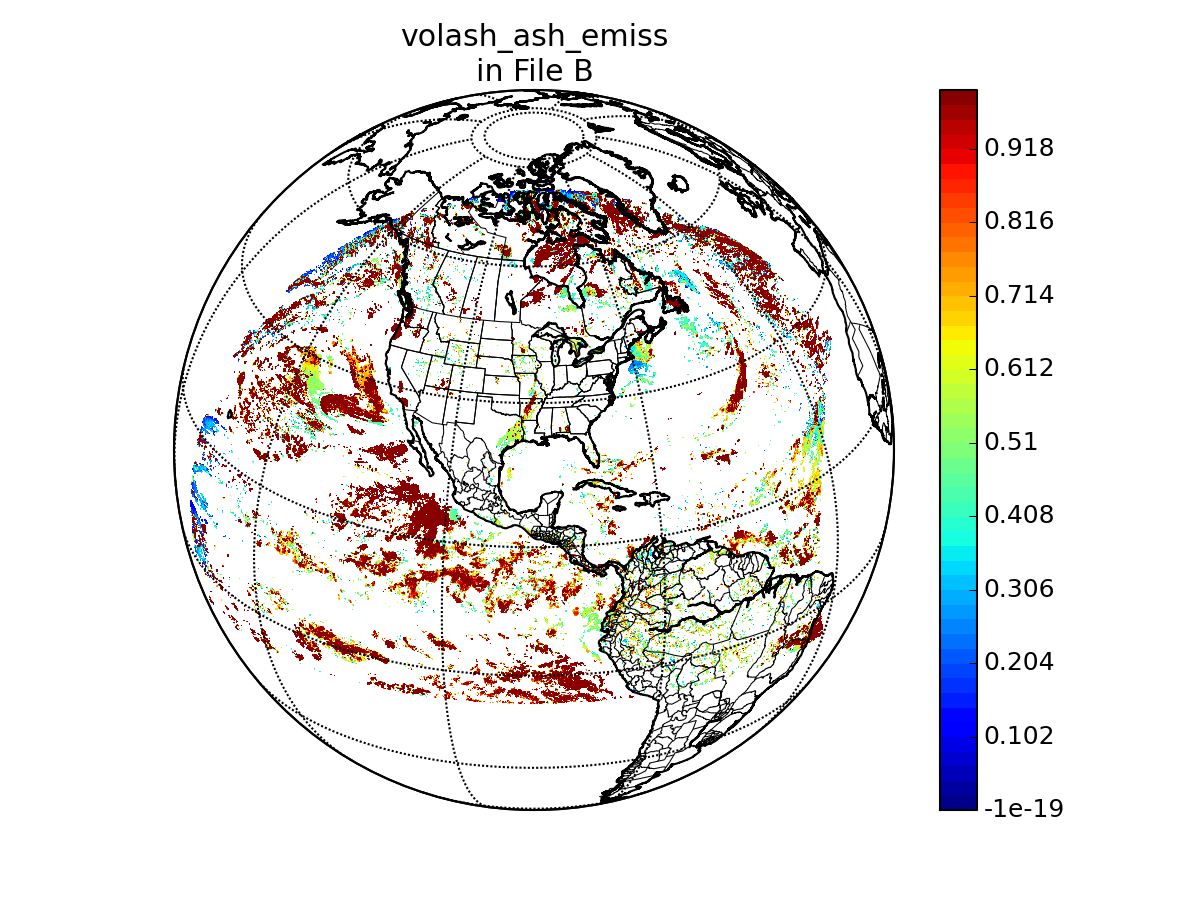
variable name in A: AshEmiss
variable name in B: goesr_ash_rtv_bridge_ash_emissivity
epsilon value: 0.01
"missing" data value: -999.0
units in A: 1
units in B: none