Monthly News Summary – October 2011
- New Satellite Tracking Dish Installed
- GOES-15 and GOES-11 Imagery of Hurricane Hilary
- CIMSS at EUMETSAT Meteorological Satellite Conference 2011
- GOES-15 Sounder Processing
- CIMSS/SSEC at Wisconsin Science Festival
- High School Students Explore Venus
- SSEC/AOS Photo Contest Winners Announced
New Satellite Tracking Dish Installed
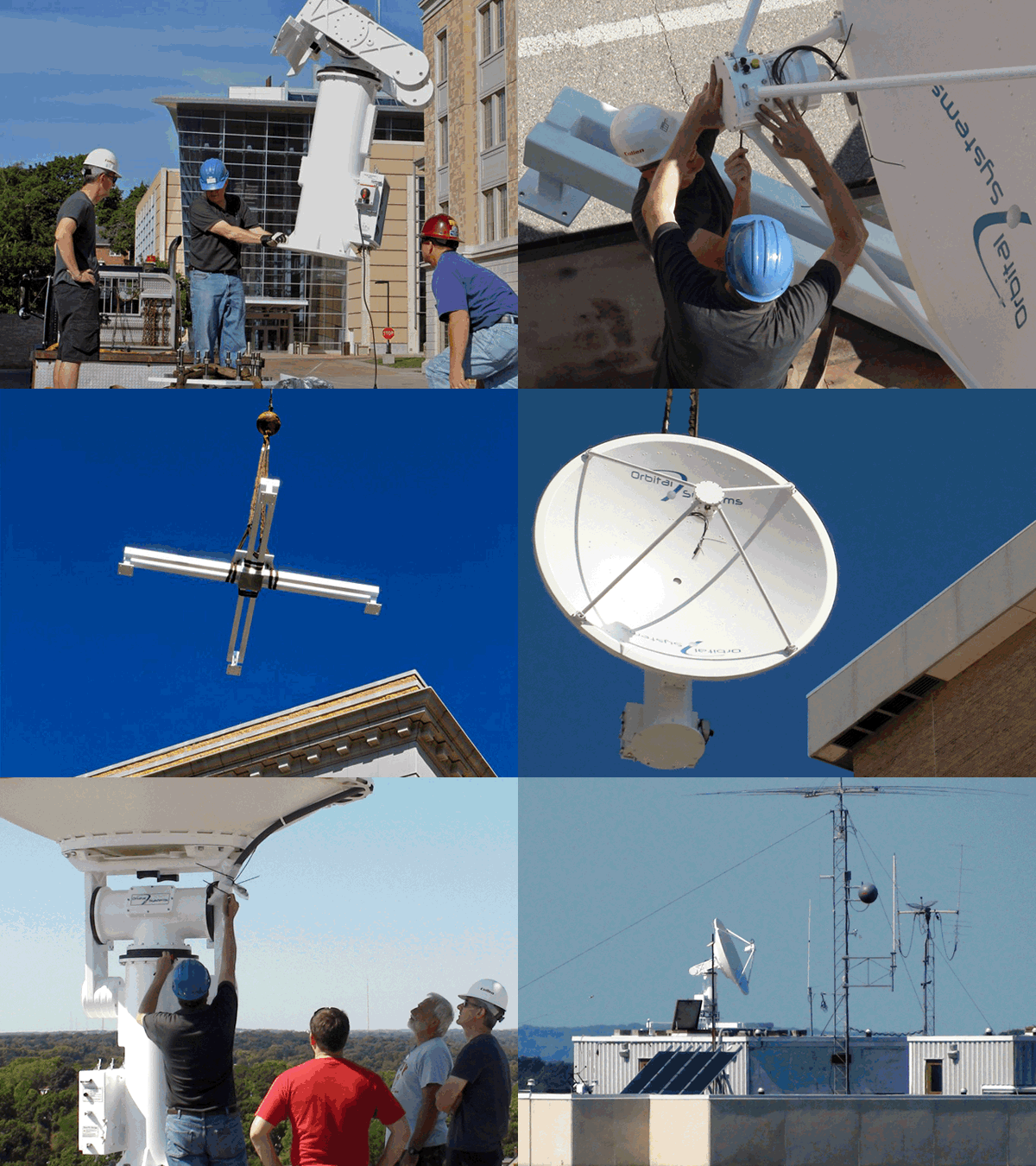
On Sunday, 11 September 2011, two massive telescoping cranes took position in the courtyard at the base of the Engineering Research Building (ERB) while a flat-bed trailer delivered a new Orbital Systems satellite tracking dish, its columnar support and four massive baseplates. Preliminary assembly work was performed on the ground while the baseplates were hoisted the 15 stories to the west penthouse structure atop the ERB.
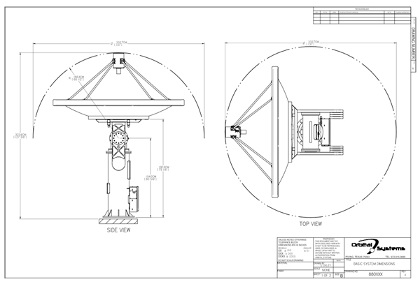
The new dish is the latest addition to the array of receiving antennae capturing satellite-acquired climate data for the Space Science and Engineering Center (SSEC) and the Cooperative Institute for Meteorological Satellite Studies (CIMSS). Mounted on the roof of the ERB on the University of Wisconsin-Madison campus, the 2.6 meter dish will follow polar satellites as they pass overhead, downloading climate data.
The baseplates were positioned on the roof and then an I-beam cross-piece was lifted and bolted to the plates. The plates themselves were not attached to the roof surface. At 565 kg (1245 lbs) the weight of the assembly, along with several concrete ballast blocks, will securely anchor the system.
Finally, the dish and column assembly were hoisted aloft and bolted to the I-beams of the cross-piece. The entire procedure went without a hitch and by 1 pm Carl Schoenberger, an engineer from Oribital Systems, along with engineers and scientists from SSEC and CIMSS, was connecting the electronics and calibrating the system.
The new antenna has both L & X-Band capability and will be used for NASA Terra and Aqua satellites, European polar orbiters, and other future planned higher capability satellites.
The ERB is an extremely desirable location for this installation, given its minimal obstructions to the horizon, maximizing satellite overpass contact time.
GOES-15 and GOES-11 Imagery of Hurricane Hilary
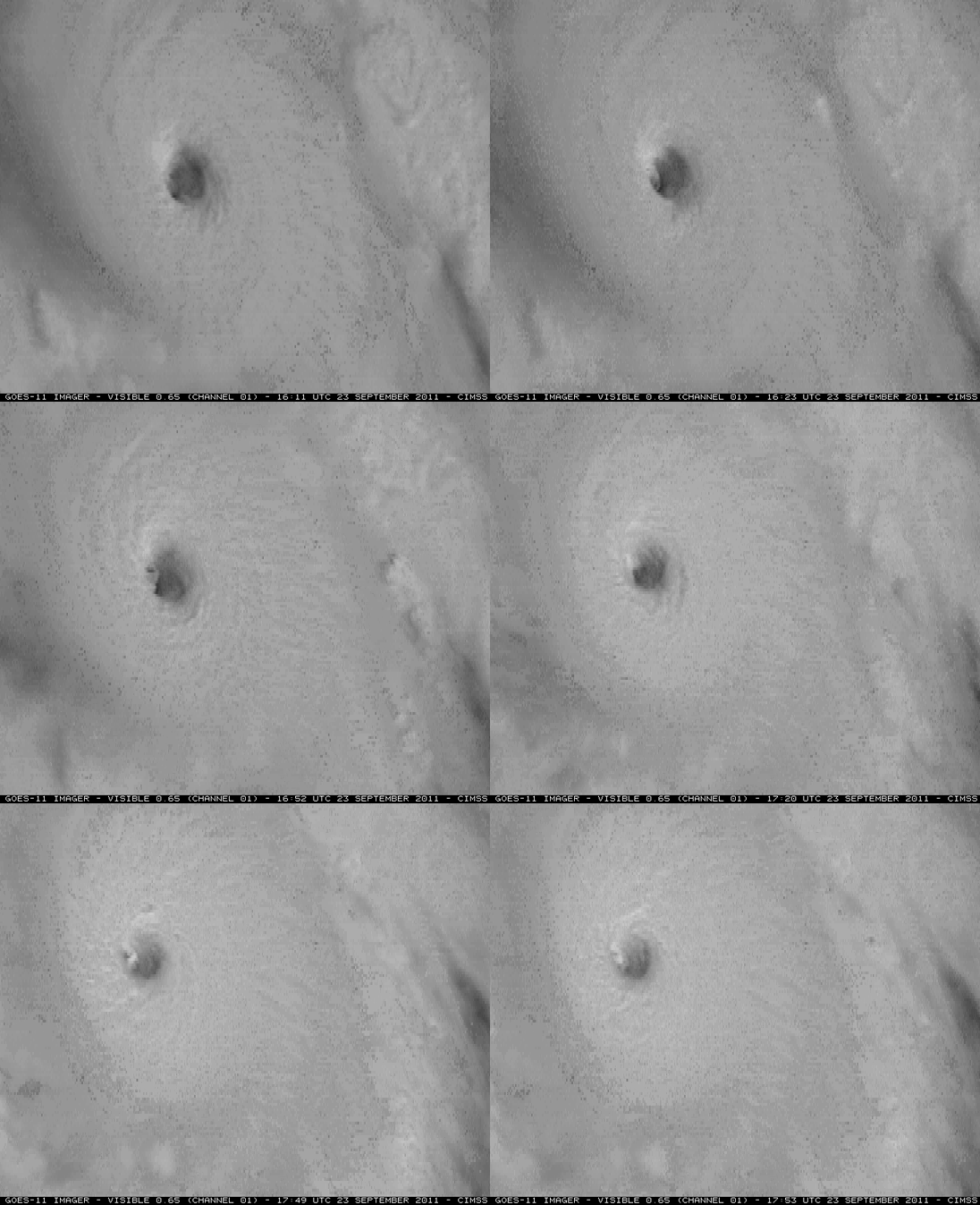
Geostationary Operational Environmental Satellite (GOES)-15 and GOES-11 Super Rapid Scan Operations (SRSO) visible channel images showing the well-defined eye of Category 4 Hurricane Hilary were posted on the CIMSS Satellite Blog.
GOES-15 is scheduled to replace GOES-11 as the operational GOES-West satellite in December 2011, and the GOES-11 SRSO imagery demonstrated the capability of a more frequent image scanning schedule that will be available with the Advanced Baseline Imager (ABI) instrument on the next-generation GOES-R satellite.
CIMSS at EUMETSAT Meteorological Satellite Conference 2011
Many scientists from CIMSS and the Advanced Satellite Products Branch (ASPB) attended the 2011 European Organisation for the Exploitation of Meteorological Satellites (EUMETSAT) Meteorological Satellite Conference held in Oslo, Norway, 5-9 September 2011.
The themes of the conference were current and future satellites, instruments, and applications; assimilation of satellite data into numerical weather prediction models; monitoring climate and understanding climate processes based on satellite data; satellite-based observations of the oceans, with an emphsis on the Arctic; nowcasting; atmospheric composition; and facilitating data access and utilization.
Chris Velden (CIMSS) served on the Program Committee. The presentations from ASPB and CIMSS personnel were (co-authors are not listed):
- Steven Ackerman (given by Bret Maddux) – Boundary layer height and boundary layer clouds over the Great Lakes
- Thomas Achtor – Supporting GEO/GEOSS goals with McIDAS-V
- Paolo Antonelli – Sensitivity of temperature and humidity retrievals to A-priori and Error covariance matrices
- Ralf Bennartz – A sharper view of fuzzy objects: Clouds and their role in the climate system as seen by satellite
- Wayne Feltz – A new satellite object-based convective storm validation methodology
- Mike Foster – Climatological record of 3D cloud effect trends as measured by AVHRR and the consequences for Earth’s energy budget
- Andrew Heidinger – NOAA’s cloud product suite for JPSS VIIRS
- Hung Lung Allen Huang – Towards building a high-performance and low-cost GPU-based satellite remote sensing processing and application infrastructure
- Tommy Jasmin – Using the McIDAS-V scientific data software system to visualize and analyze NPP data
- Jeff Key – Understanding the interactions and feedbacks between Arctic sea ice, clouds, and the atmosphere from satellite observations
- Brent Maddux – The MODIS cloud 10-year data record and uncertainty analysis
- Ralph Peterson – Enhancing objective short-range forecasts of the pre-convective environment using SEVIRI data
- Tom Rink – McIDAS-V: Analysis and visualization for Nowcasting validation and utilization
- David Santek – Delivery of real-time satellite products through a Web Map Service and event notification to mobile devices
- David Santek– Using the expected error in the quality control of satellite-derived polar winds,Xuanji Wang – Arctic sea ice properties and changes from satellite data over the period 1982~2007
- Tony Wimmers– Identifying hazardous turbulence within satellite mountain wave signaturesHong Zhang – Analysis and characterization of the synergistic AIRS and MODIS cloud-cleared radiances.
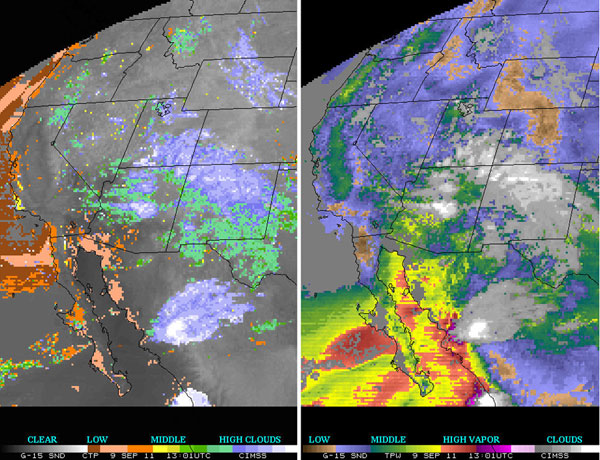
In preparation for the subsequent operational implementation of GOES-15 for western US coverage, GOES-15 Sounder products are being generated by CIMSS. Sample derived product images (DPI), generated in near-real time, are available online.
Qualitative comparisons show the GOES DPI of fair quality, similar to that at the end of the NOAA GOES-15 check-out science test.
GOES-15 Sounder Cloud-top Pressure and Total Precipitable Water (TPW) Derived Product Images from 09 September 2011 at 13 UTC.
CIMSS/SSEC at Wisconsin Science Festival
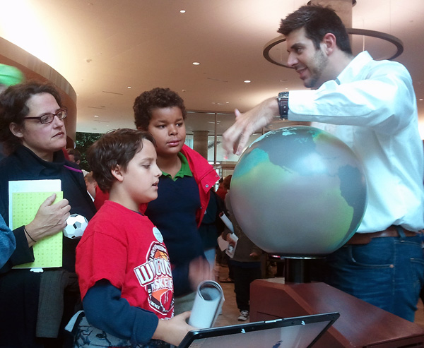
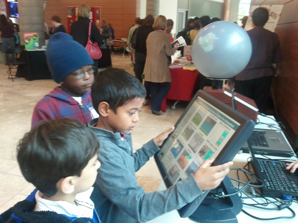
Several thousand people, including local students, had an opportunity to learn about CIMSS/SSEC data via our 3D Globe and Weather/Climate Applets during the first annual Wisconsin Science Festival’s “Street Fair” on Friday, 23 September 2011, at the Wisconsin Institutes for Discovery.
Margaret Mooney and Patrick Rowley used the 3D Globe and Applets to explain weather and climate processes and remote sensing data visualization.
Steven Ackerman also gave a presentation during the event’s opening ceremonies on Thursday, 22 September, about “Science Art” with images by R. Frey, H. Revercomb, P. Galea, M. Povich, and A. Pryor (NASA, SSEC, NOAA).
High School Students Explore Venus
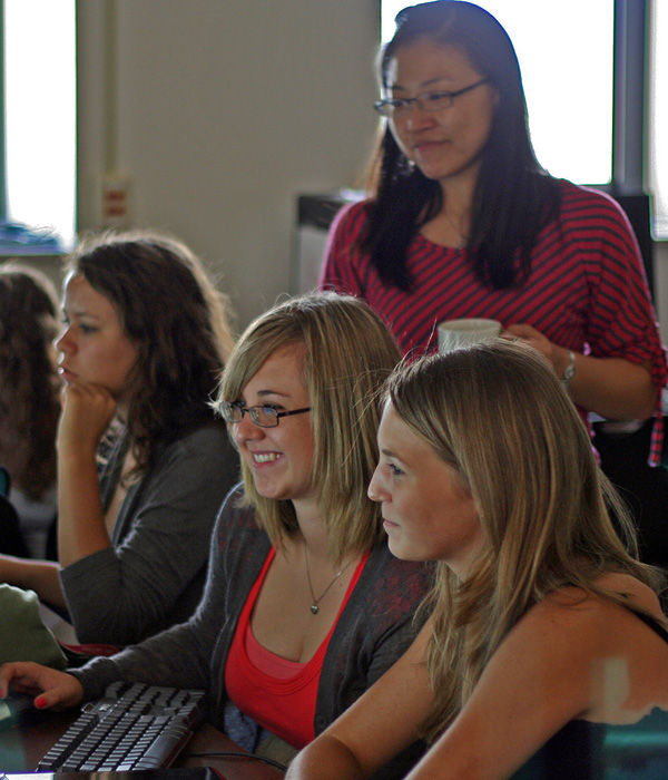
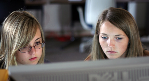
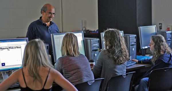
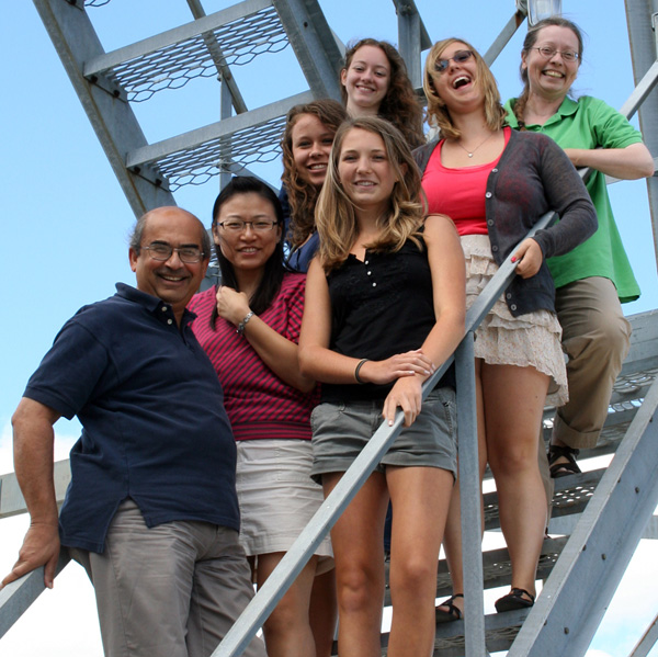
As part of SSEC’s Office of Space Science Education ongoing Venus Education activities, five high school students from New Glarus, WI, spent an intensive ten-week period getting valuable research experience this past summer.
The five young women, ranging in age from 14 to 18, successfully conducted their own analysis of Venus Express data. Their (independent) findings validated earlier studies of wind vectors from the Pioneer Venus data analysis (S.S. Limaye, 1982).
The summer project was completed with an abstract and poster submitted to the 9th VEXAG International Venus Workshop in August, 2011. We are extremely proud of the work of these exemplary young women, whose poster will be part of a featured education display at NASA Headquarters in Washington, DC.
From left to right: Dr. Sanjay Limaye, Hsuan-Yun Claire Pi, enthused students, Rose Pertzborn.
submitted by Rose Pertzborn
SSEC/AOS Photo Contest Winners Announced
Thanks to all who submitted photos to the contest this year. And congratulations to Grant Petty (1st), Dima Smirnov (2nd) and Matt Sitkowski (3rd) whose entries garnered the top spots.
Special thanks to the judges and everyone who helped make this great exhibit happen:
John Roberts, Connor Roberts, Lee Putman, Hank Revercomb, Tom Achtor, Bill Bellon,
Christine Molling, Linda Hedges, Keely Merchant, Erik Janzon and Brian Anderson.
All of last year’s photos will soon be on display in AOS, thanks to Jace Bauer.

