Monthly News Summary – November 2009
- 50 Years of Satellite Meteorology Celebrated
- 6th GOES Users’ Conference Held in Madison
- MODIS Data Identified as “Critical” for Future AWIPS Releases
- WisconsinView Passes Major Hurdle
- “Night at the Laboratory” Features Wayne Feltz
- CIMSS-NOAA-NSF Collaboration to Advance Climate Literacy
- New Appointments
- Projects and Publications
50 Years of Satellite Meteorology Celebrated
On the evening of 02 November 2009, the University of Wisconsin-Madison Space Science and Engineering Center (SSEC) invited 300 guests to celebrate the 50th anniversary of the successful launch of Explorer 7 (on 13 October 1959).
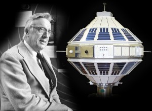
Professor Verner Suomi and the Explorer 7 satellite.
UW Professors Verner E. Suomi and Robert Parent conceived, designed, and built the innovative radiometer on Explorer 7. Their instrument made it into orbit and operated properly, becoming the first successful satellite measure of the Earth’s climate and marking the beginning of the past half-century of satellite climate studies. Professor Suomi founded SSEC in 1965 to continue and expand upon the work started with Explorer 7.
The Grand Terrace of the Monona Terrace Community and Convention Center, with its magnificent view of Lake Monona gleaming under a full moon, provided the perfect backdrop for a large display of satellite-related photographs, artifacts, documents, a full size Explorer 7 model, and other exhibits (such as a 2-foot weather display globe).
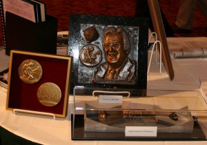
Explorer 7 bolometer and the bronze relief of Verner Suomi sculpted by former Suomi student Mike Shah.
Symposium
Hank Revercomb, the current director of SSEC, hosted a symposium at the beginning the evening, featuring several speakers who shared their personal reminiscences of Verner Suomi and those important historical times and achievements. Speaking at the symposium were:
- Gary Davis, Director of the NOAA/NESDIS Office of Systems Development;
- Franco Einaudi, Director of the Earth Sciences Division of the Sciences and Exploration Directorate of the Goddard Space Flight Center and NASA;
- Terry Kelly, Chairman, CEO, and principal owner of Weather Central, Inc.;
- Jerome Lafeuille, Chief of the Space-based Observing Division of the Space Programme Office and previously the Director of the Meteo-France Satellite Meteorology Centre;
- John Lewis, National Severe Storms Laboratory Meteorologist and Adjunct Professor at the Desert Research Institute;
- Tom Vonder Haar, Distinguished Professor of Atmospheric Science at Colorado State University (Keynote address)
Oral History Panel
Prior to the symposium, a panel of researchers and scientists who had worked at the UW with Verner Suomi met to share their memories in an oral history panel that was recorded by Wisconsin Public Television.
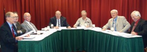
“An Oral History: Remembering Verner Edward Suomi, the Father of Satellite Meteorology,” Panel members: Larry Sromovsky, Don Johnson, Tom Haig, Bob Fox (moderator), Chuck Stearns, Tom Vonder Haar, Bill Smith.
Reception
After the symposium hundreds of guests gathered in the Grand Terrace of the Monona Convention Center for a catered reception. An open microphone was in place for willing raconteurs to relate memories of their time working with Verner Suomi, satellite studies and Explorer 7.
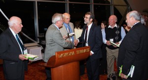
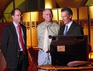
Paul Menzel invited attendees to an open microphone to relate anecdotes of Verner Suomi and their participation in the Explorer 7 project. Pictured: Fred House, Paul Menzel, Tom Vonder Haar, Jerome Lefeuille, John Lewis and Gary Davis.
Bob Lindmeier, the meteorologist for Channel 27, local ABC affiliate, broadcast his weather segments for that evening’s news programs from the Monona Terrace, sharing the spotlight with SSEC’s own “Weather Guys,” Steve Ackerman and Jon Martin.
The Weather Guys (Jon Martin and Steve Ackerman) entertain Channel 27 meteorologist Bob Lindmeier while broadcasting from Monona Terrace.
More information concerning the launch of Explorer 7 and the 50th anniversary celebration, including additional photos, is available online.
6th GOES Users’ Conference Held in Madison
The 6th Geostationary Operational Environmental Satellite (GOES) Users’ Conference was held at the Monona Terrace Convention Center in Madison, Wisconsin, 03-05 November 2009. The Conference brought together government, academia, and private industry from around the world to discuss NOAA’s current and future geostationary satellite systems.
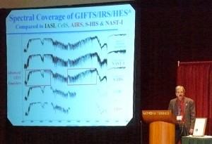
Hank Revercomb, the Director of the Space Science and Engineering Center, emphaizes the value of more advanced instrumentation for satellite observations of Earth.
Attending were over 260 scientists and researchers, including representatives from the EUropean organization for the exploitation of METeorological SATellites (EUMETSAT), the World Meteorological Organization (WMO), China, Japan, Korea, India, Brazil, and Canada.
The conference consisted of oral presentations, poster sessions, panel discussions, and a town hall meeting that provided a forum for the exchange of information and ideas between satellite operators, data producers, and data users. The town hall meeting addressed the issue of high spectral resolution sounding in a geostationary orbit. Breakout sessions provided an opportunity for the user communities to give their input on ensuring user readiness for the scheduled 2016 launch of the GOES-R satellite.
More details about the conference and additional photos are available online.
MODIS Data Identified as “Critical” for Future AWIPS Releases
The National Weather Service’s Advanced Weather Interactive Processing System (AWIPS) migration team has labeled the data collected from the University of Wisconsin-Madison MODerate Resolution Imaging Spectroradiometer (MODIS) Direct Broadcast (DB) “critical” for future releases.
AWIPS, an interactive computer system that integrates meteorological and hydrological data, is an information processing, display, and telecommunications system that is the cornerstone of the United States National Weather Service’s (NWS) operations.
Jordan Gerth, of the Cooperative Institute for Meteorological Satellite Studies, has been given the task of developing a MODIS plug-in for AWIPS II. So far, 43 different forecast offices are receiving MODIS data directly from the UW-Madison via the Local Data Manager distributed through the NWS Regional Headquarters. Twelve other offices are using UW MODIS DB data as provided through the Short-term Prediction Research and Transition (SPoRT) Center.
The keys to success of this effort are the quality of the MODIS data, the speed at which the data and products can be delivered via direct broadcast, the range of the UW antenna covering the entire lower 48 states, Jordan Gerth’s familiarity with NWS forecasters and AWIPS, Scott Bachmeier’s NWS Virtual Institute for Satellite Integration Training (VISIT) training module “MODIS Products in AWIPS”, and direct visits to Forecast Offices to determine how MODIS data can meet their needs.
WisconsinView Passes Major Hurdle
27 October 2009 – The “National Land Remote Sensing Outreach Act” (version 2 of the AmericaView Geospatial Imagery Mapping Program Act) passed on the House floor with a Roll-Call vote of 379-33. The bill, H.R. 2489, would authorize $100 million from FY 2010 through 2019 for the Department of Interior to establish a new national land remote sensing outreach program within the U.S. Geological Survey (USGS). According to the legislation, the program’s mission would be to “advance the availability, timely distribution, and widespread use of geospatial imagery for education, research, assessment, and monitoring purposes in each State and the lands of an Indian tribe.”
H.R.2489, is a major milestone for establishing a firm foundation for AmericaView and thereby WisconsinView. Since 1998, the U.S. Geological Survey has participated in AmericaView, a program which focuses on satellite remote sensing data and technologies in support of applied research, K-16 education, workforce development, and technology transfer. AmericaView is a partnership of the USGS and participating colleges and universities and has programs operating in 36 States, including WisconsinView. While AmericaView has never been formally authorized, the project received roughly $3 million annually from FY 1998 through 2006, and approximately $1 million annually from FY 2007 through 2009. H.R. 2489 would formally authorize the program and raise the authorized appropriations limit to $10 million a year.
The next challenge is passage of the Senate version before the end of this congressional session.
More details concerning the bill are available online.
“Night at the Laboratory” Features Wayne Feltz
Wayne Feltz presented an invited lecture titled “Overview of Satellite-based Aviation Applications for Detection of Thunderstorms, Turbulence, and Volcanic Ash” at the Wisconsin Alumni Association’s “Night at the Laboratory” seminar series. The audience members were from the general public and ranged in age from high school students to retired University of Wisconsin faculty members.
The seminar supplied an overview of NOAA and NASA funded satellite-based aviation weather research conducted at the Cooperative Institute for Meteorological Satellite Studies (CIMSS) and related decision support information for future Joint Program Development Office (JPDO) Next Generation Air Transportation System (NextGen) efficiency improvements due to better observations from satellite platforms.
The lecture has been posted online. Click on “Recorded Lectures by Date” and select “10/28/2009 — Wayne Feltz.”
CIMSS-NOAA-NSF Collaboration to Advance Climate Literacy
Facilitating climate literacy is one of the most important and imperative educational objectives of our time. To this end, CIMSS/SSEC recently teamed up with NOAA to conduct an NSF-funded Climate Education Summit on Saturday November 7th at the NOAA Science Center in Silver Springs Maryland.
The program targeted G4-12 geography, history and political science teachers in an effort to discern how the social sciences can advance climate literacy. CIMSS Director Dr. Steve Ackerman led the agenda, which was organized by SSEC outreach specialist Margaret Mooney. Fourteen area teachers participated to learn more about our changing climate and provide feedback to NSF, NOAA and CIMSS so these agencies can support climate system comprehension and assist educators overcome challenges explaining mitigation strategies to students and colleagues.
Steve Ackerman addresses the Summit attendees.
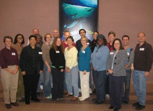
Margaret Mooney (left) with the DC Summit Group.
More information on the Summit is available online.
Jean Phillips, Director of the Schwerdtfeger Library at the UW-Madison Space Science and Engineering Center, has been appointed to serve on the History of Meteorology Committee of the American Meteorological Society. Her term starts in January 2010.
Paper on Arctic Climate Interactions Published and Highlighted: A paper (“Influence of changes in sea ice concentration and cloud cover on recent Arctic surface temperature trends”) on the influence of changes in cloud cover and sea ice extent on trends in Arctic surface temperature was published in Geophysical Research Letters. The paper was selected as an AGU Journal Highlight. The authors are Yinghui Liu (Cooperative Institute for Meteorological Satellite Studies, CIMSS), Jeff Key (NESDIS/STAR), and Xuanji Wang (CIMSS).
Paper Published on Tropical Cyclone Intensity Analysis: A paper titled “Tropical Cyclone Convection and Intensity Analysis Using Differenced Infrared and Water Vapor Imagery” was published in Weather and Forecasting (Vol. 24, No. 6., 1558–1572). The authors are Tim Olander (Cooperative Institute for Meteorological Satellite Studies) and Chris Velden (CIMSS). The article outlines a potential method and application of a differencing technique, using two channels available on all current geostationary satellites, for tropical cyclone intensity analysis. In addition, potential uses of the technique in the Advanced Dvorak Technique (ADT), including storm center determination and future intensity trend analysis, are discussed.
Manuscript Published on the Potential Benefits of Advanced Geostationary Sounders: A manuscript was published in the Journal of Atmospheric and Oceanic Technology on the potential benefits of advanced geostationary sounders. The title is “High-Spectral- and High-Temporal-Resolution Infrared Measurements from Geostationary Orbit”. The authors are Tim Schmit (STAR), Jun Li (Cooperative Institute for Meteorological Satellite Studies), Steven A. Ackerman (CIMSS), and J. J. Gurka (GOES-R Program Office). The paper can be downloaded at ftp://ftp.ssec.wisc.edu/ABS/publications/1248_JTECH_Nov-2009.pdf.