Observing the Launch of the Landsat Data Continuity Mission (LDCM) UPDATE: First images available
UPDATE: First images from Landsat 8.
Sam Batzli, the director of WisconsinView, a federally funded program housed at the Space Science and Engineering Center, UW-Madison, that offers easy access to a variety of statewide images and data, was one of about 1,000 guests invited by the U. S. Geological Survey to witness the 11 February 2013 launch of Landsat 8 at Vandenburg Air Force Base in California.
Since 1972 the Landsat satellite series has captured imagery of the earth in a systematic and continuous stream, providing the world’s longest-running, and perhaps most influential, set of data on global climate change.
“But there have been problems,” Batzli explains. “Landsat 5 was launched in 1984 and provided information for an incredible 28 years, but it finally went silent in January of this year.”
The longevity of Landsat 5 was the good news. The bad news was that Landsat 6 failed to attain orbit in October 1993. While Landsat 5 continued to collect imagery, Landsat 7 was developed and successfully launched in April of 1999. However, the continuity of the data record was threatened again as plans for follow-on missions to Landsat 7 were delayed. To make matters worse, Landsat 7 developed a mechanical problem that has severely limited its data quality since 2003.
The successful launch of Landsat 8 was vital not only to continue the program, but also to enhance it with more advanced instrumentation. From the NASA web site:
The Operational Land Imager (OLI), built by the Ball Aerospace & Technologies Corporation, will measure in the visible, near infrared, and short wave infrared portions of the spectrum. Its images will have 15-meter (49 ft.) panchromatic and 30-meter multi-spectral spatial resolutions along a 185 km (115 miles) wide swath, covering wide areas of the Earth’s landscape while providing sufficient resolution to distinguish features like urban centers, farms, forests and other land uses. The entire Earth will fall within view once every 16 days due to LDCM’s near-polar orbit.
The Thermal Infrared Sensor (TIRS) will measure land surface temperature in two thermal bands with a new technology that applies quantum physics to detect heat.
Landsat 8’s photo-sensitive detectors are designed to provide higher-resolution imagery than the electromechanical sensors of the previous missions. Engineers designed the sensors to capture the nuances of land use and land cover change, from both human and natural processes.
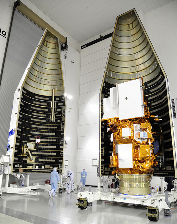
LCDM farring with Landsat 8 satellite. Photo credit: NASA
Batzli first became aware of the Landsat satellite series in the early 1990s when he was a geography graduate student at the University of Illinois. Working at the Army Corps of Engineers Construction Engineering Research Lab, Batzli was surrounded by researchers and programmers who were pioneering the use of the remote sensing software GRASS (Geographic Resources Analysis Support System) to analyze Landsat imagery and map land cover for the management of environmental resources on military land.
“Landsat caught my attention,” Batzli says. “A few years later, while working at Michigan State University’s Tropical Rain Forest Information Center, I was captivated by the systematic geographic coverage and historical depth of their imagery archive. They had one of the largest collections of Landsat imagery outside of the federal government, but I was frustrated by how difficult it was to preview this remarkable resource.”
In 2001, at a time when Landsat imagery ran about $600 per image, Batzli worked closely with a small team of programmers to design and develop Landsat.org which uses a (pre-Google) map interface to locate and acquire discounted or free “pre-owned” Landsat imagery. Today the public can download and view global Landsat imagery from the entire archive through several interfaces such as the USGS Global Visualization Viewer and USGS Earth Explorer. The free access has boosted Landsat image downloads from the thousands to the millions.
“Since arriving at UW-Madison in 2002, I have worked with Landsat imagery in the areas of natural resource mapping, lake water clarity monitoring, and emergency management,” Batzli says. “The WisconsinView program started in 2004 as a way to make Landsat imagery of Wisconsin available to the public for free download. Landsat 8 is vital for continuing that image gathering.”
Batzli describes the scene on launch day: “At the observation site we gathered some seven miles from the rocket. It was clearly visible with the naked eye, but even better through binoculars. We had television monitors and the audio feed from launch control. As the check-lists proceeded without complication, the energy and excitement in the group was palpable.”
“The final status check occurred with 20 seconds to go. We had actually rehearsed this as a chant at a pep-rally-style pre-launch briefing and were told to listen for this final set of green lights for the three major components of the rocket: Go Atlas; Go Centaur; Go LCDM! And when we heard those words, a cheer arose form the crowd and we joined in the final 10 seconds of the count down.”
“There was a rush of static form the audio feed as the engines ignited. Launch control announced ‘…and lift-off of the Atlas V Rocket….’ Suddenly we could see a pinpoint of light at the base of the rocket. It grew brighter and brighter. The rocket rose very slowly at first then accelerated smoothly and rapidly, as if being drawn upward on a wire, straight up then with a slight arc. Then the sound wave hit us and we felt the power of the engines and heard the crackle of the flame. A large bright contrail appeared as the rocket went transonic and passed Max Q (highest dynamic pressure). It was spectacular.”
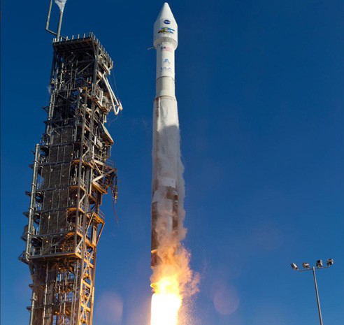
Landsat 8 launch on 11 February 2013. Photo credit: NASA
“Probably the most significant thing I learned and observed during the whole experience was the high level of dedication and cooperation that exists among the engineers, managers, and administrators from the companies and government agencies (civilian and military) that collaborate to make one of these things happen. It is truly remarkable how these different teams all come together… ULA (United Launch Alliance), NASA, Orbital, Ball, USGS, Air Force, all the suppliers… Made me feel, unexpectedly, very patriotic.”
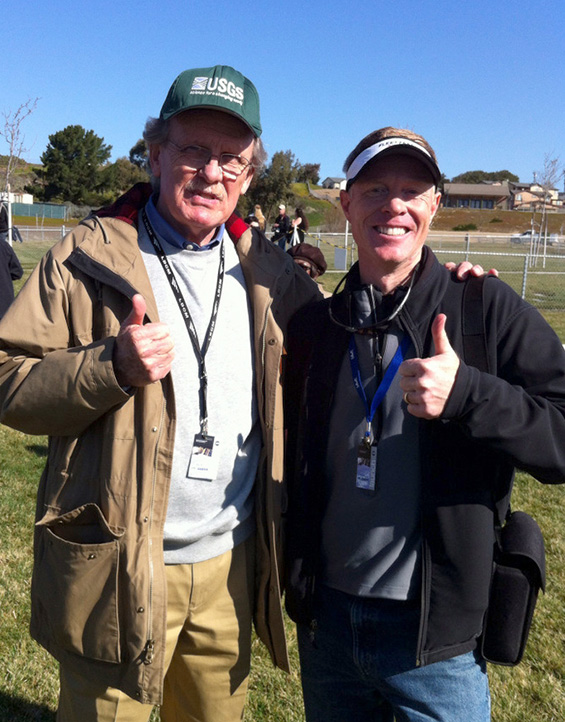
Sam Batzli (right) with Ray Byrnes, liaison for satellite missions for the U.S. Geological Survey’s (USGS) Land Remote Sensing Program, at the Landsat 8 launch viewing area.
Photo Credit: Larry Biehl, IndianaView.
Landsat 8 was successfully launched and achieved polar orbit on the morning of 11 February 2013. It is expected to be fully operational within 90 days of the launch, and will extend the unbroken 40-year record of earth observations started by the initial Landsat satellites.
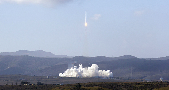
Photo credit: NASA