How to create a crash course in satellite remote sensing: One part knowledge, two parts enthusiasm
As the next generation of weather satellites will bring in unprecedented amounts of data, finding ways to make the most out of the data and getting that information into forecasters’ hands is a key challenge. The question becomes, how do you reach those who need the information and then how do you teach them?
With support from the NOAA/NASA GOES-R Program Office last year, scientists from the Space Science and Engineering Center (SSEC) and Cooperative Institute for Meteorological Satellite Studies (CIMSS) developed a bootcamp that provided a crash course in the fundamentals of satellite remote sensing and radiative transfer. The course focused on applications of the data and imagery with an emphasis placed on the polar Suomi National Polar-orbiting Partnership (NPP) and its instruments. The goal was to provide recently hired satellite liaisons stationed at National Weather Service Offices with the information they would need to advise others on the use of satellite data in weather forecasting.
For two weeks in July 2013 at the University of Wisconsin-Madison, a dozen students listened to lectures, participated in lab exercises, and made presentations on case studies. SSEC Scientist Paul Menzel taught the first week while CIMSS Director and Atmospheric and Oceanic Studies (AOS) Professor Steve Ackerman and AOS Professor Ralf Bennartz taught the second week. For Ackerman, a key to the bootcamp was combating the tendency to view satellite images as “pretty pictures” – to instead highlight the quantitative information that they carry.
As an added benefit, attendees had the opportunity to make personal connections with SSEC/CIMSS scientists that could be sustained in their work back home. Ackerman shared a particularly memorable connection from the July bootcamp. A forecaster from Oman, who had been using SSEC’s visualization software McIDAS-V, was interested in satellite analysis techniques developed by the CIMSS Tropical Cyclone (TC) group. Tim Olander, a member of the CIMSS TC research team, easily provided the requested capability.
The course evaluations reflected the positive learning experience shared by the attendees, with most describing the bootcamp as very good or excellent. While some of the material was provided as a refresher of the basics, the participants gained valuable, new insights. “I learned a lot more of the physics behind the satellite images we look at every day,” wrote one attendee while another commented, “The power/potential of hyperspectral data became very evident.”
For Menzel, Ackerman, and Bennartz the July bootcamp wasn’t their first experience in teaching a course of this style. They had held a bootcamp in March 2013 as a trial run. Attended by SSEC/CIMSS scientists, the March version allowed them to test the curriculum and see what might need to be tweaked. Menzel was struck by how the younger generation of scientists that has grown up surrounded by technology responded with unique, innovative approaches during the lab exercises.
The two-week bootcamp though owes its existence to a much longer, and successful, history of professional development and outreach at SSEC/CIMSS. For over a decade Menzel and SSEC Scientist Paolo Antonelli organized and taught remote sensing seminars around the world. For Antonelli the journey began while he was still a graduate student.
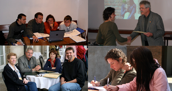
Photo collage of remote sensing seminar attendees, local hosts, and instructors in Poland and South Africa. Photos courtesy of Paolo Antonelli, SSEC.
A native of Italy, Antonelli came to the University of Wisconsin-Madison for graduate school where he took Menzel’s course on “Applications in Satellite Meteorology.” Menzel recalled Antonelli’s passionate reaction to the course content, knowing that colleagues in Europe would clearly benefit from a similar course. More discussions of this idea followed, and the remote sensing seminar series was born. While Menzel worked on condensing the material into a week-long seminar, Antonelli called upon friends in Italy to help with logistics. The first remote sensing seminar was held in Bologna, Italy in September 2001.
Though most of the seminars were hosted in Europe, and Italy in particular due to Antonelli’s connections there, they were also given in places like Brazil and South Africa. The shift from Europe coincided with a need and a desire to impact areas “often with no great tradition in satellite meteorology,” noted Paolo in an email.
Word spread about the effective seminars. In time the European Organisation for the Exploitation of Meteorological Satellites (EUMETSAT) noticed Menzel and Antonelli’s efforts and began sponsoring students – providing travel funds for them to attend the seminars – and later, hosting their own. Ackerman and Bennartz were brought aboard to help teach the EUMETSAT-sponsored courses. Ackerman commented that the efforts begun by Menzel and Antonelli helped cement CIMSS’s international reputation as a remote sensing leader, resulting in improved collaborations with partners across Europe and the globe. Ackerman further recognized their influence on the creation of the equally successful CIMSS Direct Broadcast Seminar series.
Collaborations between Menzel and Antonelli, as well as their enthusiasm for the mission, have been key to the success and long life of the remote sensing seminars. Menzel was quick to praise Antonelli’s role of facilitator/teacher as “instrumental” and appreciated his ability to “take complicated ideas and make them very simple.” Antonelli described Menzel’s vast experience with satellite meteorology missions, the “unbelievable amount of knowledge” he had and was willing to share.
The remote sensing seminars have clearly left an imprint on the two. For Antonelli, the seminars were an opportunity to not only to teach the basics of remote sensing, but also to “help scientists to fall in love with remote sensing of the Earth.”
Menzel reflected on the universal nature of satellites. “One thing I’ve always liked about satellites – they’re used everywhere in the world.” And he asserted that there is something “precious about our field” – how groups around the world may use the same theories and the same data, which they then supplement with their local knowledge to create something useful.
by Leanne Avila