S-HIS instrument provides hurricane data from unmanned aircraft
For the third year in a row, the Space Science and Engineering Center (SSEC) at the University of Wisconsin-Madison is involved in a NASA-led field campaign designed to study hurricane formation and intensity in the Atlantic Ocean Basin.
The Hurricane and Severe Storms Sentinel (HS3) campaign uses two Global Hawk unmanned aircraft that were originally developed for the military. This mission, however, equips the aircraft with scientific instruments to collect important data about the life cycles of hurricanes in the Atlantic Ocean.
One such instrument, designed and built at SSEC in the late 1990s, is the Scanning High-resolution Interferometer Sounder (S-HIS). The S-HIS measures thermal radiation at high-spectral resolution, scanning the Earth in swaths up to 25 miles wide to collect data on temperature and water vapor.
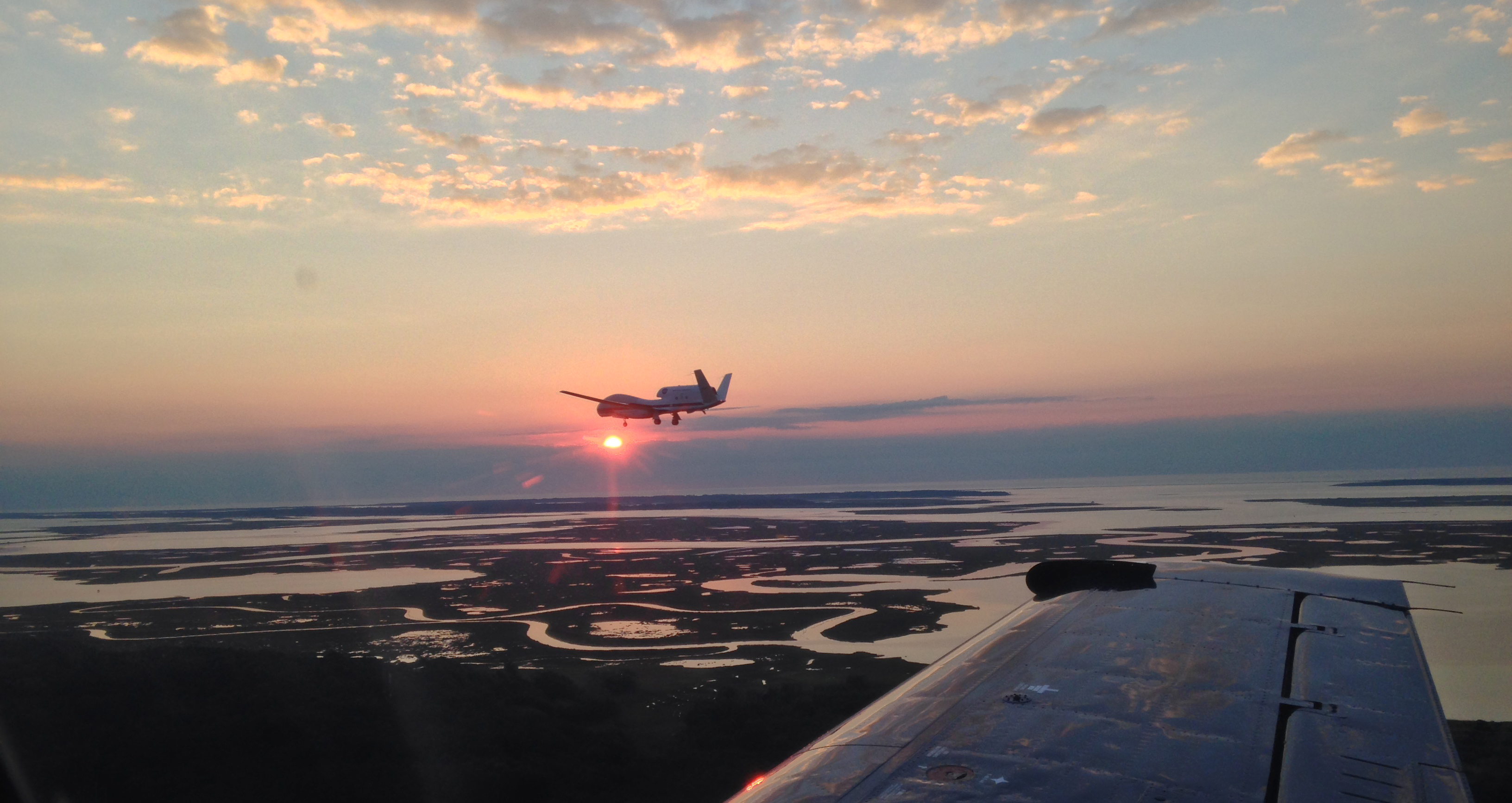
The NASA Global Hawk (AV-6) with SSEC’s S-HIS instrument onboard returning to Wallops Island, VA, after an overflight of Hurricane Edouard. Photo Credit: NASA.
SSEC Director Hank Revercomb is principal investigator for the S-HIS’ use in the HS3 mission, while Joe Taylor, an engineer at SSEC, is its project manager. In addition to his project management role, Taylor provides engineering support for the S-HIS and works on S-HIS, VIIRS, and CrIS imagery and data for the Global Hawk flights. He spends about half his time at the NASA Flight Facility operations center in Wallops Island, Virginia, where HS3 is based.
Taylor is able to watch the aircraft’s flight path — a red dot inching across the Atlantic — from his desktop at SSEC. He explained that, during a typical flight, S-HIS data from the aircraft is sent up to a geostationary satellite, back down to NASA Wallops, cross-country to NASA Armstrong Flight Research Center in California, and finally to Wisconsin for processing at SSEC. The products are then provided via web-based tools for scientists to analyze: all in less than a minute.
“We deliver data in near real-time,” he said, describing the interferometer’s main function. “Observing in the infrared, we can see through to the surface if there is not significant water vapor. We are able to see temperatures very close to the ocean surface.”
The measured infrared radiances can also be used to retrieve temperature and water vapor profiles, as well as trace gas information, he added.
Along with the S-HIS, the Global Hawk that is currently in use houses NASA’s Cloud Physics Lidar (CPL), which observes cloud layer structures and particulate matter in the air, such as dust. A third instrument onboard, NCAR/NOAA’s Advanced Vertical Atmospheric Profiling System (AVAPS), uses small parachute-like devices called dropsondes to measure temperature, humidity, and wind.
So-named because of the way they are dropped out of the aircraft’s tail, each dropsonde makes an atmospheric measurement every half-second. During a recent flight, near real-time data from the S-HIS was used to help ensure that the dropsondes were positioned directly over the eye of the storm when deployed.
Together, this fleet of instruments deals with the big picture, examining the storm’s surrounding environment, while other instruments examine inner core processes and dynamics.
In the operations center at Wallops Island, Taylor and the other instrument team members and mission scientists sit separated by glass from the Global Hawk pilots who operate the unmanned aircraft from the ground.
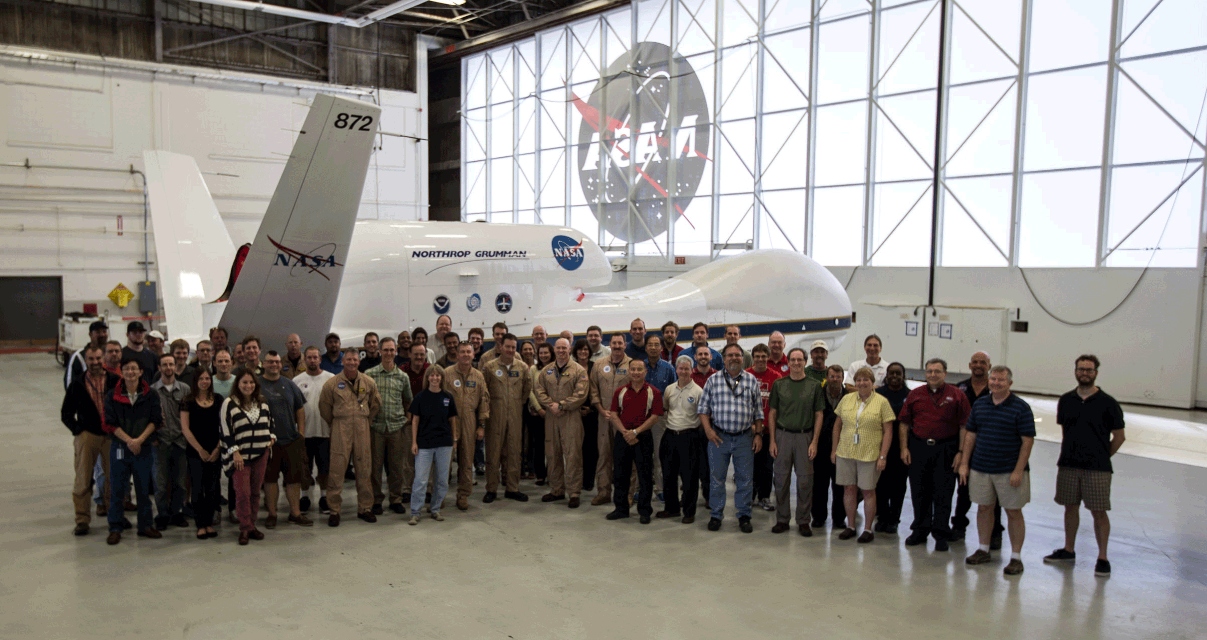
A group shot of those involved in the Hurricane and Severe Storm Sentinel (HS3) field campaign. One of two Global Hawk aircraft integral to the mission is visible in the background. Photo Credit: NASA.
Not only do Global Hawk aircraft fly with an empty cockpit, but they reach a cruising altitude of 60,000 feet. Each flight lasts 24-26 hours.
“That’s an extremely long flight,” Taylor explained. “NASA’s other high altitude aircraft, such as the ER-2 and WB-57, on which the S-HIS has also flown, typically have an at-altitude duration of eight hours or less.”
The day-long flights require full-time monitoring from the ground. For Taylor and the S-HIS team, that usually means eight-hour shifts in a rotation of three people, beginning at different hours of the day. Pre- and post-flight activities require an additional two-to-three hours before and after the flight.
“It can get pretty grueling,” Taylor said, adding that the number of flights increases dramatically during a hurricane.
During the recent advent of Hurricane Edouard in the Atlantic, they were almost back-to-back.
“For Edouard, there were four Global Hawk flights conducted in seven days, with less than a full day between flights for aircraft maintenance and instrument preparation,” Taylor said.
The nearly continuous flights allow scientists to collect data on the entire life cycle of Atlantic hurricanes, from cyclogenesis to dissipation, to better understand hurricane formation — a scientific goal of the campaign.
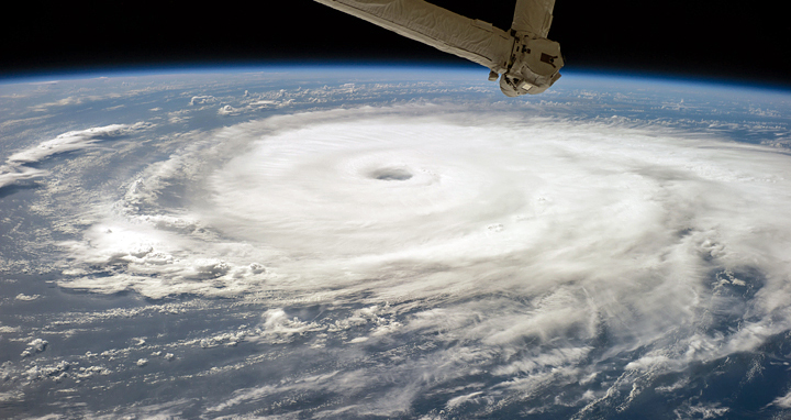
Hurricane Edouard as seen by the Expedition 41 crew on Sept. 16, 2014. Photo Credit: NASA Johnson Space Center.
“We want to know more about what conditions must be met to escalate from a tropical depression to a hurricane,” Taylor said. “To do that, we’ll need to collect as much data as possible over its entire lifespan.”
He noted that Edouard was a scientific success story for HS3, since the Global Hawk initially flew out when the storm was not yet a tropical depression, and again for every other step of the cycle: “a tropical depression, then a tropical storm, then Categories 1-3, then back down to dissipating to nothing.”
With wind speeds of more than 100 miles per hour, Edouard was the fifth named storm and fourth hurricane of the 2014 Atlantic hurricane season. It is also the first major (Category 3) hurricane in that region since 2012’s destructive Hurricane Sandy, though, unlike Sandy, it did not hit land. HS3 was unable to collect data on Sandy, Taylor recalled, because the mission had already ended for the 2012 season and the campaign’s aircraft were at NASA Armstrong, their home base, at the time the storm hit the East Coast.
HS3 is aimed at helping to predict the intensity and path of a storm, as well as a variety of other scientific outcomes. For example, SSEC senior scientist Chris Velden leads a team of researchers investigating whether the Saharan Air Layer promotes or inhibits the growth of hurricanes.
It is the experimenters’ hope that remote sensing technology will improve our large-scale understanding of hurricanes even further, allowing scientists to begin to probe the small-scale intricacies of these enormous storms.
by Sarah Witman