7 steps for stunning Earth photos
The Earth is no stranger to having its picture taken. Since the 1940s, the planet has been photographed from all angles by astronauts, satellites, and even cameras strapped to V-2 rockets. The latest addition to the U.S. weather satellite fleet, GOES-16, has already sent back some outstanding images to add to the collection, all from the vantage point of 22,300 miles away.
To capture the images, NOAA’s GOES-16 doesn’t carry the kinds of digital cameras used terrestrially. Instead, it’s packed with an array of tools to monitor the weather, both day and night. Among them, are two channels in the visible light range that are combined with a near-infrared channel to make a natural true color image. For the best lighting, GOES-16 waits until the Sun is at its back to capture the Earth fully illuminated. After each photo session, GOES-16 sends back the data to Earth where the digital bits are assembled into images.
At the University of Wisconsin-Madison Cooperative Institute for Meteorological Satellite Studies (CIMSS), researcher Kaba Bah works to convert these data into useable images, both for weather forecasts and the occasional inspiring look at the home world.
“When the data comes in, it’s only a bunch of digital 1s and 0s,” says Bah. “Our job is to make sense of them and assemble them in a way that’s accurate and useful for making weather predictions.”
Bah does this by writing algorithms to automatically sift through the sizable data sets they receive everyday. GOES-16 provides 24-hour coverage over the continental U.S. and surrounding regions using a combination cameras. When looked at as a whole, the set of images gives an in-depth look at the Earth’s weather systems, both near the surface and at varying altitudes, where different cloud structures can result in different weather patterns.
“The information we’re getting from the new satellite will help meteorologists and atmospheric scientists alike,” says Bah. “It’s even better that we’re able to capture these great photos of Earth as well.”
Satellite pictures of Earth in 7 steps
- Collect data from rooftop satellite dishes: Weather satellites like GOES-16 transmit data back to Earth where it’s captured by dishes on the roof of the UW-Madison Atmospheric, Oceanic and Space Sciences building.
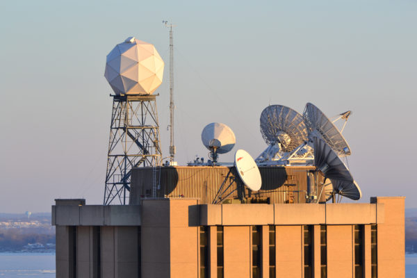
Data is collected from several geostationary and polar orbiting satellites using receiver dishes atop the Atmospheric, Oceanic and Space Sciences building in Madison, WI. Credit: Maciek Smugga-Otto.
- Process data and convert: Each day, more than 350 gigabytes of data are picked up from 10 geostationary satellites (like GOES-16), and 12 polar orbiting satellites. It takes some serious computing power to process and store that information, SSEC’s Satellite Data Services is responsible for collecting and storing that information as well as maintaining a weather and climate archive dating back to 1979. In total, SSEC has archived more than 12 petabytes (~12 mil. gigabytes) of data.
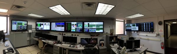
The Satellite Data Services group at the University of Wisconsin-Madison Space Science and Engineering Center (SSEC), is responsible for the access, maintenance and distribution of real-time and archive weather satellite data. Credit: SSEC

After processing, weather data is archived on-site at the AOSS building. Credit: SSEC
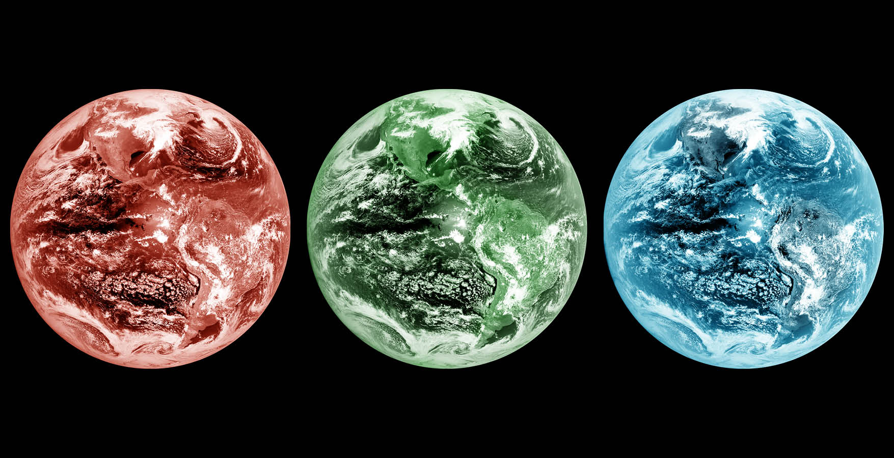
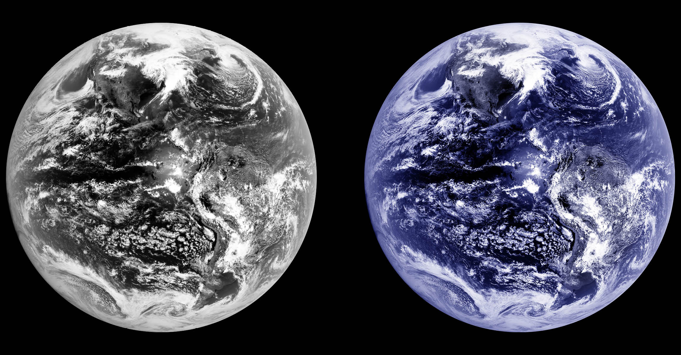
- Make a red band image: From the data, the first step is to create the “red” band image. GOES-16 has a channel tuned to pick up reflected visible light wavelengths at 0.64 micrometers (µm), what humans see as “red.”
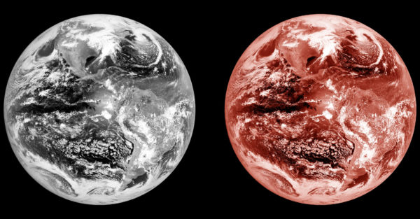
A “red” monochromatic image (left) taken by GOES-16 at 0.64 micrometers. The right image is an artistic false color representation. Credit: CIMSS/SSEC
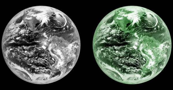
- Make a blue band image: GOES-16’s blue light channel is tuned to pick up wavelengths at 0.47 micrometers (µm). With much of the Earth’s surface covered by water, the blue light channel reveals unique features of oceans, lakes, rivers and other water bodies. This band is also sensitive to smoke and other aerosols as well.

A monochromatic image (left) taken by GOES-16 measures light at the wavelength of 0.47 micrometers, or what the human eye perceives as “blue.” The image on the right is an artistic false color representation. Credit: CIMSS/SSEC
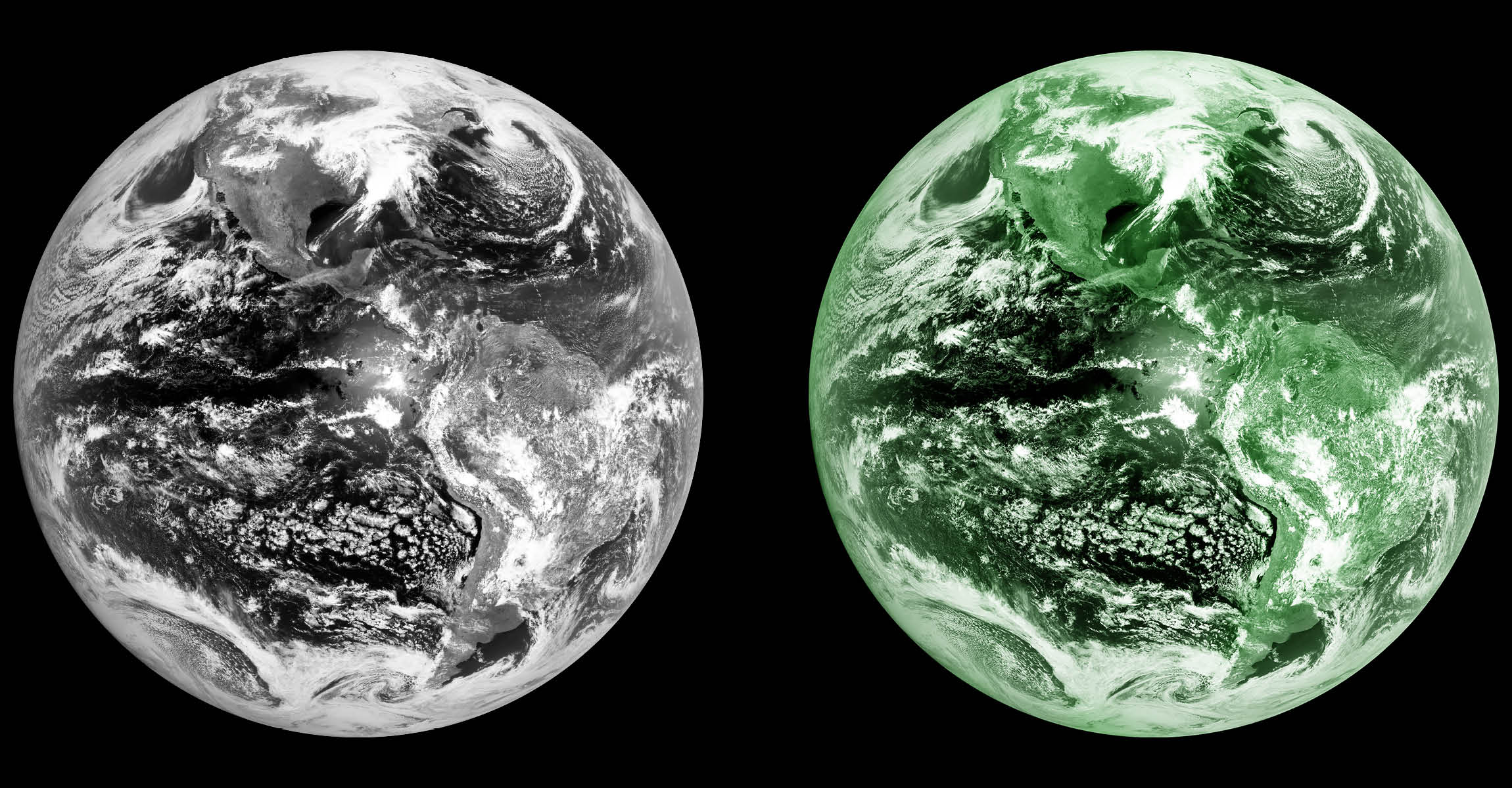
- Extrapolate the “green” image: GOES-16 does not have a green visible light channel on board, instead SSEC and CIMSS scientists use mathematics to extrapolate where the underlying green imagery would be. Afterwards, the results are compared with the GOES-16 “vegetation band” (0.86µm) which is sensitive to plants on the Earth’s surface.
A monochromatic image (left) taken by GOES-16 using near-infrared detector at the wavelength of .86 micrometers, which is invisible to the naked eye. The infrared image however is sensitive to light emissions of the Earth’s vegetation. The image on the right is an artistic false color representation. Credit: CIMSS/SSEC
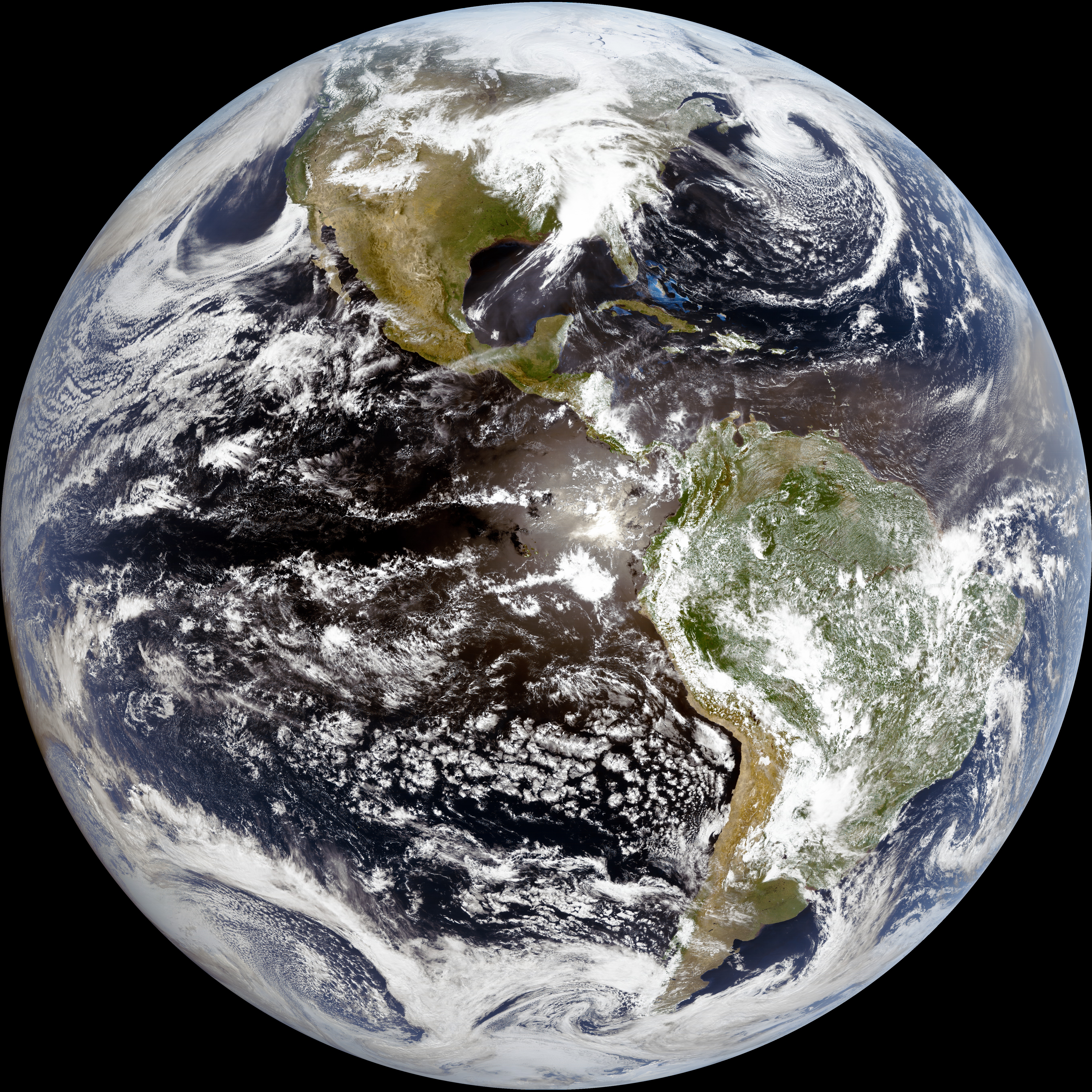
- Put it all together: The final Earth image is a composite of all three: red, blue, and green. Getting it to look natural however, is a balancing act. CIMSS researcher Kaba Bah works to create algorithms that compile the data in a way that is both computationally efficient and combines the pixels to produce lifelike images, complete with white clouds, earthen mountains, blue oceans, and green trees.
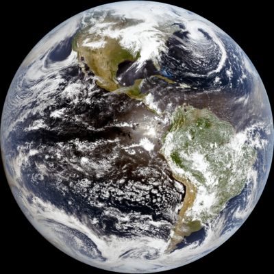
A composite true color image of the Earth. Credit: CIMSS/SSEC
- Share the image: At its highest resolution, GOES-16 can track developing weather patterns with precision. Each pixel in the image represents a half-kilometer (0.3 miles), and at this resolution, GOES-16 can send back images every 30 seconds, a significant improvement over the previous satellites.
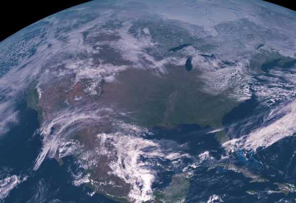
A true color image of the continental United States. Credit: CIMSS/SSEC


Looking back, satellite imagery has come a long way since 1966, when early satellites like ATS-I captured the first full-disk images of Earth. Later made into movies, those images quickly revealed new insights into Earth’s weather patterns, advancing meteorological sciences and improving forecasts.
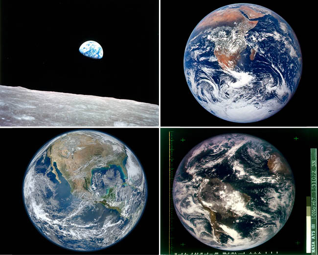
Earth images over the years. From top-left clockwise: Earth Rise taken by Apollo 8 astronauts on the Moon (1968), The Blue Marble taken by Apollo 17 astronauts in low-Earth orbit (1972), the first true color full-disk image of Earth taken by ATS-III geosynchronous satellite (1967), The 2012 Blue Marble taken by polar orbiting satellite Suomi NPP. Image credits: NASA, NOAA, SSEC
by Eric Verbeten