
Learning Activities
1. Principles in Remote Sensing 

 |
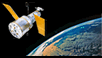
Description:This set of tutorials teaches basic concepts in remote sensing via satellites. Learners are shown how characteristics of the satellites and onboard sensors affect the amount and quality of data collected. A sampling of ways to use the data for activities such as weather forecasting and scientific research are demonstrated. At the completion of each module, learners are given opportunities to apply what they have learned to actual data collected by NASA satelllites. Learning Objectives:After successfully completing these modules, students should be able to:
Prerequisites:Students should have at least a high-school level math and physics background, and be familiar with introductory concepts related to remote sensing via satellites, including radiation, wavelength, and orbit types. A meteorological background is helpful but not essential. Pedagogical Applications:These tutorials can be used in a number of ways in various disciplines. Some suggestions are provided below.
|
Modules
|