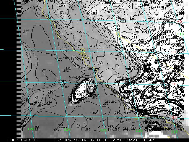
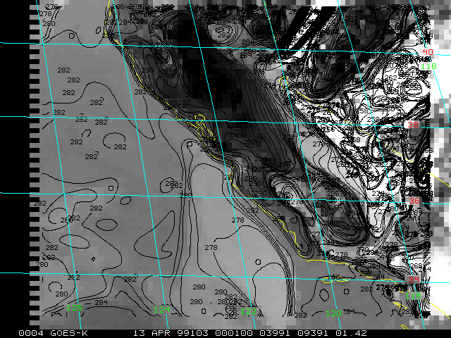
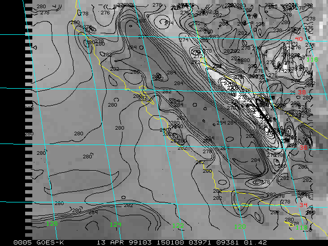
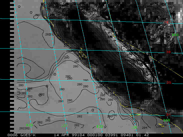
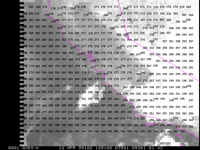
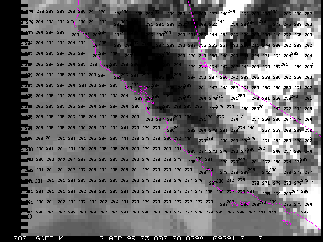
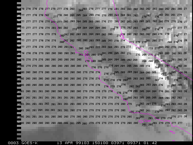
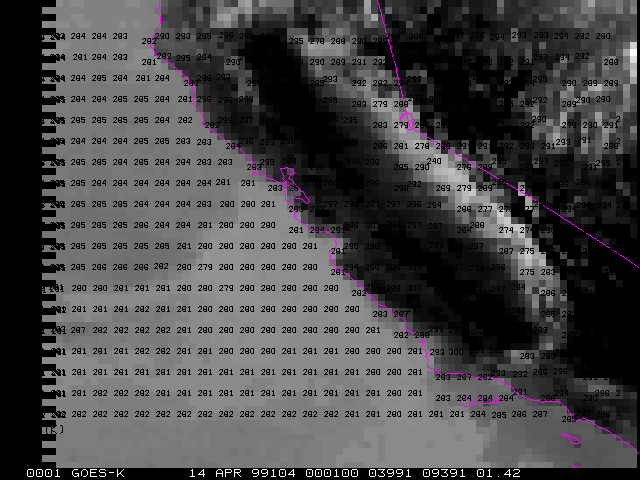
BT:
Brightness temperature from the GOES Sounder Channel 8 (window channel, 11 microns). These data are contoured at intervals of 1 degree K. Background brightness of image is inversely proportional to temperature. The brightness temperature approximates the temperature of the land/ocean surface where it is clear and of the cloud top in cloudy areas. No correction for water vapor absorption has been accounted for.
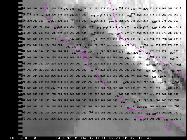
TC:
Cloud top temperature in degrees K from GOES sounder retrieval (using multiple bands). Can be compared to BT for increased accuracy.
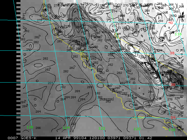
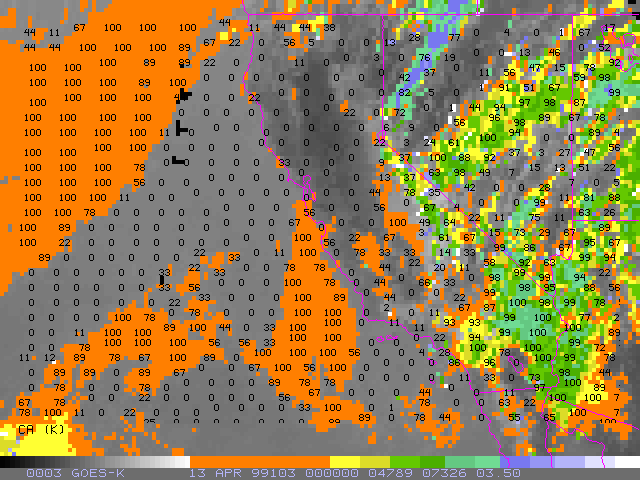
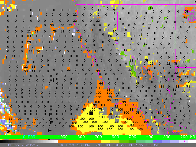
CA:
Cloud amount (numbers plotted in per cent) and cloud top pressure (color enhancement on image) from GOES sounder retrieval (CO2 "slicing technique").
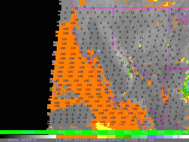
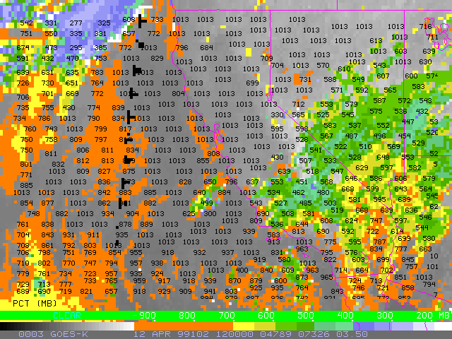
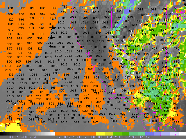
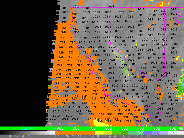
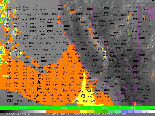
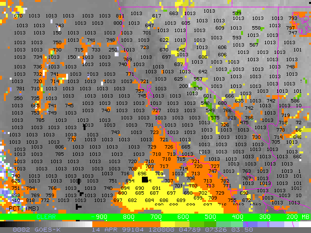
CP:
Cloud top pressure (numbers plotted in mb and
color enhancement on image) from GOES sounder retrieval (CO2 "slicing technique").
Note that the cloud top pressure has been found to
be too low (cloud top too high) for low altitude clouds. This is because
of the presence of an inversion & the "top down" search for matching
cloud top temperature to ambient temperature (currently employed in the
CIMSS cloud top pressure algorithm). It will be necessary to manually compare
the cloud top temperature with nearby rawinsondes and use a "bottom up"
approach to improve these estimates of cloud top pressure.
|
|
|
|
|
|
|
|
|
|
|
|
|
|
|
|
|
|
|
|
|
|
|
|
|
|
|
|
|
|
Return to Main Page