The Profiler Time/Height display shows winds at all levels above one station, for one or more times. Winds are shown with the meteorological wind barb symbol. The location of the barb on the plot shows the wind observation height above mean sea level, and the barb provides information about the direction and speed of the wind. For more information on what wind speeds correspond to each of the wind barbs in McIDAS-V displays, please see the table in the FAQ.
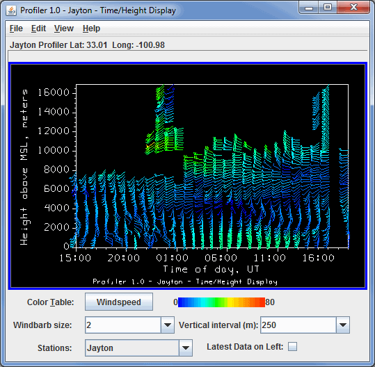
Image 1: Time/Height Display
The map position of the vertical profile is indicated by the "Lat: Long:" readout above the graph. The time and height values on the plot can be sampled by dragging the middle mouse button over the plot.
- Color Table - Shows the active color table and the associated high and low data values in the units of the display. As the mouse pointer is moved over the color bar, the value at a particular color is shown. Right click on the color bar or click on the button that displays the name of the Color Table to make modifications to the color bar. This allows you to open the Color Table Editor, change the range, select other color tables, etc.
- Windbarb size - Enlarges or reduces the size of the wind barbs.
- Vertical interval - Changes the vertical separation between wind barbs in meters.
- Stations - Switches between the station being displayed if more than one station was selected.
- Latest data on left - Changes the order of times displayed. When checked, the most recent data time is on the left; and the oldest on the right.
Many of the menu items seen utilizing this display are standard options that can be found in the Menus section of the Layer Controls page. However, there is one option that is unique to this display.
The View menu has this unique option:
- Profiler View - Allows the user to change many aspects of the display shown in both the Main Display window, and in the Layer Controls tab of the Data Explorer.