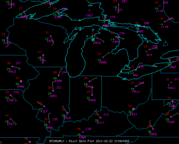
Image 1: Point Data Plot
You can make plots of point data such as meteorological surface (METAR) and synoptic surface weather station observations.
For more information see Displaying Surface and Upper Air Point Data . You can change the plot layout with the Station Model Editor.
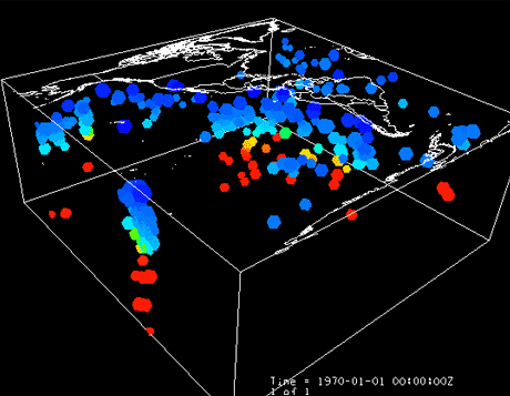
You can plot non-meteorological point data as well. The image below depicts the locations of earthquakes, sized by magnitude and colored by depth. Earthquake data can be obtained from the U.S. Geological Survey (USGS) in Google Earth (KMZ) format and can be loaded into McIDAS-V in the General->Files/Directories Chooser with the Data Type of "Google Earth Files KML/KMZ". Using the Station Model Editor, you can specify how your data will be displayed in the Main Display window.
Aircraft and drifting buoy tracks can be plotted to show the path of the sensor. You can also plot the track data as observations along the track. The track path is brought into McIDAS-V through the General->Files/Directories Chooser with the Data Type of "Text Point and Trajectory Data files". The Flythrough feature is invoked in the Main Display Window through the View->Flythrough menu item. You can set the Flythrough to follow the track path by creating and importing an XML file with location (latitude, longitude, and altitude) data via File->Import in the Flythrough window.

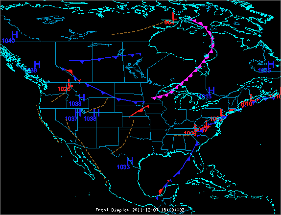
Via ADDE, McIDAS-V has the ability to plot a frontal analysis or a forecast of frontal positions. You can create these displays by selecting Front Positions in the Data Sources tab of the Data Explorer. For more information about this feature, see Displaying Fronts and Front Controls.