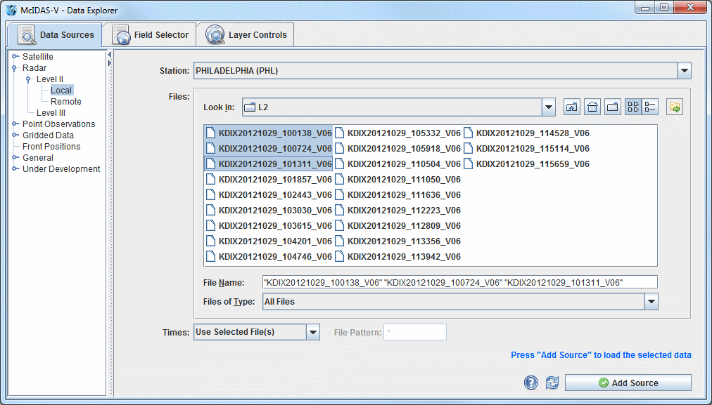
Image 1: Level II Local Radar Chooser
The Radar->Level II->Remote chooser allows for choosing Level II radar data from a remote THREDDS server. For more information on how to use this chooser, see Getting Started - Displaying Level II Radar Imagery.
The Radar->Level II->Local chooser allows for choosing Level II radar data from the local file system or a mounted drive. The Level II data is supplied as volume-scan files, each file having all data from one WSR-88D radar for all sweeps for one "time". Archived Level II radar files can be displayed through the Radar->Level II->Local file chooser. The files should be stored on the file system with each station's files in a directory (folder) whose directory name is the station 4-character ID (e.g., KTLX for Oklahoma City). In some cases, the data files do not have any location information in them, and McIDAS-V uses the directory name as a first guess at the station location. Archived Level II data is available from the National Centers for Environmental Information (NCEI).
 Help - Brings up this help page.
 Refresh - Updates the Level II radar chooser with the most recent data.
 - Loads the selected radar data.
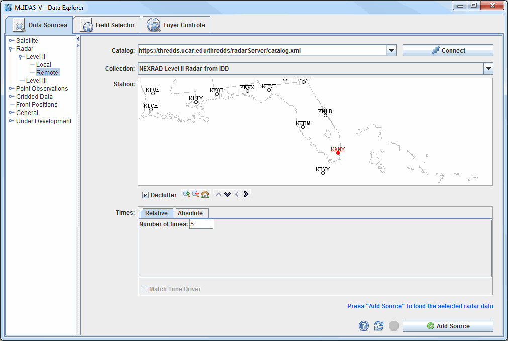 Help - Brings up this help page. Refresh - Updates the Level II radar chooser with the most recent data. - Loads the selected radar data.