OTHER INTERESTING McIDAS
IMAGES
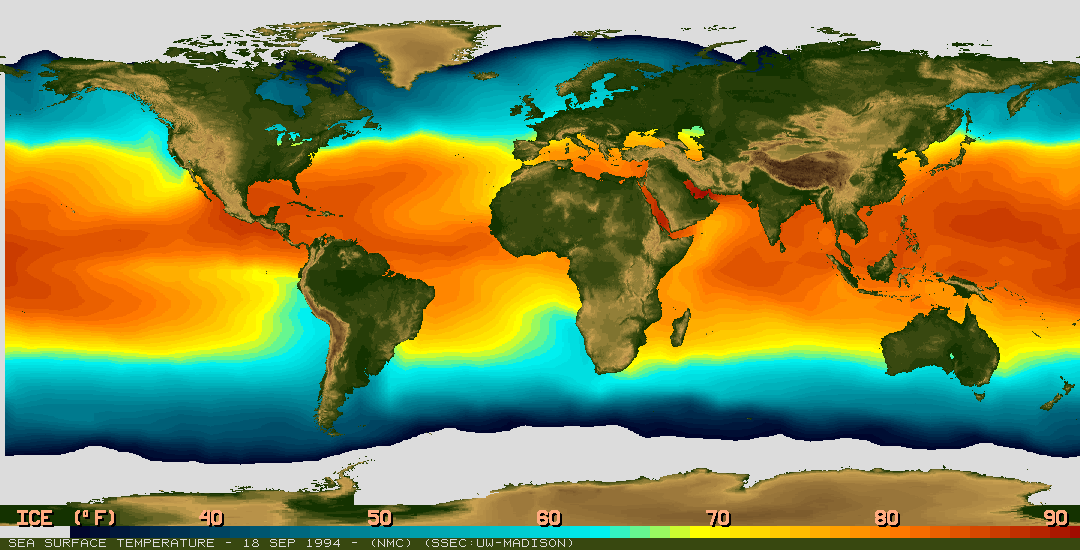
Sea Surface temperature, National Meteorological Center (NMC) data, 18 September
1994, R. Kohrs |
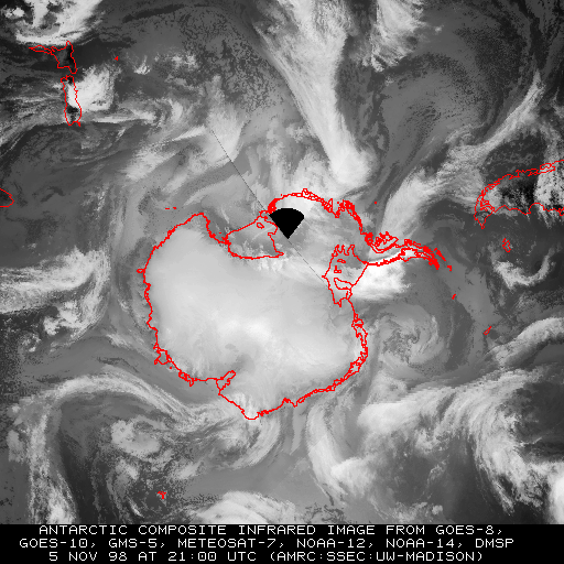
Antarctic Composite Infrared Image from GOES-8, GOES-10, GMS-5, METEOSAT-7, NOAA-12, and NOAA-14, Defense Meteorological Satellite Program (DMSP), 5 November 1998, 2100 UTC, M. Lazzara |
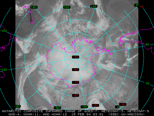
Antarctic Composite InfraRed
(IR) image centered on the South Pole, Satellites used: Geostationary Operational
Environmental Satellite (GOES)-7, METEOrological SATellite (Meteosat)-3 & 5,
Geostationary Meteorological Satellite (GMS)-4, National Oceanic and
Atmospheric Administration (NOAA)-11 & 12, 15 February 1994, 0301 UTC, M. Lazzara |
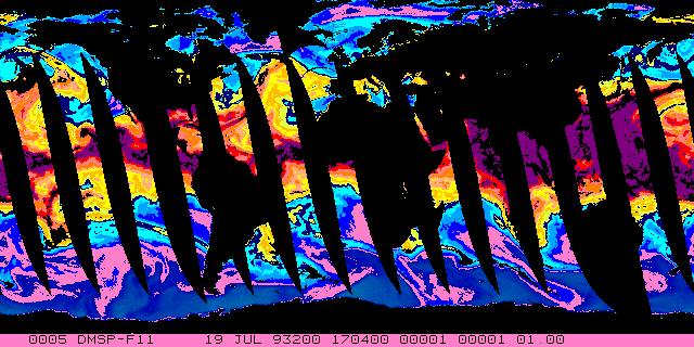
DMSP WetNet product (from satellite F-11), 19 July 1993, 1704 UTC, J. Mecikalski |
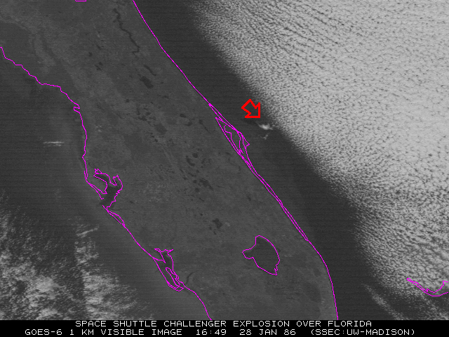
Image of Space Shuttle Challenger explosion, GOES-6 1 km visible,
28 January 1986, 1649 UTC, D. Rotzoll/M. Lazzara
|

Image of Space Shuttle Challenger explosion, GOES-6 1 km
visible, 28
January 1986, 1654 UTC, D. Rotzoll/M. Lazzara
|
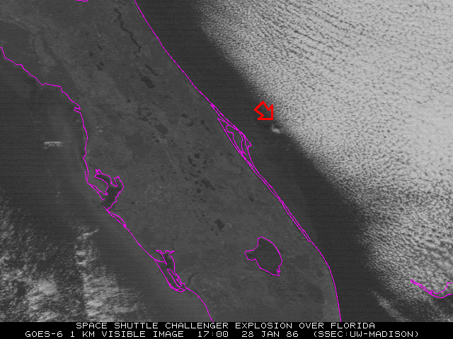
Image of Space Shuttle Challenger explosion, GOES-6 1 km visible, 28
January 1986, 1700 UTC, D. Rotzoll/M. Lazzara
|
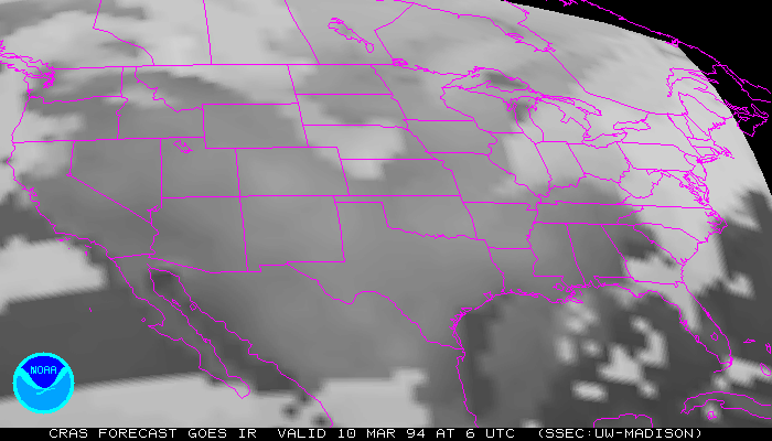
Cooperative Institute for Meteorological
Satellite Studies (CIMSS) regional forecast, GOES-IR, valid 10 March 1994, 0600 UTC |
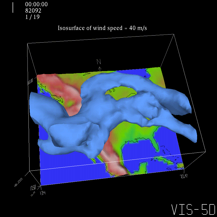
Visualization of Five-Dimensional data
(VIS-5D), Isosurface of wind speed = 40 m/s, 19 January 1992, 0000 UTC |
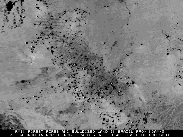
Rain forest fires & bulldozed
land in Brazil from NOAA-9, 3.7 micron IR image, 24 August 1988, 1942 UTC, E.
Prins/B. Roth/M. Lazzara |
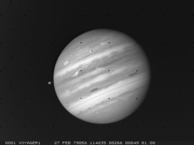
Jupiter and a moon from Voyager 1, 27
February 1979, J. Mecikalski |
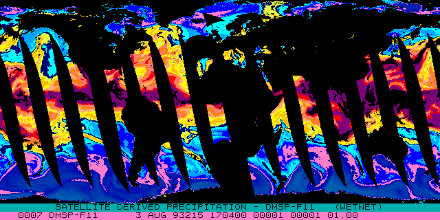
Satellite derived precipitation from DMSP
satellite F-11, WetNet product, 3 August 1993, 1704 UTC, J. Mecikalski |
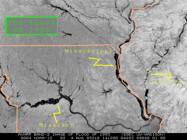
Flooded Midwest, AVHRR band-2, NOAA-12, 4 August 1993, 1412 UTC, J. Mecikalski |
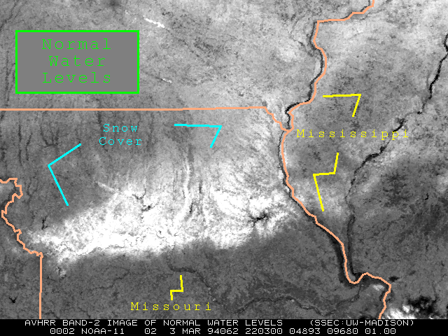
Normal
water levels for Midwest, AVHRR band-2,
NOAA-11, 3 March 1994, 2203 UTC, J. Mecikalski |
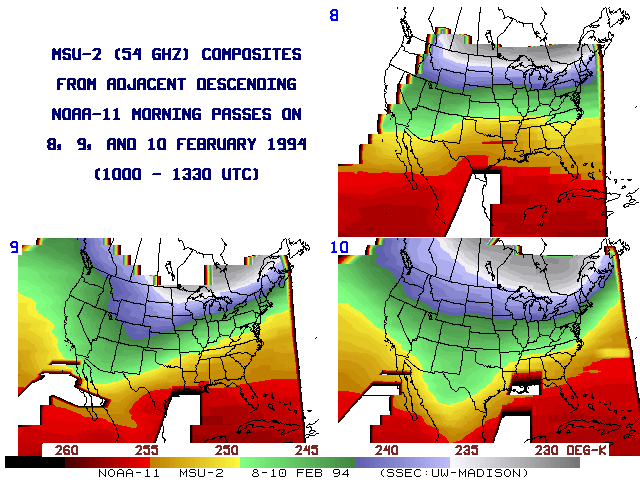
Midtroposphere temperatures
from NOAA-11 Microwave Sounding Unit (MSU) band-2, Morning passes on 8, 9,
10 February 1994, 1000-1330 UTC, M. Lazzara |
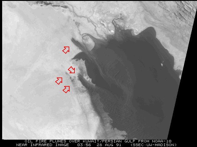
Kuwait/Persian Gulf oil fires,
NOAA-10 near IR image, 28 August 1991, 0356 UTC, M. Lazzara |
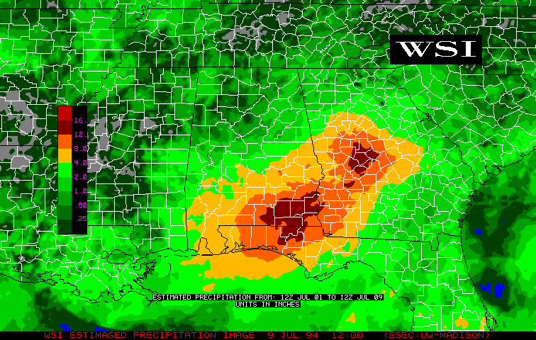
WSI estimated precipitation for
Southeastern US, shows county outlines, 1-9 July 1994, 1200-1200 UTC, M. Lazzara |
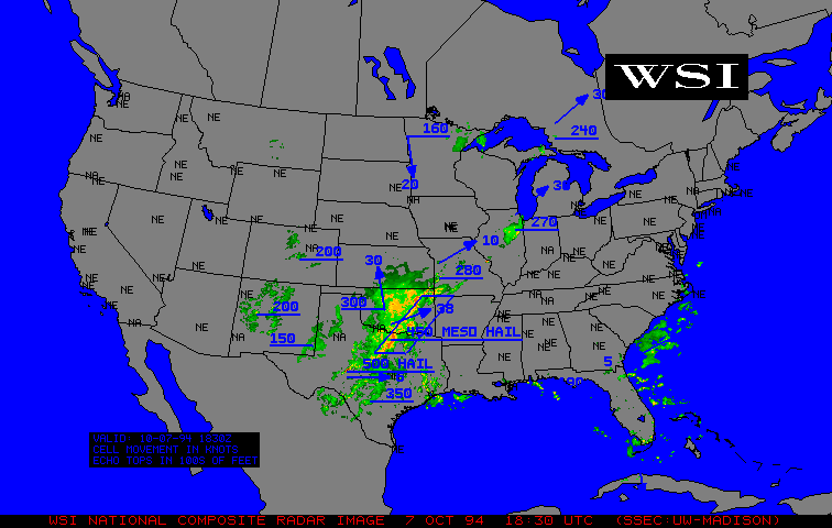
WSI US national radar imagery
composite, 7 October 1994, 1830 UTC, M. Lazzara |
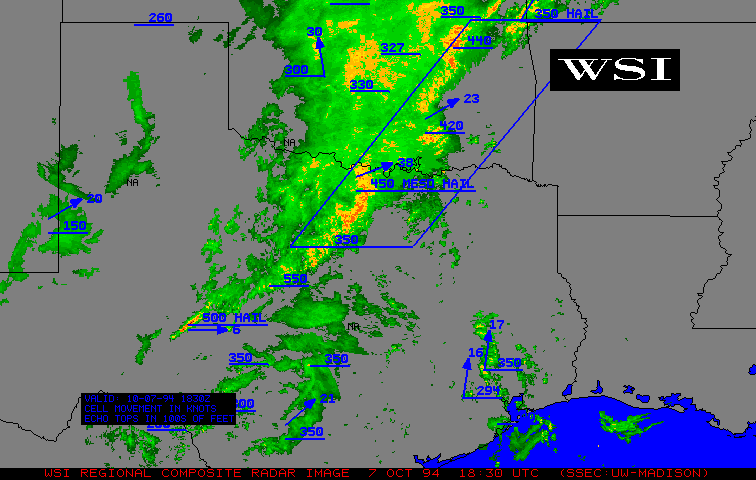
WSI regional radar imagery over
Texas (TX), US, 7 October 1994, 1830 UTC, M. Lazzara |
