10.1. Working with ABI Files
This example walks through the creation of GOES ABI GeoTIFF subset image files and adding overlays.
10.1.1. The Basics of Geo2Grid for ABI GeoTIFF File Creation
Find the options available when creating GOES-16, -17 and -18 GeoTIFFs:
geo2grid.sh -r abi_l1b -w geotiff -h
List the products that can be created from your ABI dataset:
geo2grid.sh -r abi_l1b -w geotiff --list-products -f <path_to_files>
To create GeoTIFF output files of all bands found in your data set, including true and natural color full resolution sharpened 24 bit RGBs in standard satellite projection using 8 worker threads:
geo2grid.sh -r abi_l1b -w geotiff --num-workers 8 -f <path_to_files>
Create a subset of ABI band output GeoTIFF image files for Channels 1, 2, 3 and 5:
geo2grid.sh -r abi_l1b -w geotiff -p C01 C02 C03 C05 true_color -f <path_to_abi_files>
Create ABI images over the given latitude/longitude region:
geo2grid.sh -r abi_l1b -w geotiff --ll-bbox <lonmin latmin lonmax latmax> -f <path_to_abi_files>
Create a natural color full resolution GeoTIFF from GOES-18 ABI observations acquired on 15 November 2022, 18:30 UTC over a latitude/ longitude bounding box of 128W,30N to 118W,40N . This command assumes that all bands required to create the false color image are available:
geo2grid.sh -r abi_l1b -w geotiff -p natural_color --ll-bbox -128 30 -118 40 -f OR_ABI-L1b-RadF-M6C*_G18_s20223191830*.nc
The resulting image is displayed below.
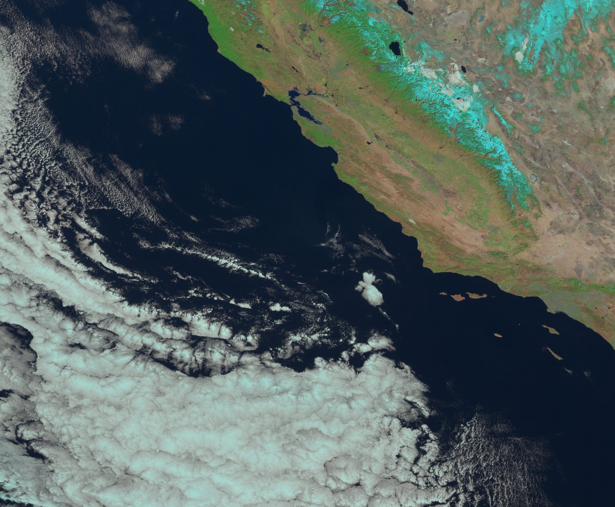
Fig. 10.1 ABI Natural color subset GeoTIFF image (GOES-18_ABI_RadF_natural_color_20221115_183020_GOES-West.tif)
Add coastlines, borders and latitude/longitude grid lines to the image, and write the output to the file “my_goes18_abi_naturalcolor.png”:
add_coastlines.sh --add-coastlines --add-borders --borders-resolution=h --borders-outline='red' --add-grid GOES-18_ABI_RadF_natural_color_20221115_183020_GOES-West.tif -o my_goes18_abi_naturalcolor.png
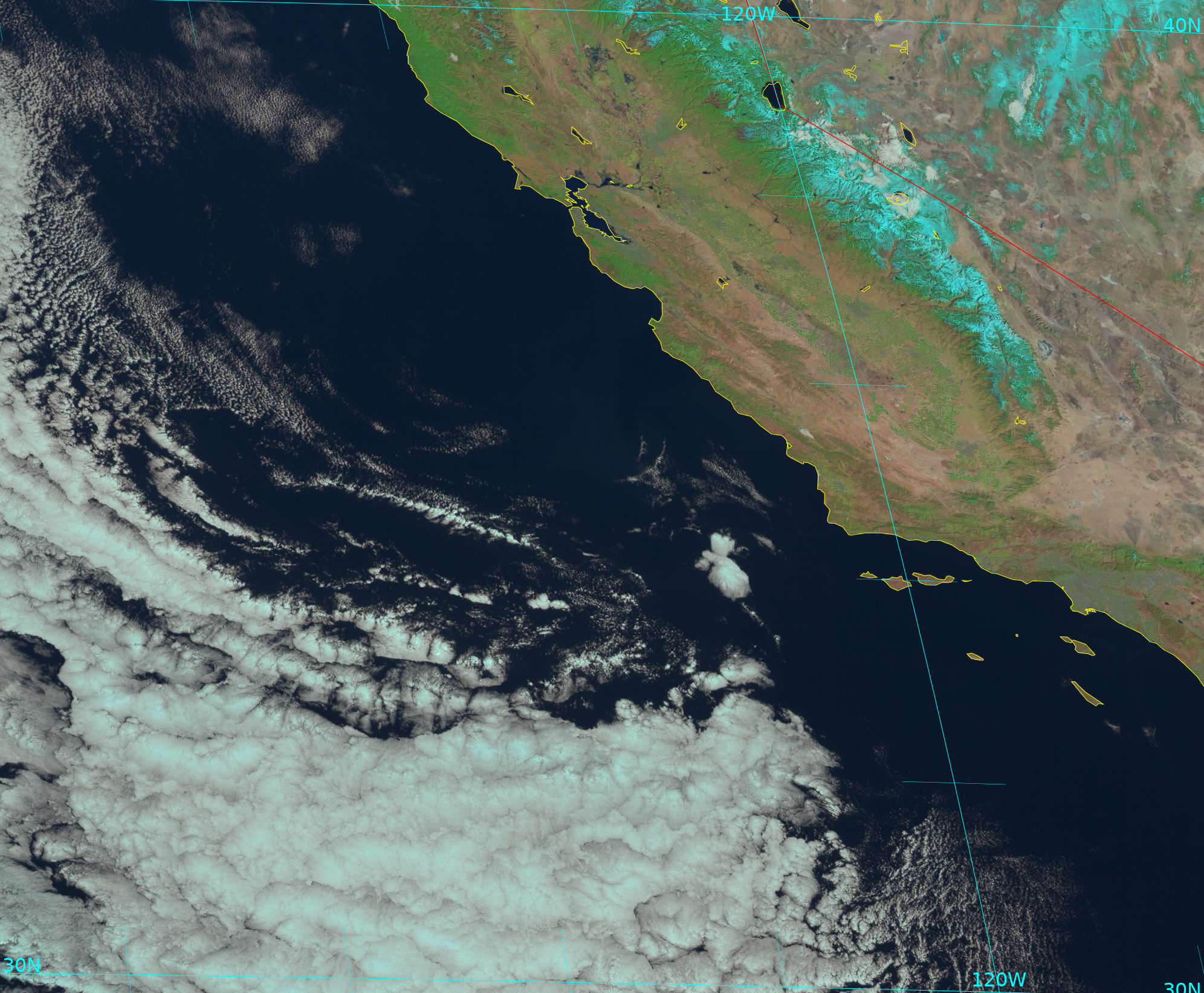
Fig. 10.2 GOES-18 natural color image with overlays (my_goes18_abi_naturalcolor.png).
Convert the natural color GeoTIFF file into a Google Earth compatible Keyhole Markup language Zipped (KMZ) file.
gtiff2kmz.sh GOES-18_ABI_RadF_natural_color_20221115_183020_GOES-West.tif
which creates the GOES-18_ABI_RadF_natural_color_20221115_183020_GOES-West.kmz file which can then be displayed easily in the Google Earth GeoBrowser.