WSI HURRICANE IMAGES
Weather
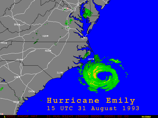
Services International (WSI) radar image of Hurricane Emily approaching
Cape Hatteras, North Carolina (NC), 31 August 1993, 1500 UTC,
J. Mecikalski |
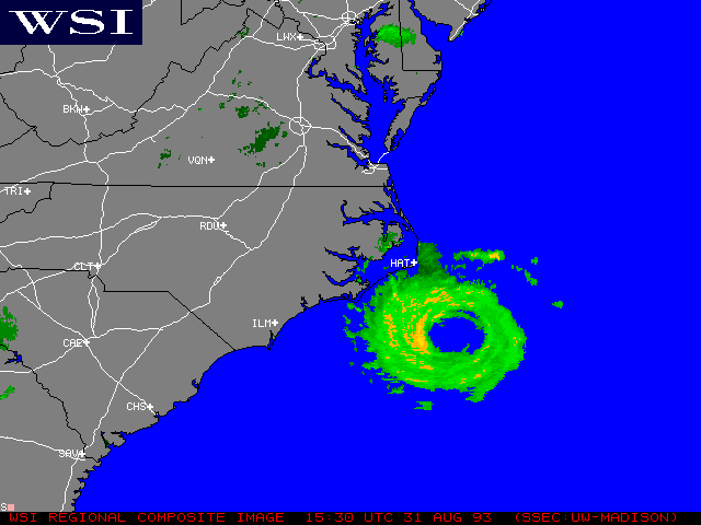
Radar image of Hurricane Emily, 31 August 1993,
1530 UTC, M. Lazzara
|
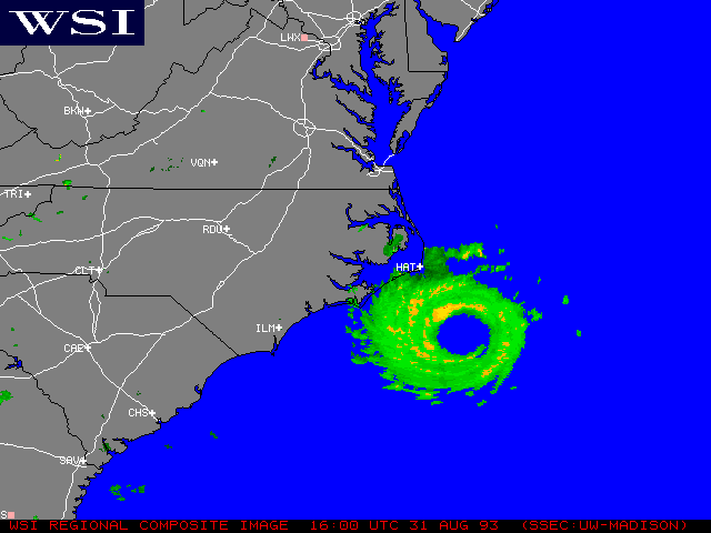
Radar image of Hurricane Emily,
31 August 1993, 1600 UTC, M. Lazzara |

Radar image of Hurricane Emily, 31 August 1993, 1630 UTC, M. Lazzara |
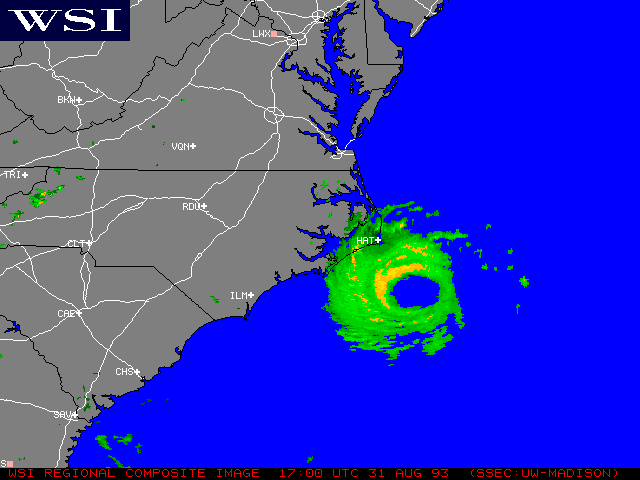
Radar image of Hurricane Emily, 31 August 1993, 1700 UTC, M. Lazzara |
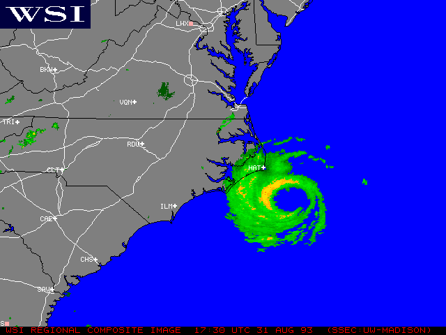
Radar image of Hurricane Emily, 31
August 1993, 1730 UTC, M. Lazzara |
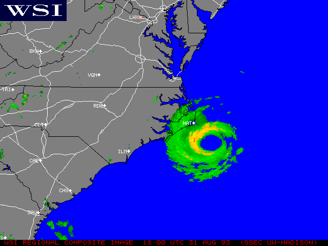
Radar image of Hurricane Emily, 31 August 1993, 1800 UTC, M. Lazzara |
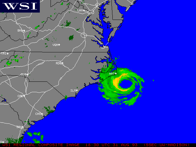
Radar image of Hurricane Emily, 31 August 1993, 1830 UTC, M. Lazzara |
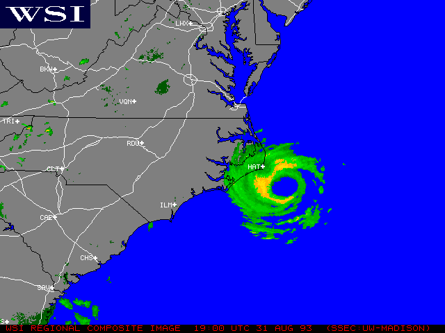
Radar image of Hurricane Emily, 31
August 1993, 1900 UTC, M. Lazzara |
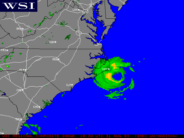
Radar image of Hurricane Emily, 31
August 1993, 1930 UTC, M. Lazzara |
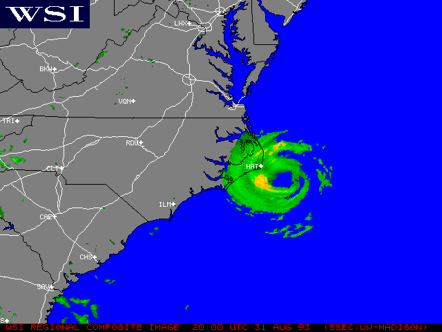
Radar image of Hurricane Emily, 31 August 1993, 2000 UTC, M. Lazzara |
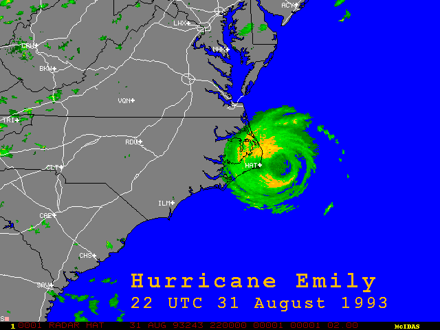
Radar image of Hurricane
Emily, 31 August 1993, 2200 UTC, J. Mecikalski |
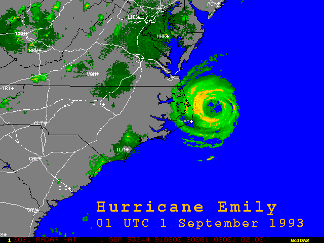
Radar image of Hurricane
Emily making landfall at Cape Hatteras, 1 September 1993, 0100 UTC, J. Mecikalski |
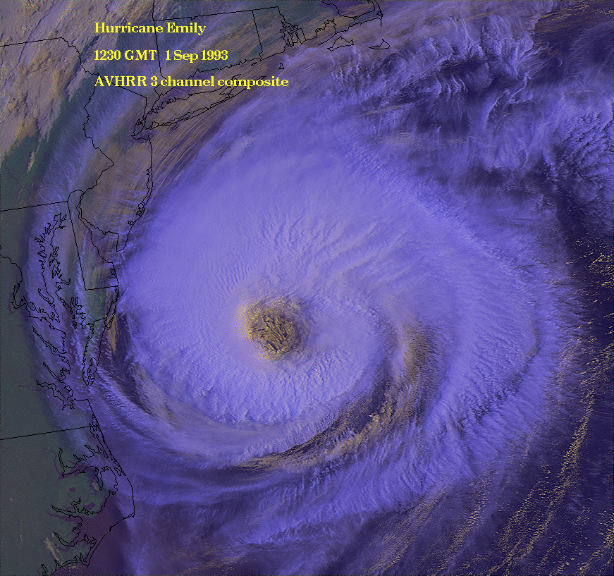
Advanced Very High Resolution
Radiometer (AVHRR) 3-channel color composite of Hurricane Emily, 1 September 1993, 1230 UTC, J. Mecikalski |
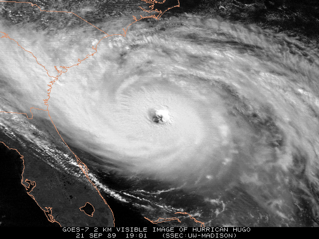
Satellite image of Hurricane Hugo, 21 September
1989, 1901 UTC, J. Mecikalski |
