« Back to "Typhoon Vongfong (Ambo) - 13-15 May 2020"
Typhoon Vongfong – 14 May 2020
Posted: May 14, 2020
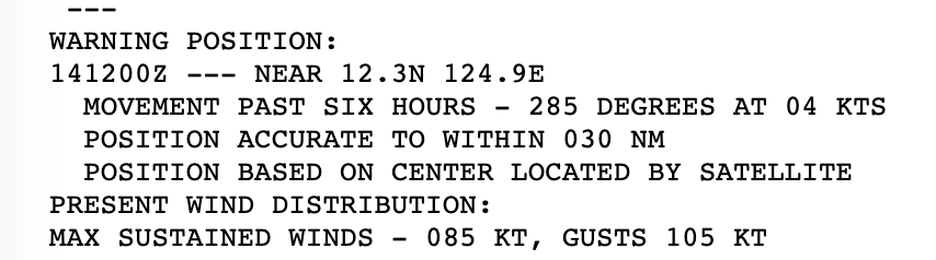
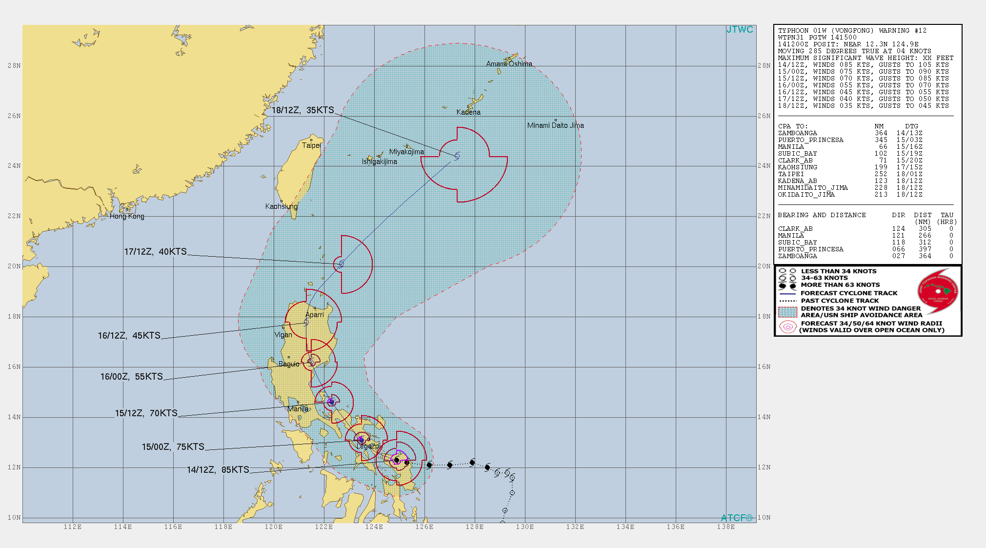
On 13 May 2020 November 2019, Typhoon Vongfong became the first typhoon of the 2020 West Pacific season. The 1500Z on 14 May, the Joint Typhoon Warning Center (JTWC) stated that Typhoon Vongfong had weakened, having winds of 85knts, or ~97mph. This would make it a weak Category 2 storm in the Atlantic basin.
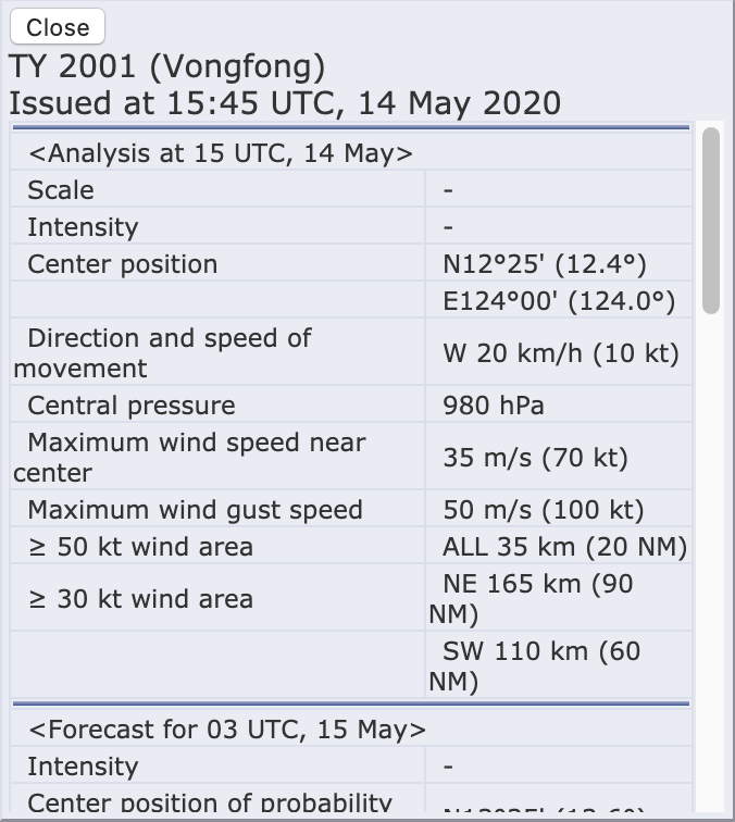
The Regional Specialized Meteorological Center (RSMC) Tokyo stated that the maximum winds at the center continued to be 70knts or ~92mph. While slightly different than the speed the JTWC showed, this difference is due to differing methods of determining the winds and due to the fact that JTWC adopts a 1 min mean wind speed, but RSMC Tokyo adopts 10 mins mean wind speed. As with the JTWC discussion, it would make Vongfong a Category 1 storm in the Atlantic basin.
Interestingly, the JMA and JTWC estimate the storm’s intensity close to each other. However, such a small difference could make the type of warning might be issued.
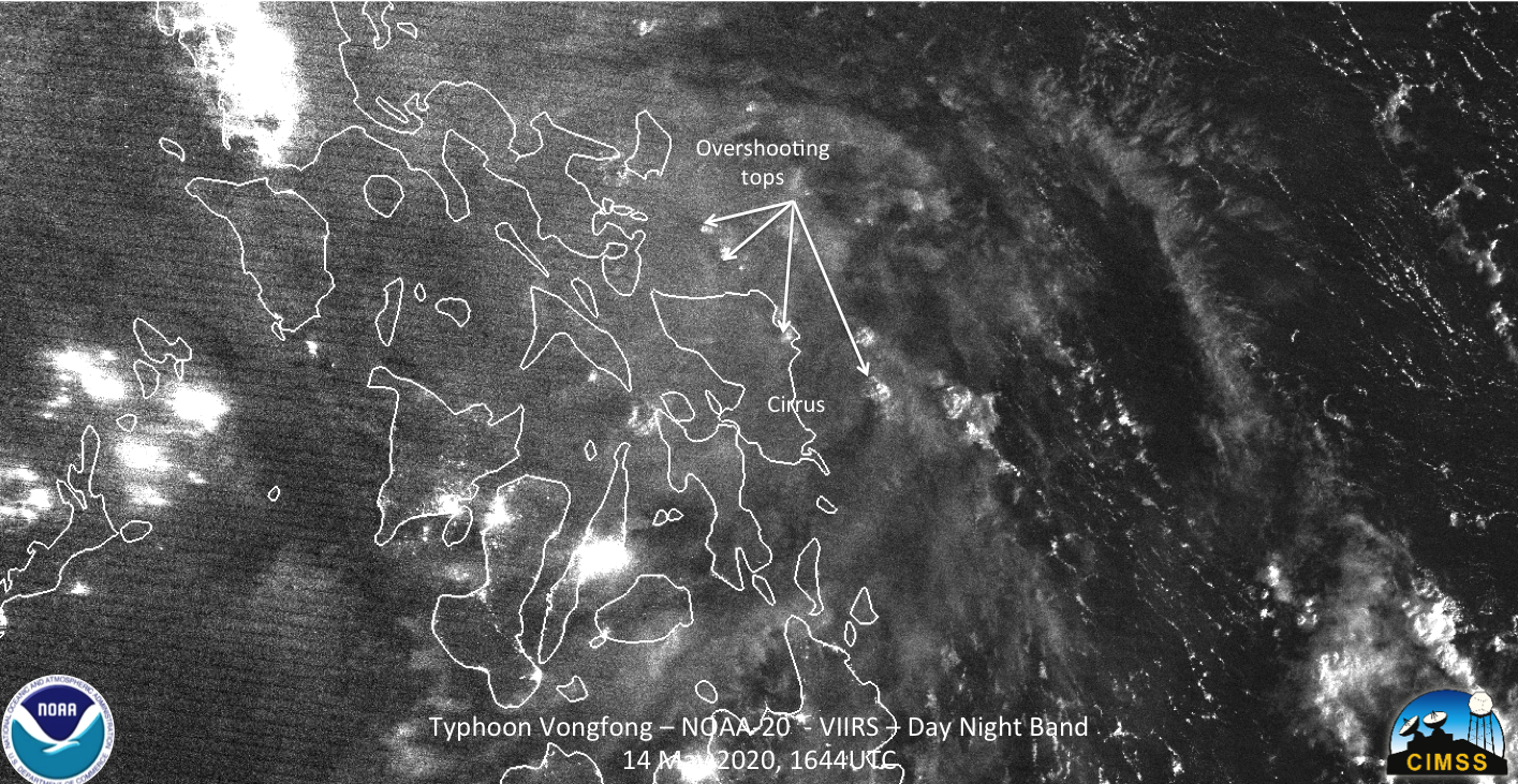
NOAA-20 saw Typhoon Vongfong at ~1644Z on the western edge of the scan. The I05 (11μm) imagery showed features that one would expect from a tropical system, including overshooting tops and tropospheric gravity waves. However, the notable difference from yesterday is that the eye is closed.
While JTWC was utilizing imagery from Himawari, their prognostic reasoning from 15Z on 14 May 2020 stated
ANIMATED INFRARED SATELLITE IMAGERY SHOWS THE EYE HAS NOW CLOSED AND CONVECTION HAS DIMINISHED
WITHIN THE EASTERN SEMICIRCLE OF THE SYSTEM, EVIDENT IN THE WARMING CLOUD TOPS.
The diminished convection could also be seen in the I05 (11μm) imagery as compared to yesterday, where convection completely surrounded the circulation.
While the moon was a last quarter moon (51% illumination) the NOAA-20 pass was such that Vongfong was partially moonlit and partially in shadow. The only features that really were apparent were the moonlit overshooting tops
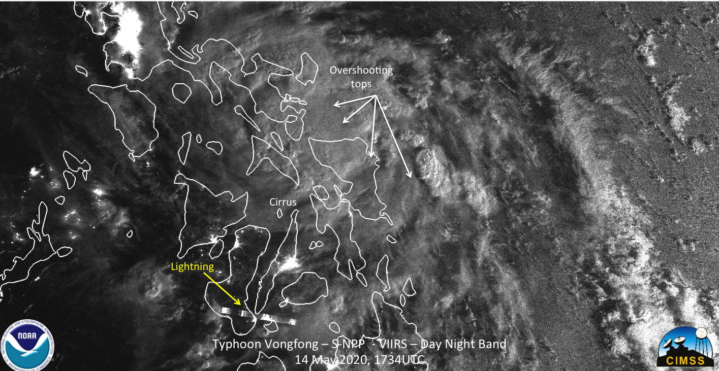
Roughly 50 minutes later, S-NPP observed Typhoon Vongfong at ~1734Z. The I05 (11μm) imagery showing similar features as NOAA-20, though slightly rotated.
Interestingly, the S-NPP DNB imagery, which was more moonlit than the NOAA-20 imagery also observed a lightning streak on one of the southern feeder bands
GCOM-W1 was in a position to observe Vongfong at ~1703UTC on the edge of the pass, between the NOAA-20 and S-NPP passes. As can be seen, the circulation is not surrounded by convection. This again confirms what mentioned by the JTWC prognostic reasoning at 15Z on 14 May 2020.
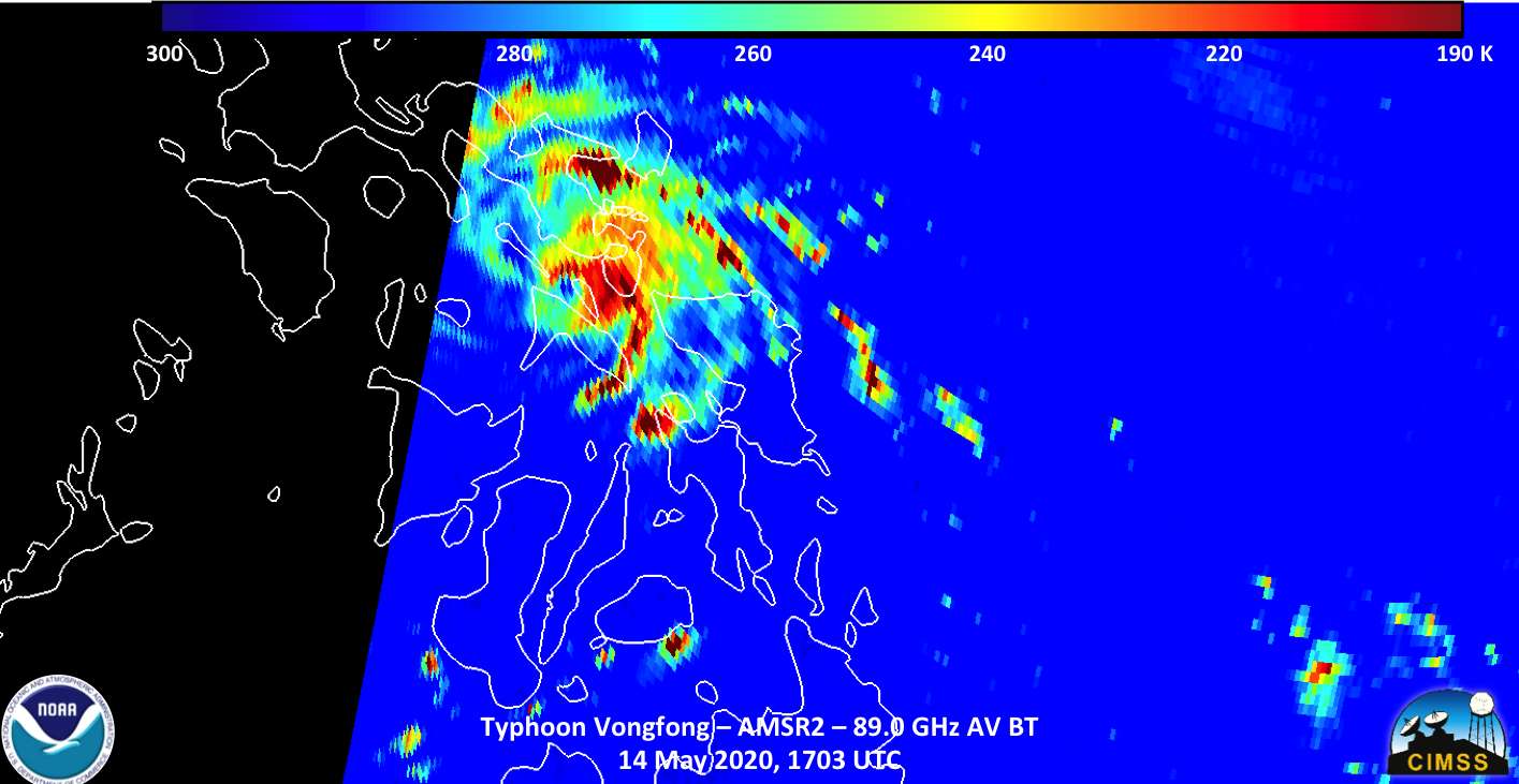
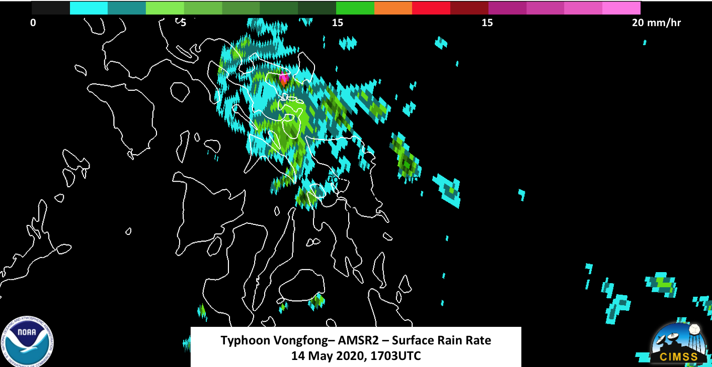
This is further supported when looking at the surface rain product, which shows potentially some clear (no rain) intruding into the circulation
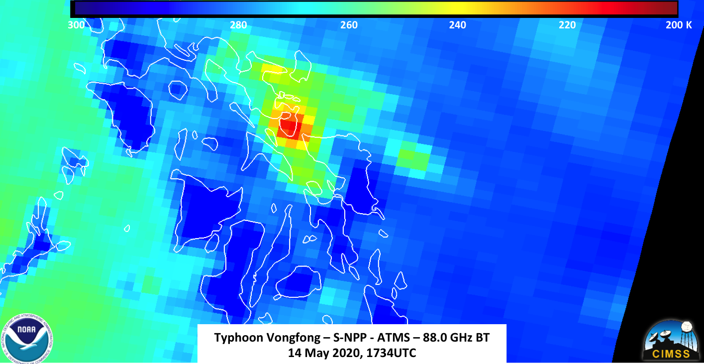
The 88.0 GHz ATMS imagery from NOAA-20 and S-NPP, while at lower resolution, did not show a circulation surrounded by convection. Rather, it showed just cold temperatures in the northeastern part of the storm where the convection was located.
The forecast from JTWC has Typhoon Vongfong continuing to weaken to ~70knts by 15 May 2020, which would be the equivalent to a Category 1 storm in the Atlantic. Both JTWC and JMA have it continuing to impact the Philippines thought the 16th of May.

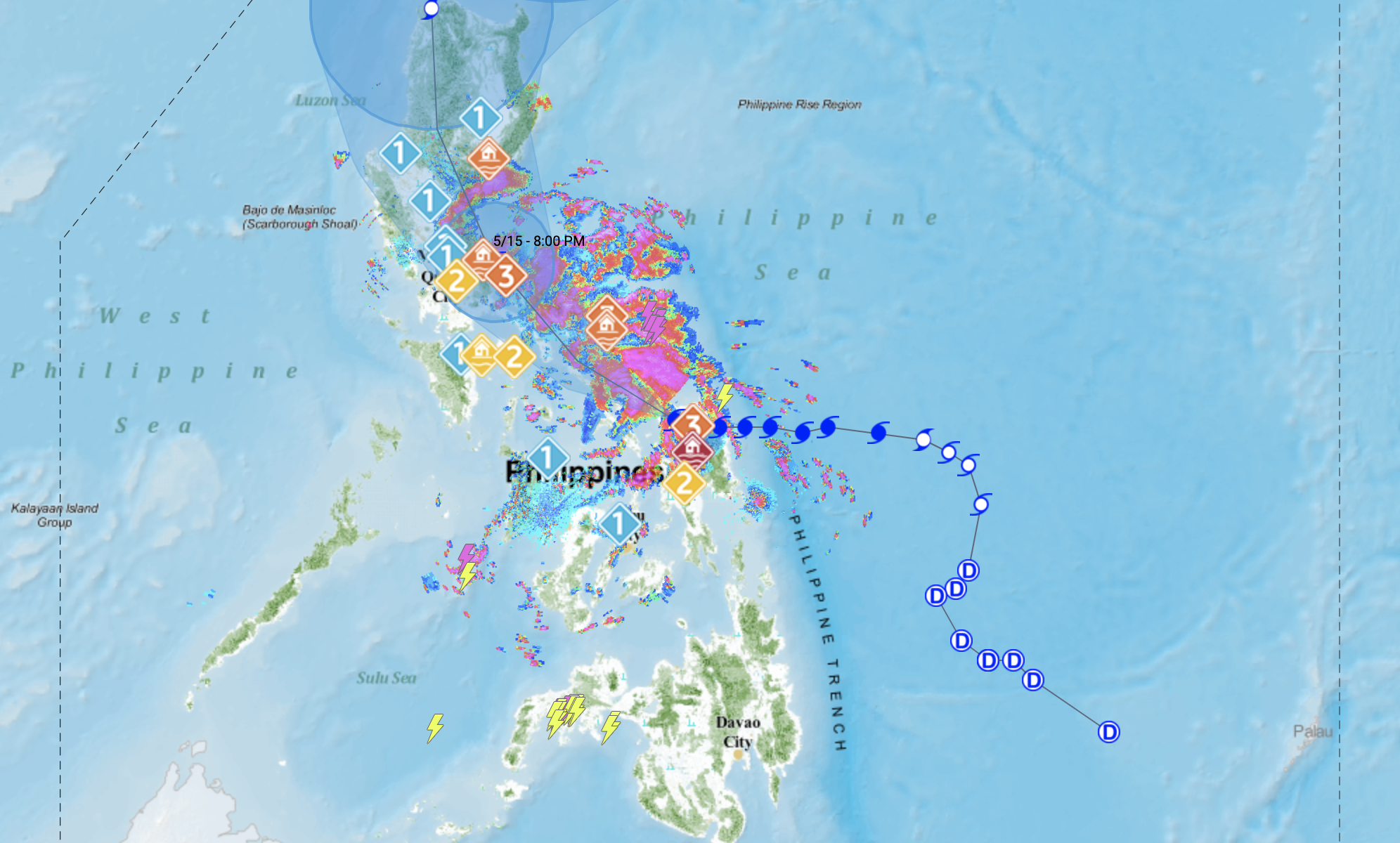
Because of the impacts to the Philippines, the Philippine Atmospheric, Geophysical and Astronomical Services Administration (PAGASA) are also tracking Typhoon Vongfong, which is called Ambo by PAGASA, to assess the impacts on the various islands in the path of the storm. Their track is also very similar to JTWC and JMA
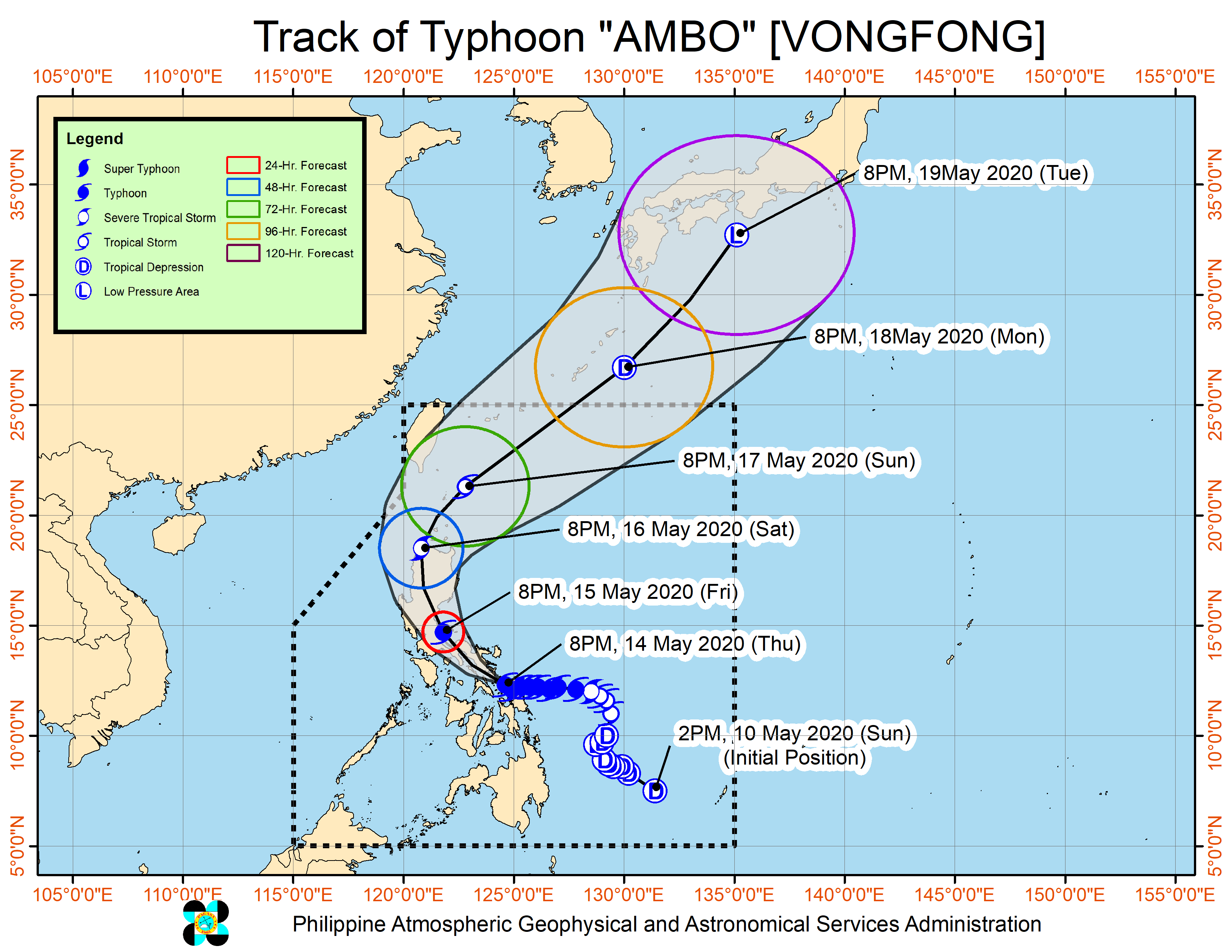
In anticipation of the storm, PAGASA has begun to issue flood alerts to various locations. This is especially important due to the fact most of the population is along the coast and in low-lying areas.