« Back to "4-5 July 2019 California Earthquake"
7 July 2018 Analysis over Ridgecrest area
Posted: July 7, 2019
While the region over ridge was cloudy, as evident by the 11μm observations from the VIIRS instrument on S-NPP at ~2:50am on 7 July 2019, shown below
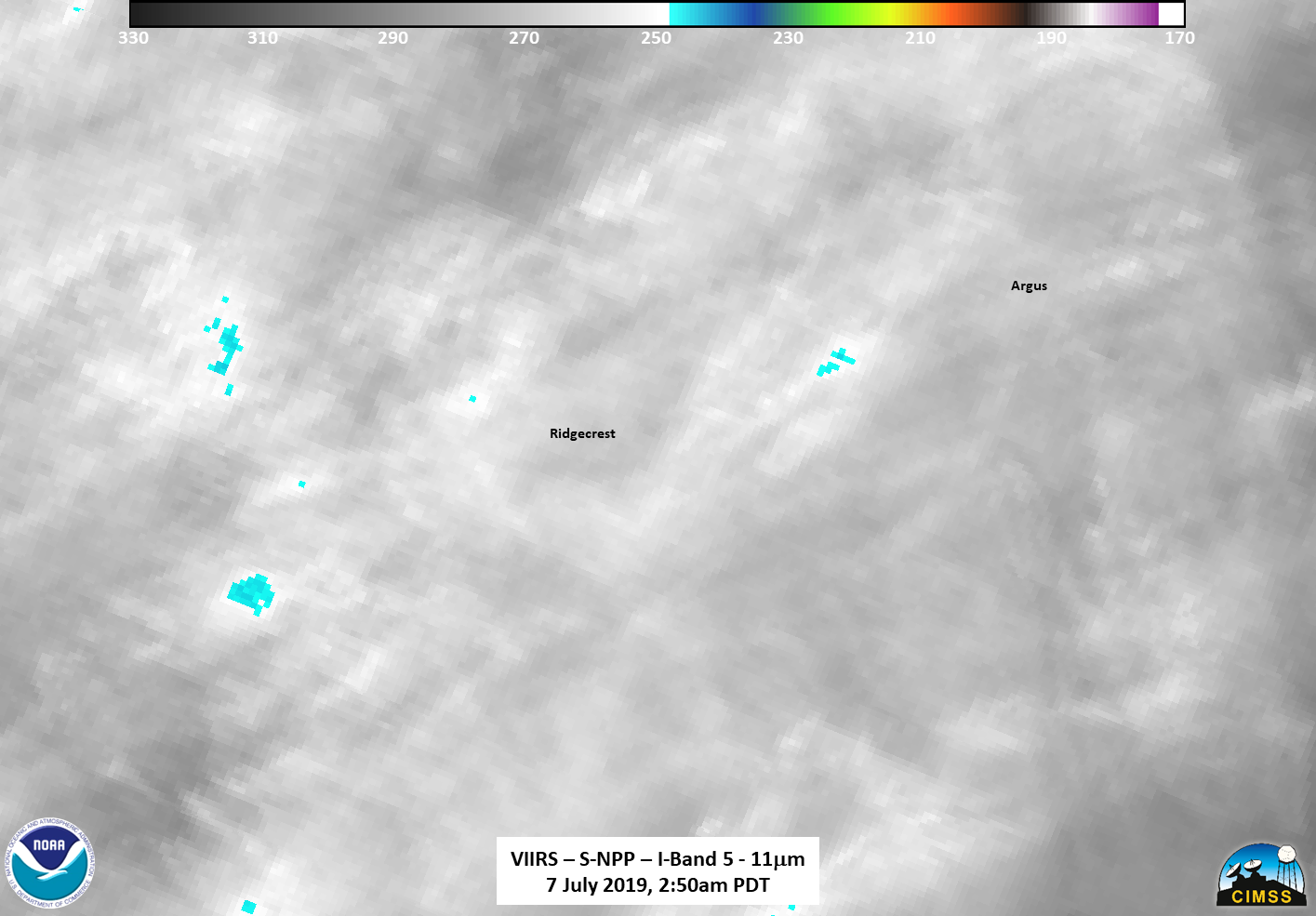
the clouds were then enough for a general comparison to follow the recovery efforts in Ridgecrest. As seen below, comparing imagery from 6 July, the power to the Argus and Searles Valley areas has been restored
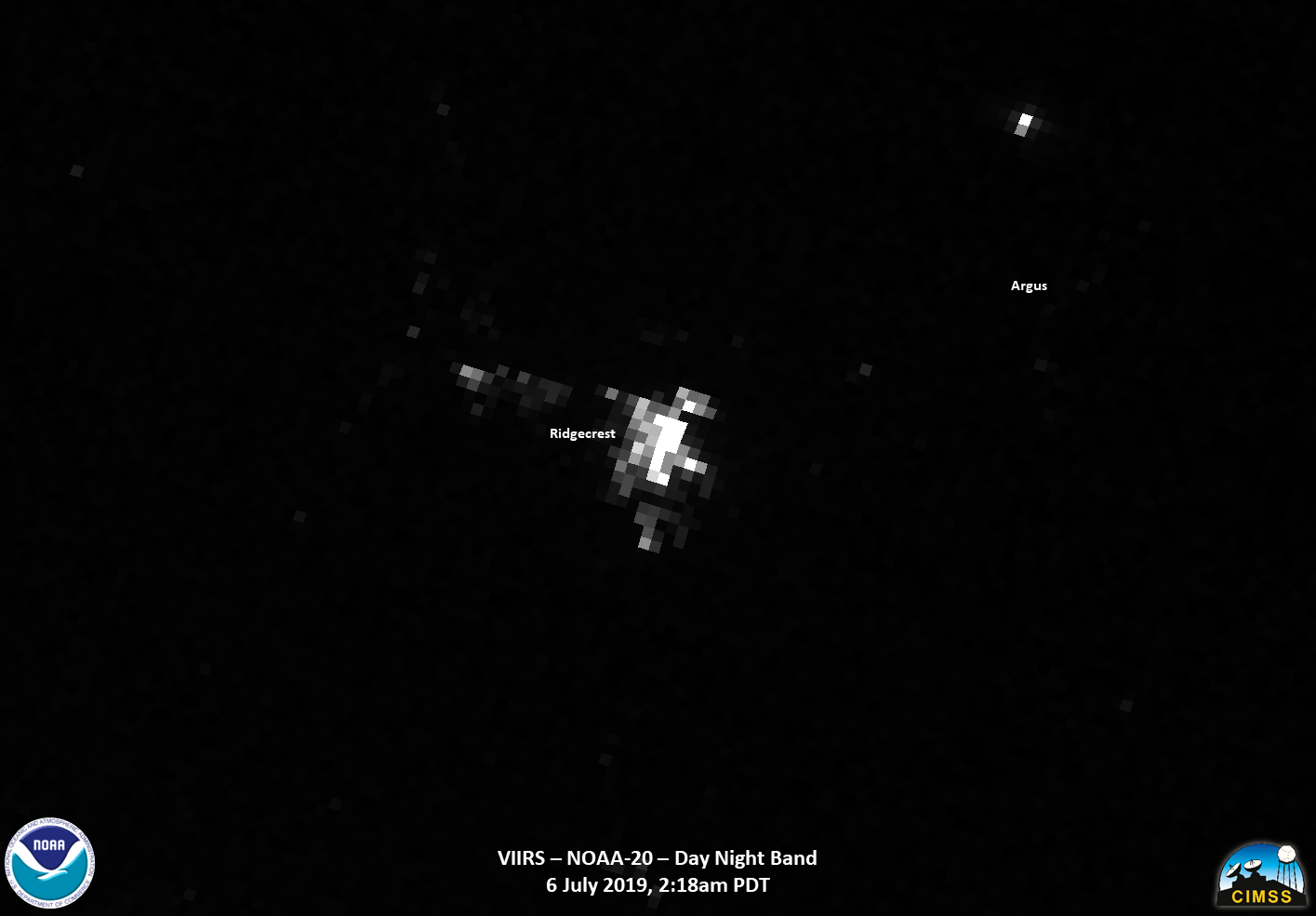

Due to the clouds in the region obscuring and scattering some of the less intense lights, particularly around the Ridgecrest region, it is hard to tell exactly the extent of the recovery. However, the outage map from Southern California Edison from this morning, roughly an hour after the S-NPP overpass shows no outages in the region
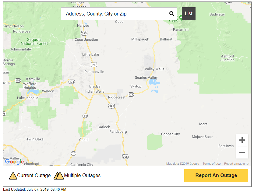
Shake map from SoCal Edison Power Outage website at ~3:40am PDT on 7 July 2019: https://www.sce.com/outage-center/check-outage-status
Thus, the differences between the 6 July and 7 July imagery in the Ridgecrest area are due to the clouds in the region. This will be the final analysis of this region at this time.

