• Search Icon

SSEC Home JPSS SDOC JPSS PGRR - Satellite-based Disaster Outreach Coordinator (SDOC)

  • Home
  • Research Support
  • UW
  • CIMSS
  • Data Services
  • AOSS Library
  • Partners
  • Careers
  • Disclaimer
  • Staff Directory
  • For Employees

« Back to "Hurricane Lorenzo - September 27-30"

Hurricane Lorenzo from morning of 30 September 2019

Posted: September 30, 2019

At 0300Z on 30 September, the NHC Public advisory stated that Hurricane Lorenzo had winds of 110 mph, making it just barely a Category 3 hurricane. This didn’t really change through the 0600Z public advisory and by 1200Z, the wind had decreased to 105mph along with a rise in pressure, making it a Category 2 storm.
Lorenzo was observed by 3 satellites again, with NOAA-20 being first at ~0402Z on the edge of scan. Because of that, features such as the mesospheric gravity waves, which could be seen due to the Waxing Crescent moon (4% illumination) were affected by parallax effect, causing them to be shifted from their notional position.

The 11μm (I05) imagery also showed a cloud filled eye with clouds expanding to the northern edge.
This is something that was also mentioned in the 0300Z National Hurricane Center’s forecast discussion

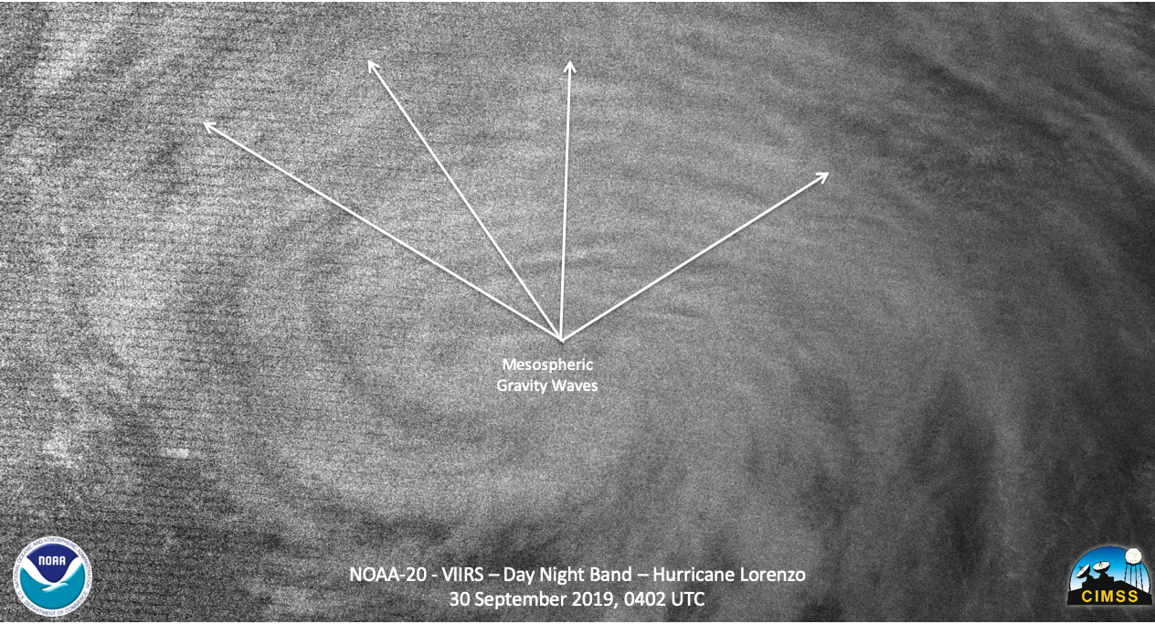
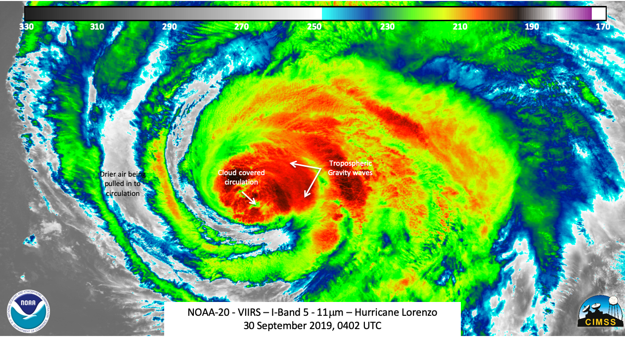
There haven’t been a lot of changes with Lorenzo this evening, with a small cloud-filled eye remaining visible and an enormous cloud shield expanding in the northern semicircle.  Satellite intensity estimates support a somewhat lower intensity than the previous advisory, so the initial wind speed is set to 95 kt. It should be emphasized that even though the peak winds are down since yesterday, the area of the hurricane-force winds has more than doubled during that time….

The next to observe Lorenzo was S-NPP at ~0552Z, which had a more nadir view of the storm. This too picked up on the cloud filled eye in the 11μm (I05) imagery
Also of note were some noticeable mesospheric gravity waves, quite possibly due to the energy being released as the storm weakened.


The ATMS imagery, which can look at the inner structure of the storm, from S-NPP picked up on what appeared to be a well defined inner core.
The AMSR2 imagery taken from the GCOM-W1 pass shortly after the S-NPP pass showed the circulation in even better clarity in the 89.0GhZ imagery.
While not shown, the 23.8GhZ showed the circulation at virtually the same location as the 89.0GhZ imagery, meaning the circulation was not skewed like a couple days ago.
Both of these observations, as well as the VIIRS IR imagery support the 0900Z forecast discussion where it stated

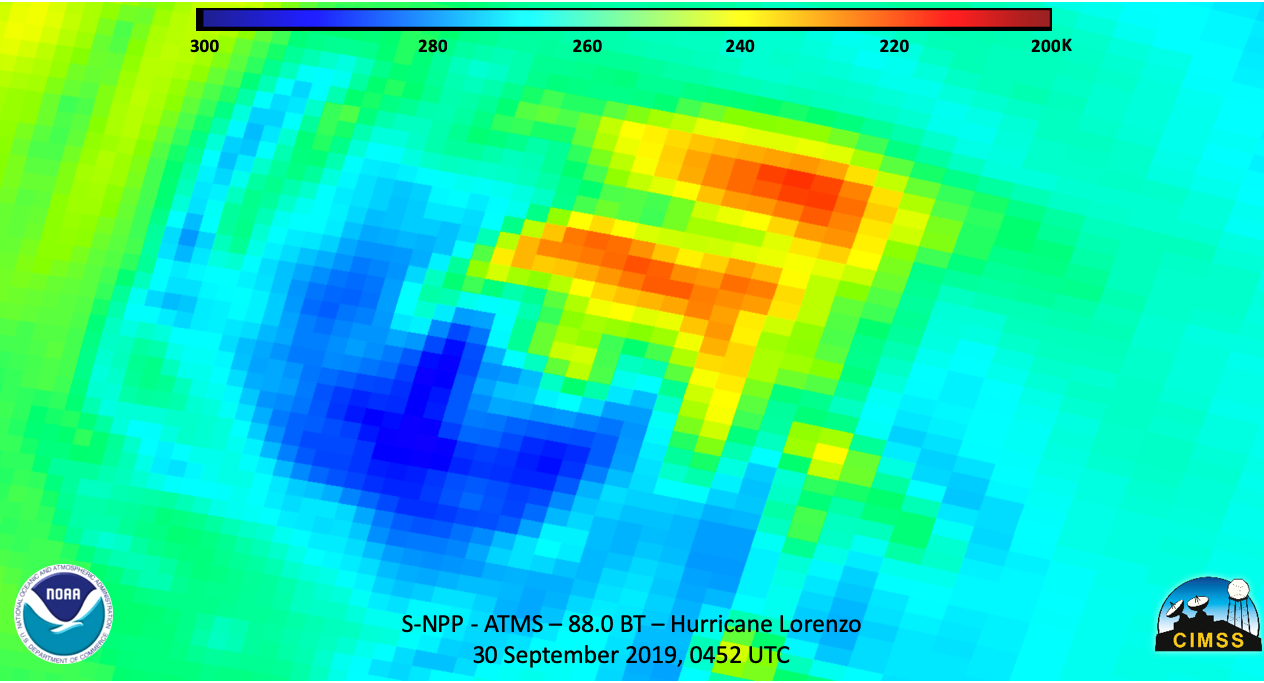
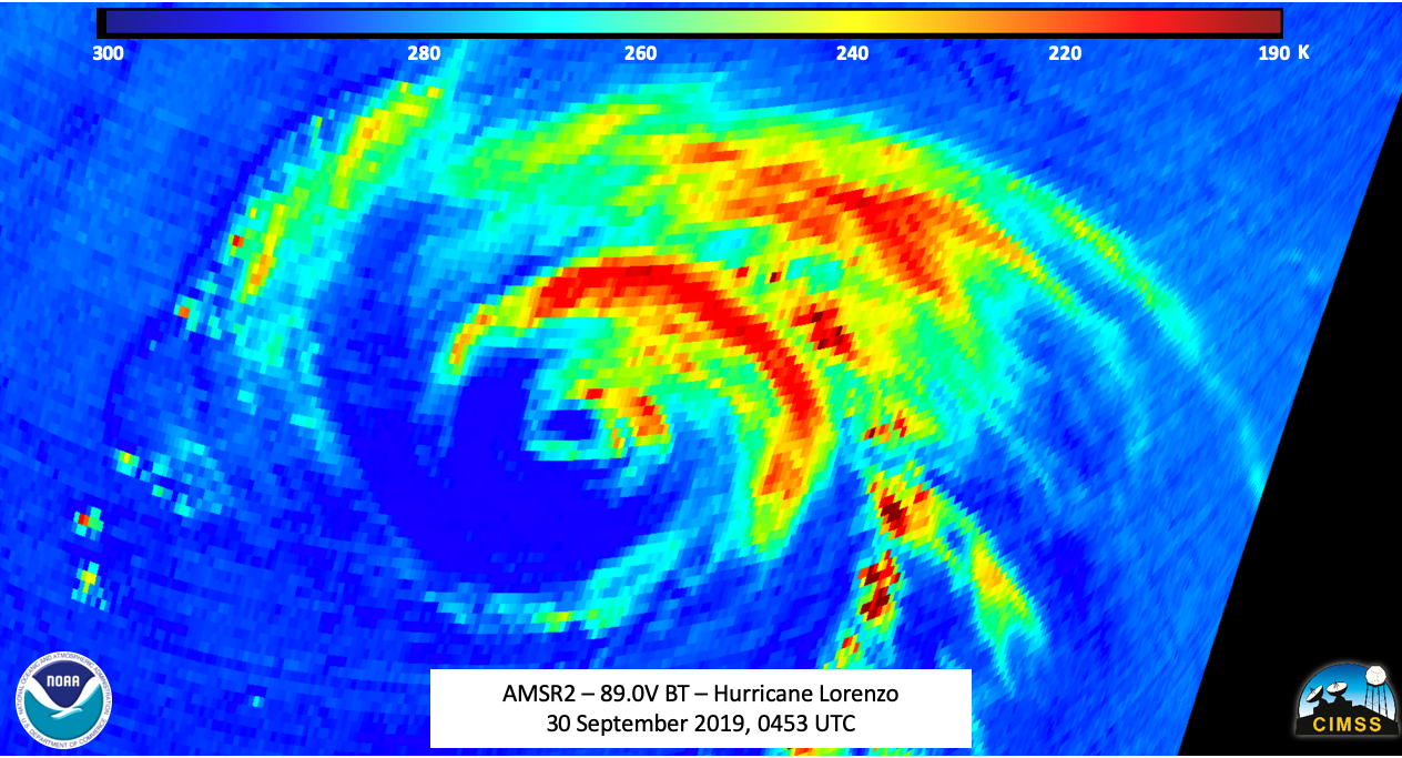
The satellite presentation of Lorenzo has generally changed little during the last several hours.  The hurricane continues to maintain a well-defined inner core with a ragged cloud-filled eye.  The outer bands are well established to the north and east of the center, but are restricted on the south side of the circulation due to some southwesterly shear and drier air being wrapped into that portion of the cyclone.  The initial intensity estimate is set at 90kt based on T5.0/90 kt Dvorak classifications from TAFB and SAB.

Lorenzo is currently moving toward the north-northeast according to the National Hurricane Center, with a turn to the northeast is expected later today. The current forecast track has the center of Lorenzo to pass near the western Azores early on Wednesday and to the west of the British Isles by Friday.
The Satellite-based Disaster Outreach Coordinator (SDOC) JPSS Risk Reduction product is run at Cooperative Institute for Meteorological Satellite Studies

Funding for this project is provided by NOAA/NESDIS JPSS Program Office
UW Logo
1225 W. Dayton St. · Madison, WI 53706, USA · 608-263-6750