« Back to "Other International Charter Calls"
July 15 2020 Floods in Bangladesh
Posted: July 15, 2020
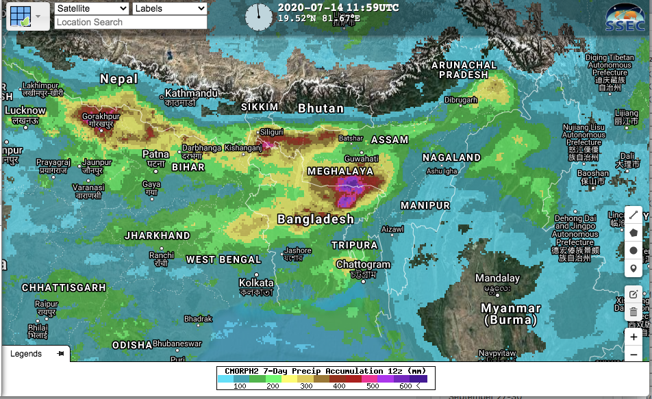
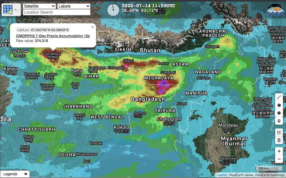
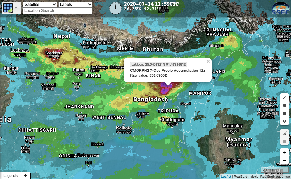
The heaviest rains in a decade have left a third of Bangladesh underwater affecting millions of people. This can be seen in the 7 day accumulated precipitation from the CMORPH2 product.
The rains have swollen two main Himalayan river systems – the Brahmaputra and the Ganges – that flow through India and Bangladesh. The extent of the swollen rivers can easily be seen in the 5-day composite
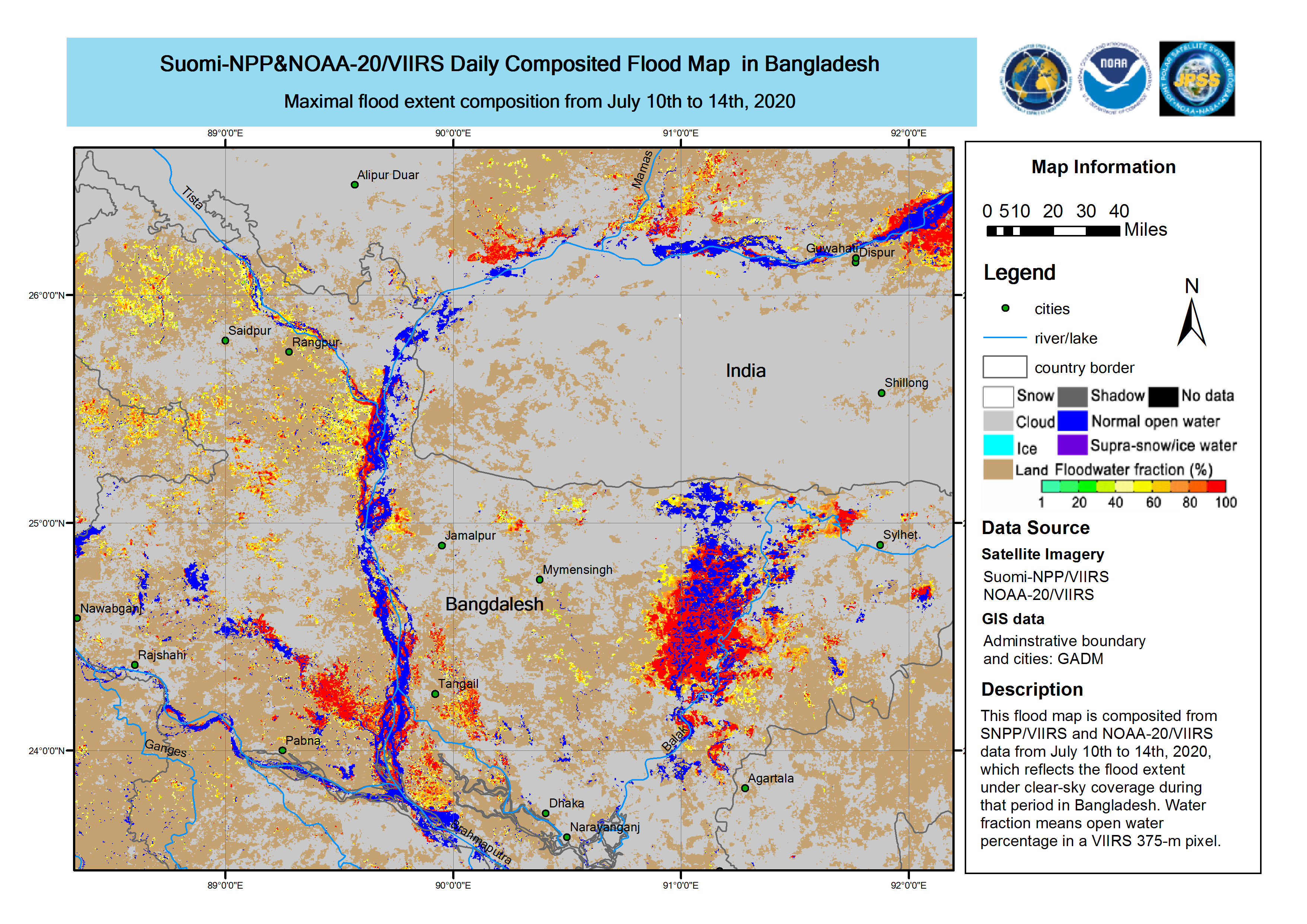
According to the International Charter call, the Brahmaputra river is almost 40cm (~1.3ft) higher than normal. While this may not seem enough, this is enough to threaten to burst the banks of the river, with over 15,000 people already evacuated in Bangladesh. Forecasts have rain occurring over the next 7-10 days, meaning further impacts are expected.

