« Back to "Midwest Flooding - Spring 2019"
26 March 2019 Midwest Flooding update
Posted: March 26, 2019
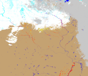
Over the last couple of weeks, the JPSS Program has been heavily involved in the response to the flooding in the Midwest. Below shows the Joint ABI/VIIRS product the daily flood detection results from VIIRS and ABI from 15 March through 25 March. There were several days that it was cloudy, so no product was produced at that time.
Joint Product produced by Sanmei Li (GMD)
The joint product is based on the VIIRS 375-m flood maps, and uses the 1-km ABI clear-sky detection results to fill the gaps of clouds and cloud shadows in the VIIRS maps. While current experimental, it provides the most complete and highest spatial resolution derived flood map.
These products, in particular the joint ABI/VIIRS product, have proven extremely popular, especially with FEMA for assessment and imagery shown to FEMA leadership, as well as the Nebraska Army National Guard. This shows the usefulness of the products to stakeholders in the United States.


