« Back to "Midwest Flooding - Spring 2019"
Red River flooding – 13 April 2019
Posted: April 13, 2019
An intense storm on the 10-12 April brought significant snows to the Upper Midwest United States. In North Dakota there were wide swaths of snowfall accumilations of 4-6″ of snow
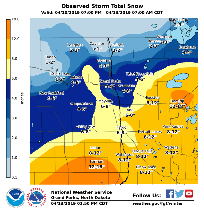
Snow Fall amounts from 10-12 April from NWS Grand Forks
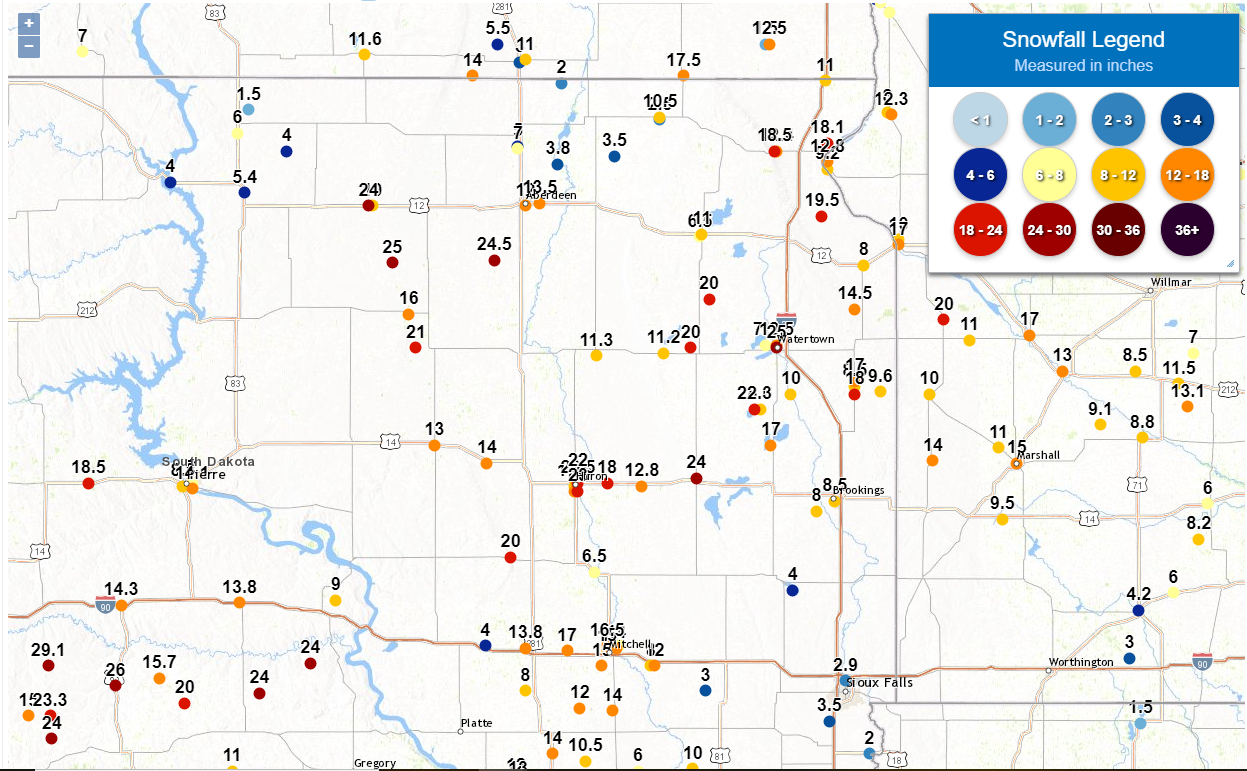
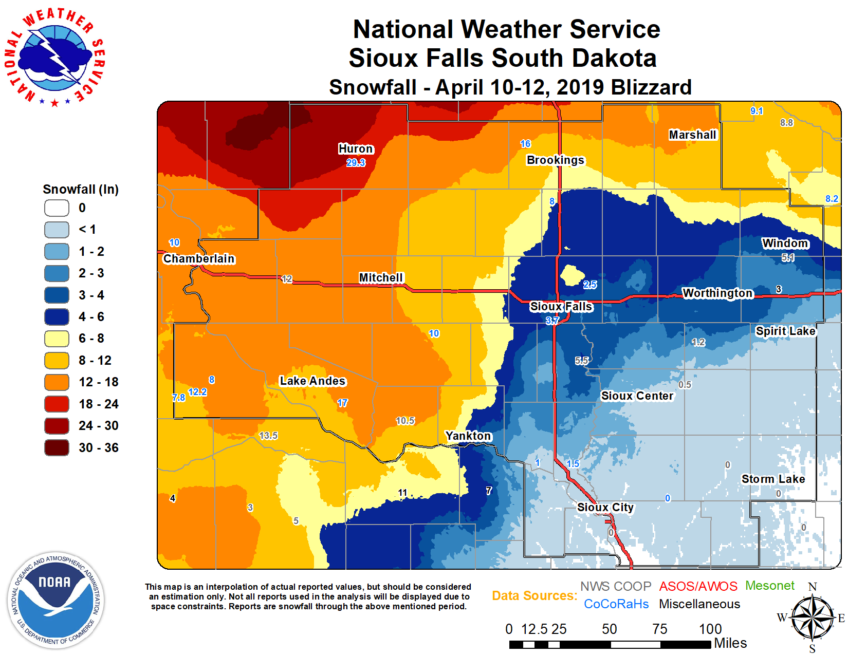
Further south in South Dakota, there were snow fall amounts of upwards of 26″ of snow, as reported by the Aberdeen (right) and Sioux Falls (left), SD NWS Forecast offices
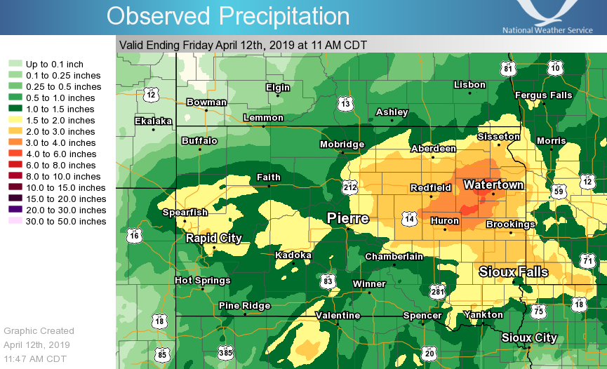
This late spring snow was extremely wet (2-6″) as emphasized by the liquid equivalent map provided by the NWS WFO in Aberdeen,SD
The warmer temperatures after the storm passed resulted have resulted in the snow melting and flowing over the already saturated ground. On 13 April, flooding was observed by the ABI and VIIRS Flood Maps and could also be seen in the VIIRS Natural Color imagery (left to right in the images below) in the Red River of the North, which flows northward into Lake Winnipeg, in Manitoba, Canada.
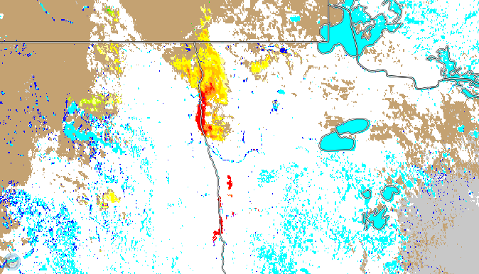
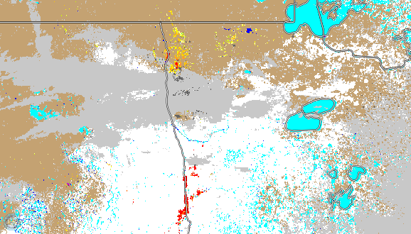

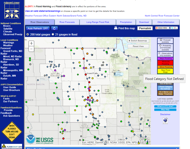
This was also confirmed by the river gauge measurements at NWS WFO Grand Folks, which showed significant flooding in the Red River valley, as screenshot shown below
Over the next several days, it is expected that the snow will continue to melt and flow into the various rivers, such as the Red River of the North (in northern North Dakota) and the Missouri River to the south. Both river basins are already saturated from the existing wet winter of 2018-2019. The VIIRS, ABI and Joint ABI/VIIRS product, along with the Natural Color imagery and river gauge data will provide useful information as to the location and amount of flooding that occurs.

