« Back to "Super Typhoon Hagibis - October 6-13 2019"
Typhoon Hagibis on 12 October 2019
Posted: October 12, 2019
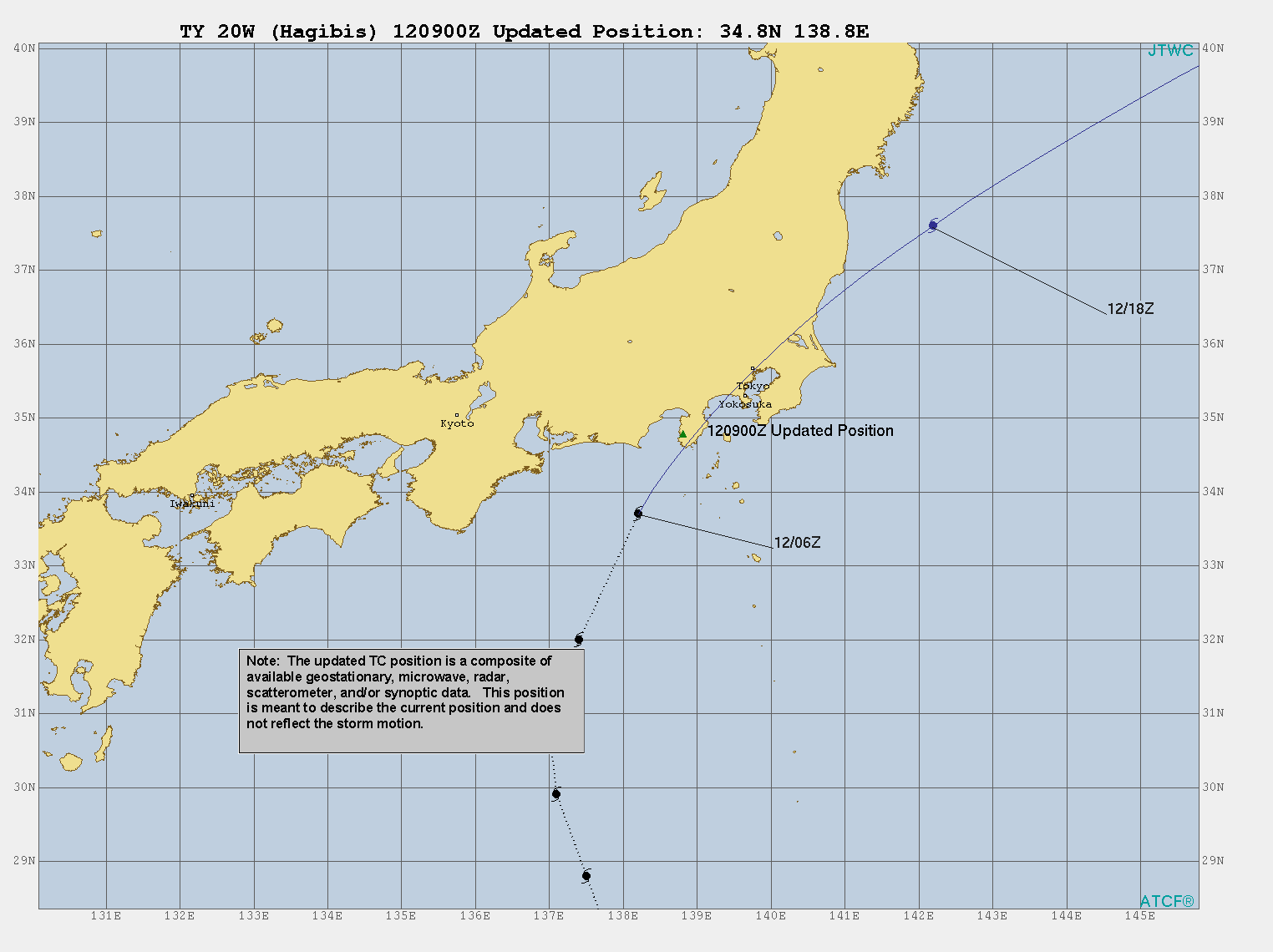
At 0900Z on 12 October, the Joint Typhoon Warning Center (JTWC) placed Typhoon Habigis, which means “speed” or “swiftness” in the Philippine language Tagalog, at approximately 34.8N 138.8E, which was near Nishiizu-chō (西伊豆町) which is in the Kamo District (賀茂郡) of the Shizuoka Prefecture (静岡県). This is in the Chūbu region (中部地方) or central region of Honshū (本州), which is the main island of Japan.
Their 0900Z discussion stated that Habigis had sustained winds of 80knts, or ~97mph. This would make it a weak Category 2 storm in the Atlantic basin. In addition earthquake with a preliminary magnitude of 5.3, struck 55km SSE of Katsuura (勝浦市), Japan or about 144km from Tōkyō (東京), at ~0922Z according to the USGS. The Japan Meteorological Agency, which also acts as their geological service, stated the magnitude was 5.7, which is stronger than the preliminary USGS estimate.
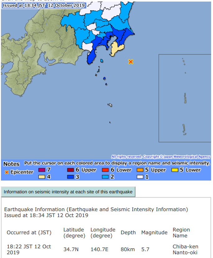
Screenshot from the Japan Meteorological Agency’s earthquake website on 12 October 2019
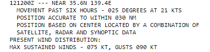
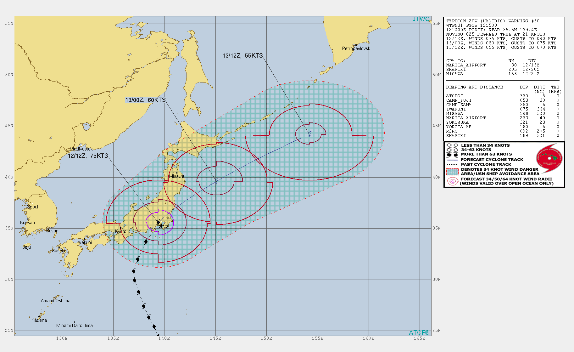
By 1500Z, the Joint Typhoon Warning Center (JTWC) stated that Typhoon Habigis had further weakened to having winds of 75knts, or ~86mph. This would make it a Category 1 storm in the Atlantic basin.
The Regional Specialized Meteorological Center (RSMC) Tokyo stated that the maximum winds at the center were 65knts or ~75mph. Again, this difference is due to differing methods of determining the winds and due to the fact that JTWC adopts a 1 min mean wind speed, but RSMC Tokyo adopts 10 mins mean wind speed. This would make it barely a Category 1 storm in the Atlantic basin.
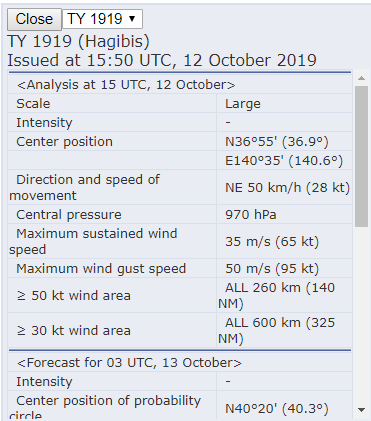
It is also worth noting that the 1550Z location from JMA places it nearly offshore, near Iwaki (いわき市) in Fukushima Prefecture (福島県).
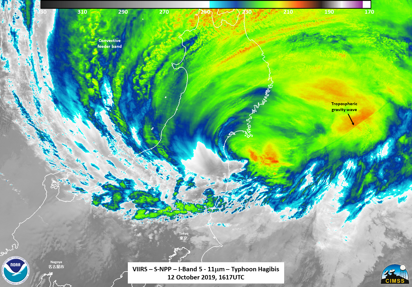
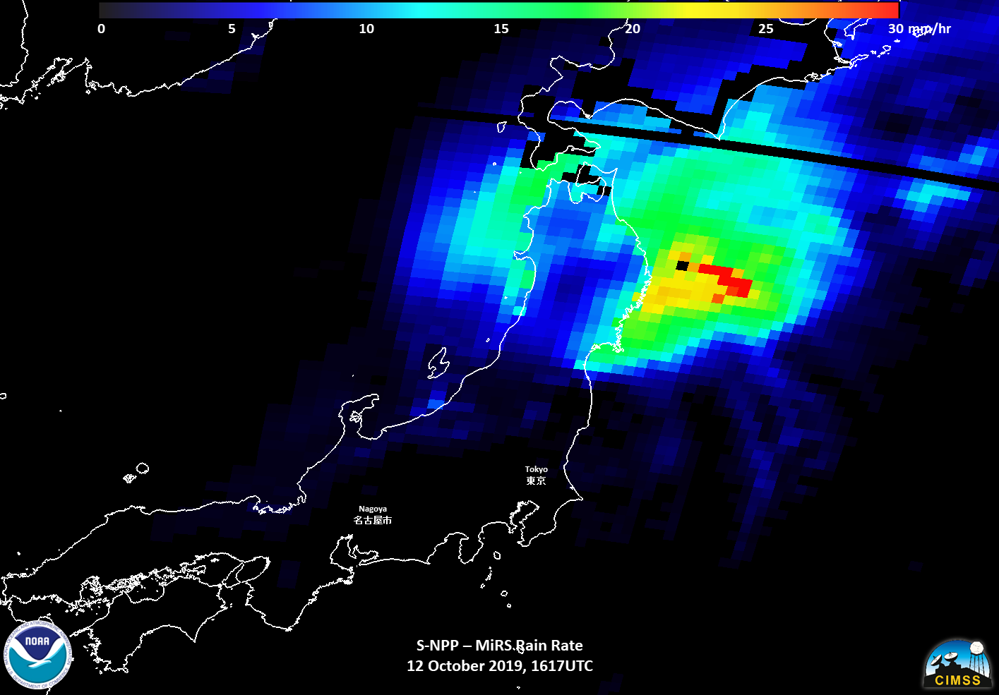
S-NPP first saw Typhoon Habigis at ~1617Z on the western side of nadir. The waxing gibbous moon (98% illumination) provide enough illumination to see the structure of the storm and the wide region the storm continues to feed off of.
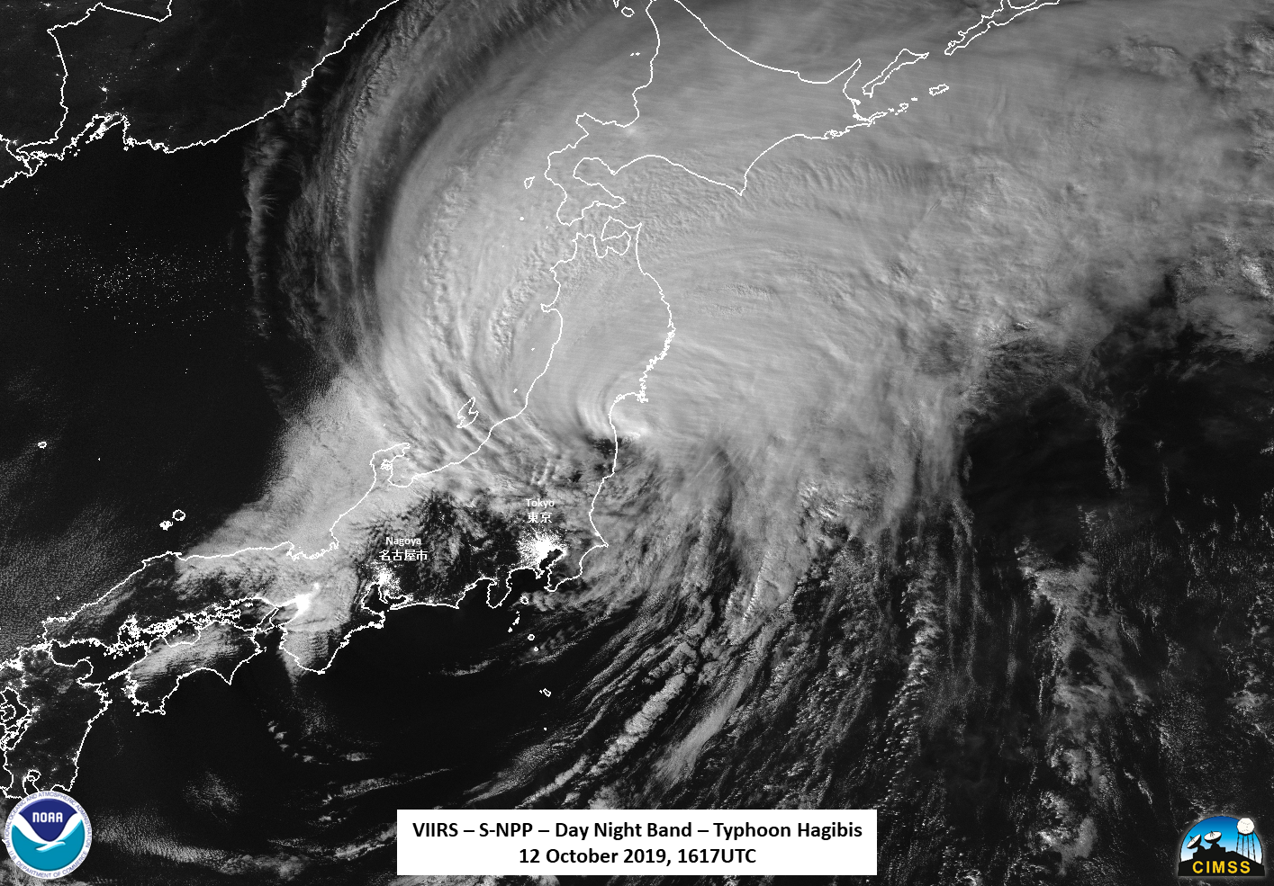
One can clearly see the fact in the DNB and the I05 (11μm) imagery that the most about of convection and affects of the storm continue to be offshore and on the northwestern side of Honshū (本州). However, the area around Tōkyō (東京) and Nagoya (名古屋) appear to be clear, after being lashed with rain over the last several days.
An examination of the zoomed in imagery near the circulation center reveals that there is a fairly straight line that appears in the convection. While one might think it is a contrail, an examination of the I05 (11μm) imagery shows it has waves associated with it, meaning it is probably a meteorological feature and likely not due to an aircraft, especially give where it was in relation to the strongest convection from the storm.
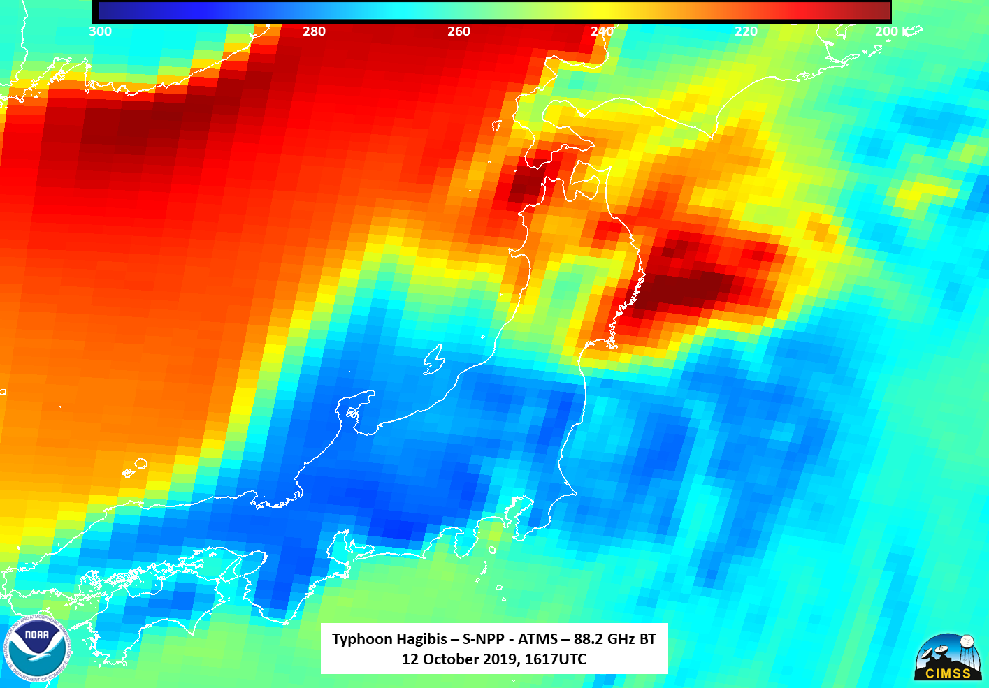
The ATMS 88.2GhZ imagery shows that the storm continues to bring in warmer air from the Pacific side of the storm, while areas where there is convection continues to me dominated by cooler air
In fact, the AMSR2 image from GCOM-W1 taken at approximately 1648Z , roughly 30 minutes after the S-NPP pass, showed similar structure in the 88.9GHz imagery.
However, the 23.8Ghz showed the broad area of circulation not readily seen in the IR or 88.9GHz imagery.
The final satellite, NOAA-20 saw Typhoon Habigis at ~1707Z, again on the eastern side of the scan. Again, because of the location of the satellite with respect to the storm, features were distorted due to parallax effects being on the extreme eastern edge. However, it is important to note that features, such as the nearly linear wave feature could be seen in roughly the same location
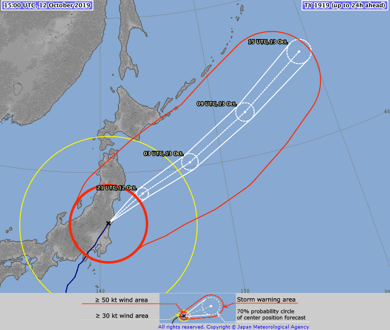
The forecasts from JTWC and JMA, shown below, continue to have it exiting the eastern part of Japan before 00Z on 13 October and rapidly moving off to the North Pacific rapidly over the next day.
This storm has caused Japan to advise 8 million people to evacuate due to the potential of severe flooding, according to media reports. In fact, JMA issued a Level 5 alert, which is the highest level of alert in Japan, for large parts of central and eastern Japan due to “unprecedented rainfall””

JMA alert levels, courtesy of NKH News. Link here
Another interesting thing to show is the use of SAR data for other purposes. At ~2053 on 11 October 2019, the European Space Agency’s (ESA)/Copernicus Sentinel-1A satellite, which has synthetic-aperture radar (SAR), passed over Habigis. Utilizing this methods described in Monaldo, Jackson, and Li (2017) and other publications, NOAA’s Satellite Oceanography and Climatology Division, specifically the Sea Surface Roughness Group at NOAA/STAR, can derived winds from this imagery, as shown below.
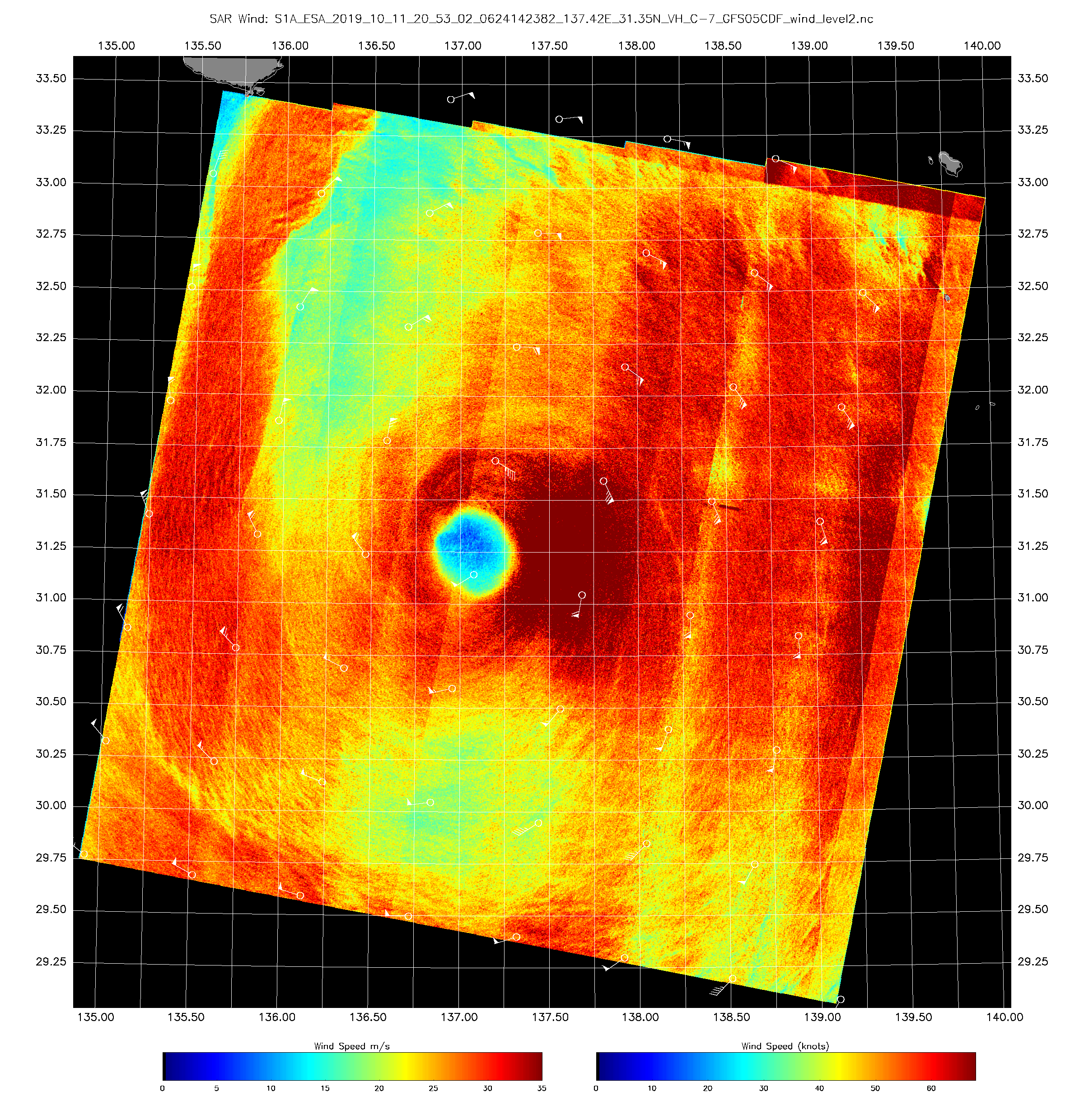
Sentinel-1A/B acquired by ESA/Copernicus, provided by Christopher Jackson, NOAA/STAR/SOCD
Contains modified Copernicus Sentinel data 2019

