« Back to "Super Cyclonic Storm Amphan - 17-19 May 2020"
Extremely Severe Cyclonic Storm Amphan – 19 May 2020
Posted: May 19, 2020
On 19 May 2020, Amphan had winds of 100knts or 115mph according to the 2100Z the Joint Typhoon Warning Center (JTWC)
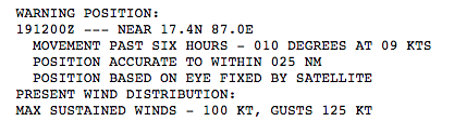
This would make it a Category 4 storm in the Atlantic basin or a Extremely Severe Cyclonic Storm on the scale used by the India Meteorological Department. The RSMC New Dehli estimated maximum sustained winds at 21Z of 115 knts (132mph), making it the same type of storm.
![]()
There were only passes from NOAA-20 and S-NPP on the 19th, with GCOM-W1 being out of position to observe Amphan. As with prior discussions, this will be in two parts: VIIRS and microwave imagery
VIIRS
SNPP observed Amphan first at ~1921Z on the edge of the scan, followed by near nadir pass from NOAA-20 at ~2011Z. Both passes were on the edge of the scan (western and eastern, respectively), though NOAA-20 was slightly closer to nadir. In each case, the I05 (11μm) imagery presented a little lopsided storm, with the central dense overcast mainly over the ocean. In both case, well defined tropospheric gravity waves and some overshooting tops could be seen
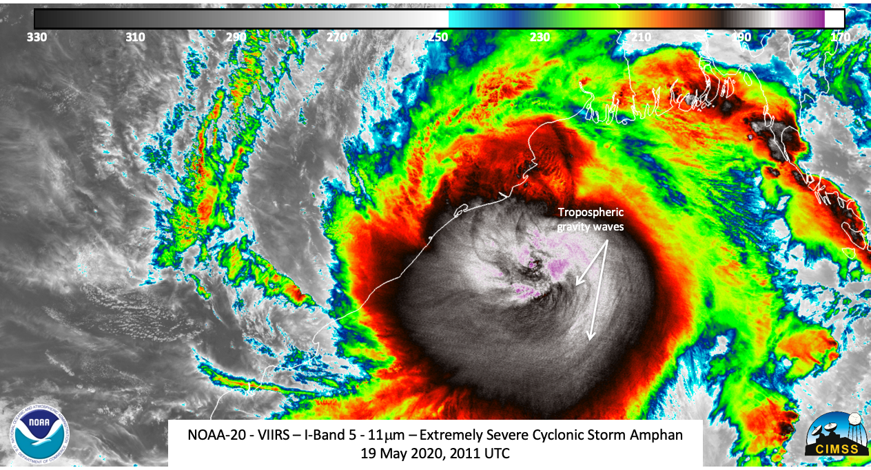
Zooming in provides much more structure and detail to the storm, including several “waves” circulating around the center.
The 1921Z S-NPP imagery also shows an overshooting top at the center of circulation with a brightness temperature of 170.6K (-102.55 °C).
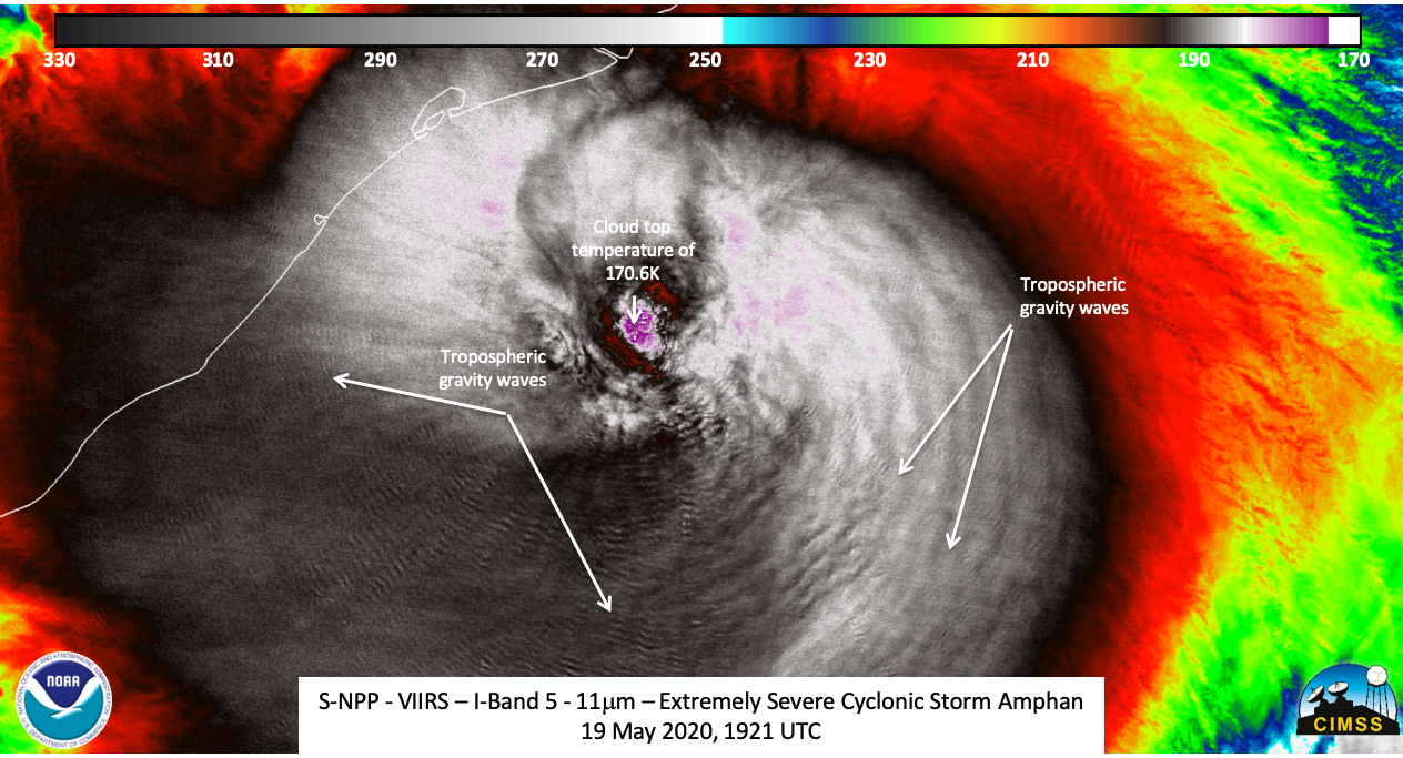
The moon phase was a Waning Crescent moon with ~5% illumination, meaning that (again) the only illumination are from either man-made lights, lightning or airglow from the mesosphere. For a third night, mesospheric gravity waves could be seen in both the S-NPP and NOAA-20 imagery.
The 50 minute difference from S-NPP and NOAA-20 show some temporal movement of these waves over time
Microwave
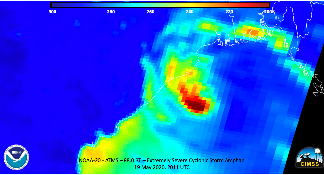
As mentioned above, only the ATMS instrument was the only microwave sensor observing the Amphan. NOAA-20 provided the best view of the inner part of the storm. The of 21Z Joint Typhoon Warning Center (JTWC) discussion stated that the eastern side of the eye was open.
IN ADDITION TO A MICROWAVE EYE SEEN IN A 191033Z SSMIS 91GHZ PASS. THE EYEWALL IS
OPEN ON THE EASTERN SIDE OF THE EYE, INDICATIVE OF THE EASTERLY SHEAR AND MID-LEVEL DRY AIR.
This could be seen in 88.2GHz pass from NOAA-20
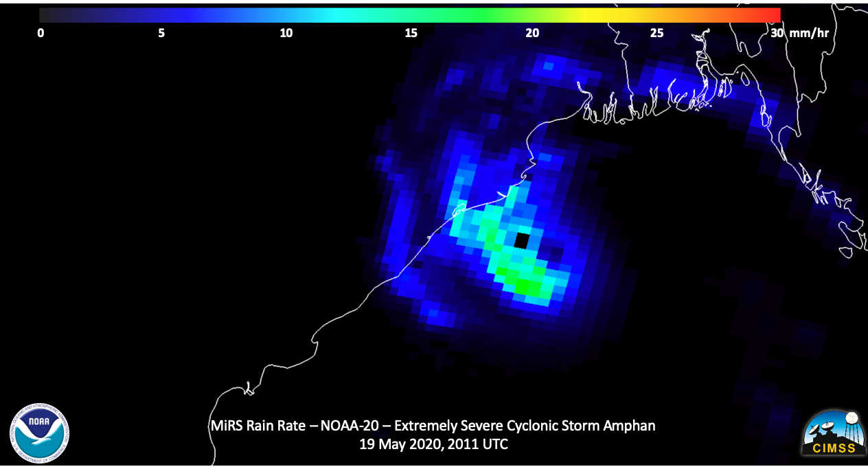
In addition the derived rain rate from the Microwave Integrated Retrieval System (MiRS) rainfall rate product showed the rain where the most convection (coldest temperatures). Also the circulation could also be seen.
Forecasts and impacts
The forecast from RSMC New Dehli and the JTWC show Amphan hitting the Bangladesh coast within the 48 hours, weakening as it approaches the coast.
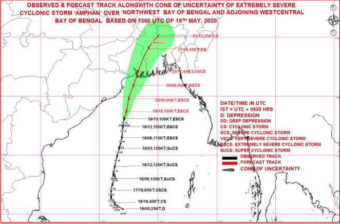

This area is low-lying and highly populated and with the ongoing CoVID-19 pandemic, this will effect the evacuations and the response to the landfall. The International Charter has been preemptively activated by the government of India and Bangladesh to help aid in the response to the expected major impacts to the storm.

