Monthly News Summary – September 2011
- CIMSS Tracks Hurricane Irene
- AERIbago Wows at Wisconsin State Fair
- James Kossin and Tim Schmit Collect Medals
- GOES-15 and -14 Imager and Sounder Images
- Jean Phillips Appointed Chair of AMS History Committee
- AMS Selects CIMSS-authored Article as “Paper of Note”
- Operational Use of Leo/Geo Winds by the National Center for Atmospheric Research
- ASPB and CIMSS Participation in GIMPAP and PSDI Annual Reviews
- GOES-R Proving Ground Training at Local Wisconsin NWS Office
- A Reminder – The Airport Display Ends Its Stellar Run
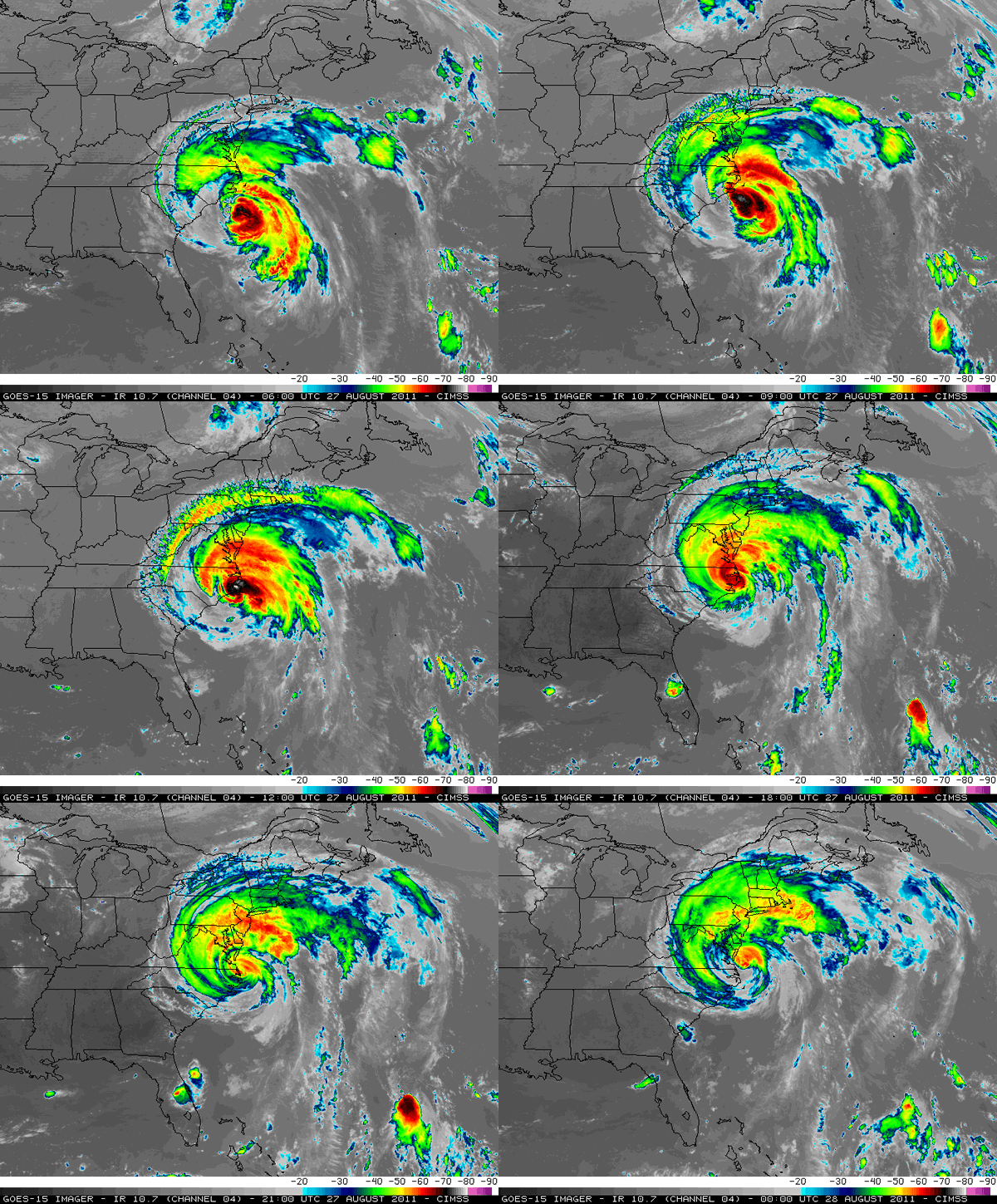
The Cooperative Institute of Meteorological Satellite Studies (CIMSS) Satellite Blog provided ongoing coverage of Hurricane Irene’s impact on the U.S. East Coast.
Many other images available include:
A loop of IR images from NOAA’s newest satellite – GOES-15.
Also available are many GOES-13 Rapid Scan Operations (RSO) animations (imagery as often as every 5-10 minutes, instead of the usual 15-minute interval):
A few 1-km resolution MODIS + POES AVHRR IR images:
A nice 3-channel Red/Green/Blue (RGB) false-color AVHRR image:
AERIbago Wows at Wisconsin State Fair
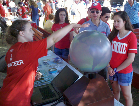
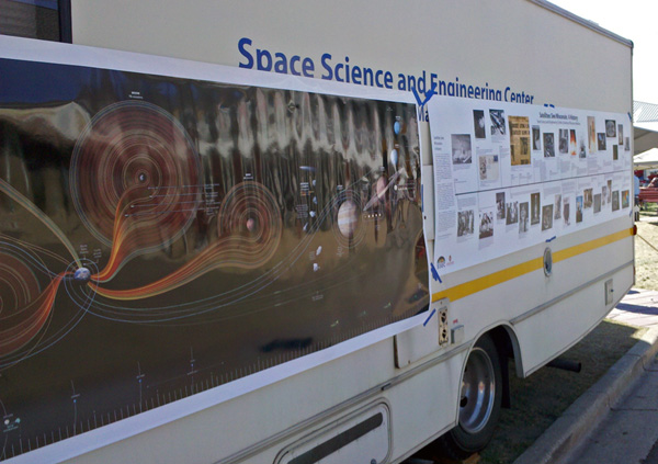
On 10 August 2011, eight people plus one beast (AERIbago) from CIMSS/SSEC/AOS participated in UW-Madison Day at the Wisconsin State Fair. The beautiful weather brought out many people who had an opportunity to learn about satellites and earth science on our 3D Globe, see Antarctic gear modeled by AMRC, and even take a peek inside the AERIbago.
Aside from these experiences, many of the visitors also went away with information about our weather & climate applets, our mobile applications, and knowing more about the research done in our building.
It was an excellent opportunity to both educate the public and promote CIMSS/SSEC research. Erik Olson and Russ Dengel dealt with the navigation of the AERIbago into and out of the fair grounds, while the AMRC crew made the supreme sacrifice of dressing up in Antarctic gear in the middle of summer to attract interested eyes.
Submitted by Patrick Rowley
James Kossin and Tim Schmit Collect Medals
James Kossin, NOAA/CIMSS, was among the recipients of the Office of Oceanic and Atmospheric Research’s Gold Medal for excellence in research and data stewardship leading to a more confident assessment of the influence of human-induced climate change on hurricanes.
Tim Schmit of the NESDIS/STAR Advanced Satellite Products Branch, and Don Hillger of the STAR Regional and Mesoscale Meteorology Branch in Fort Collins, CO, received a Department of Commerce Silver Medal “For revolutionizing NOAA Science Tests for geostationary satellites, significantly reducing the likelihood of a single satellite configuration.”
This year’s NOAA awards ceremony will be scheduled for the fall.
GOES-15 and -14 Imager and Sounder Images
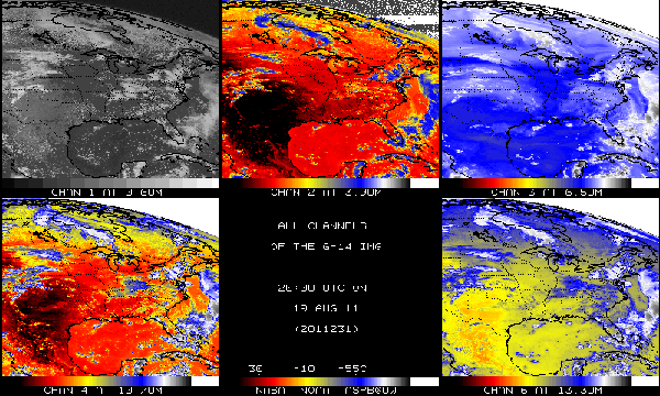
Images from both the Imager and Sounder of GOES-15 have been compared to images from both the operational eastern and western GOES.
GOES-15 is located near longitude 90 West. Data from the Imager and Sounder are being made available until 05 August 2011. Qualitative comparisons show the GOES-15 images to be of good quality, similar to the end of the NOAA science test. Images and animations can be found online.
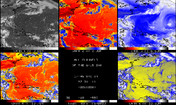
The five spectral bands from the GOES-15 Imager, from 18 UTC on 27 July 2011.
In addition, images from both the Imager and Sounder of GOES-14 have been compared to images from both the operational eastern and western GOES.
GOES-14 is located near longitude 105 West. Data from the Imager and Sounder were made available until 19 August 2011. Qualitative comparisons show the GOES-14 images to be of good quality, similar to the end of the NOAA science test. Images and animations can be found online as wells as an animation of fog from three separate GOES.
Other GOES-14 images of Tropical Storm Gert can be found on the CIMSS satellite blog.
The five spectral bands from the GOES-14 Imager, from 20 UTC on August 19, 2011.
Jean Phillips Appointed Chair of AMS History Committee
On 02 August 2011 the American Meteorological Society (AMS) Executive Committee appointed Jean Phillips, SSEC Librarian, as the next chair for the History Committee. Her term will begin at the AMS Annual Meeting in January and will continue for three years.
AMS Selects CIMSS-authored Article as “Paper of Note”
An upcoming article, “Intensity and Structure Changes During Hurricane Eyewall Replacement Cycles” by Matthew Sitkowski (CIMSS/AOS), James P. Kossin (NOAA/CIMSS), and Christopher M. Rozoff (CIMSS), was selected as a Paper of Note for the Bulletin of the American Meteorological Society (BAMS).
The authors analyzed 14 Atlantic basin hurricanes to develop an unprecedented climatology of inner-core intensity and structure changes associated with eyewall replacement cycles. The article will appear in Monthly Weather Review later this year.
The BAMS section called “Papers of Note” helps deliver noteworthy topics to a wider audience by expanding the readership of the full papers beyond the AMS community.
Operational Use of Leo/Geo Winds by the National Center for Atmospheric Research
Beginning in August 2011, the National Center for Atmospheric Research (NCAR) in Boulder, Colorado, began using the CIMMS-generated Leo/Geo high latitude winds product in their operational Antarctic Mesoscale Prediction System (AMPS) model.
The Leo/Geo winds product is an experimental product in which cloud features are tracked at high latitudes from images composed of geostationary and polar orbiting satellite data. The goal is to fill the gaps in satellite-derived winds coverage that lie in the 60 to 70 degree (north and south) latitude bands.
This product has been used routinely in the US Navy’s NRL Atmospheric Variational Data Assimilation System Accelerated Representer (NAVDAS-AR) since November 2010.
ASPB and CIMSS Participation in GIMPAP and PSDI Annual Reviews
Several scientists from the Advanced Satellite Products Branch (ASPB) and CIMSS remotely participated in the GOES-I-M Product Assurance Plan (GIMPAP) and Product System Development and Implementation (PSDI) Annual Reviews held from 09-11 August 2011 in Suitland, MD.
ASPB and CIMSS scientists presented a total of 10 new GIMPAP projects on a variety of topics including deep convection, cloud properties, data assimilation, biomass burning, radar/satellite data fusion, and tropical cyclones.
In addition, Jeff Key (NOAA/NESDIS/STAR), Andrew Heidinger (NOAA/NESDIS/STAR), and Michael Pavolonis (NOAA/NESDIS/STAR) represented 6 PSDI projects (as project lead or back-up lead) involving the transition of polar winds, cloud properties, Arctic composite satellite imagery, tropical cyclones, and volcanic ash to operations.
GOES-R Proving Ground Training at Local Wisconsin NWS Office
On 09 August 2011 two CIMSS and STAR scientists conducted a training shift with forecaster J. J. Wood at the southern Wisconsin National Weather Service (NWS) Forecast Office in Sullivan (designation of MKX).
Gary S. Wade (StAR/Advanced Satellite Products Branch (ASPB)) described and demonstrated experimental CIMSS products using (current) GOES data, which are being evaluated as proto-type products, in preparation for GOES-R; these products included GOES Imager-based convective initiation (CI) and GOES Sounder-based “Nearcasting.”
Kathy Strabala (CIMSS) described and demonstrated experimental CIMSS products which are based on select spectral bands, currently available on the NASA MODerate resolution Imaging Spectroradiometer (MODIS) instrument, but to also be available on GOES-R. These products include fog/low cloud parameters, cloud type, sea surface temperature (SST), and vegetation index.
Simulated GOES-R imagery, obtained by radiative transfer projection from numerical forecast model fields, was also demonstrated, invoking a desire for the marked improvements in temporal, spatial, and spectral resolution that will come with the GOES-R imager.
Patrick Rowley, a data interpretation specialist at CIMSS, also participated in the training.
A Reminder – The Airport Display Ends Its Stellar Run
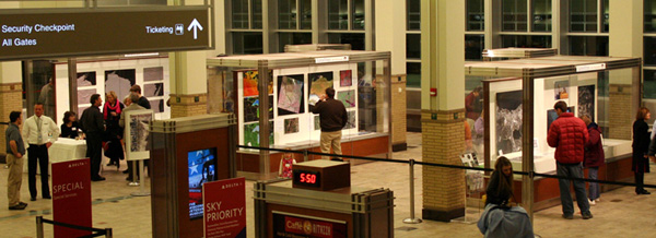
After a brilliant and successful run, the Satellites See Wisconsin exhibition at the Dane County Regional Airport closes on 10 September and will be taken down on 12 September.
The Explorer 7 satellite model, the 3D globe and all other materials will be shipped back to SSEC on 12 September or later that week.

