PREFIRE — CubeSats improve climate models and predictions
Across Greenland, a 3,000-meter (9,800-foot) thick ice sheet blankets the large island holding enough water to raise sea levels by 7 m (23 ft). For millennia, the cycle of melting and freezing has played a major role in regulating Earth’s temperature and climate. However, climate change is impacting the Arctic faster than anywhere else on Earth, creating an urgency among scientists around the world to study and understand those changes.
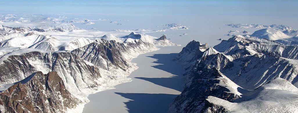
Credit: NASA/Michael Studinger
A collaborative research project aims to answer pivotal questions about how Arctic ice like the Greenland Ice Sheet and sea ice will respond to a warming climate. The Polar Radiant Energy in the Far InfraRed Experiment, or PREFIRE, is led by Tristan L’Ecuyer, professor of Atmospheric and Oceanic Sciences and director of the University of Wisconsin–Madison Cooperative Institute for Meteorological Satellite Studies. The project seeks to fill missing informational gaps in climate models through the use of satellite observations.
“Changes at the poles are driving global changes,” says L’Ecuyer. “Melting glaciers are causing sea levels to rise while changing energy flows are influencing global weather patterns.”
The PREFIRE project will gather data with CubeSats, which are shoebox-sized satellites with sensitive detectors used to measure infrared light. More than 60 percent of Earth’s energy is emitted at the poles in the far-infrared; however, this part of Earth’s energy spectrum has not been measured previously. By collecting accurate measurements of these emissions, the PREFIRE project seeks to improve climate models used to predict future changes in sea ice and glacial ice.

Climate models are foundational for climate studies. They can help understand variability and aid scientists in identifying where changes can occur due to a warming climate. These models answer complex questions about the climate and can be used to test different climate scenarios and interactions. This information plays a critical role in developing policies to respond to future changes. The National Science Foundation and National Center for Atmospheric Research Community Earth System Model is a global, coupled climate model that includes sea ice simulations as well as ocean and atmospheric circulations around the world. A key component of the CESM is a smaller scale climate model, the Ice-sheet and Sea-level System Model. These models work together to understand changes in the polar regions.
The ISSM, developed by the NASA Jet Propulsion Laboratory and University of California Irvine, was created to understand the formation and flow of ice sheets, the effect of ice on the water cycle and how climate forcings can affect sea level.
Nicole-Jeanne Schlegel is a scientist with JPL and PREFIRE co-investigator who works with the ISSM to study sea level and ice sheets, specifically focusing on the Greenland Ice Sheet. This model replicates the Greenland Ice Sheet’s fluctuations and can predict how the snow changes through time depending on atmospheric conditions.
“PREFIRE will offer us new opportunities to monitor a region that is changing dramatically before our eyes, though we don’t know the full impact of how, and what consequences it will bring,” Schlegel says.
Ice sheets and sea ice respond very differently to changes in global temperature. Sea ice can change quickly based on ocean and atmospheric temperatures with response times of less than a decade. In contrast, snow landing on the Greenland Ice Sheet becomes a part of the ice sheet over many centuries due to the force of gravity squeezing out air pockets. This ice is then gradually pushed toward the edges of the sheet over thousands of years and eventually flows, breaks off and melts into the ocean. It takes far longer to make an ice sheet than it does to melt it.
Historically, the relationship between snow accumulation and melting has been in balance and the Greenland Ice Sheet has maintained its thickness. However, in recent years, climate change has disrupted its equilibrium.
“Just 30 years ago, people thought that this ice sheet was in equilibrium,” Schlegel explains. “Now, there is much more melt happening than what snow is replacing into the reservoir.”
Because ice sheets and glaciers in the polar regions regulate sea level rise, and ice sheets, glaciers and sea ice are regulators of the Earth’s heat budget, there is a growing urgency to monitor changes as average global temperatures increase. It is difficult to observe activity below the ice surface, but models can help explain what is happening and how the ice flows. However, there is still a great deal of uncertainty in models.
The PREFIRE mission can help reduce the uncertainty in these climate models by filling in missing information in the polar regions, especially information in the far-infrared. This missing information can help scientists understand more about the radiation balance of the ice and determine how much energy is absorbed and emitted. These measurements of the surface of the ice, when incorporated into models, can help predict the temperature beneath the surface.
“As scientists, we’re supposed to put the story together with the smallest amount of uncertainty,” says Schlegel.
Due to the vastness and remoteness of Greenland, observational data can be sparse, but is necessary for evaluating how models are performing. Once compiled, these pieces of information will begin to tell the story of the region’s climatological history as well as its future. The PREFIRE mission will provide frequent observational measurements each time its CubeSats pass over the Arctic and Antarctic — enabling scientists to further understand the future of polar ice conditions and the impacts of a warming climate.
This work is supported by NASA.