Monthly News Summary – April 2006
Irresistible force meets immoveable object
 |
|
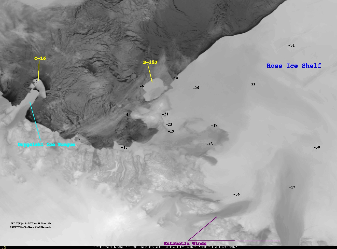
C-16 ran into the Drygalski Ice Tongue and knocked off the tip. Click the image above to view a larger image.
|
During the week of March 20, iceberg C-16 moved quickly northwestward toward the Drygalski Ice Tongue, a spit of ice half the size of Wisconsin’s Dane County. C-16 is a portion of an even larger iceberg that broke off the Ross Ice Shelf in 2000, in a regular calving schedule that helps the ice shelf maintain its size. Calving refers to the process where large sections of ice fall into the sea from an ice shelf.
Meteorologist Shelley Knuth, in the UW-Madison’s Antarctic Meteorological Research Center (AMRC), creates images of icebergs daily, sometimes more often, using satellite data. Using images and imagery composites, the center has monitored the large tabular icebergs since the current calving period began in 2000. This is the first time this cycle has been observed since satellites were invented in the 1960s.
Glaciologists are watching the effect of the iceberg on the Drygalski Ice Tongue, both to take the opportunity to learn more about movements of large icebergs and to watch possible effects on the continent’s climate. The ice tongue is such a large object that, if the whole tongue were to break off, it could significantly alter the climate of that part of Antarctica and change ocean currents.
Under cloud cover on March 24, iceberg C-16 appeared to collide with the ice tongue. When the clouds lifted on March 27, sea ice was acting as a cushion between the two big ice chunks. According to Douglas MacAyeal, glaciologist at the University of Chicago and long-time collaborator with the UW-Madison’s AMRC, this is “something that sea ice is not normally known for.”
On March 29, the Drygalski Ice Tongue and iceberg C-16 were still separated by a cushion of ice, but the tongue’s tip was nicked as C-16 continues along the coast. University of Wisconsin–Madison’s Communications Office released a news tip on March 28; the National Science Foundation’s International Polar Year web site linked to SSEC’s longer feature.
—by Terri Gregory
View the latest iceberg images:
http://amrc.ssec.wisc.edu/iceberg.html
Learn more about icebergs with this FAQ:http://amrc.ssec.wisc.edu/icebergfaq.html
 |
|
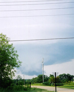
The Weather Channel featured the tornado outbreak that occurred in Stoughton, WI last August.
|
Stoughton tornados—The Weather Channelfeatured the tornado outbreak that occurred in Stoughton, WI on August 18, 2005 on its new Storm Storiesseries. The episode aired on March 16.Storm Stories attempts to capture “the incredible stories of everyday individuals who have crossed paths with some of Mother Nature’s most perilous conditions.”
Imagery used in text book—One of SSEC’s images appeared inNature of Biology Book 1, which was published by John Wiley & Sons Australia, Ltd. Produced with data from the Advanced Very High Resolution Radiometer (AVHRR), the image is of sea surface temperature and accompanies a section titled “Satellite of the Earth Observing System.” SSEC’s Web address was printed with the image.
Image use —A GOES image of Hurricane Katrina appears on the front page of “Environmental Research,” the monthly newsletter of the French Ministry of Ecology and Sustainable Development. The issue is April 2006. The image accompanies an article on censoring environmental research in Australia and the United States; NASA scientist James Hansen’s climate research is mentioned as a victim of U.S. censorship.
BUND Heidelberg, an environmental group based in Germany, used one ofLiam Gumley’s hurricane images on the cover of their annual report. Gumley uses MODIS satellite data to generate full color images.
Enhanced Hot Water Drill publicity—In an article on IceCube,Wisconsin Week Wire and Wisconsin Week (March 22) featured anEnhanced Hot Water Drill. SSEC’s Ice Coring and Drilling Servicesdesigned and helped the Physical Sciences Laboratory make the drill for the IceCube project who recently finished a season of threading neutrino sensors into deep holes in the ice at the South Pole. The holes were drilled using the hot water drill.
The Wisconsin State Journal’s Ron Seely noted the contributions of the hot water drill in an article about IceCube on March 26. The Register, a well-written, somewhat irreverent online journal, also mentions the drill in a March 22 article on IceCube.
The CIMSS Tropical Cyclones team recently received praise for their Web site. Ron Barretto works for Florida’s St. Petersburg Times with their emergency management group and executive management team. He sent the Tropical Cyclones team a note of thanks for the team’s “great coverage and help during the last few hurricane seasons.” According to Barretto, the team’s site provides “somewhat broader information.” He went on to say, “The work of SSEC, and in particular the CIMSS Team, has and continues to make my job a lot easier.”
 |
|
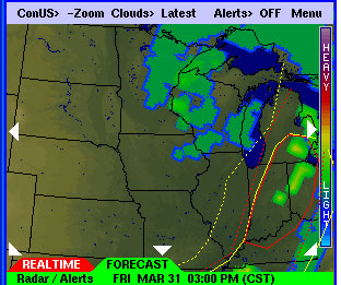
The PAW service now includes radar and cloud forecast imagery.
|
Over the last month,Russ Dengelintroduced a new product set to hisPDA Animated Weather (PAW) service. The service continues to gain popularity and will add new features as needed.
The PAW service now includes radar and cloud forecast imagery. Using data from the CIMSS Regional Assimilation System (CRAS), a numerical weather prediction model, the product creates forecast animations that progress three hours ahead for each image. Users can choose to impose Severe Weather Outlook Regions produced by the Severe Storms Prediction Center over the forecast imagery.
To accommodate the new forecast animations, Dengel added color coded tabs to the bottom of the PAW display allowing users to toggle between real time and forecast information.
Dengel also received word that the American Geophysical Union (AGU) accepted his presentation about the PAW service for their Spring 2006 Joint Assembly. His talk is titled “Web Based Access to Real- Time Meteorological Products Optimized for PDA-Smartphones.”
Last month, the Wisconsin Department of Transportation posted a link to the PAW from their page on winter road conditions. The link is underneath the map as “Map version for PDAs (by UW SSEC Madison).”
Clouds in On Wisconsin—A short piece on the complexities of cloud research appeared in the spring 2006 edition of On Wisconsin. Steve Ackerman (CIMSS) talked about the challenges of figuring out “what makes a cloud a cloud.” He pointed out that the definition of a cloud can vary depending on what instrument a researcher uses to define it. Ackerman also discussed the importance of having more consistency in measurements from weather satellites because understanding cloud patterns is crucial to climate prediction.
 |
|
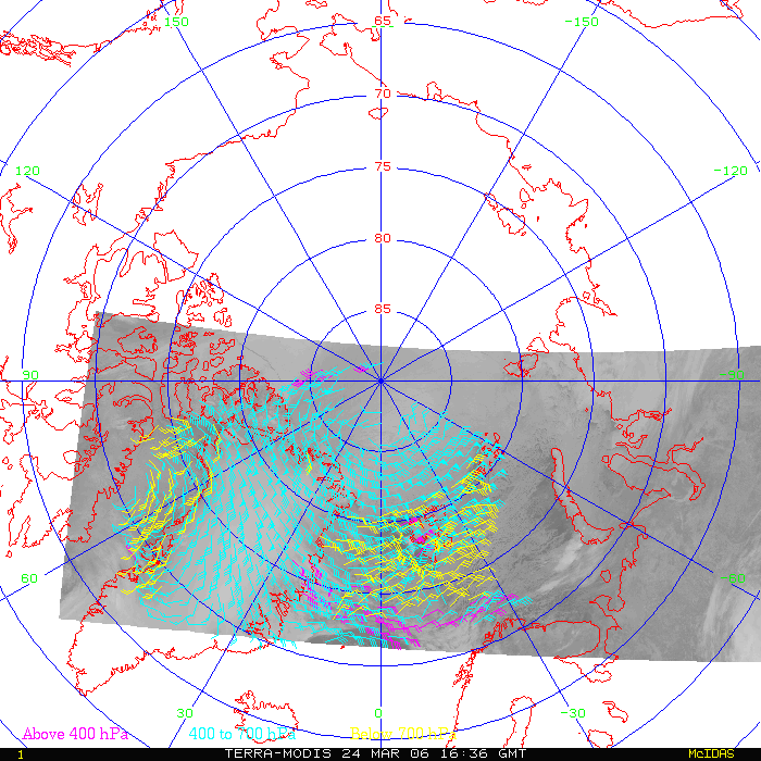
Direct Broadcast sites can produce winds products faster than conventional processing systems, meaning that numerical weather prediction centers can include more wind data in early model runs. Click the image above to view a larger image.
|
Polar winds in operational use—On March 15, the Fleet Numerical Meteorology and Oceanography Center (FNMOC) began using the direct broadcast MODISpolar winds productfrom McMurdo, Antarctica, in their operational weather forecast system. Developed by a team of CIMSS researchers led by Jeff Key, the McMurdo MODIS polar winds product uses data from the National Science Foundation’s direct broadcast system. This product is available faster than the product previously in use at FNMOC, which allows early model runs to include significantly more wind data.
Direct Broadcast polar winds—On March 24, The Kongsberg Satellite Service (Ksat) facility in Tromsø, Norway generated the first Direct Broadcast MODIS polar winds for the Arctic. Direct Broadcast sites can produce winds products faster than conventional processing systems, meaning that numerical weather prediction centers can include more wind data in early model runs. In the near future, MODIS winds and other products will be generated routinely in real time at Ksat in Tromsø.
Time capsule—SSEC provided materials to NOAA for a time capsule at their new building in College Park, MD. As a part of this, Jean Phillips, librarian for SSEC’s Schwerdtfeger Library, printed several images taken by the Multicolor Spin-Scan Cloud cover Camera, which launched November 5, 1967 on ATS-III. The center’s public information office provided a booklet on the life of Verner E. Suomi, acknowledged father of weather satellites and SSEC cofounder and first director.
Fire data published—CIMSS’s Biomass Burning group recently had two papers published. Conservation Biology published “Inhibition of Amazon deforestation and fire by parks and indigenous lands.” This paper summarized a study that showed a significant reduction in land destroyed by both deforestation and fires by designating land as reserves and indigenous lands. The study used GOES data. The Journal of Geophysical Research published “Mesoscale modeling of Central American smoke transport to the United States: Top-down assessment of emission strength and diurnal variation impacts.” This paper discussed the application of information derived from an algorithm developed by the CIMSS Biomass Burning group called the GOES Wildfire ABBA. In this particular study, hourly measurements of smoke emissions derived from the WF-ABBA numerically simulated the movement of smoke from Central American biomass burning into the southeastern United States during the spring of 2003.
Math class visits—SSEC hosted the New Glarus, Wisconsin High School Mathematics class of Margaret Nott. The two dozen juniors and a senior listened attentively as SSEC and NOAA staff explained how they use math in their work. Tony Wimmers of the Tropical Cyclones group and manager of the IDEA project advised the students in how to best prepare themselves for college and a career using math. Perhaps Wimmers’s most surprising advice was that they needed English more than they might think; scientists and engineers need to communicate. Evan Richards, electronics engineer who has managed some of SSEC’s most complex and scientifically successful spaceflight instrumentation programs, talked about using math in engineering. Terri Gregory, SSEC’s public information coordinator, introduced the class to satellite concepts from the building’s roof. Three scientists then demonstrated the use of mathematics in applications: DonWylie presented a math problem about the height of an indoor sports practice facility, Kris Bedka explained how we measure winds, Bob Aune told how we predict weather with computers.
Exploration Station features Java applets —SSEC’s Margaret Mooney and Tom Whittaker welcomed about 500 visitors to their exploration station at the April 1 Science Expeditions annual outreach event. Mooney is an SSEC outreach specialist and Tom Whittaker is the developer of interactive educational Java applets. Together they presented Explore the Atmosphere, allowing visitors to explore physical processes such as tornadoes, air density effects on baseballs, satellite imagery, thunderstorms and snowflake crystals. Nearly 2000 people visited all 40 Exploration Stations, 4 Science Spectaculars and 3 other places on campus. Five hundred more visitors were counted at the door than last year, and at least 25% more presenters and volunteers (about 160 this year).
Jean Phillips, librarian for SSEC’s Schwerdtfeger Library, is winner of this year’s Chancellor’s Award for Excellence in Service to the University. Her library is a campus special library dedicated primarily to atmospheric sciences and providing many special services to its clients and to the public. Among them are: ITAR and other federal papers and announcements, and the Bentley snowflake collection. The award is funded by the Wisconsin Alumni Association and will be presented in a May meeting of UW-Madison’s Academic Staff Assembly.
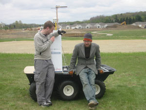 photo courtesy of Calculated RISC’s blog photo courtesy of Calculated RISC’s blog |
|
REALbasic Developer interviewed Dave Parker and Mike Woodworth about their experience with the DARPA Grand Challenge.
|
A team consisting of Dave Parker (SSEC) and a friend from junior high, Calculated RISCcreated “The Little Big-Endian that Could” and entered it in the Defense Advanced Research Projects Agency (DARPA) annual Grand Challenge. REALbasic Developer interviewed Parker and his friend, Mike Woodworth, about their experience “creating an autonomous vehicle with REALbasic” for their April edition. REALbasic is the programming language Parker and Woodworth used to program and control their vehicle. The interview touches on various difficulties Calculated RISC faced along the way and how they used REALbasic.
The DARPA challenge serves to catalyze the research and development of self-piloted ground vehicles. After an extensive application process, select teams try to complete a designated course through the desert in the Southwest United States in hopes of winning the $2 million prize. Although the team did not make it into the top 40, they made it onto the alternate list. This list includes only ten teams. Check out Calculated RISC’s blog to see pictures of their vehicle and read about their experience.