Sponsor, Quick Guides and References
Sponsor and development
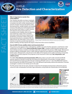
The GOES-R Fire Product is based on the WF-ABBA heritage algorithm as has been developed and maintained by Chris Schmidt at the Cooperative Institute for Meteorological Satellite Studies (CIMSS). Operationally, the GOES-R product is run within the GOES-R Ground System. A standalone version over select regions is currently running at CIMSS using GOES-R Rebroadcast (GRB) antennas at CIMSS. Algorithm Theoretical Basis Document for Fire / Hotspot Characterization
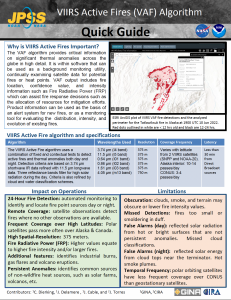
The JPSS VIIRS Active Fire algorithm (VAF) was developed by (insert). Operationally the VAF is run at NOAA and is also run as part of the Community Satellite Processing Package (CSPP) at CIMSS, utilizing data Level 1 data (reflectances and brightness temperatures) for VIIRS over the continental US from S-NPP and NOAA-20. Algorithm Theoretical Basis Document For NOAA NDE VIIRS Active Fire
Sponsor funding for this project is provided by NOAA/NESDIS, JPSS and GOES-R programs
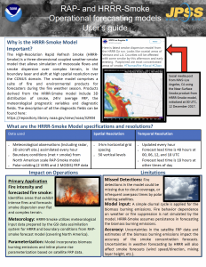
Quick Guides