Tools, Archive and Training Links
Training
UCAR/COMET has developed a free training course on the usage of this website here
La capacitación de UCAR sobre el uso del sitio web de inundaciones globales del Grupo de Pruebas de Satélites de la NOAA se puede encontrar aquí
Tools
A selection of products are available in AWIPS2, for more information refer to this link to help document
LEO/GEO Archive
The GMU archive is CURRENTLY OFFLINEThe experimental archive of the NOAA LEO/GEO Flood extent products can be downloaded: https://jpssflood.gmu.edu/
Products in GIS (shapefile and geoTIF) as well as the raw HDF formats and visual png images of the products are available from 02 October 2019 through the previous day are available for user specified domains and time periods.
1-day and 5-day composites from 2012-2020 and August 2023 – Present can be found on AWS at
this link to the Amazon Web Service
The 1 day composites can be found in the link to the VIIRS 1 Day (VFM_1day_GLB) folder and the 5-day in the link to the VIIRS 5 Day (VFM_5day_GLB) folder
Please note that the raw files are in NetCDF4, but are organized similarly to the HDF files. Also GeoTIF and Shape files are available
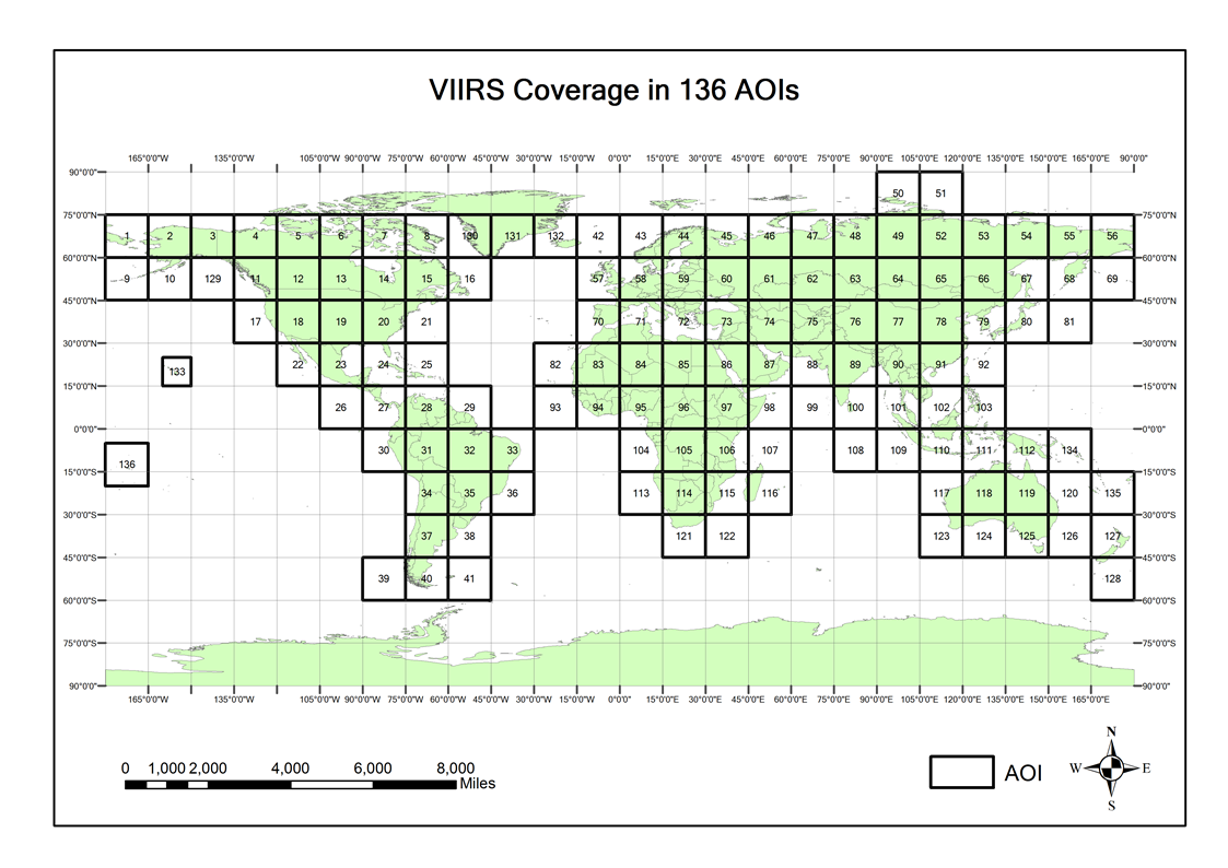
Link to Area of Interest Map to locate which GBLxxx files are needed for a specific area can be found by clicking this link. It is suggested that users use the Amazon Command Line interface to download files. Files located on the AWS bucket are egress free downloads.
LEO/GEO NRT Cloud repositories
The LEO VIIRS Flood swath products on AWS can be found at
This link for NOAA-21
and this link for NOAA-20
The ABI VIIRS Flood products on AWS can be found at : (link TBD)
Value information within files
Information on the values contained in the geoTIF, PNG and raw files can be found at this link.
If you have any questions, please contact William Straka (william.straka @ ssec . wisc . edu)

