• Search Icon

SSEC Home NOAA Satellite Proving Ground Global Flood Website NRT NOAA global flood map products and information

  • Home
  • Real Earth Flood Products
  • Sponsor, quick guides and references
  • Blogs and useful links
  • Tools, Archive and Training Links
  • Research Support
  • UW
  • CIMSS
  • Data Services
  • AOSS Library
  • Partners
  • Careers
  • Disclaimer
  • Staff Directory
  • For Employees
  • Example cases of flood product usage
  • CIMSS Blogs on Flooding
  • RealEarth in Apple Store

Example cases of flood product usage

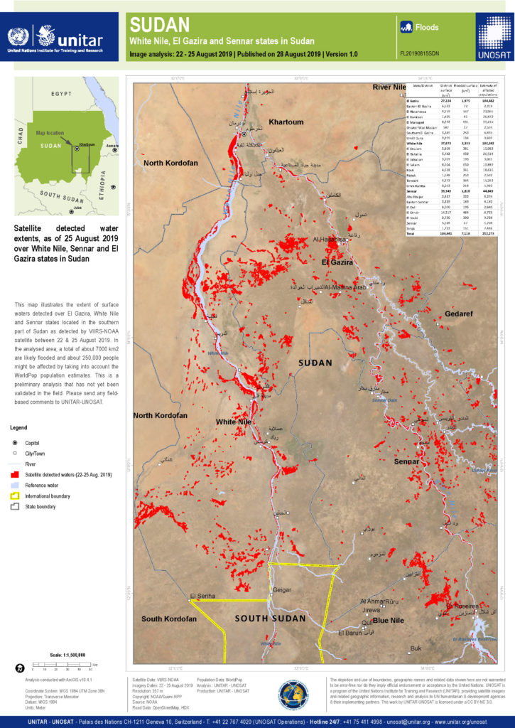
  • An example use of the 5-day VIIRS composite in the International Charter
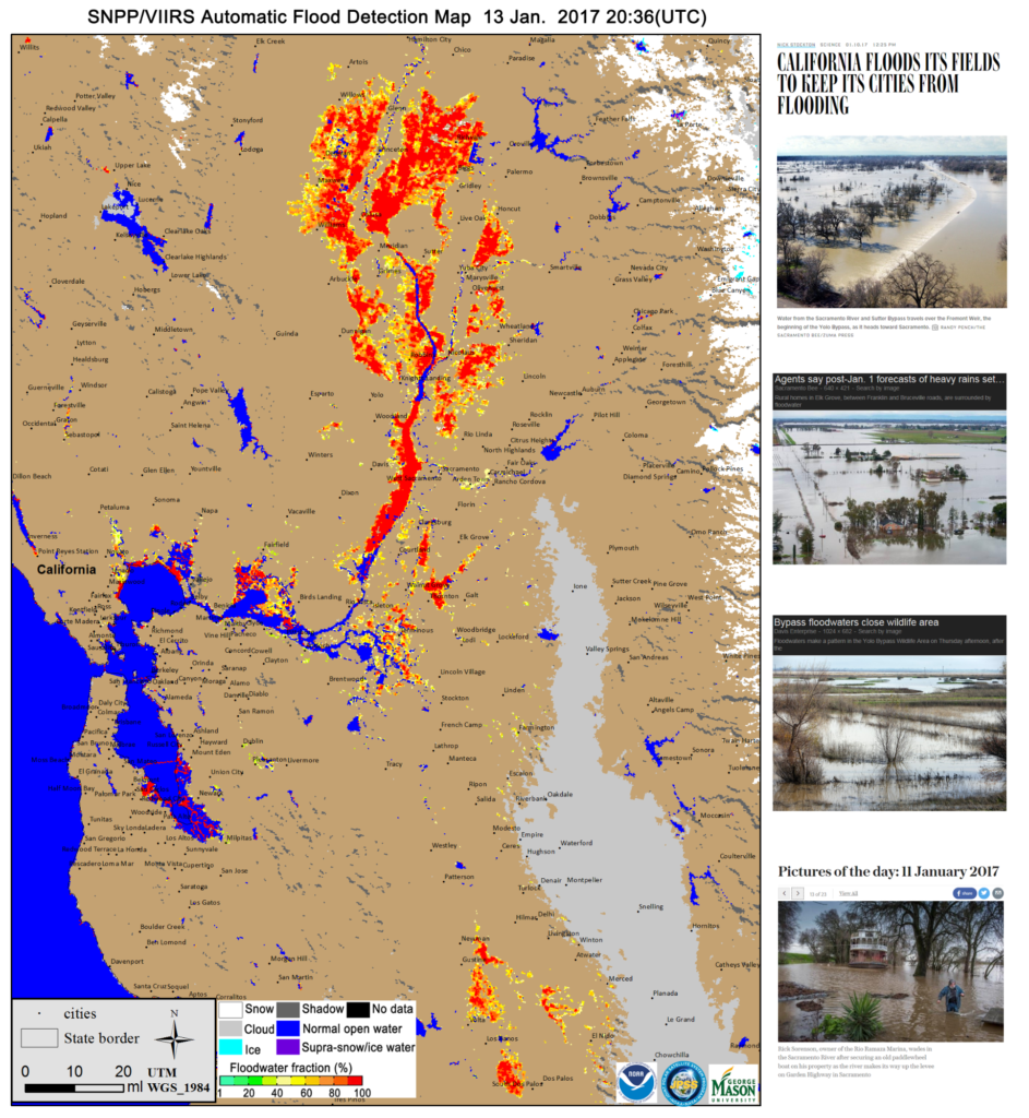
  • An example of VIIRS flood map (left) and pictures (right) of flooding in Northern California.
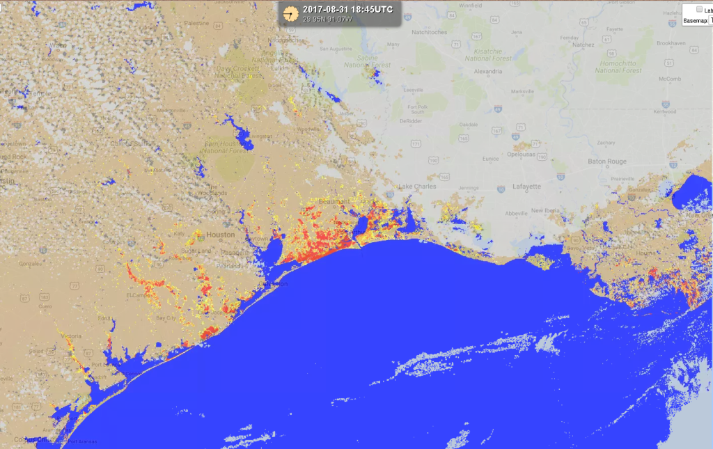
  • Example ABI flood product from 31 Aug 2017 showing flooding in South Texas after Hurricane Harvey
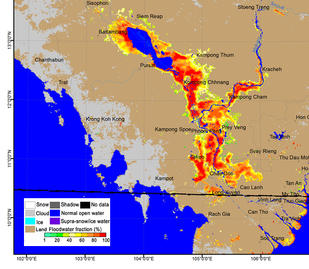
  • Flood product in Cambodia from 21 August 2018 using Himawari-8/AHI
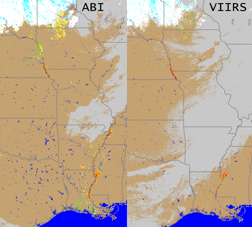
  • ABI and VIIRS Flood Products from 20 March 2019
The Geostationary and JPSS Flood map product is developed by George Mason University and the products are processed in near realtime at the Cooperative Institute for Meteorological Satellite Studies

Funding for this project is provided by NOAA/NESDIS, JPSS Program Office and GOES-R
UW Logo
1225 W. Dayton St. · Madison, WI 53706, USA · 608-263-6750