« Back to "Super Cyclonic Storm Amphan - 17-19 May 2020"
Very Severe Cyclonic Storm Amphan – 17 May 2020
Posted: May 17, 2020
On 16 May 2020, a depression formed in the southeast Bay of Bengal and was later named Cyclonic Storm Amphan as it intensified. By 16 May 2020 Amphan became a Very Severe Cyclonic Storm. At 09:00 UTC of May 17, Amphan intensified into a very severe cyclonic storm and within 12 hours, the storm had developed an eye. On 17 May 2020, the 2100Z the Joint Typhoon Warning Center (JTWC) stated that Amphan winds of 115knts, or ~132mph. This would make it a Category 4 storm in the Atlantic basin.
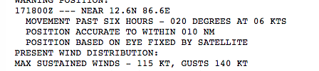
RSMC New Dehli estimated maximum sustained winds at 21Z of 155-165 km/hr (96-102mph), which would make it a Category 3-4 storm in the Atlantic
![]()
There were only passes from NOAA-20 and S-NPP, with GCOM-W1 being out of position to observe Amphan. This discussion is broken into two parts: VIIRS and microwave imagery
VIIRS
NOAA-20 observed Amphan first at ~1907Z on the western edge of the scan followed by a near nadir pass of SNPP at ~1957Z. As you would expect both NOAA-20 and S-NPP showed the defining characteristics of a mature tropical cyclone. These included convection surrounding the circulation center along with cold cloud top temperatures and tropospheric gravity waves. In addition, the two passes 50 minutes apart provided some insight into the temporal movement of the storm
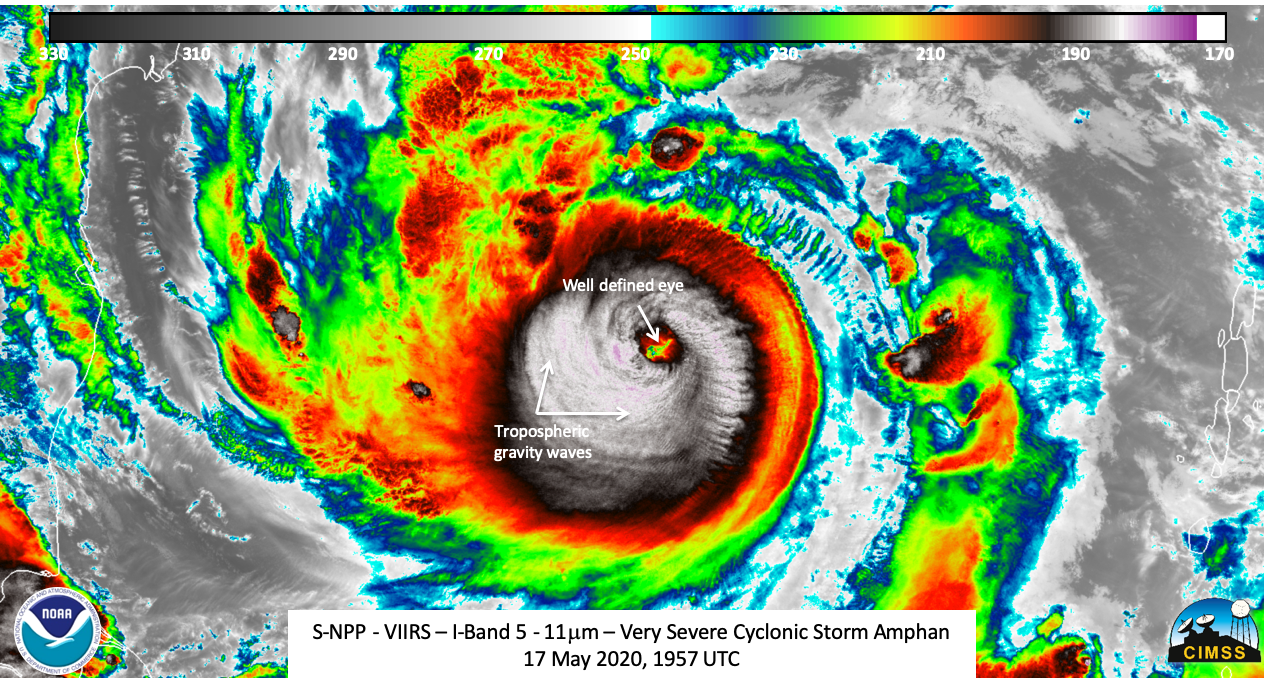
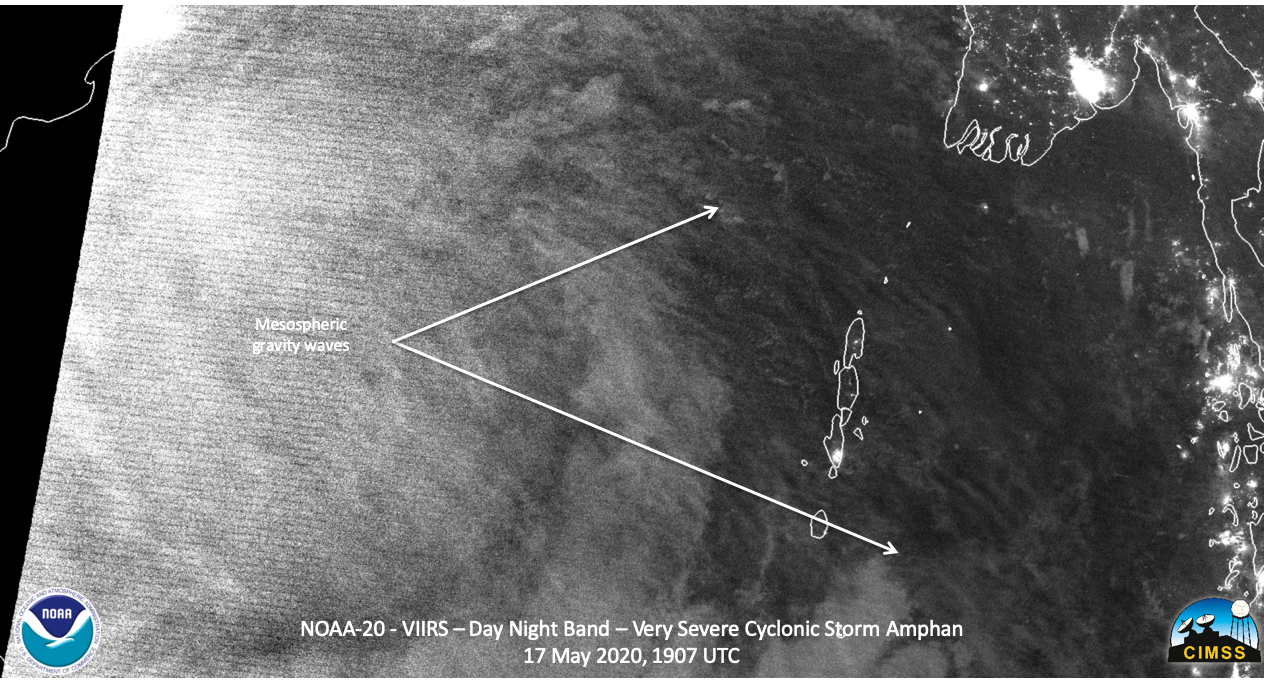
The waning crescent moon (24% illumination) meant that features were illuminated by emitted lights from cities as well as airglow. The rapid intensification of Amphan was strong enough to produce mesospheric gravity waves. These could be seen in the NOAA-20 imagery
and were somewhat more easily see in the near nadir S-NPP imagery
If one expands out the view, one can see that these waves extend over 800km from the center of circulation
Microwave
Only the ATMS from S-NPP and NOAA-20 were able to observe Amphan, though with the storm being on the edge of the scan, the best observation was from the S-NPP near-nadir pass. As can be seen, the convection (colder temperatures) is nearly completely surrounding the center of circulation.
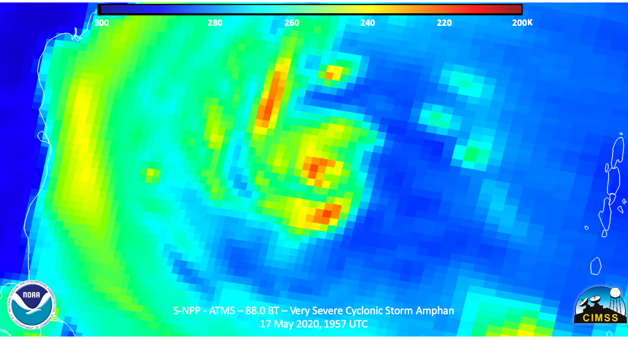
Unfortunately GCOM-W1 was not in a position to observe Amphan during the nighttime pass
Forecasts and impacts
The forecast from RSMC New Dehli and the JTWC show Amphan hitting the Bangladesh coast within the next couple of days as a major tropical cyclone.

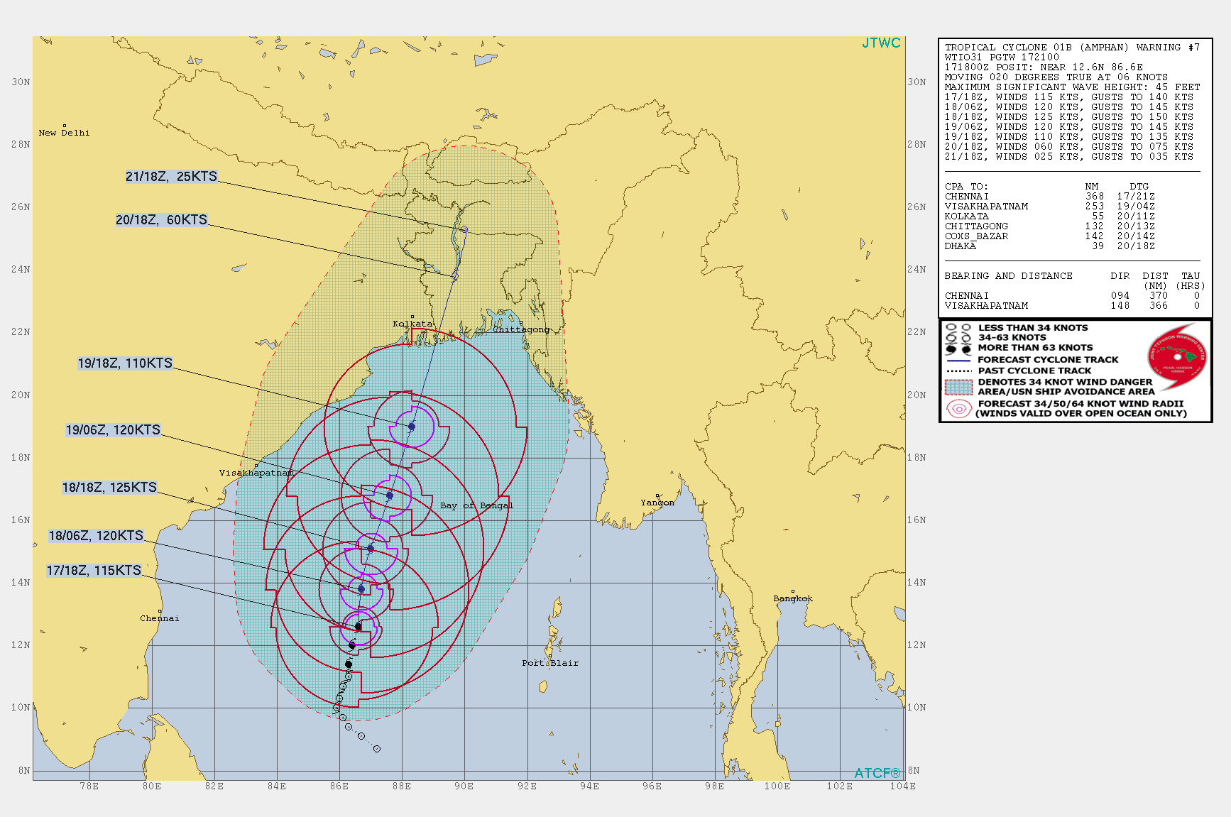
The area forecast to be hit is both low-lying and highly populated. With the ongoing CoVID-19 pandemic, this will effect the evacuations and the response to the landfall. The International Charter has been preemptively activated by the Indian government to help aid in the response to the expected major impacts to the storm.

