« Back to "Super Typhoon Hagibis - October 6-13 2019"
Flooding as a result of Typhoon Hagibis from 12 and 13 October 2019
Posted: October 13, 2019
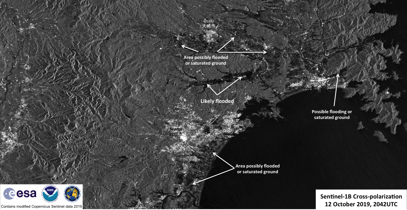
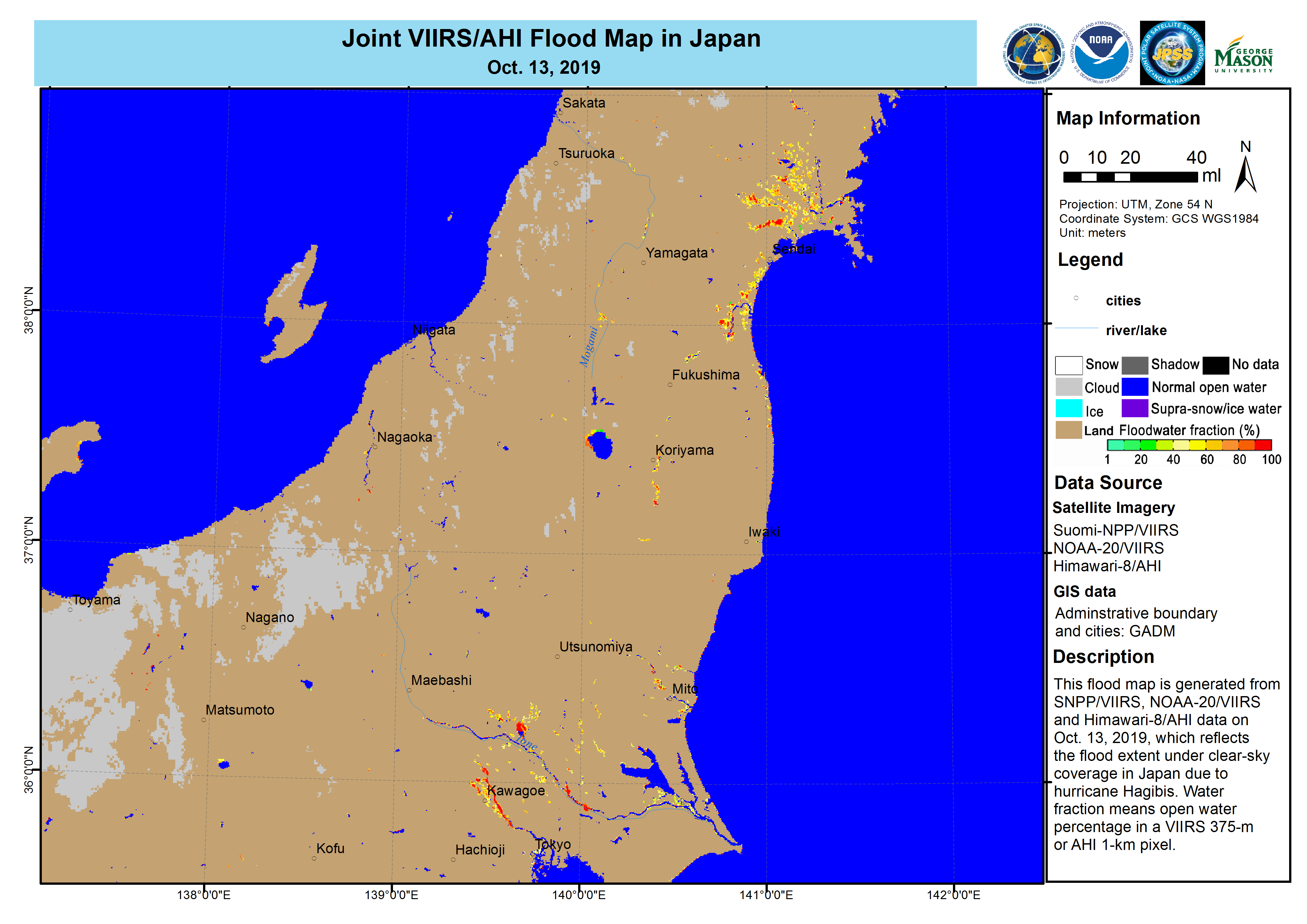
As expected, there was some flooding from Hagibis. There were three main regions that had flooding according to media reports (ABC News, Reuters). These were the area around Nagano, the area around Tōkyō (東京), and in the Fukushima Prefecture (福島県) and Miyagi Prefecture (宮城県). This flooding was observed by both Synthetic-aperture radar (SAR) imagery from Sentinel-1B during the storm (Sentinel-1A was used as pre-storm reference), collected by NOAA’s Satellite Oceanography and Climatology Division, specifically the Sea Surface Roughness Group at NOAA/STAR, as well as the the VIIRS and AHI Flood Products.
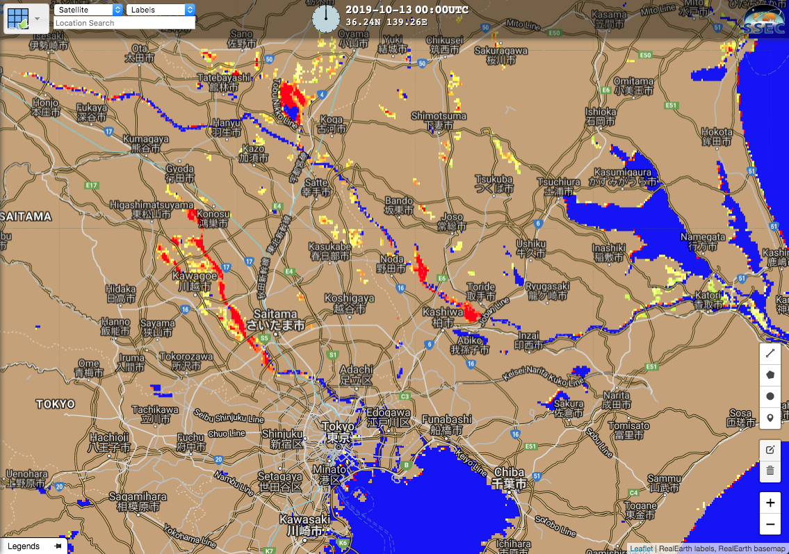
The overall flood situation could be seen in the Joint VIIRS/AHI Flood Product, produced by George Mason University, seen here from 13 October 2019, which was the first day there were clear skies over Japan
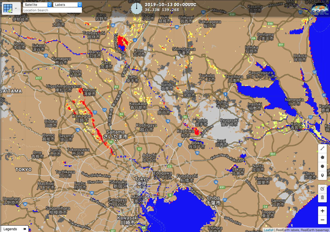
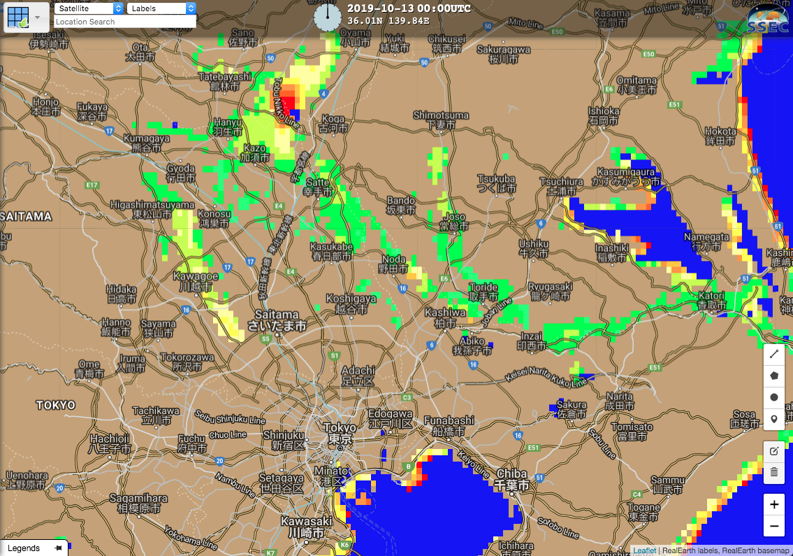
Tōkyō (東京)
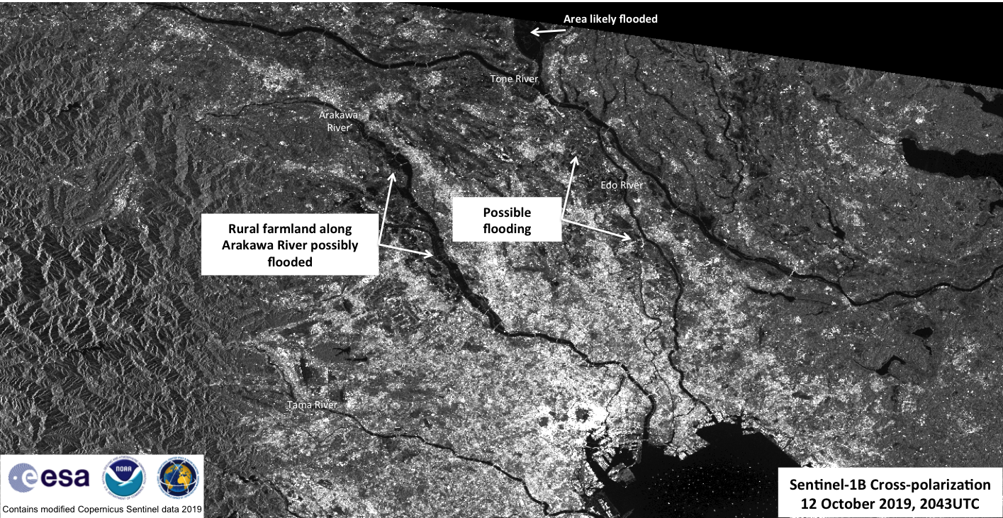
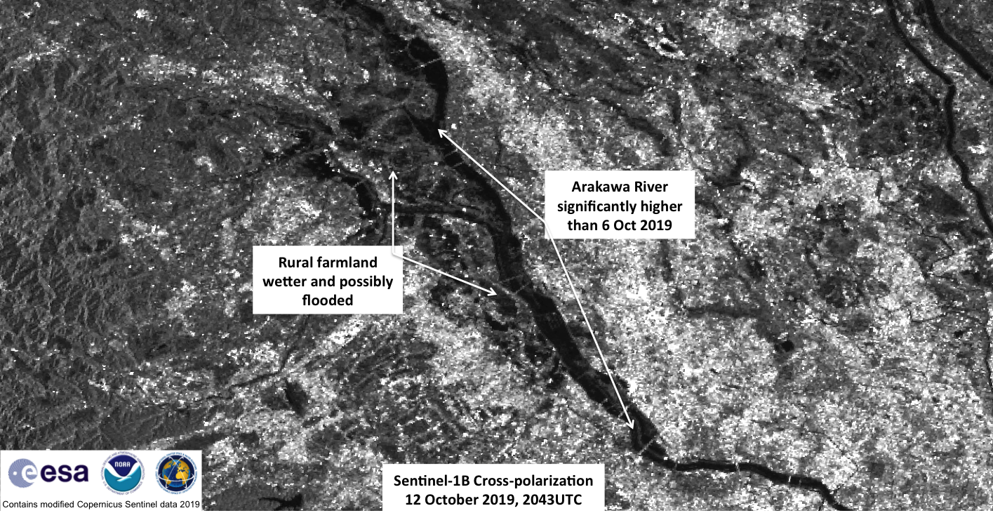
The primary areas in Tōkyō (東京) that were affected were the areas around Kawagoe-shi (川越市), parts of the Tama River (多摩川), Tone River (利根川). Sentinel-1A passed over the region at ~2043UTC on 6 October 2019 (~5:43am on 7 October 2019 JST), providing an excellent “pre-storm” shot for the ~2043UTC on 12 October 2019. Recall that the VIIRS pass from the previous post was at 1617 UTC on 12 October 2019, so this is only a few hours after Hagibis had departed Japan.
Sentinel-1A/B acquired by ESA/Copernicus, provided by Christopher Jackson, NOAA/STAR/SOCD
Contains modified Copernicus Sentinel data 2019
Sentinel-1A/B acquired by ESA/Copernicus, provided by Christopher Jackson, NOAA/STAR/SOCD
Contains modified Copernicus Sentinel data 2019
Sentinel-1A/B acquired by ESA/Copernicus, provided by Christopher Jackson, NOAA/STAR/SOCD
Contains modified Copernicus Sentinel data 2019
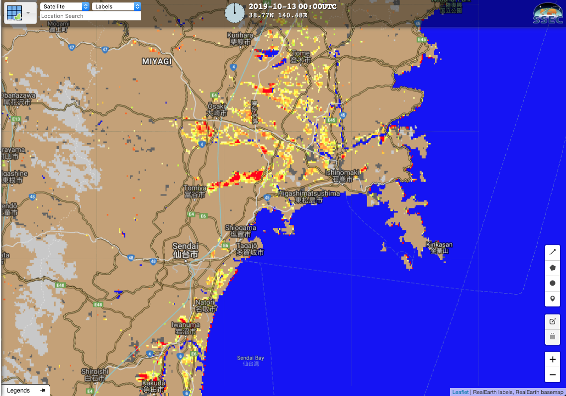
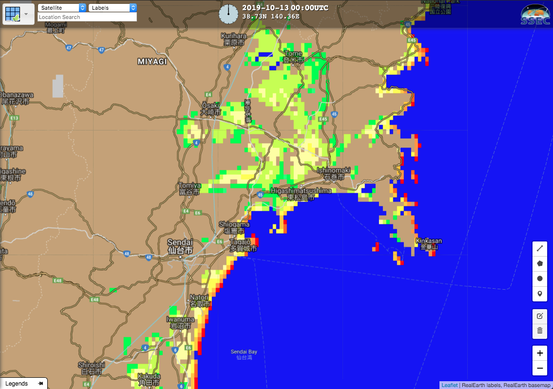
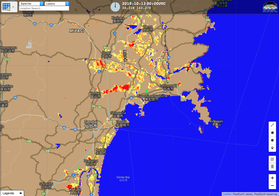
Fukushima Prefecture (福島県) and Miyagi Prefecture (宮城県)