McIDAS-V Radar Imagery Examples
[Satellite | Model | Radar | Observation]
McIDAS-V can display Level II and Level III radar data. Radar display types include sweep views in 2- and 3- dimensions, cross sections, and isosurfaces. Multi-station composites can be made by overlaying images from adjoining stations. The remapping and overlaying capabilities of McIDAS-V make integrating radar data with other meteorological and geophysical data simple for even the novice user.
The examples below demonstrate some of the capabilities of McIDAS-V with radar data. Click on the image to view a larger version. If applicable, a link to the example bundle is also provided for interactive use in McIDAS-V.
[All examples on this page were created by members of the McIDAS User Services using McIDAS-V software.]
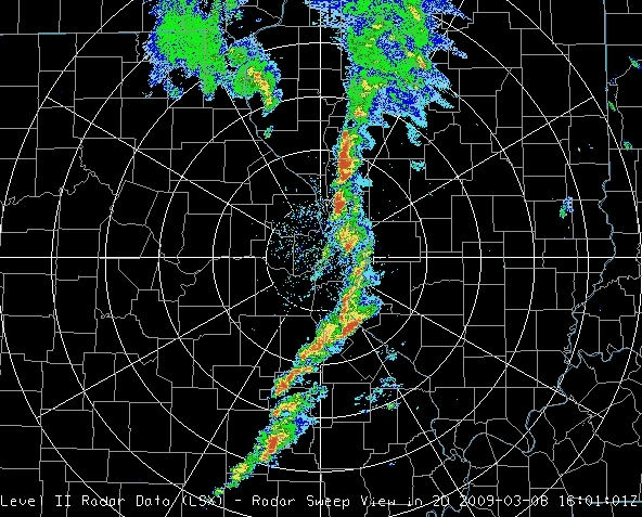
Level II 2D radar sweep of a bow echo over St. Louis, MO on March 8, 2009. (Bundle)
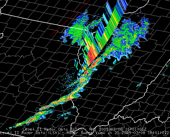
Level II pseudo-RHI from a bow echo over St. Louis, MO on March 8, 2009. (Bundle)
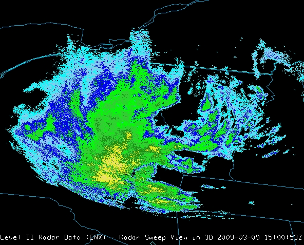
Level II 3D radar sweep perspective view from Albany, NY on March 9, 2009. (Bundle)
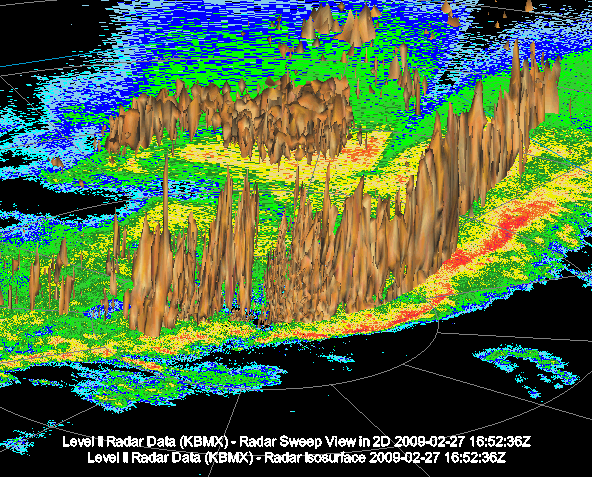
Level II 3D isosurfaces over 2D sweep from a bow echo over Birmingham, AL on February 27, 2009. (Bundle)
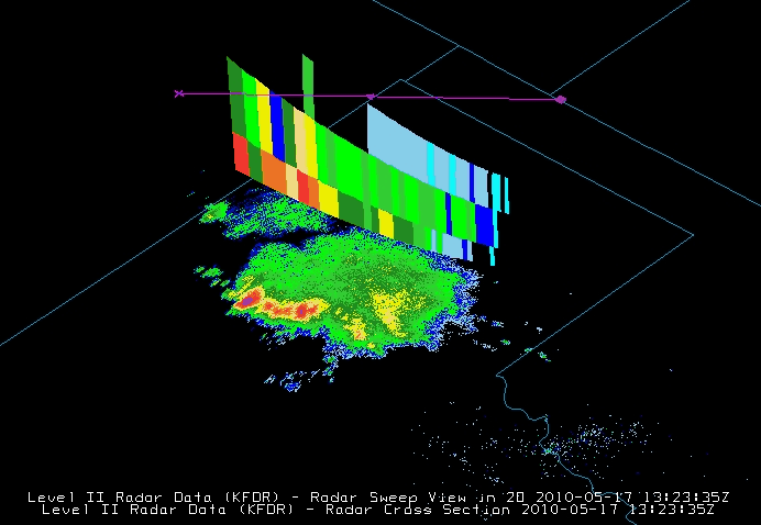
Level 2 radar cross section of a strong storm cell over Texas. (Bundle)
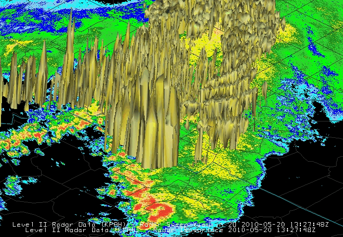
Level 2 radar isosurface at 40dBz over a strong storm in Illinois, Kentucky, and Tennessee. (Bundle)
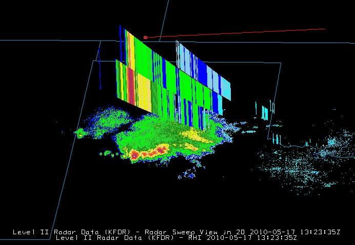
Level 2 radar RHI display over a storm in northwestern Texas. (Bundle)
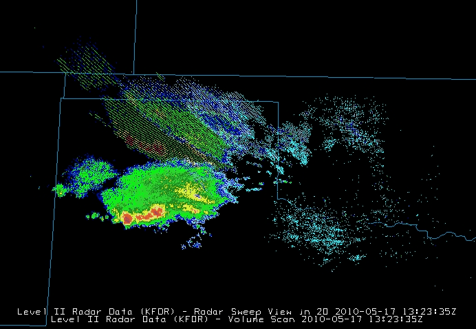
Level 2 radar volume scan over a storm in northwestern Texas. (Bundle)
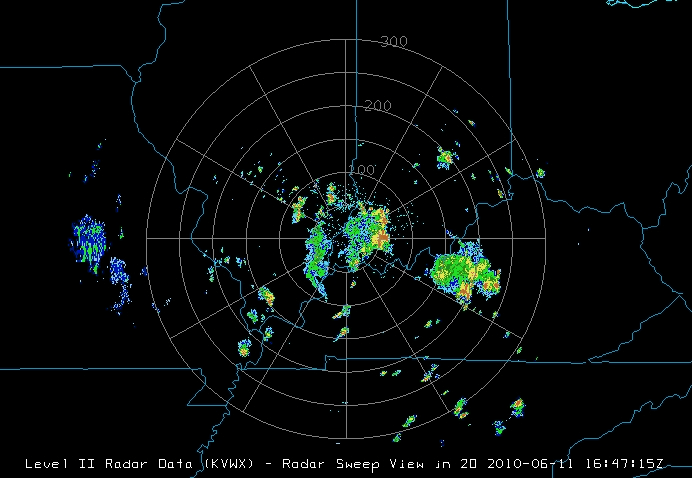
Level 2 Base Reflectivity with range rings over a storm in Indiana. (Bundle)
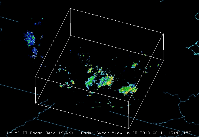
Level 2 Base Reflectivity with a 3D sweep. (Bundle)
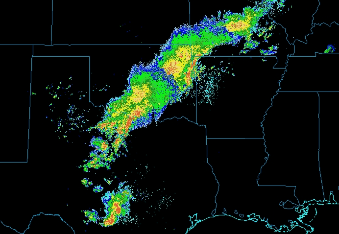
Composite display of 4 different radar locations of a storm over Texas and Oklahoma. (Bundle)
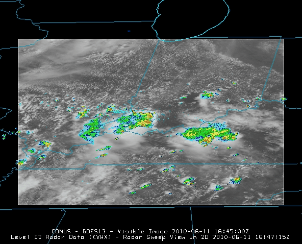
Radar overlaying a visible satellite image of a storm in Illinois, Indiana, and Kentucky. (Bundle)