Monthly News Summary – March 2002
Hurricanes Remembered
by Terri Gregory, SSEC Public Information Coordinator
March 2002
This issue of In the News covers news and events occurring mainly in February 2002. Use images freely with credit to the Space Science and Engineering Center, University of Wisconsin–Madison. We’d appreciate a copy or notice when you use something.
Tropical Cyclones—Chris Velden, team leader of the CIMSS Tropical Cyclones group, is an expert interviewed on Discovery Channel’s “Billion Dollar Disasters: Hurricane Floyd.” The show premiered January 23 and, according to University Communications (March 1), also runs Monday, March 4 at 10 p.m.; Tuesday, March 5, at 2 a.m.; and Saturday, March 9, at 4 p.m. Velden also appeared on WORT-FM Radio’s “8 O’clock Buzz” with host Linda Jameson on Monday morning, March 4 . Velden will also serve as scientific advisor for a show timed for the tenth anniversary of Hurricane Andrew. Tools developed by Velden’s group have given forecasters “the ability to provide earlier storm warnings to the public and emergency government officials.”
Weather Research
Forecasts improved—Tony Schreiner (CIMSS) and Tim Schmit and Robert Aune (NOAA at SSEC) have made changes in a forecast model that will improve the forecasting of precipitation. The operational cloud top pressure retrieval from GOES sounder data will be used in the new 20 kilometer Rapid Update Cycle (RUC20) forecast model. The initial 3-dimensional fields for clouds and precipitation (hydrometeor) will be updated by combining cloud-top pressure data from GOES with the background RUC hydrometeor field. This improves the initial fields for clouds, water vapor, ice, rain, snow and graupel and the resulting forecast. The Change Notice, issued in late February, stated that the new RUC will become operational on April 10. The RUC was developed by NOAA’s Regional Analysis and Prediction Branch for users needing short-range weather forecasts, such as those in the U.S. aviation community.
Satellite data adds value to Navy model—The Naval Research Lab in Monterey, California is creating real-time observation sensitivity plots that show how each element of the current global observing network could change the cost function (or, global 72-hour forecast error) in the Navy Operational Global Atmospheric Prediction System. The estimates show that frequently the total Observation Sensitivity Potential for the operational satellite winds nearly equals that of the radiosonde network, and is more important than aircraft winds or surface data. This is mainly because of large analysis/forecast sensitivities over the oceans where there are few radiosonde observations, so the satellite winds provide a relatively large amount of the total value.
MODIS TPW—Researchers Suzanne Wetzel Seemann and Jun Li (both SSEC/CIMSS) have revised the algorithm that retrieves total precipitable water (TPW) from MODIS data. They made several substantial changes that improve the retrievals in desert regions where MODIS had significantly overestimated the precipitable water. This includes the large desert areas in northern Africa and also smaller deserts in southwestern United States, Mexico, Australia and Asia. Other changes corrected a less significant, but systematic moist bias over midlatitude land. Comparisons of MODIS observations with those from ground-based instruments at the Southern Great Plains ARM-CART site in Oklahoma and with TPW from GOES-8 and 10 now show good agreement, particularly during the day. Other improvements address the noise introduced by striping and other instrument effects. The new algorithm is now compatible with the second MODIS instrument that will be launched on the AQUA satellite.
 |
Click on the small image for a comparison of images generated from both algorithms, revised (top) and the one used operationally now (bottom) with a color bar between them showing millimeters of precipitable water. A substantial difference in the two images is seen in the amount of precipitable water shown in, for example, northern Africa. |
New Products—Tim Schmit and Elaine Prins (NOAA) and Tony Schreiner and Joleen Feltz (CIMSS) provided descriptions for three new GOES products to be included in NOAA’s GOES Products and Services Catalog. The new products are the GOES Imager Clear Sky Brightness Temperature (CSBT) product, the Wildfire Automated Biomass Burning Algorithm (WF_ABBA), and the Merged Automated Cloud/Aerosol Detection Algorithm (MACADA) product. The CSBT and WF_ABBA are currently being transferred into National Environmental Satellite, Data, and Information Service operations. The MACADA is an experimental research product that is being used to monitor trends in clouds and smoke in South America.
 |
This is one panel in a larger figure (click on the little one) showing the application of the GOES MACADA in South America for 1445 UTC on August 26, 1995. Output from the MACADA includes a cloud analysis (panel b, shown here) and a smoke analysis (panel c). The MACADA output is then used in computing aerosol optical thickness (AOT) (panel d). |
 |
This imager mask (upper left in a larger figure) dramatically shows difference in clear and cloudy sky. This is an example of the GOES Imager Clear Sky Brightness Temperature product for 1745 UTC on August 15, 2001. |
Aerosol Thickness Findings—Joleen Feltz (CIMSS) and Elaine Prins (NOAA) have presented findings to NASA’s Goddard Space Flight Center for the contract, “Characterizing the Spatial and Temporal Distribution of Aerosol Optical Thickness Over the Atlantic Basin Utilizing GOES-8 Multispectral Data.” In studying aerosol optical thickness, Feltz and Prins found that, in South America, correlations between the AERONET sun photometer network and GOES-8 derivations varied between 0.82 and 0.93 for values below 1.5. Correlations in North America ranged from 0.77–0.97 when only land based estimates were compared. The North American study also had some limited sun photometer derivations taken from ships. When this data was included, correlations between sun photometer and GOES-8 derivations were between 0.50 and 0.97. More study is necessary to improve aerosol optical thickness derived from GOES-8 observations by refining the North American cloud product used to determine clear sky, adjusting albedo estimates for different ecosystems, and adjusting the GOES-8 sensor degradation to reflect the most recent studies by Knapp and Vonder Haar.
The microphysical properties of clouds is the topic of a paper accepted by the journal, Meteorology and Atmospheric Physics. The paper presents a comparison of observations from aircraft, satellite and surface instruments during a year-long experiment that studied Arctic climate and weather—the Surface Heat Budget of the Arctic (SHEBA), First International Satellite Cloud Climatology Project Regional Experiment–Arctic Clouds Experiment (FIRE/ACE). Jeff Key (NOAA team leader at SSEC) is a co-author of the paper titled, “Dynamical and microphysical characteristics of Arctic clouds using integrated observations collected over SHEBA during the April 1998 FIRE-ACE flights of the Canadian Convair.” Other authors are employed by the Meteorological Service of Canada), NOAA and NASA.
Broadcast
Weather Guys—Steve Ackerman and Jonathan Martin appeared on Larry Meiller’s WHA Radio call-in show on February 25. As always, they covered a wide variety of topics related to climate and weather. Global change was a hot item this Monday. In response to Meiller’s question on global warming, Martin noted that January 2002 was the “warmest in 108 years of record keeping.” This winter has been warmest in the U.S.’ central Midwest, with Wisconsin the “bull’s eye” of that abnormally warm area. Martin warned of possible drought conditions this summer, because “lakes that are normally covered with ice during winter have been open and the liquid water has been able to evaporate more readily.” “We will get calls on lake levels,” suggested Ackerman. Indeed, Lake Michigan now is a meter lower than normal. Martin also noted an unusual pattern of Canadian storms. Steve Ackerman, though, noted that it may be too soon to forecast drought conditions in the spring, depending on snowfall in the next two months. They discussed a misleading editorial which confused short-term forecasts with climate forecasts. While Ackerman does believe we have global warming, he said that the uncertainty exists in what causes warming and change. Martin added that certainty is an illusive logical quantity. A caller noted that global warming models don’t account for decades-long variations, as around World War II. Ackerman agreed that climate models generally look at longer-range trends.
A caller asked if researchers had looked at the effects on cloud cover of the absence of contrails for a short while after September 11. Ackerman said that a longer period of time is required for meaningful research, but he was willing to speculate that surely there had been some effect.
Listen in on the Weather Guys and their astute callers on March 25, the last Monday of the month at 11:45 a.m. Central Time. Listeners in Madison, Wisconsin can tune into 970 AM, or 90.7 FM. Or listen in on the Internet. Click on Live Ideas Network Webcast. Both Steve Ackerman and Jonathan Martin are professors in UW–Madison’s Department of Atmospheric and Oceanic Sciences. Ackerman also directs the Cooperative Institute for Meteorological Satellite Studies.
In Print
SGP Ice Storm—In the February Southern Great Plains newsletter, Argonne National Laboratory in Illinois used an SSEC MODIS image to show a swath of ice across the Great Plains, including the Cloud and Radiation Testbed (CART) site in north-central Oklahoma and south-central Kansas. James Liljegren, Southern Great Plains Site Manager, also showed pictures of instruments and fields covered with ice and described widespread damage. Argonne Laboratory is one of nine Department of Energy Laboratories engaged in the Atmospheric Radiation Measurement program, along with many offices in NASA and NOAA and several universities, including UW–Madison. Argonne manages the Southern Great Plains CART site where SSEC provides Atmospheric Emitted Radiance Interferometers and their measurements.
On the Net
A MODIS image received at SSEC’s direct broadcast facility was referenced in NASA’s Earth Observatory page, “Open-cell cloud formation over the Bahamas.” The SSEC image provides a broad view in black and white, showing cold air moving down from the north along the U.S. east coast.
Icebergs—UW–Madison’s George Weidner and Jonathan Thom traveled south to service the Antarctic network of Automatic Weather Stations, including those on icebergs B-15A and C-16. The National Science Foundation released iceberg news in February, particularly of a visit made to B-15A by Douglas MacAyeal, University of Chicago glaciologist. MacAyeal expects the two icebergs to collide and break apart. The Antarctic Meteorological Research Center has made available a series of iceberg images and weather data collected on the icebergs.
RH—A long article on relative humidity, mostly dwelling on why it gets so dry in houses in the winter, names an interactive module on the Verner Suomi Virtual Museum as a good way to learn about the topic. H. Michael Mogil’s piece ran in The Washington Post on February 9.
Education and Outreach
Travel news from UW–Madison (February 14) promotes a star-studded experience for university alumni and their friends. Sanjay Limaye, director of SSEC’s Office of Space Science Education and a planetary scientist, has teamed with Jim Lattis, director of UW Space Place and a historian of astronomy, to take a group of travelers to the U.S. southwest. Limaye and Lattis will take their group to observatories and national parks and monuments in April for the “Cacti to Craters” tour. The program is the first in the UW–Madison Astronomical Crossroads Series, developed by the Wisconsin Alumni Association, UW Space Place and the WINNERSS program. WINNERSS stands for Wisconsin Idea National Network Education and Research in the Space Sciences, and is a university outreach program that strives to increase public and student interest and knowledge in the space and earth sciences. Participants in the Cacti to Craters tour will increase their knowledge in a visit to the WIYN Observatory on Kitt Peak, Meteor Crater, the Lunar Planetary Lab, University of Arizona’s Optical Mirror Making facility and other interesting places. Tourists will also visit the Grand Canyon’s southern rim, Sedona and other enchanting locales. The tour is ideal for amateur astronomers, technophiles and lovers of the Southwest. For cost and other information, contact the Wisconsin Alumni Association at 888-922-8728 or on line.
Honors
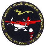
Forecasting lauded—Chuck Stearns, George Weidner and Matthew Lazzara received patches from Raytheon, who provide skilled support services to Antarctica’s researchers, for their help with weather forecasts for an evacuation. Lazzara is a coauthor with Andrew Monaghan, David Bromwich and others on a paper about forecasting for that event. “Performance of Weather Forecast Models in the Rescue of Dr. Shemenski from South Pole in April 2001” is being written for Monthly Weather Review.
Johnson Award—University Communications released news on February 25 that Jun Li, a CIMSS researcher at SSEC, has received the NOAA Johnson award. The award will be presented jointly by NOAA and the National Space Club in Washington, DC in March. Jun Li “has helped guide projects that evaluate and enhance the U.S. remote sensing program, for polar and geostationary weather satellites (known as POES and GOES).” The award was also noted on line and will be used in the print versions of Wisconsin Week (February 27 and March 13), the campus newspaper.
Meetings
The Sixth International Winds Workshop will be held in Madison, Wisconsin, May 7–10 at the Monona Terrace Community and Convention Center. The event is held every two years to “provide an established forum for data providers, users and the science community to exchange experience and knowledge on the use and interpretation of [Atmospheric Motion Vectors] derived from multi-spectral satellite imagery data. It also provides an important way for these communities to improve the use of satellite data in [numerical weather prediction],” according to a summary of the Fifth International Winds Workshop held in Lorne, Australia. Presentations are encouraged on any aspect of wind measurements from satellite imagery and their use in numerical weather prediction, climate applications or in nowcasting (very short-term weather forecasting, especially for approaching severe weather). Also, this year invited presentations will cover research work on wind retrievals from active and passive microwave instruments.
Workshop organizers encourage participation from all organizations operating meteorological satellites, as well as from data users and researchers. Chris Velden of SSEC’s Cooperative Institute for Meteorological Satellite Studies (CIMSS) is local organizer. The workshop is co-organized by the European organization for the exploitation of meteorological satellites (EUMETSAT). The event is co-sponsored by CIMSS, the World Meteorological Organization, the Japanese Meteorological Agency and the National Environmental Satellite Data and Information Service of the U.S. National Oceanographic and Atmospheric Administration. For more information, visit the Eumetsat Web site, click on Announcements and then on Conferences and Workshops.