SSEC Brings New Satellite Capabilities to Hawaii
Hawaii – vacation paradise. Endless miles of Pacific Ocean surrounding it in all directions. Isolation, peace, and quiet.
Hawaii – weather data desert. Endless miles of Pacific Ocean with no permanent weather forecasting installations within hundreds of miles.
On the continental United States we take for granted our numerous, closely-spaced radar installations as well as our abundant surface observations of weather conditions. Hawaii doesn’t enjoy either of those advantages, making satellite observations of weather in the Pacific Ocean even more vital.
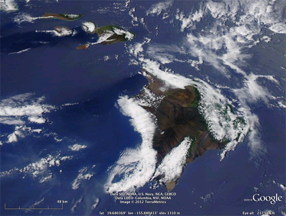
Aqua MODIS image in Google Earth – 2319 UTC (1:19 pm HST) 08 August 2012.
Islands (from top left): Molokai; Lanai; Kahoolawe; Maui; the Big Island.
“Honolulu is most data-starved National Weather Service (NWS) office with the largest area of responsibility in the entire United States,” says CIMSS meteorologist Jordan Gerth. “The area they cover amounts to five times the size of the continental United States. Our local office covers part of Southern Wisconsin.”
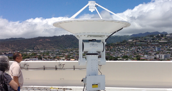
In the spring and summer of 2012, SSEC provided end-to-end installation and operations support for a new X/L band satellite dish capable of receiving data from several different satellite systems. Gerth visited Hawaii in the spring, and again in the summer, to coordinate pre-installation efforts, such as setting up the servers and communication systems. Project Manager Liam Gumley was on hand for the actual installation of the dish on 08 August.
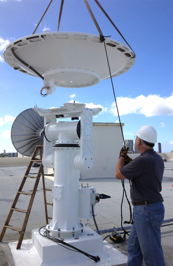
Allan Bundens of Orbital Systems guides the dish to its mount
on the roof of a Honolulu Community College Building. (photo by Liam Gumley)
“The installation went very smoothly,” Gumley says. “In fact, we starting hoisting the housing up at 8 am and had the system up and running, acquiring data, before lunch time. The first data was sent to the NWS office at 11:45 that morning. They now have a steady stream of satellite data to work with.”
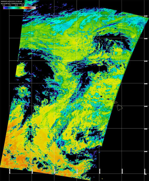
First Terra MODIS pass – 2148 UTC (11:48 am HST) 08 August 2012.
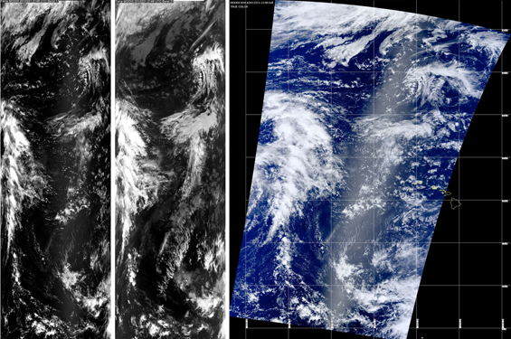
Visible Quicklook (left), Infrared Quicklook (center), True color (right)
(Note Hawaiian Islands outlines in right image).
The Honolulu NWS office, where the servers controlling the dish and its online storage are housed, is located on the University of Hawaii (UH) campus on the hills of Oahu. The new dish itself was installed on a tall building at Honolulu Community College, about six miles from the UH campus, on flatter land nearer the coast, for less obstructed viewing of the horizon.
The dish is precision-guided by a co-located GPS system to maintain a steady lock on the several polar-orbiting satellites from which it downloads data. Receiving a full satellite pass from horizon to horizon, takes about ten minutes. The satellites repeat the same path once every 16 days.
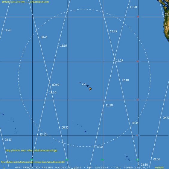
Overpass tracks of the Suomi NPP polar-orbiting satellite on 30 August 2012.
The dashed circle represents nominal coverage from the Honolulu installation. All times in UTC.
The dish’s controlling software keeps the schedule of satellite overpasses and maintains a priority list of which satellite to track and receive information from. Different satellites have different channels, resolutions, and bands with which to make different products. The top priorities for the Honolulu NWS are:
- the NASA Earth Observing Systems satellites, Terra and Aqua, with their MODIS imaging sensor and its 1km resolution and water vapor channels;
- the Suomi NPP with the VIIRS 750m day/night band;
- and POES satellites with the 1 km resolution AVHRR.
The advent of the day/night band on the VIIRS was very important to the Pacific Region. Being able to access the Suomi NPP with its VIIRS day/night bands means the NWS is no longer losing the succinct presentation of clouds at night because of lack of sunlight. Forecasters can track weather systems far out into the Pacific on a 24-hour basis using moonlight at night.
“The day/night capabilities of VIIRS are the biggest advancement to our satellite constellation, geostationary and polar, in the past ten years,” says Gerth.
This dish supplies the Honolulu NWS office data in real time, as opposed to waiting for a unit on the continent to forward the download hours later. Additional polar orbiting products will be made available to Pacific Region within the next year, including volcanic ash (important with active volcanoes so close to hand) and sulfur dioxide detection capability.
Both Gumley and Gerth, and research associate Kathy Strabala, will travel to Hawaii over the next six months, conducting training for the Honolulu NWS forecasters and students from UH in system operation. Gerth and Strabala have had a great deal of experience in working with the Advanced Weather Interactive Processing System (AWIPS), the NWS forecasters’ cornerstone data processing system.
“The training will focus on showing the Hawaiian forecasters what the satellite products look like in AWIPS and how to best use them there,” says Gumley. “And some more theoretical training on where the products came from and what algorithms are used to develop it.”
“The SSEC involvement has really been successful,” says Gerth. “Because we have the expertise here that we can share with meteorologists in Hawaii so that they can provide better weather services to the islands.”
A NOAA grant funded the project, with some additional installation funding from the UH. In addition to its primary focus of supplying data to the Honolulu NWS, the dish will also provide data to the UH School of Ocean and Earth Science and Technology. A private company, Orbital Systems, supplied all the hardware and specifications.

